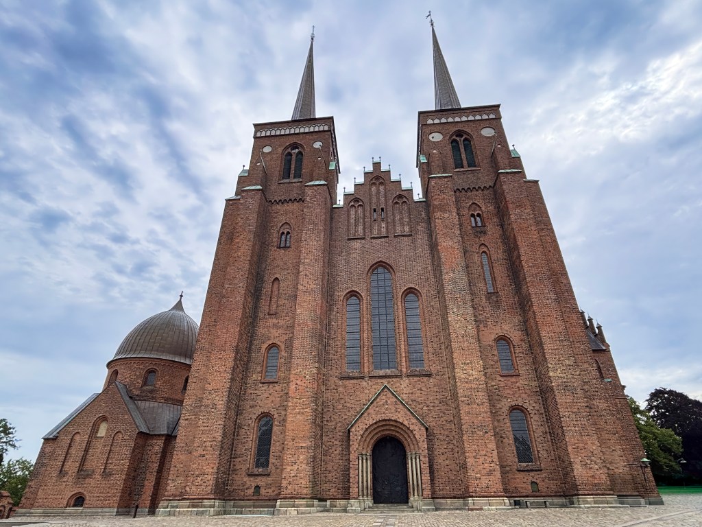
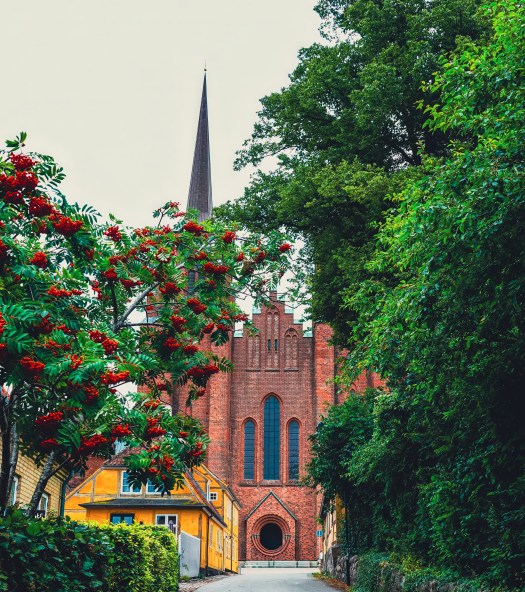
Step into Roskilde, Denmark, and you’re walking straight into the pages of history. Long before Bluetooth connected our phones, King Harald “Bluetooth” connected his kingdom to Christianity. Around the year 980, he built a wooden church in Roskilde. This church set the stage for centuries of royal tradition. By 1080, that humble wooden chapel had been replaced by a grand travertine structure. Eventually, the soaring brick cathedral that dominates Roskilde today rose from the same sacred ground.
This isn’t just another church. It’s the beating heart of Denmark’s royal past. It is a UNESCO World Heritage Site. It is also the final resting place of kings and queens who shaped the nation. As you wander through its towering Gothic arches and past centuries-old tombs, you’re not just sightseeing. You’re tracing the footsteps of Vikings, monarchs, and visionaries who left their mark on Europe.
- Practical Travel Tips
- The layout of the cathedral
- 🚪 The King’s Door: A Modern Symbol in an Ancient Cathedral
- 🎶 The Raphaëlis Organ: A Soundtrack to Centuries
- 👑 The Royal Box: A Glimpse into Regal Worship
- ✨ The Sacred Stage: Where Monarchs Met the Divine
- 👑 The Royal Tomb Trail: Walking Through Denmark’s Regal Past
- 🚪 Starting Point: The Choir – Margrete I
- 👑 The Absolute Monarch: Christian V in the Canon’s Chancel
- ✨ Three Things to Notice at Christian V’s Tomb
- 🌌 The Builder King’s Chapel – Christian IV
- 🌹 South Chapel – Frederik II & Sophie of Mecklenburg
- 🏰 Chapel of the Three Kings – A Regal Triad
- 📏 The King’s Pillar – Measuring Majesty
- 🕊️ Christian IX’s Chapel – The Grandparents of Europe
- 💎 St. Brigitte’s Chapel – A Monument to Modern Monarchy
- 🛠️ Designed by Bjørn Nørgaard
- 🗝️ Hidden Gems Trail 🐾
- 🌍 Final Reflection
Practical Travel Tips
📍 Location: Roskilde, just 30 minutes by train from Copenhagen.
🕰️ Opening Hours: Typically open daily, but check ahead for seasonal changes. You can check the opening hours here.
🎟️ Tickets: Small entrance fee, with discounts for students and families.
🌸 Best Time to Visit: Spring and summer for lively festivals, autumn for fewer crowds.
🎶 Nearby Attractions: Pair your visit with the Viking Ship Museum or, if you’re lucky, the world-famous Roskilde Festival.
The layout of the cathedral
A Walk Through Time
The story begins with Harald Bluetooth, the Viking king who unified Denmark and Norway and introduced Christianity to his people. His wooden church in Roskilde was modest, but symbolic—it marked the dawn of a new era.
By 1030, Estrid, sister of King Canute the Great, replaced Harald’s wooden chapel with a travertine stone church. Just fifty years later, Bishop Svend Normand oversaw the construction of an even larger travertine church in 1080. These stone structures paved the way for the magnificent brick cathedral that began rising in the 1170s under Bishop Absalon.
Each phase of construction reflects Denmark’s transformation—from Viking paganism to Christianity, and from wood to stone to brick.
Architectural Marvel
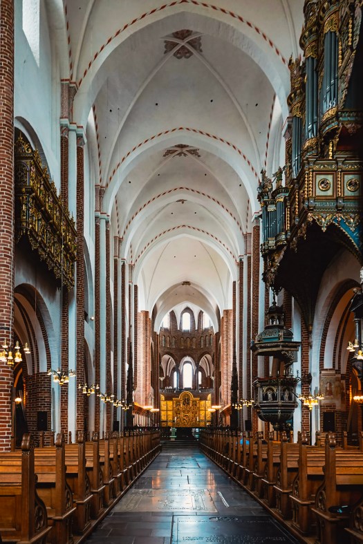
Roskilde Cathedral isn’t just old; it’s groundbreaking. Built in the 12th century, it was the first major brick church in Scandinavia, setting the standard for northern European architecture. Its soaring Gothic arches, Romanesque foundations, and later Renaissance and Baroque additions make it a living museum of styles.
Recognized as a UNESCO World Heritage Site, the cathedral embodies more than 850 years of European architectural evolution. Walking through its chapels feels like time travel, each corner whispering stories from a different century.

🚪 The King’s Door: A Modern Symbol in an Ancient Cathedral
Not all of Roskilde Cathedral’s treasures are centuries old. In 2010, Danish artist Peter Brandes designed and installed The King’s Door, a striking bronze portal that replaced an older entrance. Its design tells the biblical story of the Journey to Emmaus: after Jesus’ death, two disciples meet a stranger and share a meal with him. When he breaks the bread, they suddenly recognize the resurrected Christ.
The symbolism is powerful—recognition, revelation, and transformation—echoing the cathedral’s role as a place where history and faith meet. According to tradition, only the Danish royal family may enter through this door, while others may leave through it. It’s a subtle but fascinating reminder of the cathedral’s continuing role in Denmark’s monarchy and spiritual life.

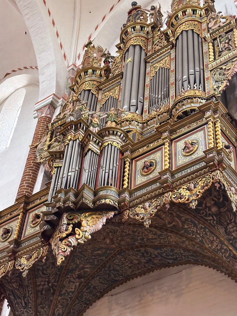
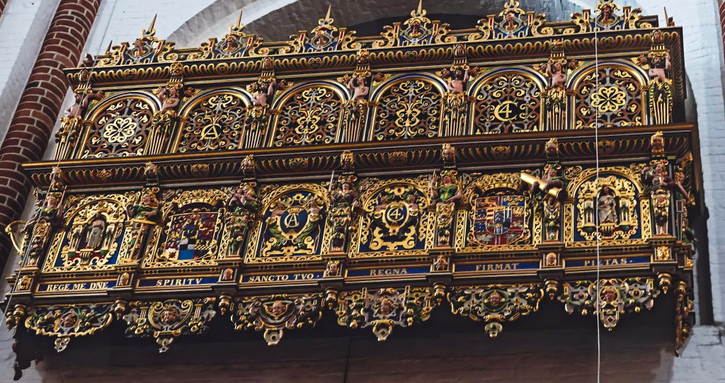
🎶 The Raphaëlis Organ: A Soundtrack to Centuries
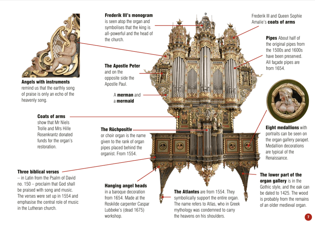
As you wander through Roskilde Cathedral, don’t miss the majestic Raphaëlis organ. It is perched high above the nave. The organ sits like a musical time capsule. Known for its vintage tone and considered one of the world’s finest, this baroque masterpiece has echoed through the cathedral for centuries. Originally rebuilt in 1554 by Dutch organ builder Herman Raphaëlis, it underwent a dramatic transformation in 1654 to reflect the ornate Baroque style of the time. Today, the organ blends elements from the Middle Ages, Renaissance, and Baroque, making it a living archive of European music history.
Once reserved for Latin chants sung by priests, the organ’s role expanded after the Reformation in 1536, when congregational singing in Danish became central to worship. The cathedral now hosts regular services and concerts, and even runs a choir school for children alongside several adult choirs—ensuring that music remains at the heart of this sacred space.

👑 The Royal Box: A Glimpse into Regal Worship
Tucked into the grandeur of Roskilde Cathedral is a quiet relic of royal tradition—the Royal Box, donated by King Christian IV. This elegant feature once offered private viewing rooms for the monarch and queen, allowing them to attend services with dignity and discretion. One room was reserved for the king, the other for the queen, reflecting the ceremonial formality of royal worship in earlier centuries. Though no longer in use, the Royal Box remains a fascinating architectural detail. Today, royal visitors are seated in the chancel, closer to the altar, blending tradition with modern protocol while preserving the cathedral’s deep connection to Denmark’s monarchy.
✨ The Sacred Stage: Where Monarchs Met the Divine
At the heart of Roskilde Cathedral stands the main altar, a place of profound spiritual and royal significance. Initially reserved for Catholic mass, it was later transformed by the Reformation. Over centuries, the altar has witnessed Danish monarchs kneeling in prayer. They have been crowned in ceremony and honored in death.
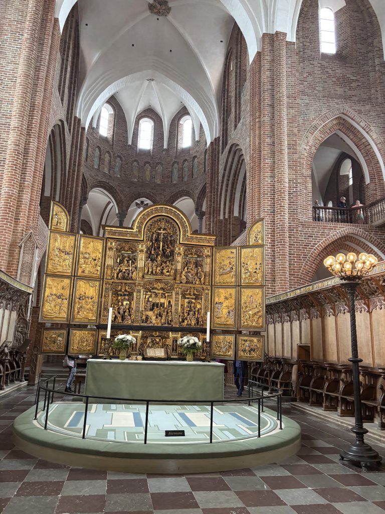
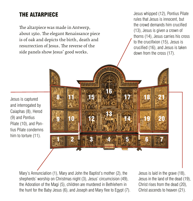
The altarpiece, crafted in Antwerp around 1560, is a jewel of Renaissance artistry. Carved from oak, it unfolds like a visual sermon, depicting the birth, death, and resurrection of Jesus in intricate detail. The reverse of its side panels reveals scenes of Christ’s good works, offering a dual narrative of devotion and compassion. 2 things to notice on this altar piece.
Scenes of Christ’s Life The central panels vividly depict the birth, death, and resurrection of Jesus, offering a complete narrative of salvation in one sweeping work of art.
Reversible Side Panels Turned outward, the side panels reveal Christ’s good works—moments of compassion and teaching that balance the drama of the central story with everyday acts of faith.
👑 The Royal Tomb Trail: Walking Through Denmark’s Regal Past
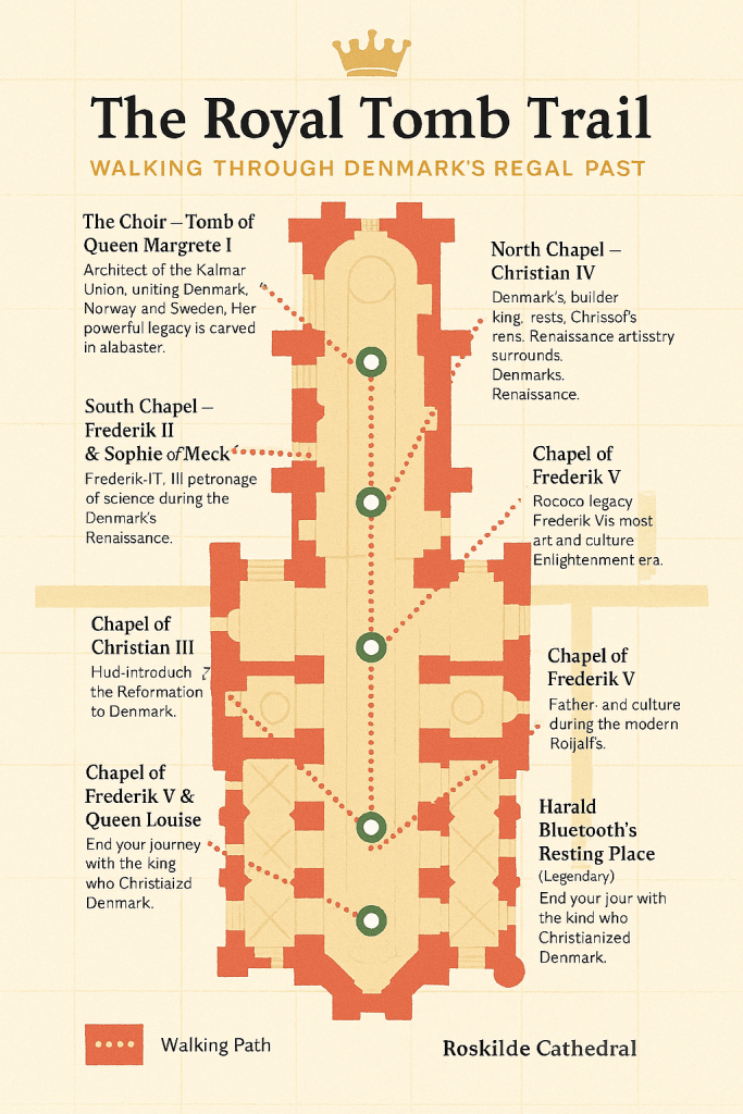
🚪 Starting Point: The Choir – Margrete I
Start your trail in the choir, the holiest part of the cathedral. Here lies Queen Margrete I, the founder of the Kalmar Union, whose sarcophagus rests directly behind the altar. Her unusual placement reflects her extraordinary power and the reverence she commanded. Pause here to learn about her secret reburial in 1413.
👑 The Absolute Monarch: Christian V in the Canon’s Chancel
Christian V’s burial site is located right behind Margrete I tomb. It is in the Canon’s Chancel and places him at the heart of the cathedral’s clerical space. This symbolizes the close ties between royal power and religious authority. His reign marked the consolidation of the absolute monarchy. This was codified in Denmark’s laws. His tomb reflects this era of centralised royal control.
✨ Three Things to Notice at Christian V’s Tomb
- Dynastic Grouping Christian V rests near Frederik IV and their queens, Charlotte Amalie and Louise. This grouping emphasizes dynastic continuity, showing how Roskilde became a family mausoleum for successive monarchs.
- Baroque Influence The tomb’s design reflects the Baroque style of the late 17th century. It is characterized by grandeur and ornamentation. These elements mirror the cultural tastes of his reign.
- Placement in the Canon’s Chancel Unlike Margrete I behind the altar or Christian IV in his starry chapel, Christian V’s tomb is placed within the clergy’s space. It is integrated there. This placement highlights the intertwining of royal authority and ecclesiastical tradition. It serves as a reminder of how monarchs shaped worship. Monarchs also influenced politics.
🌌 The Builder King’s Chapel – Christian IV
Step into the Chapel of Christian IV, Denmark’s longest‑reigning monarch. Known as the “Builder King,” he left behind castles, towers, and fortifications across the country. His tomb is set beneath a vaulted ceiling painted deep blue with golden stars, creating a celestial canopy. Notice the ornate sarcophagus and knightly statues that frame his resting place, symbols of both his ambition and his martial strength.
***Inside King Christian IV’s chapel, there is a striking painting that commemorates his bravery at the Battle of Colberger Heide (1644).
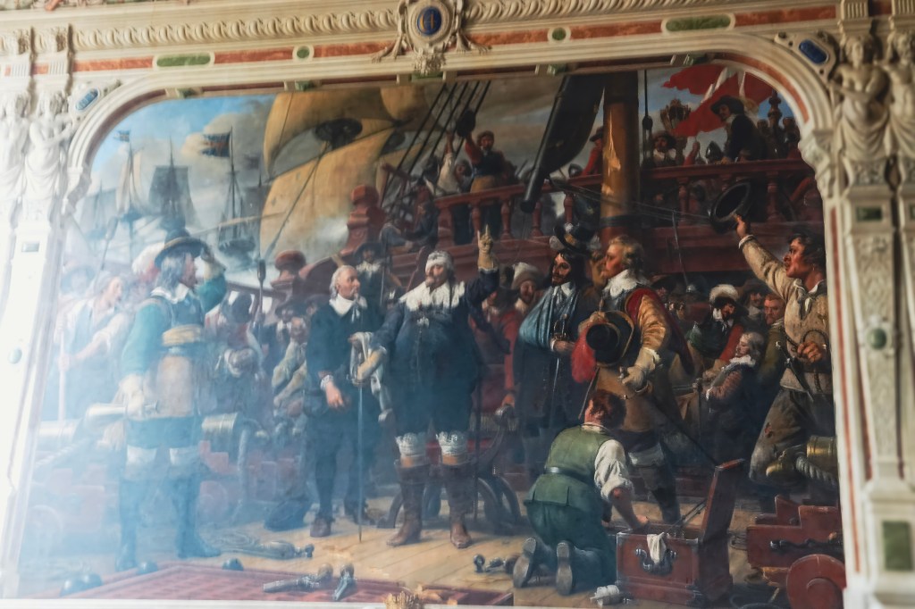
The artwork depicts Christian IV wounded in the eye by shrapnel during the naval battle against Sweden. Despite his injury, he famously refused to leave the deck of his flagship Trefoldigheden, continuing to command his men. This moment became a national symbol of courage, later immortalized in Wilhelm Marstrand’s 19th‑century painting, which hangs in the chapel as part of the king’s memorial.
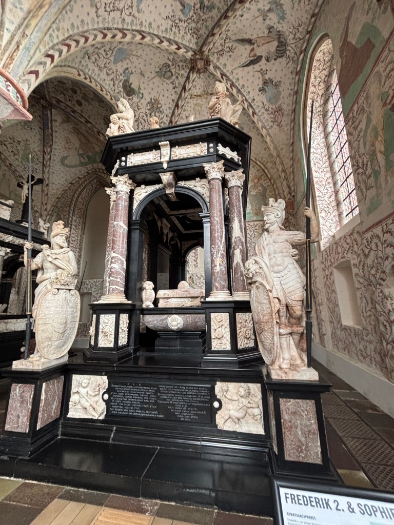
🌹 South Chapel – Frederik II & Sophie of Mecklenburg
Cross to the South Chapel, where Frederik II and his queen, Sophie, rest side by side. Frederik II was a patron of science and supported Tycho Brahe, the famed astronomer.
Their tombs are adorned with Renaissance flourishes—roses, stars, and celestial symbols—hinting at the intellectual flowering of their era. Sophie’s tomb is especially elegant, reflecting her influence as a learned and politically savvy queen.
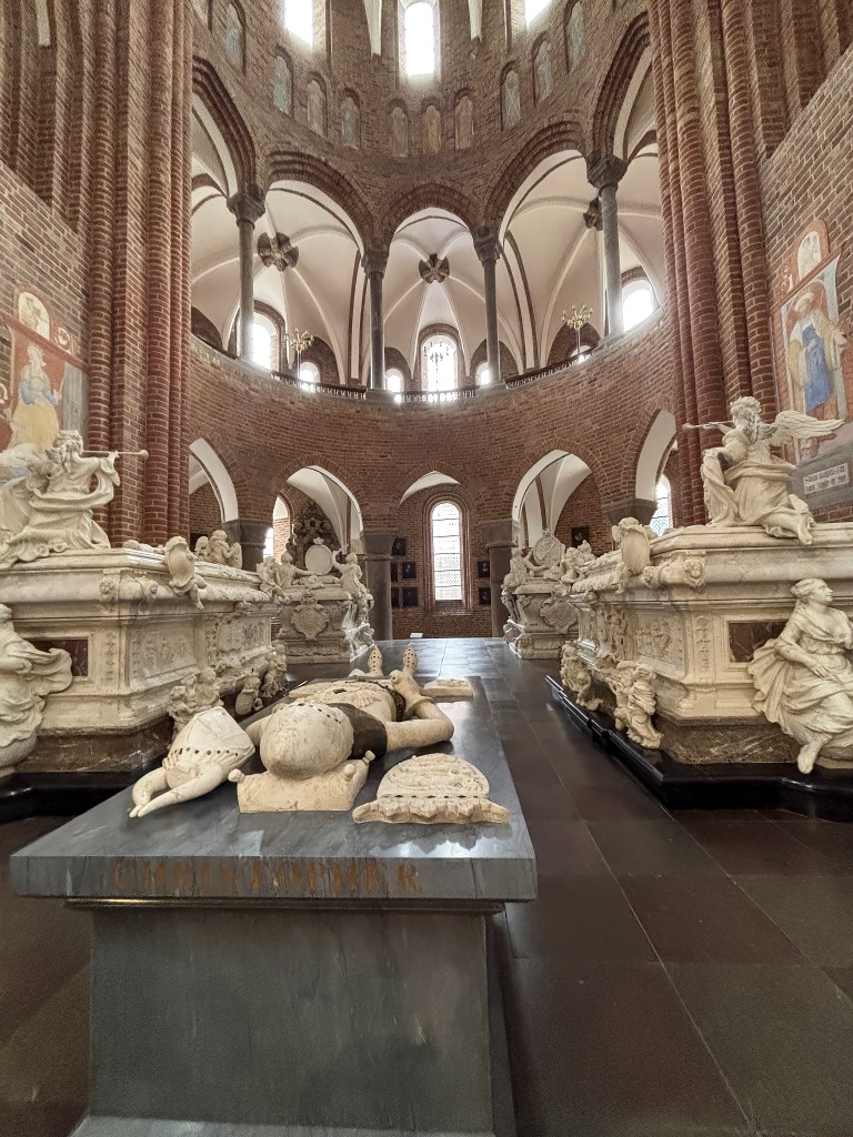
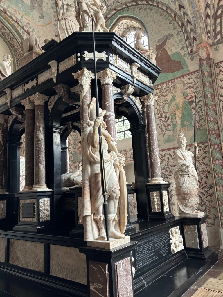
🏰 Chapel of the Three Kings – A Regal Triad
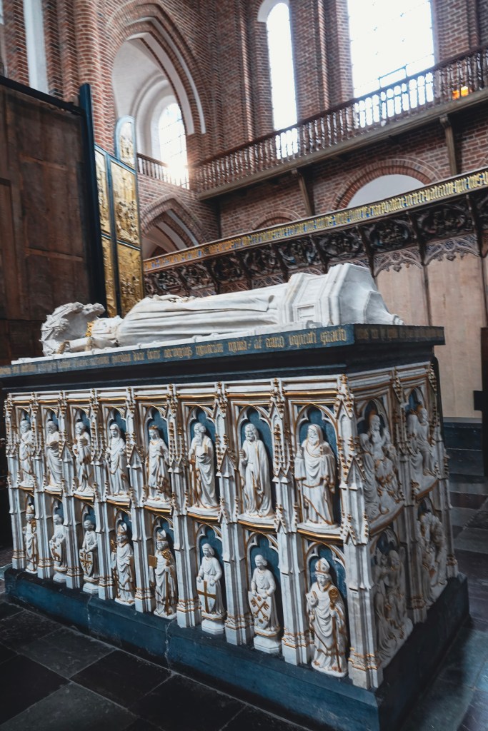
As you step into the Chapel of the Three Kings, you are immediately struck by the grandeur of two monumental tombs that dominate the space. These are the sepulchral monuments of Christian III and his son Frederik II, standing side by side in solemn symmetry.
- Christian III’s Monument Crafted in Antwerp by the innovative sculptor and architect Cornelis Floris (ca. 1514–1575), Christian III’s tomb reflects Renaissance artistry with its balance of grandeur and restraint. It embodies the king’s legacy as the Reformation monarch, who introduced Lutheranism to Denmark.
- Frederik II’s Monument While his father’s tomb was being built, Frederik II commissioned his own—deliberately modeled on Christian III’s design. Yet, in true Renaissance fashion, he made his monument slightly larger. It was more detailed. This was a subtle assertion of his own reign’s prestige. His monument carries richer ornamentation, echoing his patronage of science and culture, including his support of astronomer Tycho Brahe.
Beneath these monuments lie the crypts where both kings and their queens rest. Their presence marks a turning point: from Christian III onwards, all Danish monarchs have been buried in Roskilde Cathedral, cementing its role as Denmark’s royal mausoleum.
📏 The King’s Pillar – Measuring Majesty
Before leaving the Chapel of the Three Kings, pause beside the large granite column known as the King’s Pillar. Unlike the solemn tombs nearby, this pillar offers a playful yet poignant tradition: measuring the heights of visiting royals.
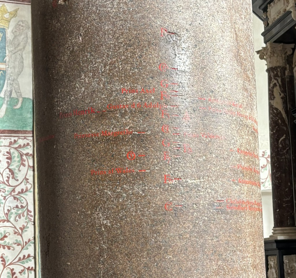
Etched in red inscriptions, the column records centuries of royal stature—literally. Among the most notable:
- Tsar Peter the Great of Russia: Towering at 208.4 cm, he holds the record as the tallest royal measured here.
- King Chulalongkorn of Siam: The shortest on record, his height adds a delicate contrast to the pillar’s legacy.
This tradition turns the chapel into a living ledger of monarchy—where stone remembers not just reigns and rituals, but the very presence of kings and emperors. It’s a charming reminder that even in death, royals leave behind more than monuments—they leave behind measurements.
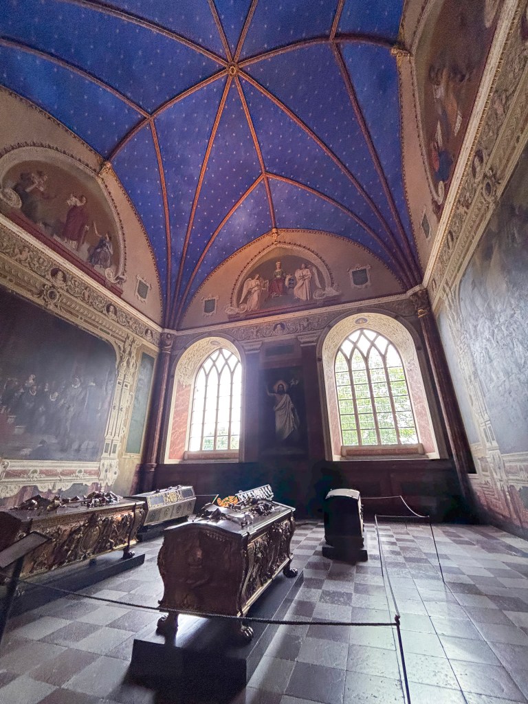
🕊️ Christian IX’s Chapel – The Grandparents of Europe
At the far end of Roskilde Cathedral lies the Christian IX Chapel, also known as the Glücksburger Chapel. Built between 1919 and 1924 in the Byzantine Revival style, this extension feels markedly different from the medieval and Renaissance chapels you’ve already explored. Its domed arches and mosaic-like ornamentation create a serene, almost modern atmosphere.
✨ The Double Sarcophagus
The northern arm of the chapel is dominated by a large white marble double sarcophagus, where King Christian IX (d. 1906) and Queen Louise of Hesse-Kassel (d. 1898) rest together. Their tomb is a symbol of enduring partnership, reflecting their role as the dynastic heart of modern Europe.
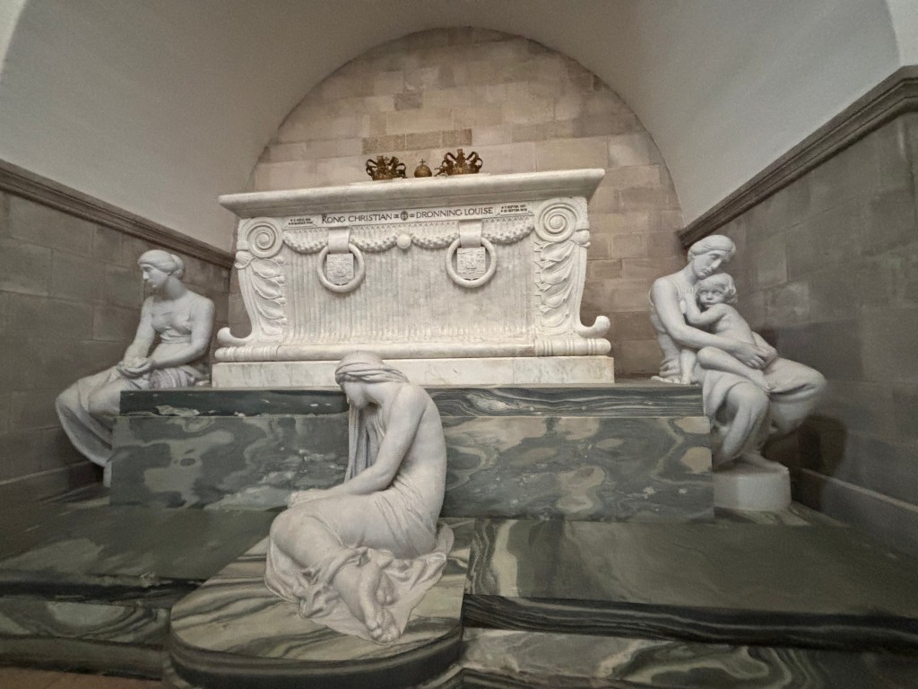
🎭 Sculptures of Emotion
Surrounding the sarcophagus are three Carrara marble statues by Edvard Eriksen, the sculptor behind Copenhagen’s iconic Little Mermaid. Each figure embodies a timeless human response to loss:
- Grief – bowed in sorrow
- Memory – contemplative, holding the past
- Love – eternal devotion
Together, they transform the chapel into a space of reflection, where art and mourning intertwine.
The Little Mermaid’s sisters is another name for the female figures on Christian IX and
Queen Louise’s sarcophagus. They were made by the sculptor Edvard Eriksen (1876-1959)
whose wife posed for them and his most well known work: The Little Mermaid. They symbolise Remembrance, Grief and Love.
👑 Other Royal Burials
The chapel also houses:
- King Frederik VIII and Queen Louise of Sweden-Norway
- King Christian X and Queen Alexandrine
This makes the chapel a dynastic hub, connecting three generations of Danish monarchs.
🌍 The Grandparents of Europe
Christian IX and Queen Louise earned the nickname “Grandparents of Europe” because their children married into nearly every major royal family of the continent. Their descendants include monarchs of Britain, Russia, Greece, and beyond—making this chapel not just a Danish resting place, but a cornerstone of European royal history.
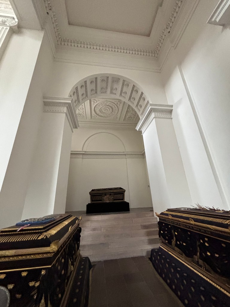
💎 St. Brigitte’s Chapel – A Monument to Modern Monarchy
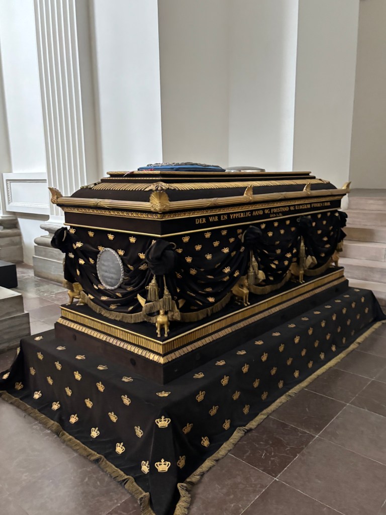
Your trail through Denmark’s regal past ends not in stone, but in glass, bronze, and light. In St. Brigitte’s Chapel, the newest addition to Roskilde Cathedral’s royal mausoleum, stands the sarcophagus of Queen Margrethe II and Prince Henrik—a monument that reimagines royal memory for the 21st century.
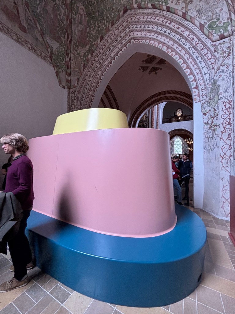
🛠️ Designed by Bjørn Nørgaard
The monument was designed to be covered until after the Queen’s passing. The covering is a bench, also designed by Nørgaard, in three colors representing the Queen and her two sisters
🗝️ Hidden Gems Trail 🐾
Roskilde Cathedral isn’t just about towering Gothic arches and royal tombs—it’s also full of delightful surprises tucked into corners and galleries. For curious visitors, here’s a trail of hidden gems to seek out:
- ⏰ The Medieval Clock (c.1500): Watch as Kirsten Kimer strikes the quarter-hour bell, then stay for the drama of St George slaying the dragon on the hour, complete with a death wail before Per Døver strikes the big bell.
- 🚪 The King’s Door (2010): Designed by Peter Brandes, this bronze portal depicts the “Journey to Emmaus.” Tradition allows only the royal family to enter through it, while others may exit.
- 👑 The Royal Box: Donated by King Christian IV, it once held separate rooms for the king and queen during services. Though no longer in use, it’s a fascinating glimpse into royal ceremony.
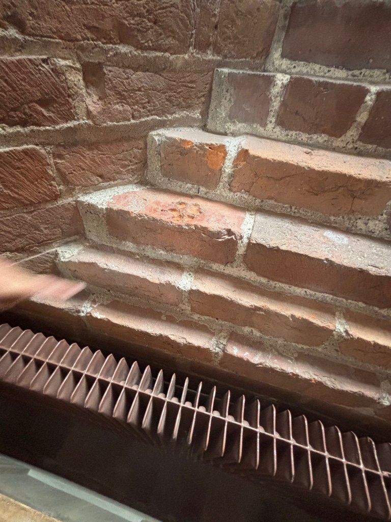
- 🐾 The Dog’s Footprint: In the Middle Ages, a curious dog stepped into soft clay before a brick was fired. Its paw print remains immortalized in a windowsill in the gallery—a playful reminder that history isn’t only made by kings.
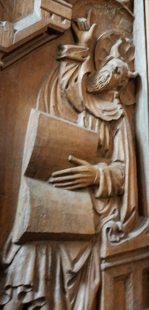
- 😇👿 Moses with Halo vs Horns: In the pew area, look closely at carvings of Moses. Some show him with a halo, others with horns—a quirky result of a medieval translation mix-up where “radiant” was misread as “horned.”
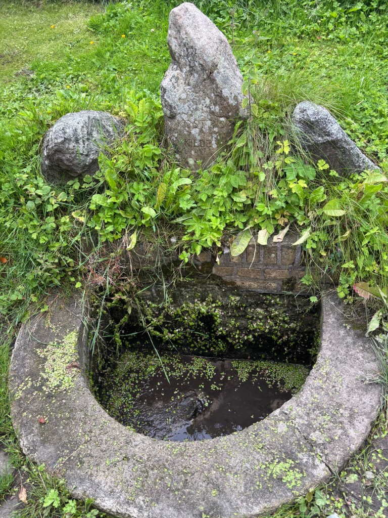
- Rektorkilden – The Headmaster’s Spring
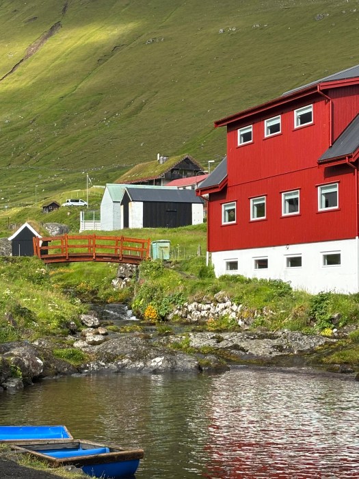
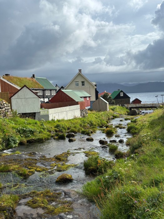
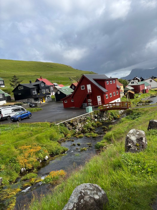
Just beyond the cathedral’s formal chapels lies a quiet, moss-lined spring with a story as dramatic as any royal tomb. Rektorkilden, or The Headmaster’s Spring, flows through the garden of the former residence of Roskilde Grammar School’s headmaster. Its current form dates to around 1880, though the buildings nearby trace back to 1821 and earlier.
Follow this trail, and you’ll uncover the cathedral’s personality beyond its grandeur—a mix of legend, artistry, and even a touch of canine mischief.
🌍 Final Reflection
Roskilde Cathedral is more than a burial church—it is Denmark’s memory palace, where stone, glass, and legend converge. Each chapel tells a story of power, faith, and artistry, while hidden corners whisper tales of everyday life and folklore.
To walk the Royal Tomb Trail is to trace the arc of monarchy, from Viking kings to modern queens. To wander the Hidden Gems Trail is to glimpse the humanity behind the grandeur—dogs, mistranslations, and mythical monsters. Together, they remind us that history is not only about rulers and monuments, but also about the quirks, myths, and imperfections that make a culture alive.
Visiting Roskilde is not just sightseeing—it’s time travel, a journey through centuries where every stone and story invites reflection on how the past continues to shape the present.