My recent adventure through this Nordic paradise was nothing short of magical. Here are the highlights from my journey through some of the most captivating corners of the Faroes. I took 7-hour Highlights of the Faroe Islands tour and visited some of the most spectacular places in the Faroese. The journey to some of the remote villages themselves is an adventure, including driving through the world’s first underwater roundabout.
The day started with a pick up from my hotel in Torshavn at 8.30. We were only 3 people on this tour which made it very intimate and personal. We had an amazing guide, Barbara. She was a Faroese native and entertained us throughout the day with fun and interesting stories about her country.
- Eysturoyartunnilin: A Subsea Wonder
- Gjógv: Gorgeously Remote
- Tjørnuvík: Black Sands and Viking Echoes
- Saksun: Serenity in a Natural Amphitheater
- Fossá Waterfall: The Tallest Cascade in the Faroes
- Funningur: Tranquility in the Heart of Faroe Mountains
- Buttercup Road-High Mountain road
- Kirkjubøur: Echoes of the Past in the Faroese Landscape
- Final Thoughts
Eysturoyartunnilin: A Subsea Wonder
Opened in December 2020, the Eysturoyartunnilin is an 11.2 km (6.9 mile) long undersea tunnel that dives 189 meters (620 feet) beneath the North Atlantic. It links the capital Tórshavn with the towns of Runavík and Strendur, dramatically reducing travel time from over an hour to just 15 minutes2.
At the heart of this tunnel lies the world’s first underwater roundabout. It is a glowing circular junction. This junction connects three branches of the tunnel. The centerpiece is a giant natural rock pillar. It was left intact during construction. Faroese artist Tróndur Patursson transformed it into a stunning art installation. His 80-meter steel sculpture features life-sized figures holding hands around the pillar, symbolizing unity and the Faroese spirit of cooperation. Watch the video below with sound on. Our fabulous guide Barbara was singing a traditional Faroese song that is linked to this artwork
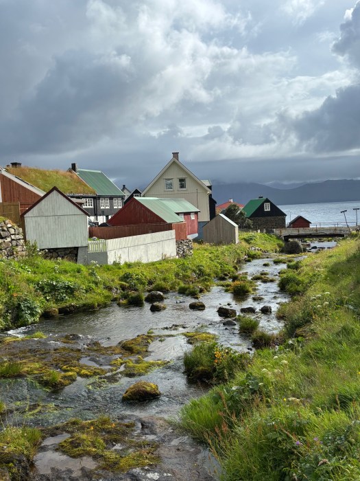
Gjógv: Gorgeously Remote
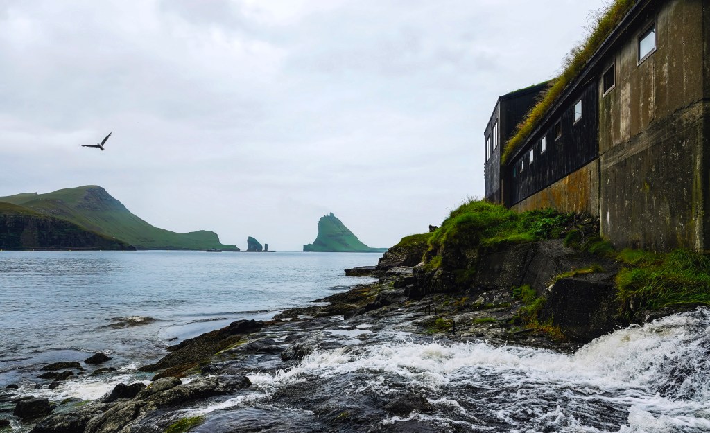
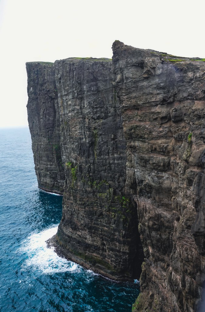
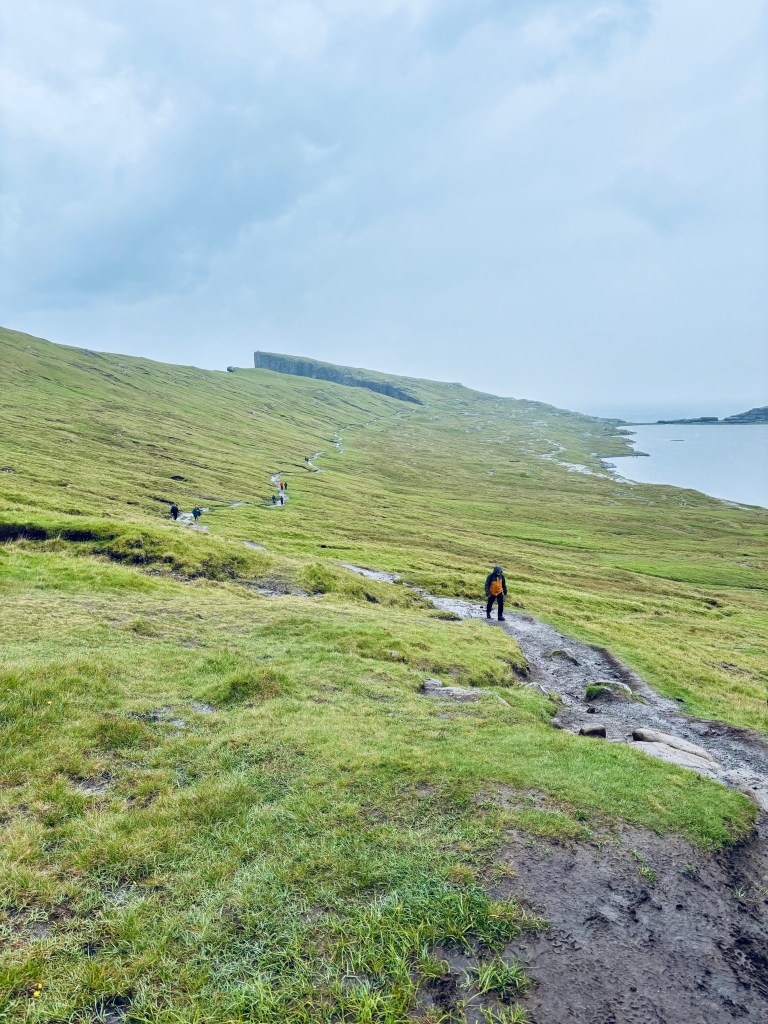
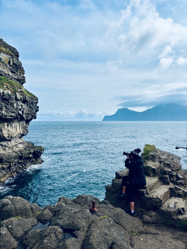
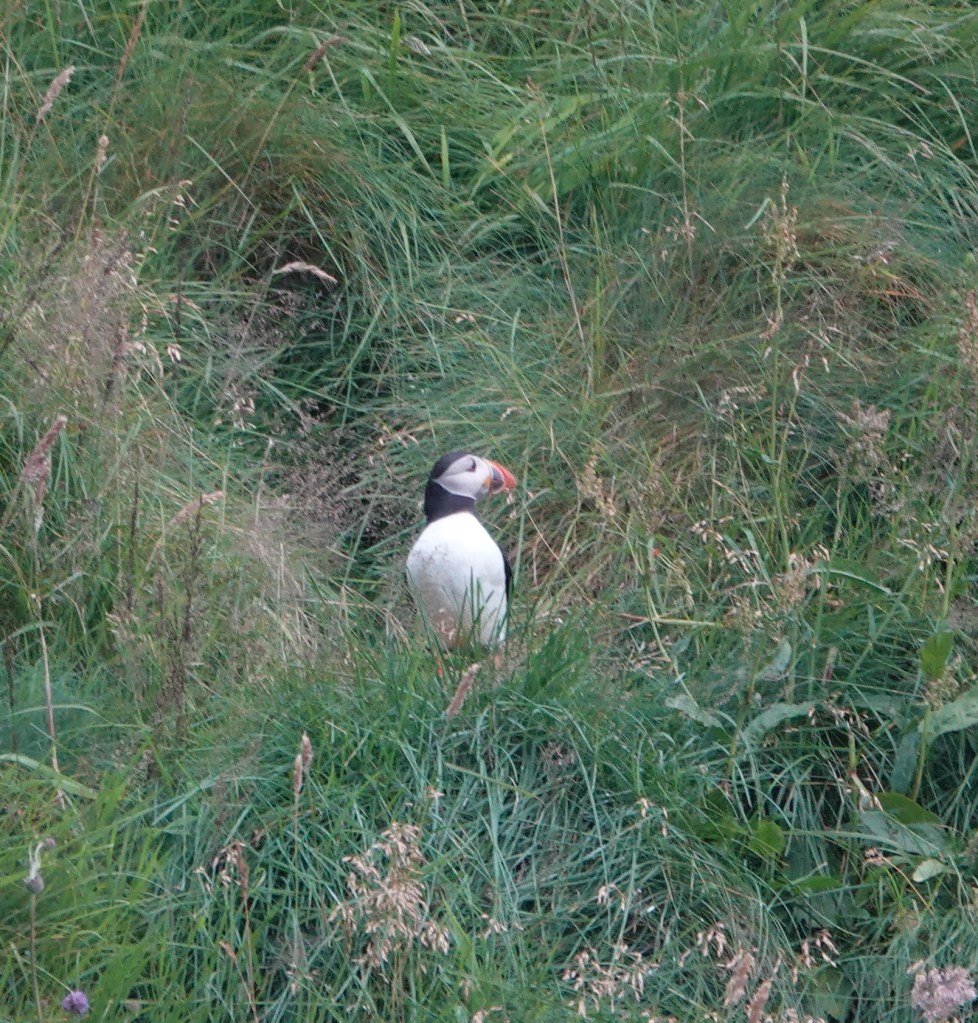
First stop on our highlight tour is the village of Gjógv, named after its dramatic sea-filled gorge, is a village that feels like the edge of the world. The gorge itself is a natural harbor, and the views from the cliffs above are breathtaking. I sat on the famous bench overlooking the Atlantic, watching puffins and taking tons of photos. My day 1 trip to Mykines Island was canceled because of the weather. I had been dying to photograph puffins, and finally, I had my chance in Gjógv. Below is the picture of me taking photos of Puffins and behind me the Kalsoy island, where James Bond meets his inevitable demise in No Time To Die

The entire town is beautiful and there are lots of hiking trails if you want to enjoy nature and the surrounding area. If you want to stay in the village, there is one hotel Gjaargardur Guesthouse, that also has an on-site cafe and restaurant.


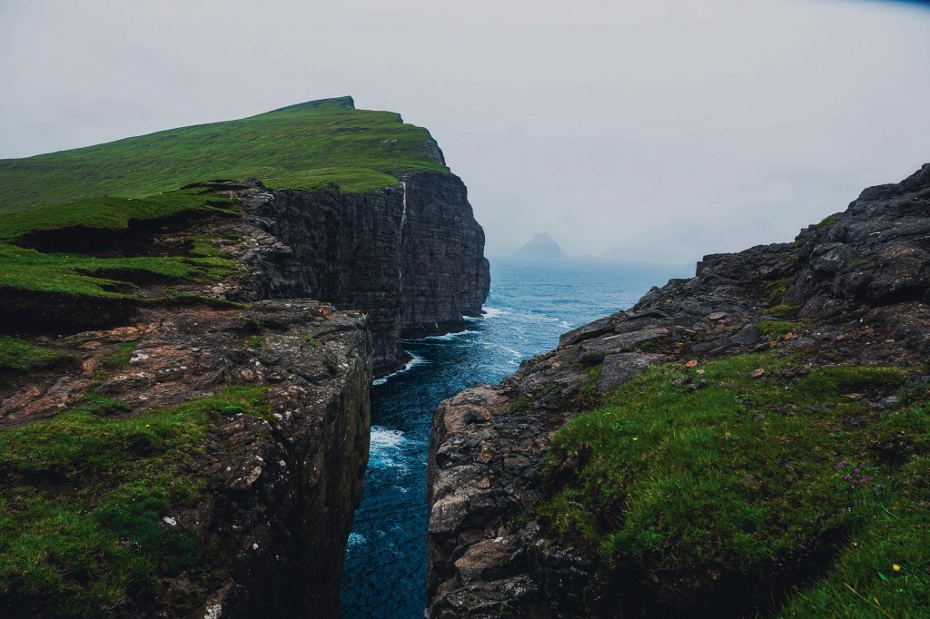
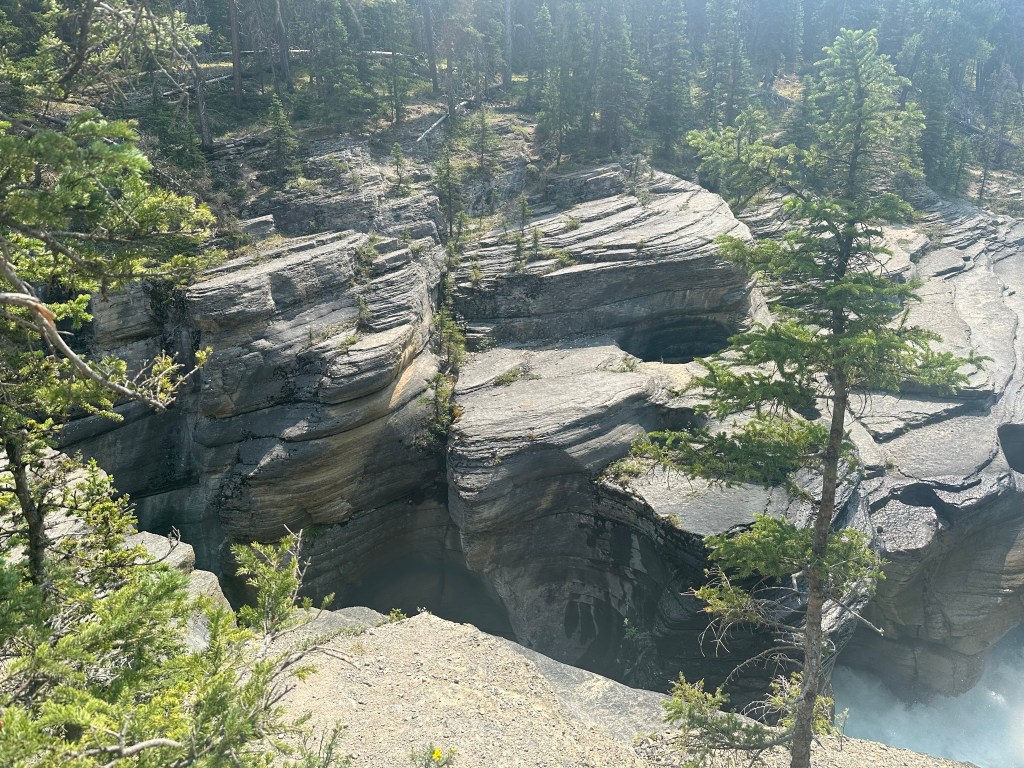
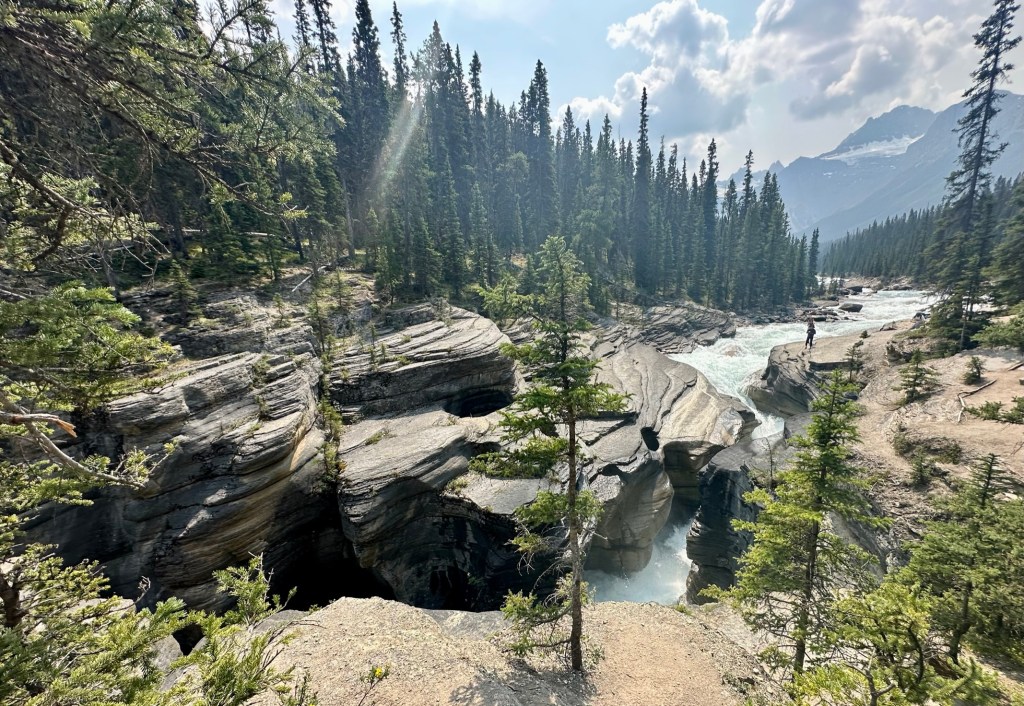
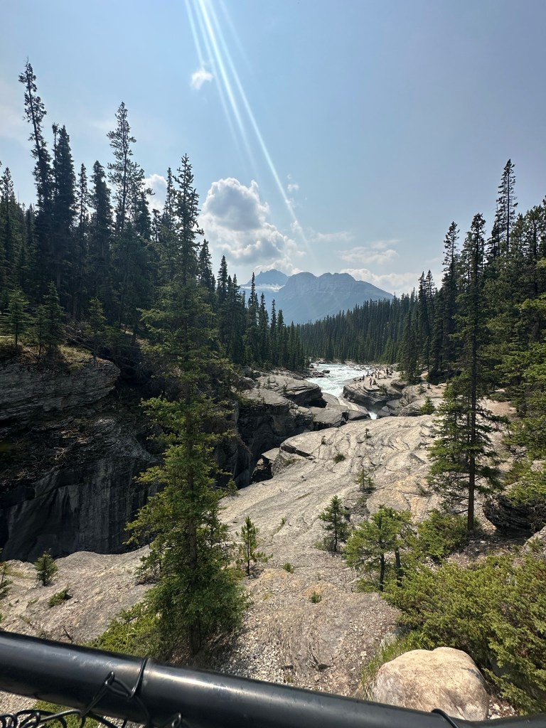
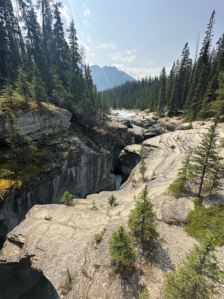
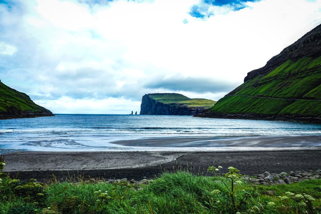
Tjørnuvík: Black Sands and Viking Echoes
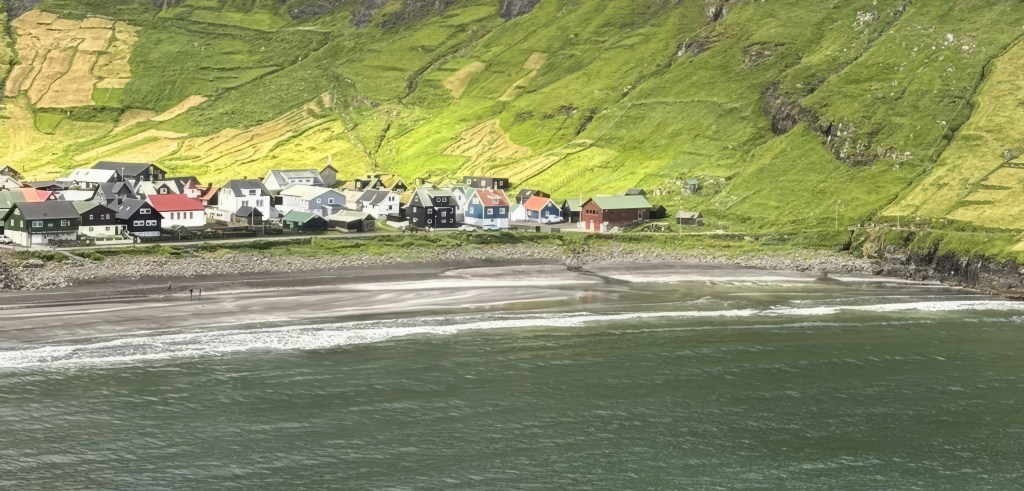
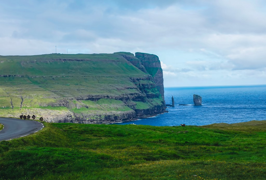
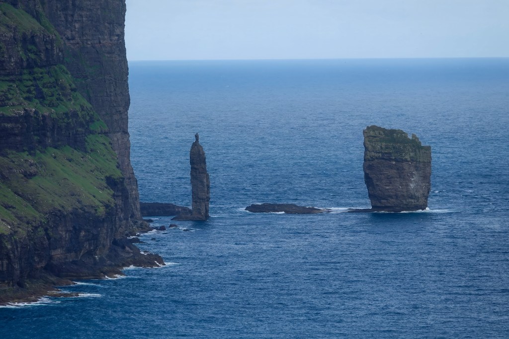
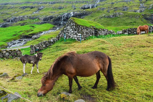
Tjørnuvík is the northernmost village on Streymoy and boasts a stunning black-sand beach framed by steep mountains. From here, you have a view of the iconic sea stacks. They are called Risin og Kellingin, also known as “The Giant and the Witch” which rise impressively from the ocean. According to Faroese folklore, a giant and his witch wife were sent from Iceland to steal the Faroe Islands. As they tried to drag the islands back home, they were caught by the rising sun and turned to stone—forever frozen in their attempt.
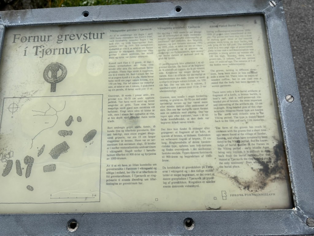
Viking burial site
Near the Tjørnuvík beach, you can also see a Viking burial site. This burial site was uncovered in 1950s and gives you glimpse into the lives and culture of early Norse settlers.
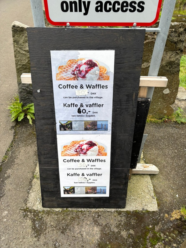
The village also has a surf shop and a cute little cafe that serves waffles and coffee run by a local man (Cash only service)
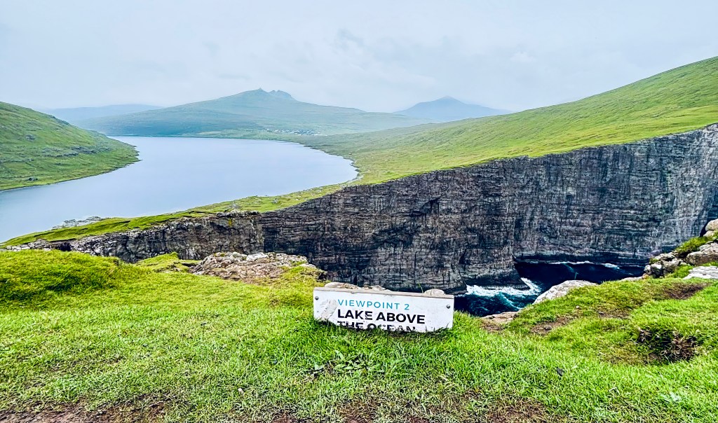
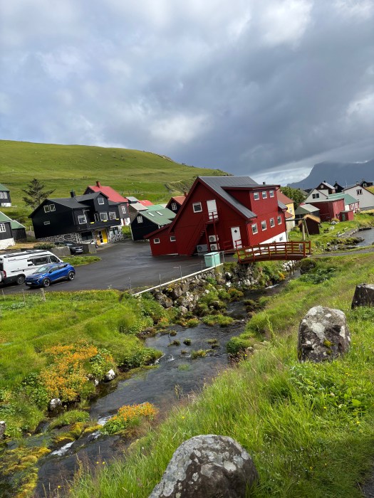
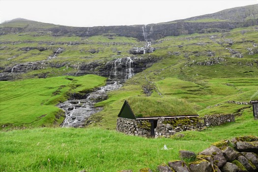
Saksun: Serenity in a Natural Amphitheater
Next stop: Saksun. This tiny village is tucked into a valley surrounded by towering mountains and overlooks a tidal lagoon that was once a fjord. With only 11 people and an old church perched above the lagoon, it is postcard-perfect village, and the hike down to the black-sand beach is surreal, especially when the tide is out.
A highlight for hiking enthusiasts is the hiking trail from Saksun to Tjornuvik. This hiking path winds through mountain trails marked by cairns and offers fantastic views of the surrounding mountains and fjords.
The Village Church of Saksun possesses a distinctive historical significance. Initially situated in Tjørnuvík, the church was carefully dismantled and relocated via a mountain hiking trail to its present site in Saksun. It was subsequently re-consecrated on the third Sunday after Trinity in 1858. The original trail over the mountains remains accessible today and is widely regarded as one of the most picturesque routes in the Faroe Islands. Notably, the church now features exterior stone walls, reflecting a transition from earlier wooden construction methods. Elements such as the interior walls, support beams, and altar continue to evoke the church’s origins in Tjørnuvík.
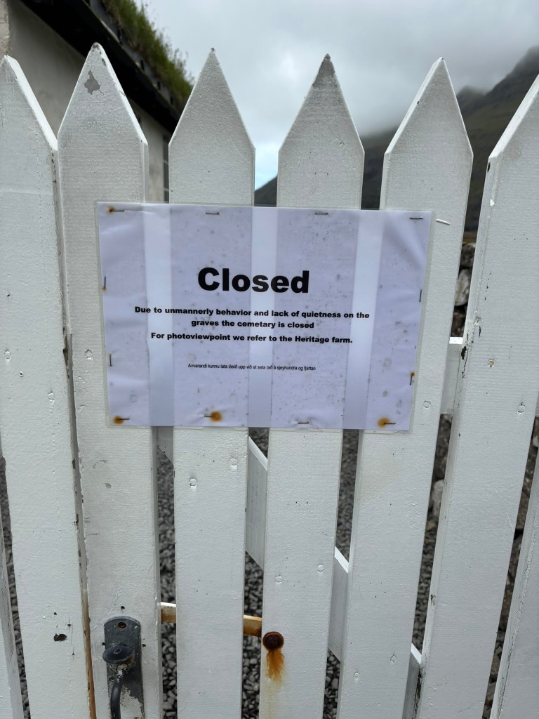
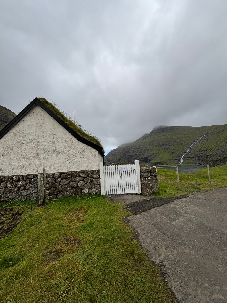
The church is not open to public anymore due to an incident that happened few years ago and you can only see it from outside
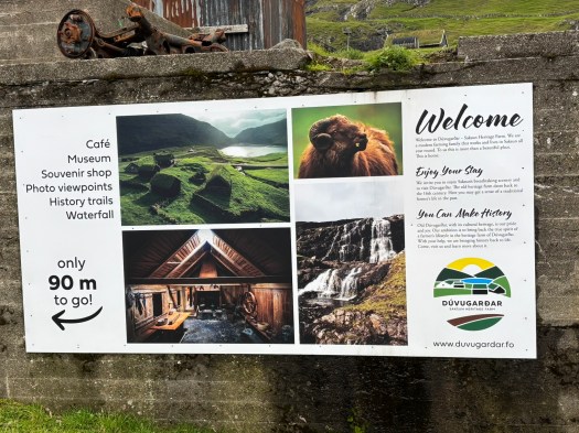
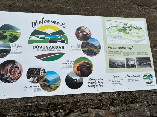
Dúvugarðar: A Living Testament to Faroese Farming Traditions
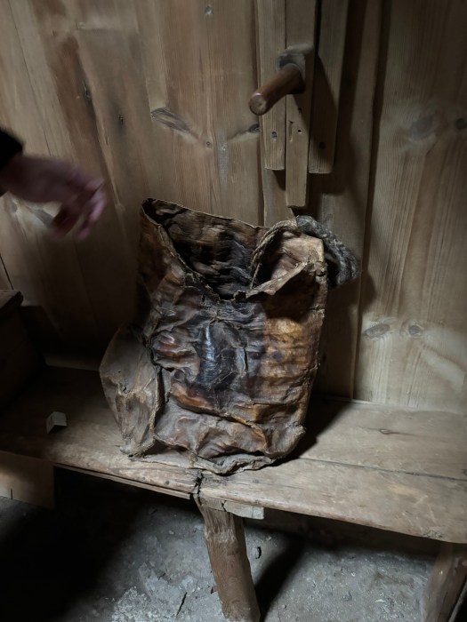
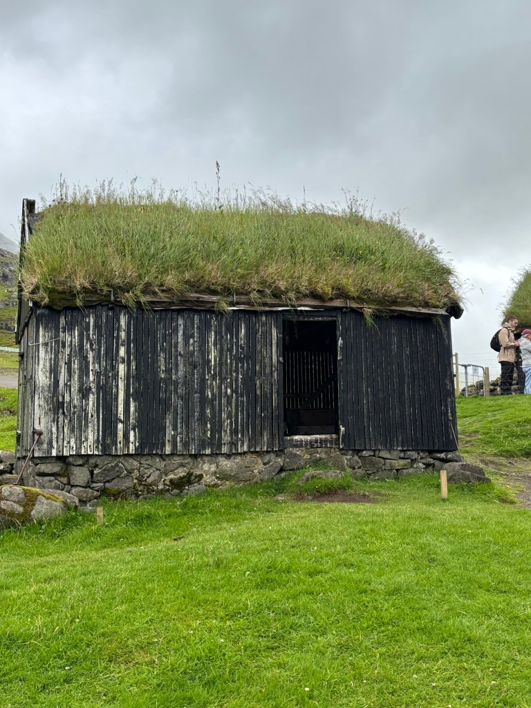
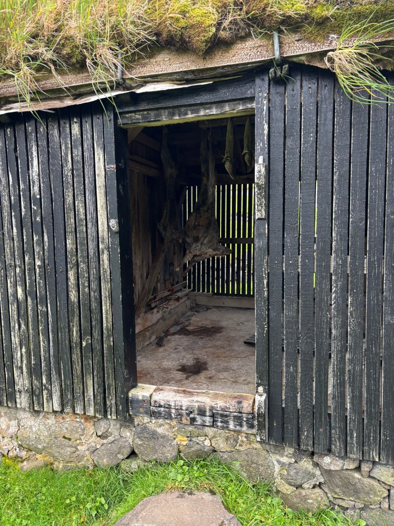
Saksun is also home to Dúvugarðar farm, which dates back to the 16th–18th century and stands as a remarkable testament to traditional Faroese farming life. Throughout the centuries, this historic site has preserved the essence of rural life in the Faroe Islands, highlighting authentic agricultural practices and enduring craftsmanship. The farm’s architecture and layout embody the methods and customs that influenced generations of Faroese farmers, offering visitors a unique window into the daily rhythms and cultural heritage of the region.
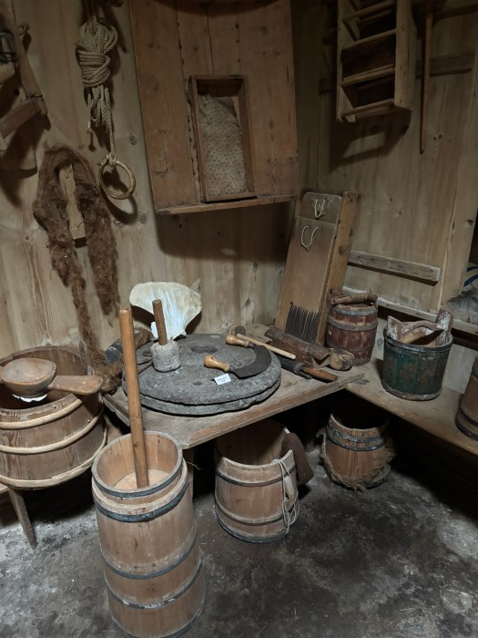
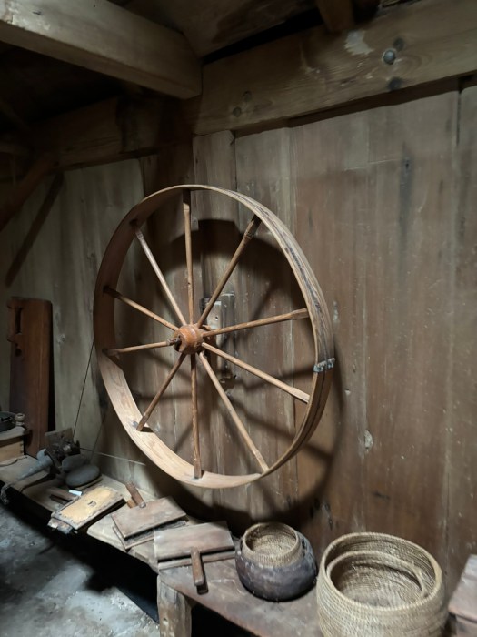


The Farmhouse: From Communal Home to Museum
Once home to dozens of people living under a single roof, the farmhouse now functions as an open-air museum. Visitors can explore a variety of carefully preserved and restored historical rooms. Each space features period textiles, authentic furniture, and traditional tools, allowing guests to immerse themselves in the daily life and craftsmanship that defined the farm through the centuries. The museum setting provides a tangible connection to Faroese domestic life as it once was.
Exploring the Landscape and Amenities
Visitors are invited to walk along history trails leading to a nearby waterfall, which offers breathtaking views and opportunities to capture iconic photos of the grass-roofed buildings against the stunning valley landscape (This spot is insta famous but was roped off when I was visiting and I was unable to take the iconic photo). Additional amenities at Dúvugarðar include a café serving light meals and hot beverages, as well as a small souvenir shop featuring locally handmade items.
Practical Information
The farm is accessible via a picturesque single-lane road, with parking available on-site. The main entrance charges an adult fee of 150 DKK, while access to the paths leading to the waterfall and nearby beaches remains free for all guests. This was one of the most picturesque places in the Faroe Islands and a popular spot for Instagram photos. The museum is definitely worth going through.
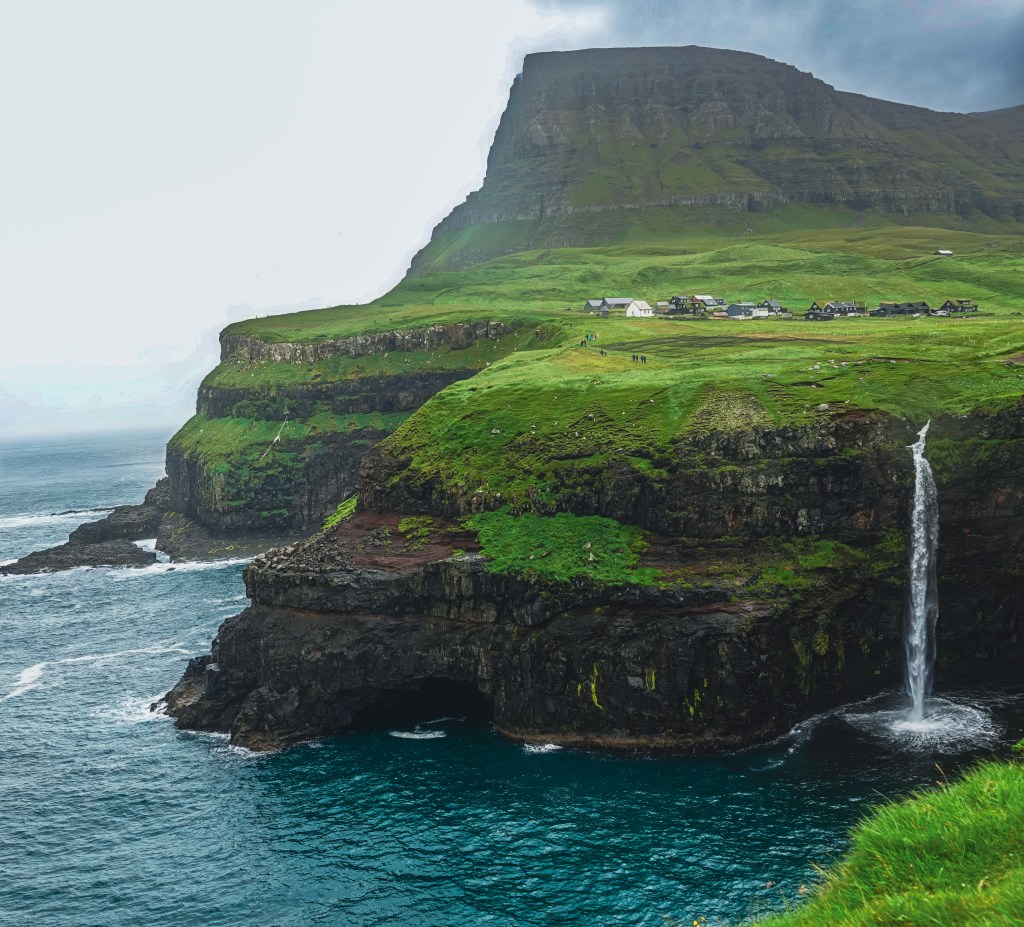
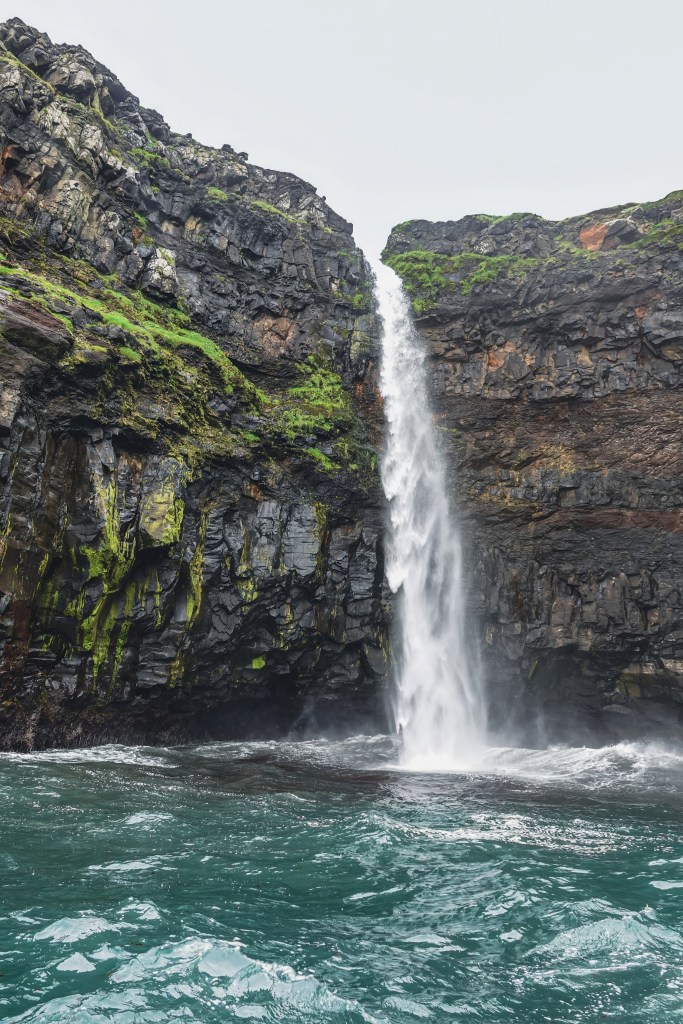
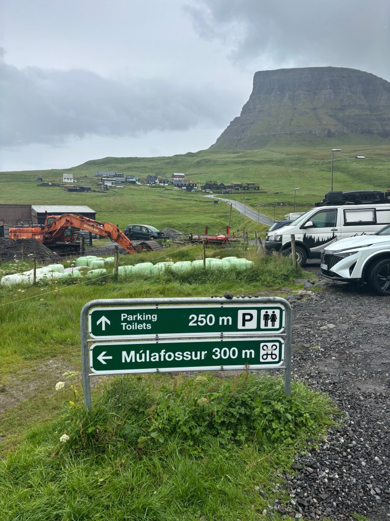
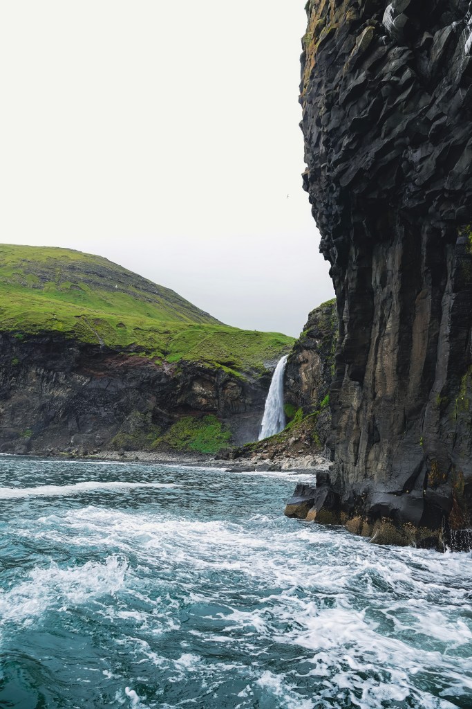
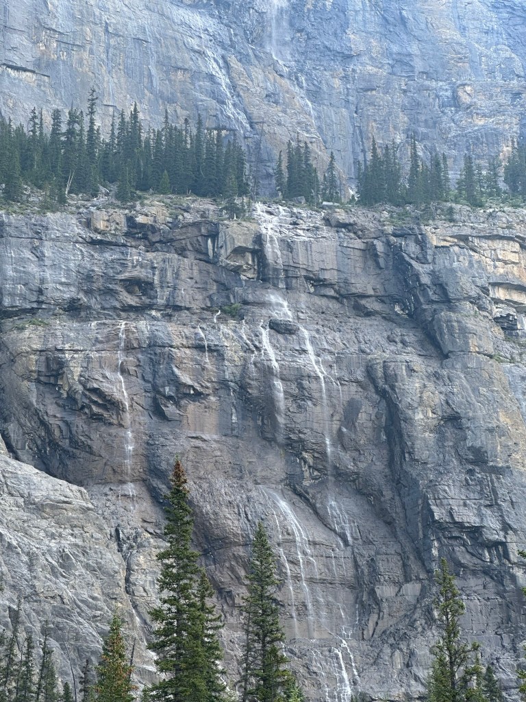
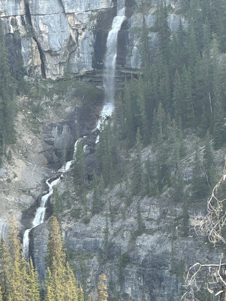
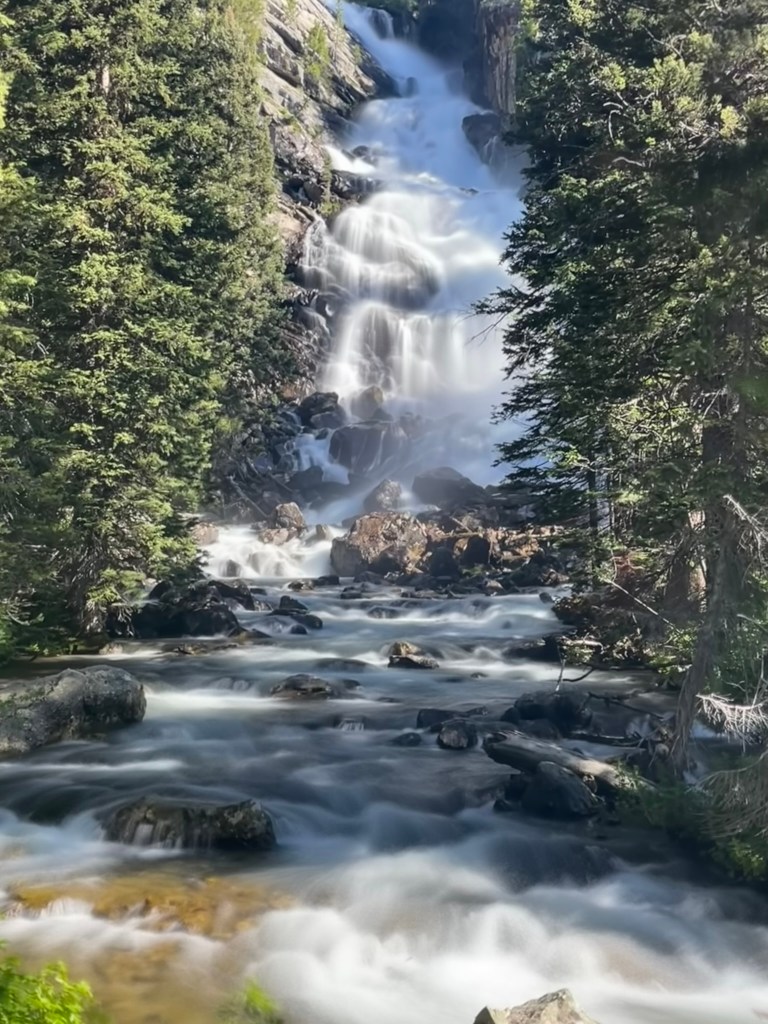
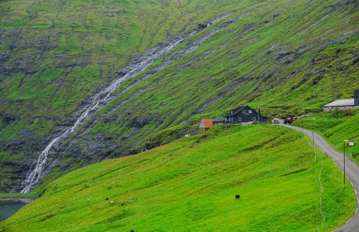
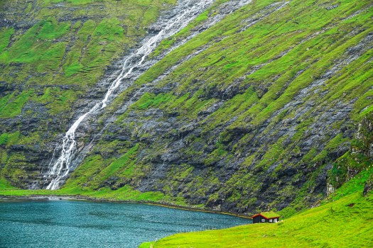
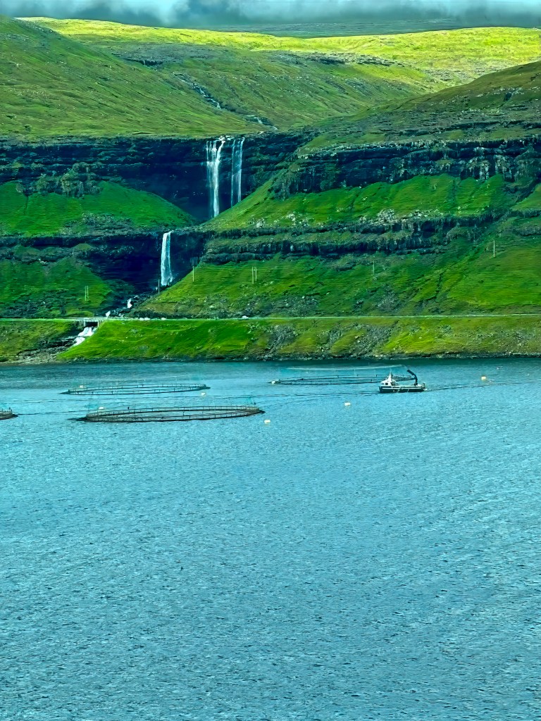
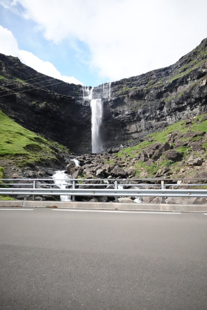
Fossá Waterfall: The Tallest Cascade in the Faroes
No trip is complete without witnessing the majestic Fossá Waterfall, the tallest in the islands. Cascading in two tiers down a cliffside, it’s a powerful sight—especially after rain. The waterfall is located right next to the road and doesn’t require much hiking to view it. The best photograph I took of these falls was actually from the other side of the lake where you can see the entire waterfall or with a drone where you can capture the different tiers of the waterfall.
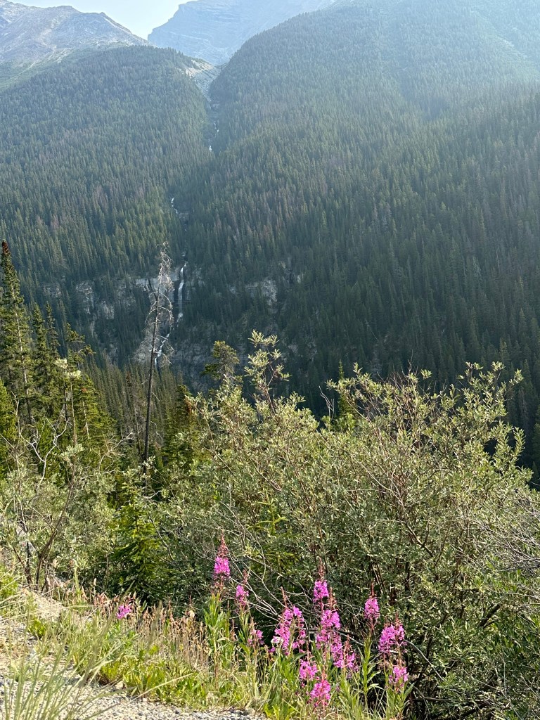
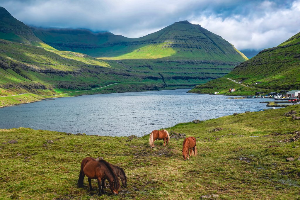
Funningur: Tranquility in the Heart of Faroe Mountains

On the way back from Gjógv , we stopped at a carstop and crossed to the other side to get the panoramic view of the village of Funningur and its surroundings. The winding road slides its way down the mountainside from the highest mountain of Faroe Islands known as Slættaratinduor, rising 880m (2887 feet) above sea level. You can use this road to reach the village. You can also hike from the car stop to Hvíthamar, which is a very popular and easy hike.
Hvíthamar Hike: Quick Overview
The Hvíthamar hike (Gongturur route) is a short, scenic trail above Funningur in Eysturoy, covering 2 km with an elevation gain of 124 meters. Trail completion typically takes about an hour, reaching up to 428 meters before looping back to Gjáarskarð pass.Getting There
Start at Gjáarskarð mountain pass between Funningur and Gjógv. Limited parking is near the cattle grid; green posts and a stile mark the trailhead. From Tórshavn, drive about 40–45 minutes and choose between the toll Eysturoyartunnilin or Streymin Bridge.
Highlights
- Hvíthamar Ridge Viewpoint: A metal railing marks a vista over Funningsfjørður fjord, Funningur, and nearby peaks, just 10 minutes from the trailhead.
- Skeggjanøv Viewpoint: After another 10–20 minutes uphill, enjoy extended views to Kalsoy Island.
Buttercup Road-High Mountain road
The “Buttercup Road” refers to a signposted network of scenic routes in the Faroe Islands, not a single specific road. These roads are marked with a yellow buttercup flower and are known for offering breathtaking views as they wind through mountains and to remote coastal villages. Some examples include the mountain road (Oyggjarvegur) above Tórshavn and routes to scenic villages like Saksun and Tjørnuvík.
We took the mountain road (Oyggjarvegur) after visiting Saksun on our way to Kirkjubøur. We joined this mountain at the gas station near Lake Leynavatn and drive 18 km (11 mi) of paved surface, connecting Tórshavn. We stopped at couple spots but the memorable spot for me was valley of Mjørkadalur. You can also see the huge windmill park on this road.
Prison-Panorama View over Kaldbaksbotnur, Coolest Prison in the World
The prison lies in an area called Mjørkadalur, which means the “Valley of Fog” since clouds tend to form near the surrounding mountain peaks above the fjord of Kaldbaksfjør∂ur.

There are about 13 prisoners in this prison, and each gets their own individual cell with a working television. They also have a mini-golf course out back to while away the hours. It is most beautiful prison I have seen and asked our guide how do get a room in that prison:-) which had better views than a 5-star hotel.
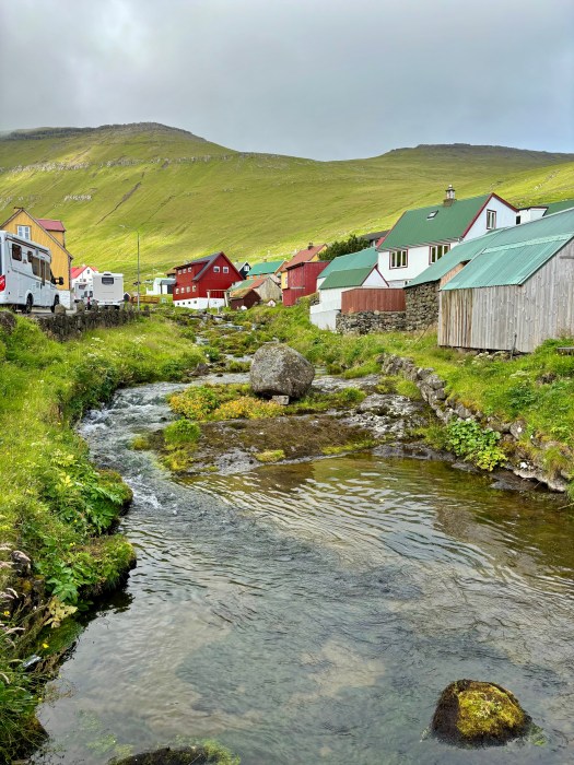
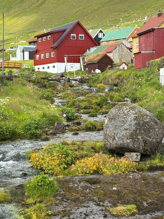
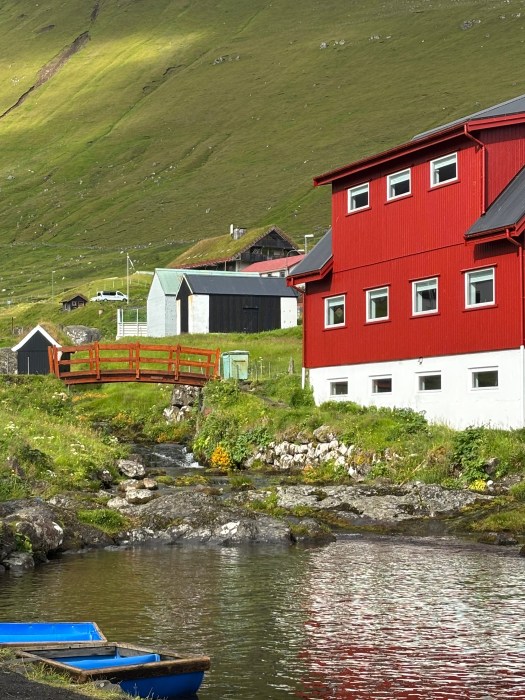
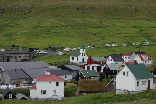
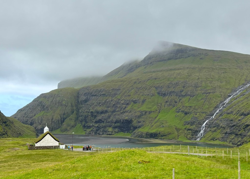
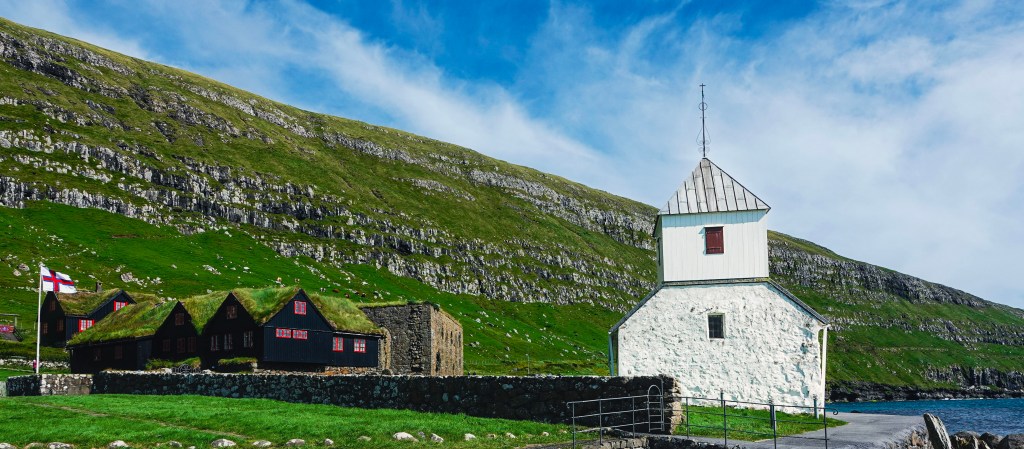
Kirkjubøur: Echoes of the Past in the Faroese Landscape
This was the last stop on our Faroe Islands highlight tour, but closest to the capital Torshavn. It is the Faroe Islands’ most historically rich village. It is a must-visit for any traveler seeking a deeper connection to the islands’ past. Kirkjubøur is perched on the edge of the sea with sweeping views of Hestur and Koltur. It is home to three remarkable landmarks.
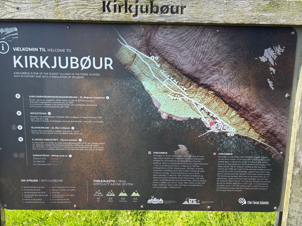
The ruins of Magnus Cathedral
Also known as The Múrunin (Wall), the ruins of unfinished Magnus Cathedral can be seen right behind the St. Olav’s church. Built around the 1300s, it was reputed to have been one of the finest churches in Scandinavia.
Saint Olav’s Church
Another landmark is Saint Olav’s Church, the oldest still-used church in the Faroese, dating back to the 12th century. You can see an impressive altarpiece painting by the famous Faroese artist Samuel Joensen Mikines inside the church.
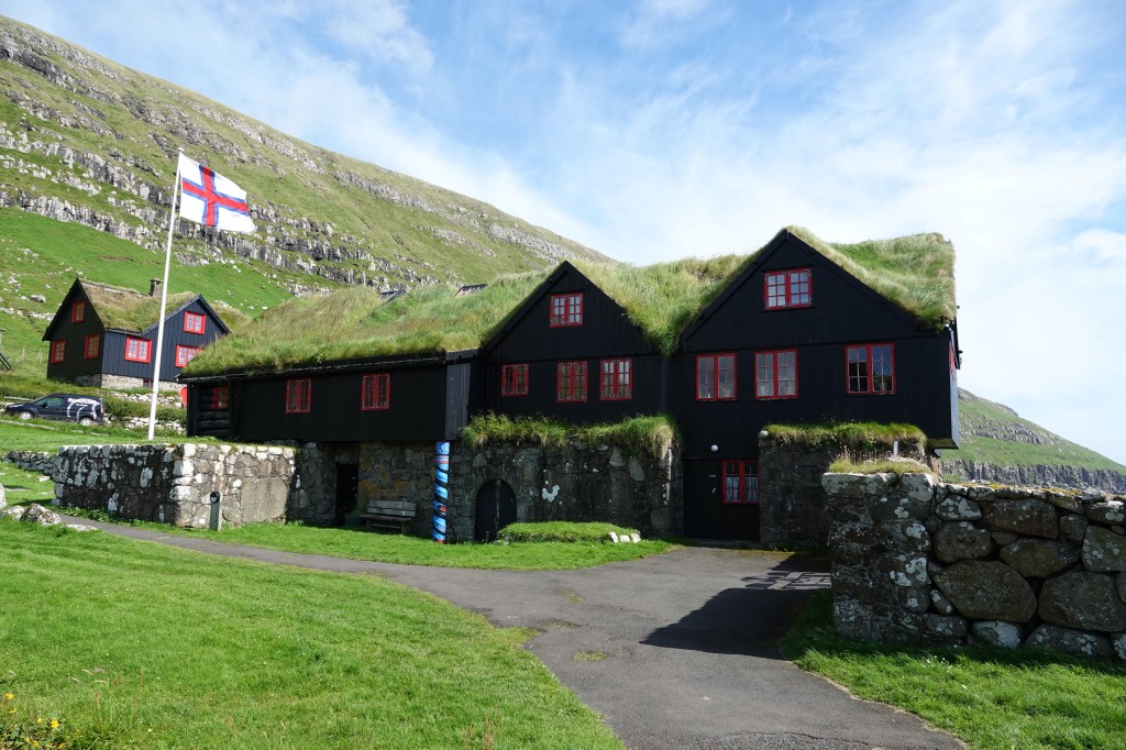
Kirkjubøargarður
Also known as King’s farm, Kirkjubøargarður, is a turf-roofed farmhouse that’s been continuously inhabited for nearly a thousand years. The current owners are the 13th generation of the Patursson family. It is one of the oldest inhabited wooden houses in Europe. You can walk through the house and appreciate the history and legends surrounding this charming house.
Walking through this village feels like stepping into a living museum. History, nature, and tradition blend seamlessly into the landscape.
Final Thoughts
The Faroe Islands are a place of contrasts—wild yet peaceful, remote yet welcoming. Whether you’re chasing waterfalls, exploring Viking history, or simply soaking in the silence, this archipelago offers a kind of magic that lingers long after you leave.
If you’re craving a destination that’s off the beaten path and rich in soul-stirring landscapes, the Faroes are calling. And trust me, you’ll want to answer.