Prepare to be swept away by the unparalleled beauty of the Canadian Rockies! The Icefields Parkway connects Lake Louise and Jasper. It is widely regarded as one of the most scenic drives in the world. Imagine towering mountains, glistening glaciers, vibrant blue lakes, and cascading waterfalls unfolding before your eyes with every turn. This post is your guide to experiencing the very best of this incredible journey.
Pro tip: Download the Guidealong app for Canadian Rockies tours. This app provides a delightful narration of the various viewpoints. It ensures that you won’t miss any of the fantastic sights along the way.
- Icefields Parkway Stops from Lake Louise:
- Herbert Lake
- Hector Lake
- Crowfoot Glacier Viewpoint and Bow Lake Viewpoint
- Bow Lake
- Peyto Lake and Bow Summit
- Waterfowl Lakes and Chephren Lake
- Mistaya Canyon
- Saskatchewan River Crossing
- Weeping Wall
- Icefields Parkway Viewpoint, Bridal Veil Falls, Panther Falls
- Parker Ridge
- Tangle Creek Falls
- Stutfield Glacier Viewpoint
- Beauty Creek to Stanley Falls
- Sunwapta Falls
- Goats & Glacier Lookout/Viewpoint
- Athabasca Falls
- Horseshoe Lake
- Valley of the Five Lakes
- Final thoughts
Icefields Parkway Stops from Lake Louise:

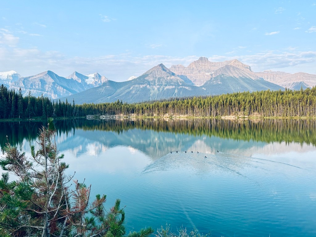
Herbert Lake
Location: 7km from Lake Louise/226km from Jasper
- Features: Small lake, short 1-mile loop trail around the lake. Known as a photographer’s favorite for its reflection of the peaks, including Mount Temple.
- Parking: Parking lot on the west side.
Herbert Lake is an easy stop on the Icefields Parkway. The photos I took here are some of my favorite pictures from the trip.
Hector Lake
Location : 23km from Lake Louise/211km from Jasper
- Features: Largest lake in Banff National Park, partially obstructed viewing area off the west side.
- Activities: Hike to the lake (2.8 miles, 390 ft elevation gain).
- We did not stop here.
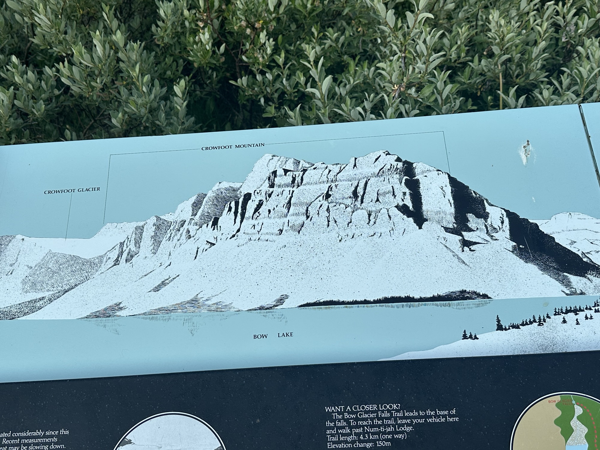
Crowfoot Glacier Viewpoint and Bow Lake Viewpoint
Location: 32 Km from Lake Louise/ 194 Km from Jasper
- Features: Viewpoint to see the Crowfoot Glacier, Bow Lake, and surrounding mountains.
It offers a scenic vista of the glacier, which is named for its three “toes” that once resembled a crow’s foot. The viewpoint is a roadside pull-off, making it easily accessible for visitors driving along the Icefields Parkway.
Its a beautiful viewpoint that doesn’t require much hiking and worth the stop.

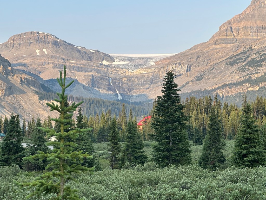
Bow Lake
Location: 37km from Lake Louise/194km from Jasper
- Features: Offers views of the Wapta Icefield, Bow Glacier, and Crowfoot Glacier. Road on the west side leads to Num Ti Jah Lodge (small snacks available).
- Activities: Hike to Bow Falls (5.5 miles out and back, 925 ft elevation gain), moderate hike with stairs (poles recommended). You can enjoy activities like canoeing and stand-up paddleboarding on the lake.
We stopped at the viewpoint to take in the towering mountains and the beautiful lake. There is an information panel in the parking lot that shows various views you can see from the spot.

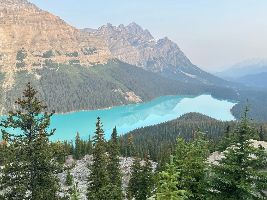
Peyto Lake and Bow Summit
Location: 45km from Lake Louise/188km from Jasper
- Features: Highest elevation point, beautiful lake (especially on a sunny day), known for its unique turquoise color. Expect a busy area.
- Activities: 2km walk from the parking lot to the viewpoint platform, then trails to the upper ridge
This is one of the best viewpoints on the IceFields parkway and we stopped here on our way out around 7.30AM and again on the way back in the afternoon. The parking lot can get busy, but we didn’t have any issues getting parking early in the morning or late in the afternoon. There is a main trail that leads to the popular viewpoint. There is supposed to be another trail that leads to a closer view, but we couldn’t find it.
Waterfowl Lakes and Chephren Lake
Location: 60km from Lake Louise/174km from Jasper
- Features: Less crowded lakes compared to other Banff lakes, providing a more serene and tranquil experience for visitors. A viewpoint is available past the FCFS campground, offering stunning panoramic views that are perfect for photography and relaxation.
- Activities: Chephren Lake Hike- 5 miles round trip, 833 ft elevation gain (mostly at the beginning).
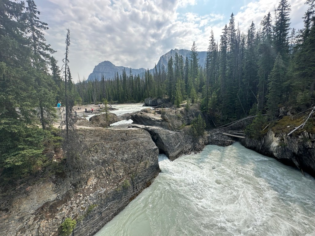
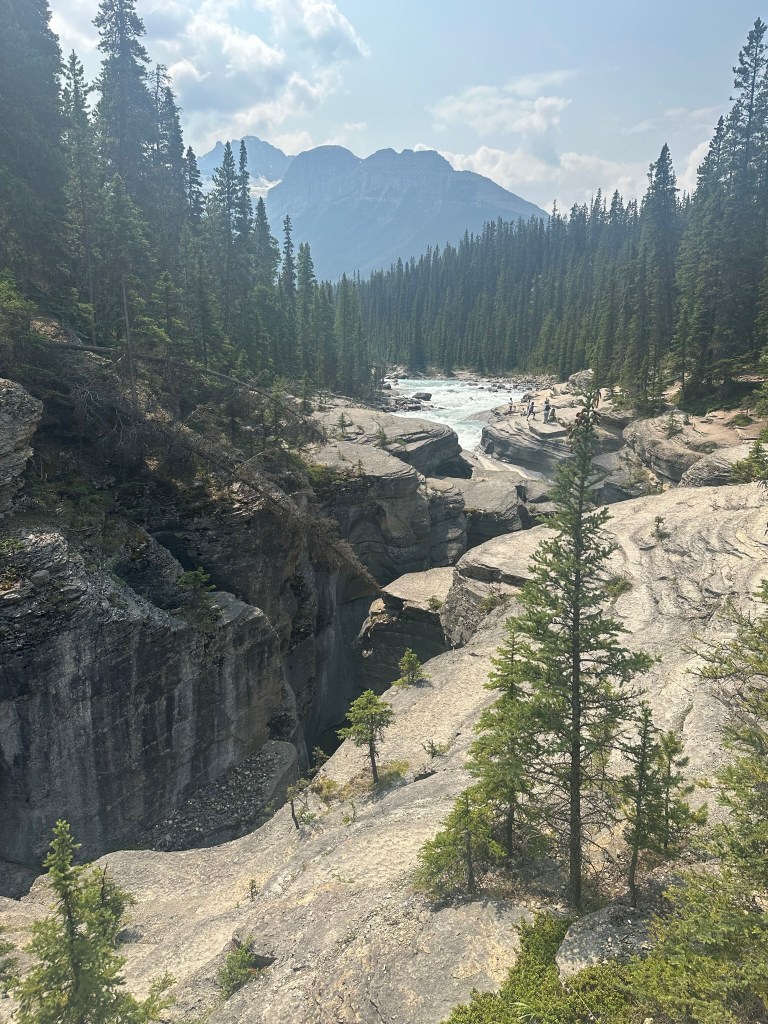
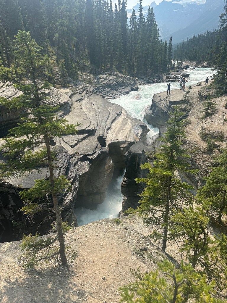
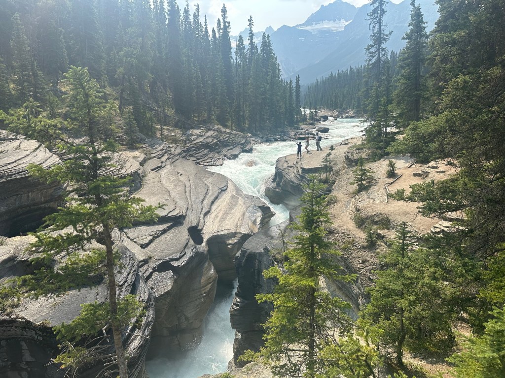
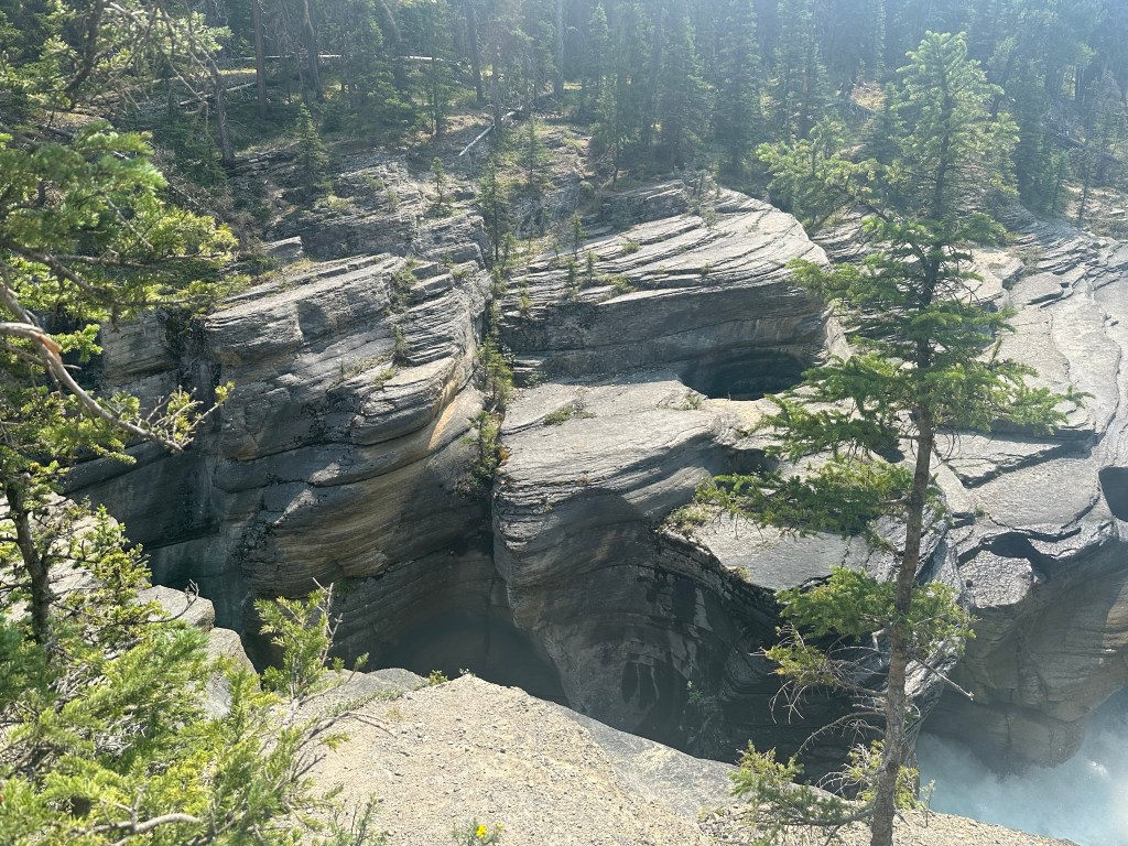
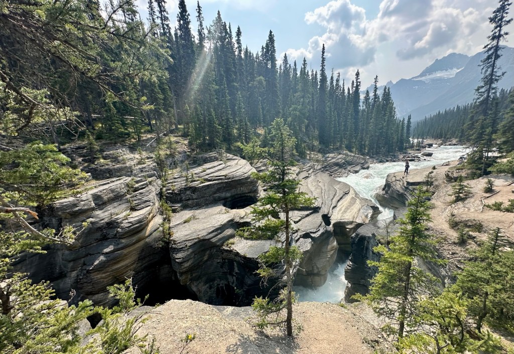
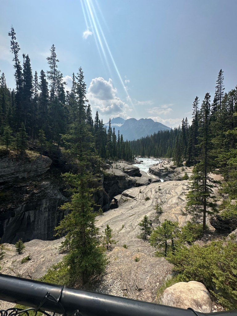
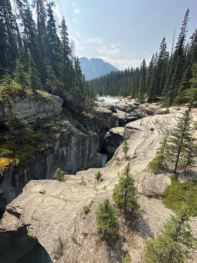
Mistaya Canyon
Location : 75km from Lake Louise/158km from Jasper
- Features: Popular spot, reachable by a short trail with a scenic observation bridge. Visitors often notice the river’s erosion. This natural phenomenon led to the remarkable formation of the canyon.
- Activities: Mistaya Canyon Waterfall hike (0.7 miles, 193 ft elevation out and back).
- Parking: A pull-out area is available on the west side, but parking is limited
- We stopped here on the way back from the Athabasca Glacier walk.
Saskatchewan River Crossing
Location: 80km from Lake Louise/153km from Jasper
- Features: Only stop on the Icefields Parkway if you need gas or food. We stopped and got coffee. The store has lots of postcards and T-shirts.
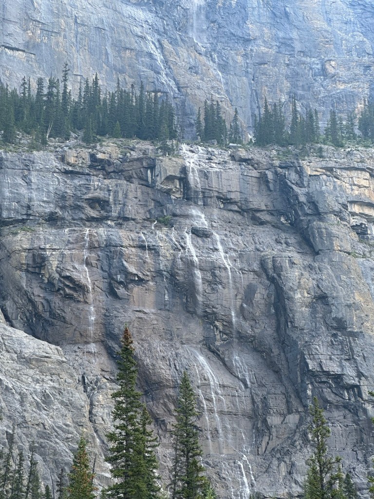
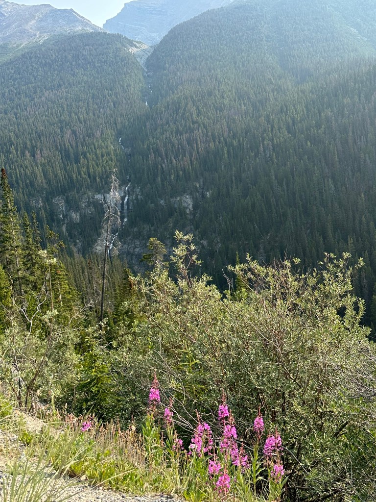
Weeping Wall
Location: 109km from Lake Louise/125km from Jasper)
- Features: Unique location where water comes through the mountains. Reviews mention it looking like “tears” falling down the hill. Best seen during the spring melt. It wasn’t awe-inspiring when we saw it in July
- Parking: Parking on the west side. The view is off to the right. You can see it without leaving your car.
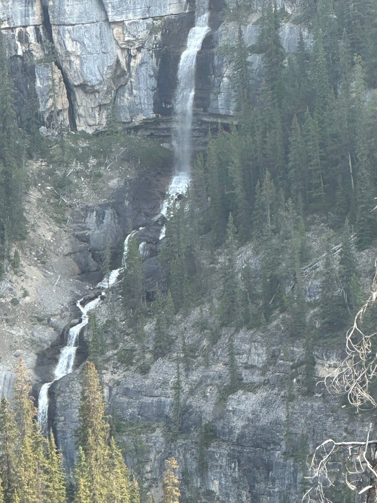
Icefields Parkway Viewpoint, Bridal Veil Falls, Panther Falls
Location: 116km from Lake Louise/118km from Jasper
- Features: Two pull-outs on the east side after the Big Bend. The first provides a view looking back at the Parkway and Bridal Veil Falls.
- Activities: Panther Falls Trail-0.8 miles out and back, 232 ft elevation gain. Reviews suggest turning around at Panther Falls (a 0.6-mile round-trip hike) as the view of Bridal Veil Falls is the same from the pull-out.
- We couldn’t find the entrance to Panther Creek Trail and didn’t go on the trail
Parker Ridge
Location: 121km from Lake Louise/112 km from Jasper
- Features: Highly recommended hike along the Parkway. The trail is 2.7 km (one-way) with 305 m of elevation gain.
- Parking: Parking lot on the west/south side for the trailhead.
- We didn’t go on this trial as we had 10.30 slot for the Columbia Icefields visit, but this is on my bucket list to visit next time we are in Banff
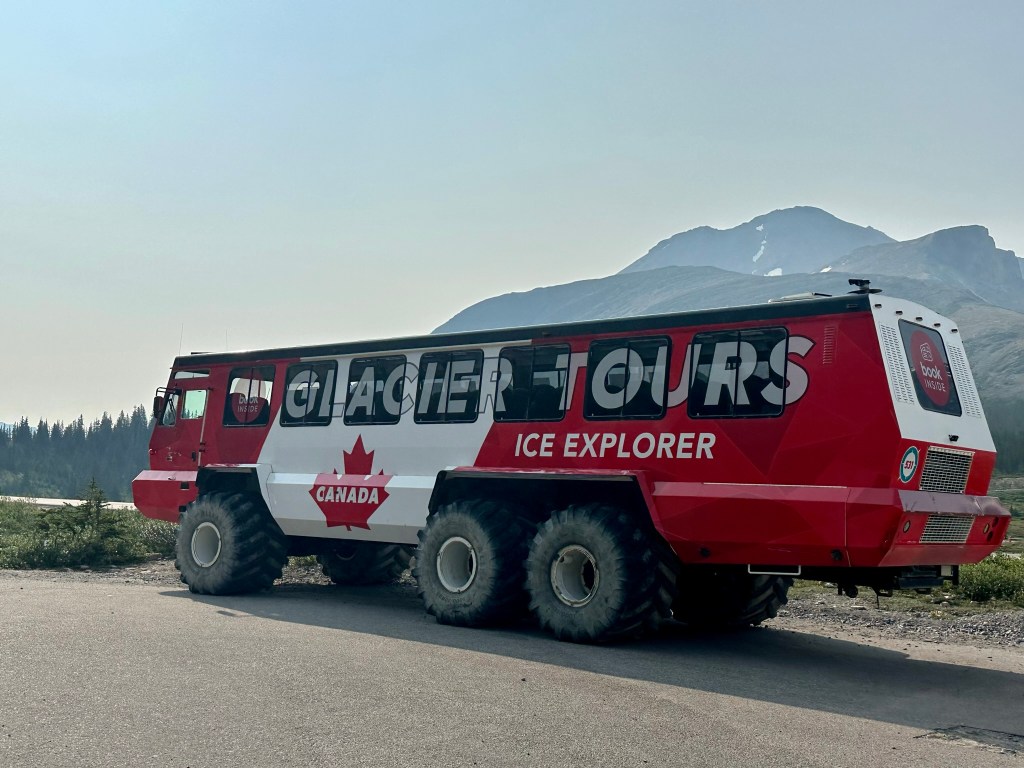
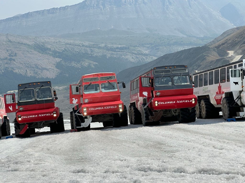
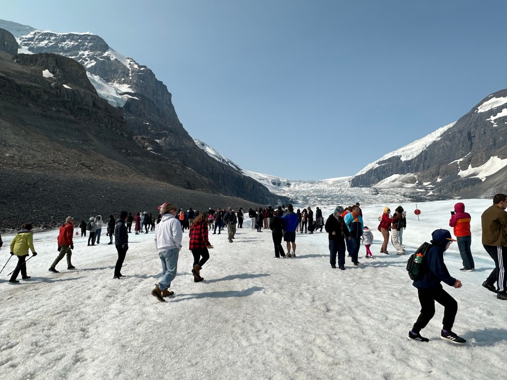
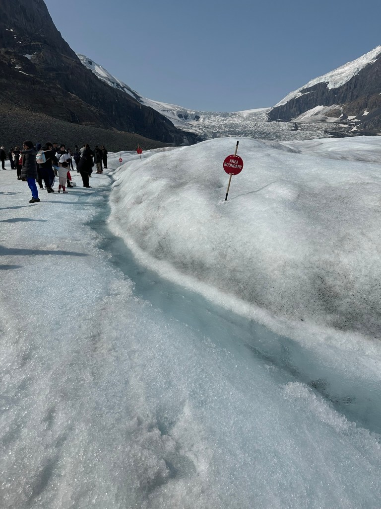
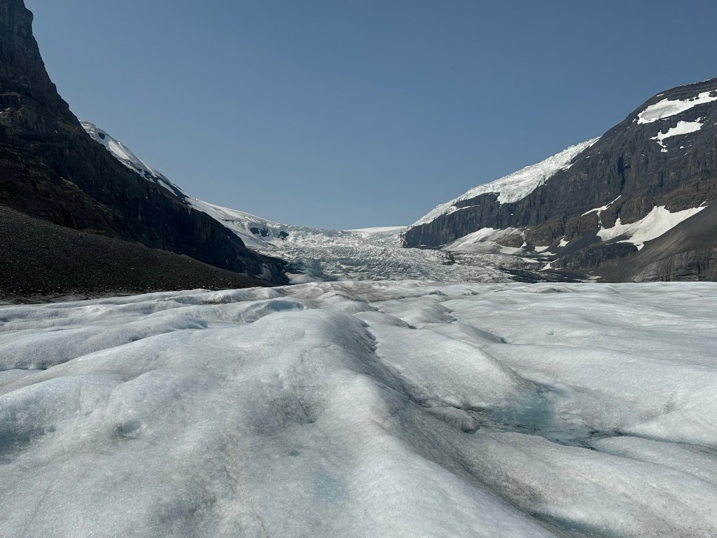
Columbia Ice Field tour, and the toe of the Athabasca Glacier
Location: 130km from Lake Louise/103km from Jasper
The toe of Athabasca Glacier hike:
- Right after the information center, turn left on Snocoach Rd, then right onto Glacier Road
- Toe of the Glacier Trail: 0.9 miles, 200 ft.
Columbia Icefields tour:
A Columbia Icefield tour includes an Ice Explorer ride on the Athabasca Glacier and a visit to the Columbia Icefield Skywalk, providing unique views of the glacier. Tours start from the Columbia Icefield Discovery Center.
Key features of the tour:
- Ice Explorer Ride: You’ll travel on a specially designed, all-terrain vehicle. This vehicle takes you onto the Athabasca Glacier. The glacier is one of the six principal “toes” of the Columbia Icefields.
- Glacier Walk:You’ll have the opportunity to disembark and walk on the glacier. You can feel the ancient ice. You might even fill your water bottle with meltwater.
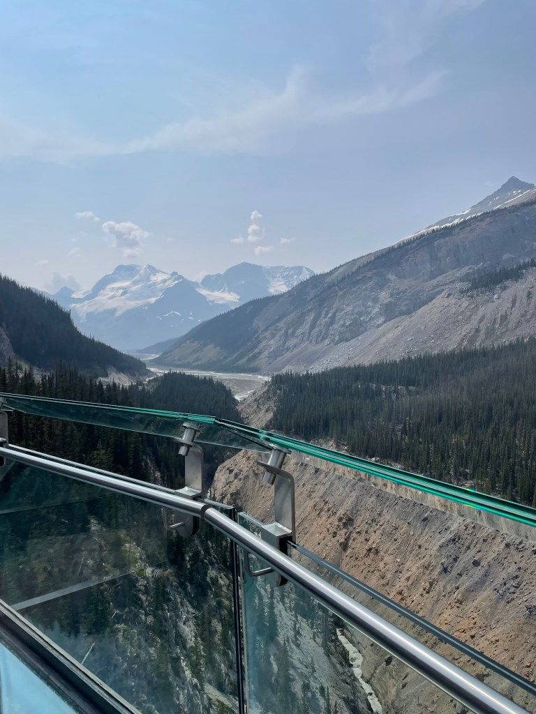
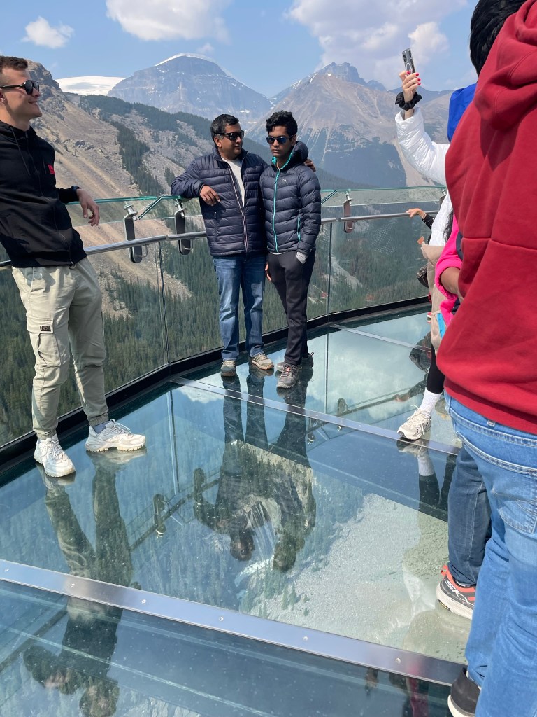
- Columbia Icefield Skywalk:This glass-floored walkway offers stunning views of the Sunwapta Valley. It gives breathtaking views of the surrounding glaciers. The structure is suspended 918 feet above the valley floor.
- Informative Commentary:Guides offer insights into the geology, history, and environmental changes of the Columbia Icefields.
Tour Details:
- Tours leave often throughout the day from the Columbia Icefield Discovery Centre.
- The experience typically lasts 2.5 to 3 hours.
- Warm clothing and waterproof shoes are recommended due to potentially cold and windy conditions on the glacier.
- Consider booking in advance, especially during peak season. You can buy tickets here.
We didn’t like the skywalk as much and felt like it was a waste of time. If we do this again, we would choose the toe of the glacier as our destination. Alternatively, we might consider a guided ice walk, such as this one.
We had lunch at the restaurant in the Columbia Icefield’s visitor center and drove back to Lake Louise village.
There are additional stops along the Icefields Parkway from the Columbia Visitor Center. These stops are worth visiting on the way to Jasper if you decide to continue. We hope to return and stop at the remaining stops along the way to Jasper.
Tangle Creek Falls
Location: 135km from Lake Louise/96km from Jasper
- Features: Multi-tiered waterfall right beside the highway, beautiful and easily accessible.
- Parking: Parking on the west side.
Stutfield Glacier Viewpoint
Location: 139km from Lake Louise/95km from Jasper
- Features: Offers views of mountains and glaciers.
- Parking: Parking loop off the west side.
Beauty Creek to Stanley Falls
Location : 145km from Lake Louise/89km from Jasper
- Features: Unofficial Parks Canada trail, 2.4 miles (out and back). The hike features a narrow canyon with eight waterfalls.
- Trail Details: Starts flat, then climbs a short, steep hill. The trail follows Beauty Creek and passes multiple waterfalls before reaching Stanley Falls.
- Finding the Trailhead: Unmarked pull-out on the east side of the road (sign in the lot). It’s about 0.5km south of the Beauty Creek Hostel.
Sunwapta Falls
Location 179km from Lake Louise/56km from Jasper
- Features: Very popular stop. Picturesque waterfalls originate from the Athabasca Glacier. The upper falls are easily accessible near the parking lot.
- Activities: Hike to the upper and lower falls (2 miles, 469 ft elevation gain). The trail to the lower falls involves a downhill slope and some roots.
- Access: Turn at the Sunwapta Falls Lodge (road off the west side) to reach the parking lot.
Goats & Glacier Lookout/Viewpoint
Location : 194km from Lake Louise/38km from Jasper
- Features: Quick and rewarding stop with stunning views of hanging glaciers, rugged peaks, and the Athabasca River.
- You might spot mountain goats here.
- Activities: Short walking loop (0.2 miles, no elevation) off the west side.
Athabasca Falls
Location :202km from Lake Louise/32.5km from Jasper
- Features: A popular stop on the way to Jasper; a powerful waterfall with a large volume of water.
- Activities: Short, paved walk with stunning views (0.6 miles, 82 ft elevation gain). Trails and viewpoints offer you the opportunity to view the falls from various angles. You can also descend to the river. Consider exploring the trail network, which includes a bridge, a pothole, and ends at the river.
- Access: Turn onto Highway 93A off the west side; the parking lot will be on your left.
Horseshoe Lake
Location : 205km from Lake Louise/28km from Jasper
- Features: Small lake off the east side, known for cliff jumping. The lake is right beside the highway, with ledges overlooking the water.
- Parking: Small parking area.
- Note: It can get busy, and parking can be challenging.
Valley of the Five Lakes
Location: 223km from Lake Louise/10.5km from Jasper
- Features: This popular hike features five clear lakes with unique shades of blue and green. The trail is wide and relatively easy, with some elevation changes.
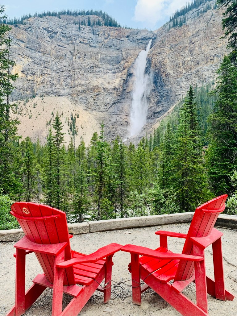
- Activities: 4.5 km loop trail. The trail passes through a forest, crosses a boardwalk, and follows a ridge with views of the lakes. Viewing benches and Parks Canada Red Chairs are along the trail.
- Access: Located just under 9 km south of Jasper along the Icefields Parkway.
Final thoughts
The Icefields Parkway is considered one of the most beautiful drives in the world, and definitely lives up to the hype. We started around 6.30 AM from Lake Louise Inn and had the highway pretty much to ourselves for the first couple of hours. We also saw a few bears and other animals along the way. If you have, this is worthwhile to add to your itinerary, and try to drive as far as possible and stop along the way. For our itinerary, we were back in Lake Louise by 3 PM, making it a great day trip.