Imagine standing before a wall of fiery red sandstone, where the cliffs don’t just touch the sky—they tell the stories of gods. Welcome to Badami, the 6th-century capital of the Chalukya Empire, where history isn’t found in books, but carved directly into the heart of the mountains.
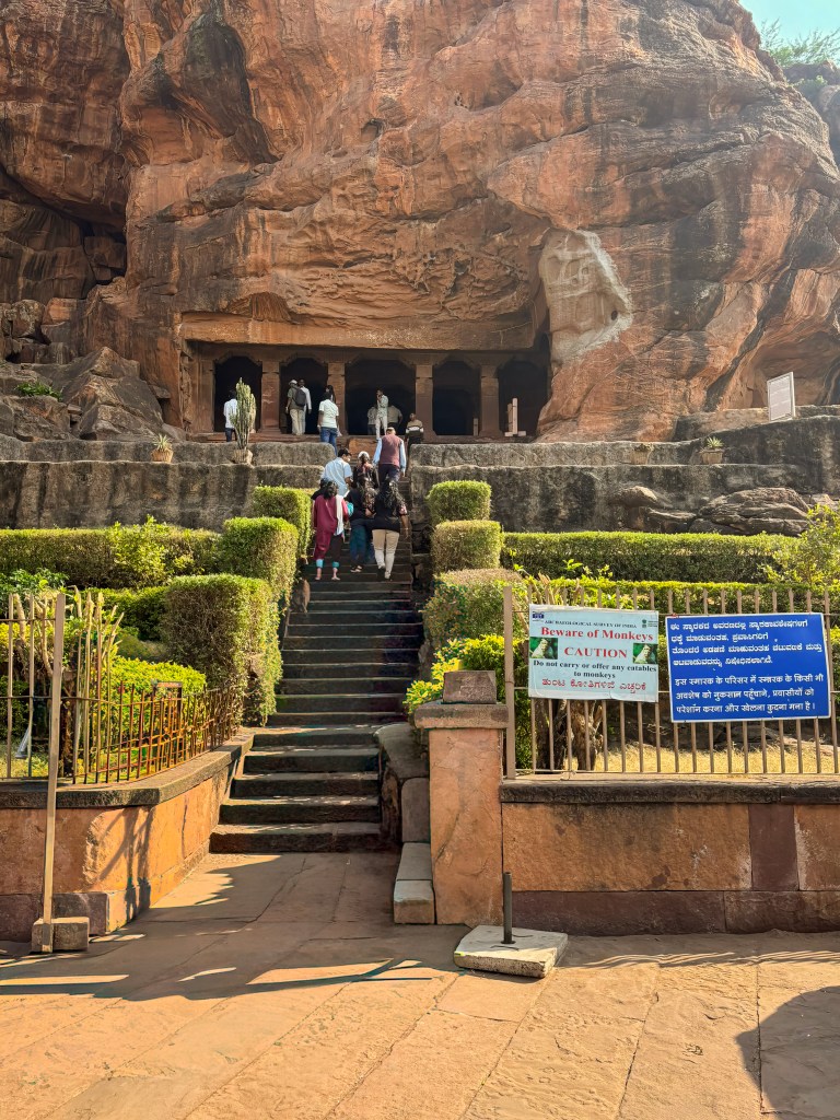
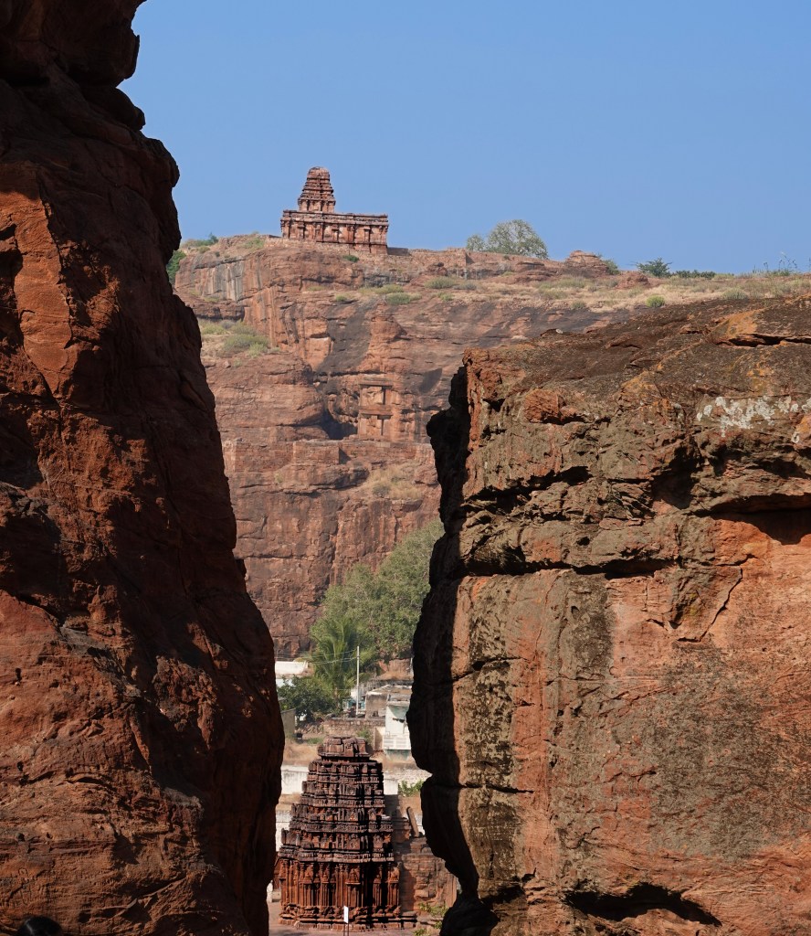
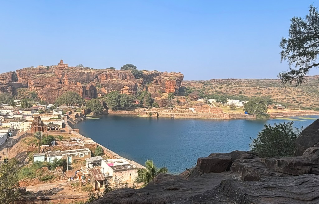
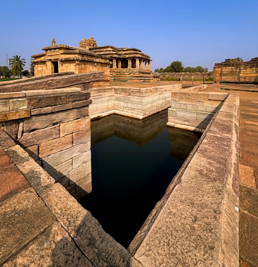
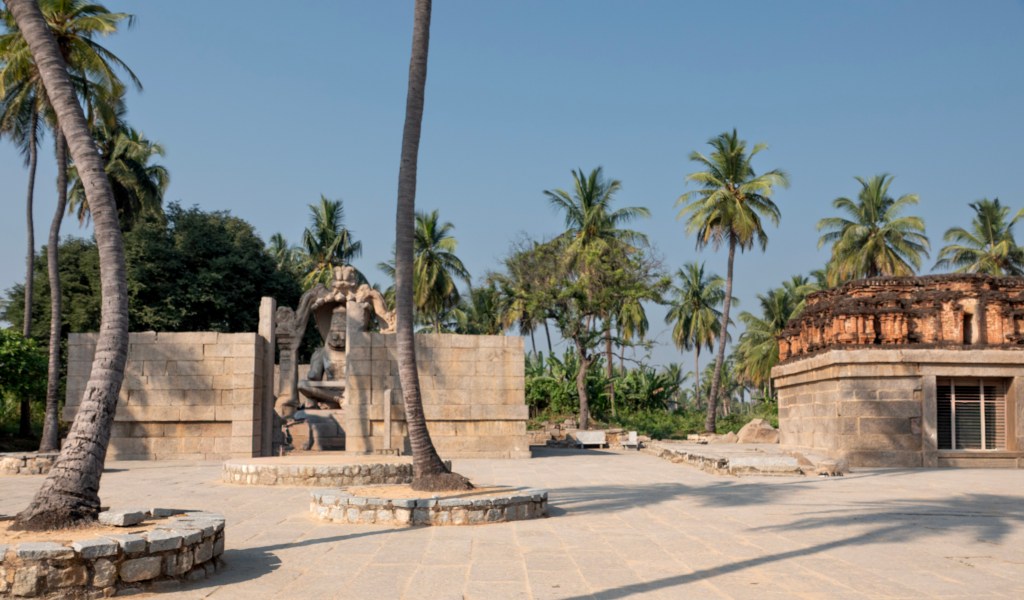
Carved into dramatic cliffs overlooking the emerald Agastya Lake, the Badami Caves are more than just monuments; they are a masterclass in ancient artistry. From the cosmic dance of Shiva to the serene presence of Jain Tirthankaras and the majestic incarnations of Vishnu, these four rock-cut temples offer a rare window into a time of profound religious harmony.
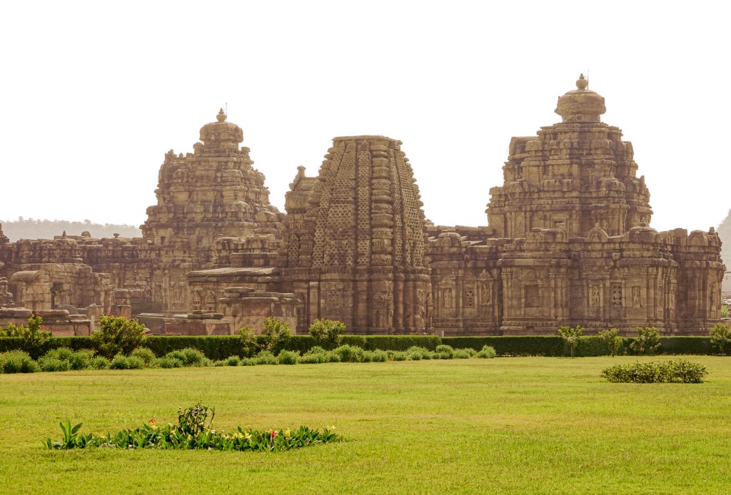
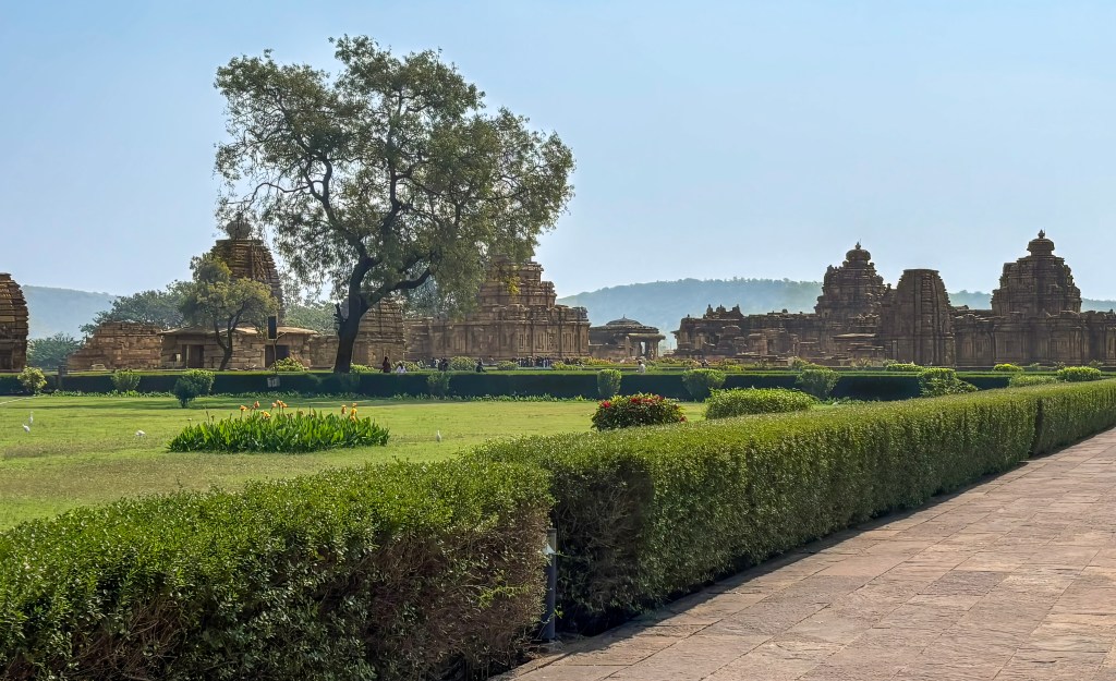
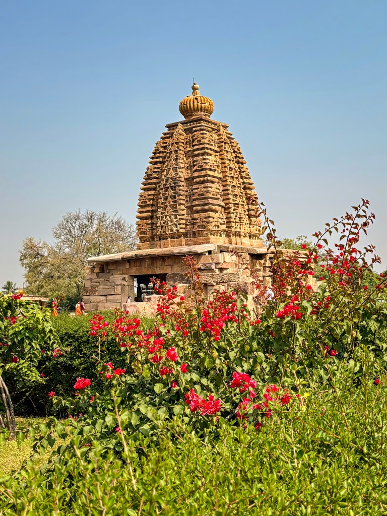
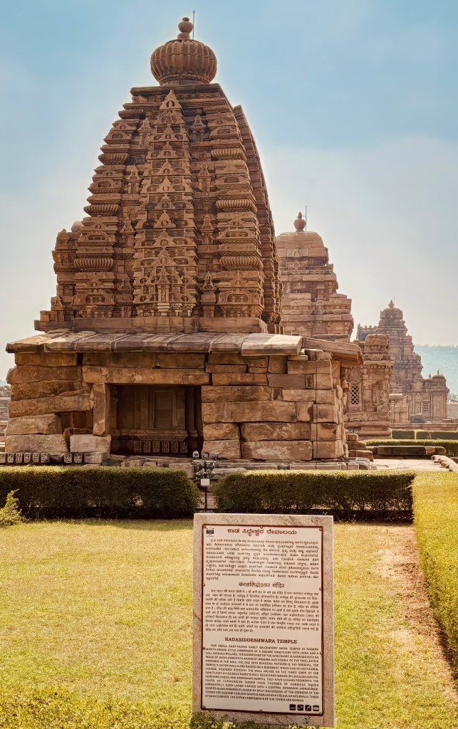
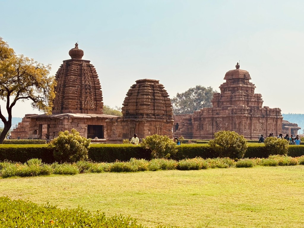
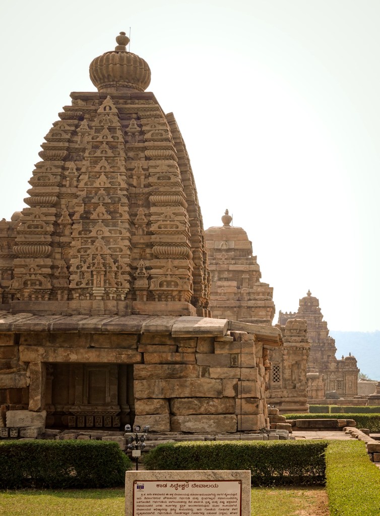
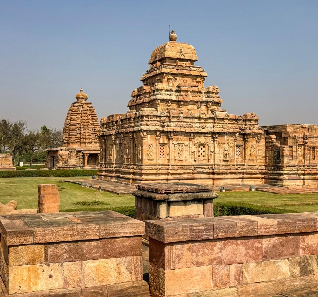
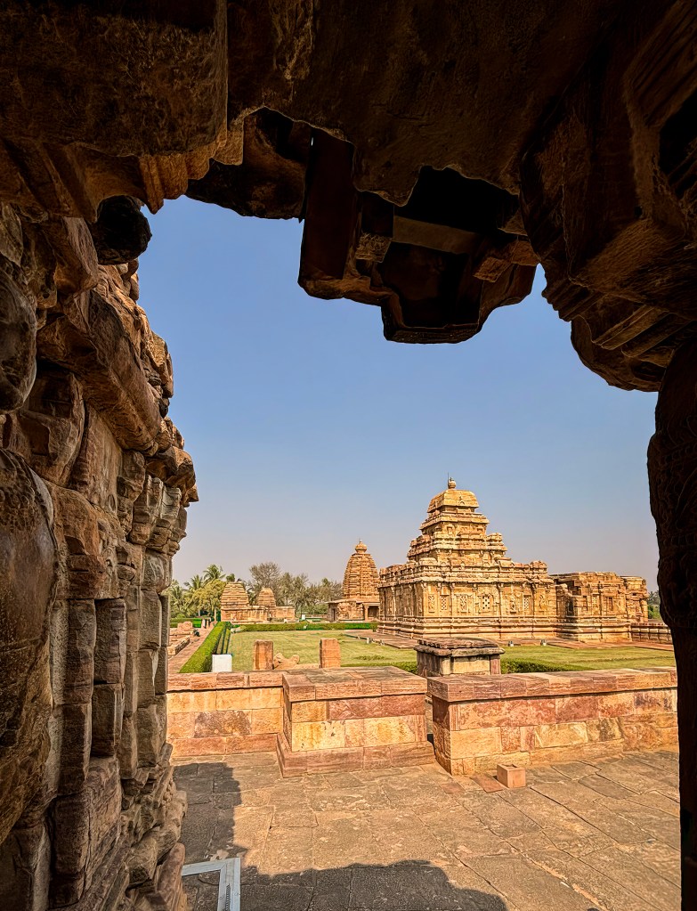
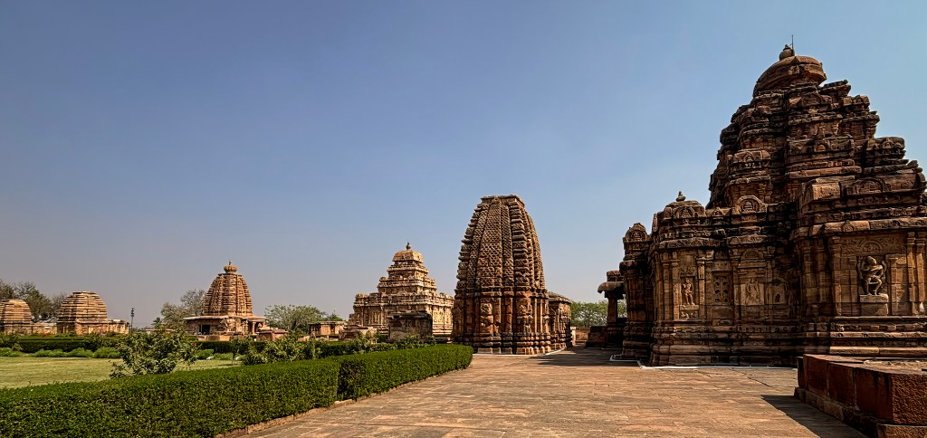
Are you a history buff chasing the legacy of kings? Maybe you are an art enthusiast marvelling at ceilings that still hold the whispers of ancient paint. You could also be a spiritual seeker seeking peace amid rocky peaks. Badami promises a vibe that is as breathtaking as it is serene. Get ready to explore this “cradle of architecture.” You’ll step into a world where stone truly comes to life. You can add Aihole and Pattadakal to this trip to admire Chalukyan temple architecture.
- Where is Badami, and how to reach it
- Main Attractions
- Badami Cave temples-The Four Iconic Caves
- Jamiya mosque
- Exploring Agastya Lake
- Bhootnatha Temples
- Where to stay in Badami
- Final thoughts
Where is Badami, and how to reach it
Badami is located in the Bagalkot district of north-central Karnataka, India. It is situated in a ravine between rugged red sandstone cliffs. You can visit Badami along with Pattadakal and Aihole- the 3 cities known as the “Cradle of Indian temple Architecture” and UNESCO world heritage sites. We visited Badami (and Pattadakal and Aihole) as a day trip from Hampi which makes a perfect 3-5 days trip from Bangalore. I would suggest 2 days in Badami (the only place with decent hotels), if you are a photographer or a history buff. Day 1 spent in Badami and day 2 in Aihole and Pattadakal.
How to Reach Badami
- By Train: This is the most convenient way to reach the town. Badami Railway Station (BDM) is roughly 5 km from the town center.
- By Air: Badami does not have its own airport.
- Hubli Airport (HBX): The nearest airport, approximately 105 km away, offering domestic flights from cities like Bengaluru and Mumbai.
- Belgaum Airport (IXG), located roughly 150 km away, is also a secondary option.
- Bengaluru International Airport: For international travelers, flying into Bengaluru (approx. 450 km away) and then taking a train or bus is a common route.
- By Road: Badami is well-connected by National and State Highways.
- From Nearby Cities: You can take Karnataka State Road Transport Corporation (KSRTC) buses from Hubli (100 km). Private buses are also available. Buses are also available from Belgaum (140 km) and Bijapur (120 km).
- From Bengaluru: Private buses depart in the evening (approx. 10-hour journey).
- From Hampi: At roughly 140 km away, many visitors hire a taxi or rent a motorbike for a scenic 3.5 to 4-hour drive.
Main Attractions
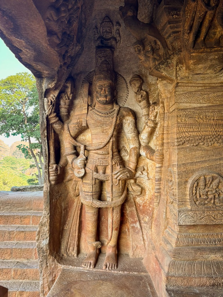
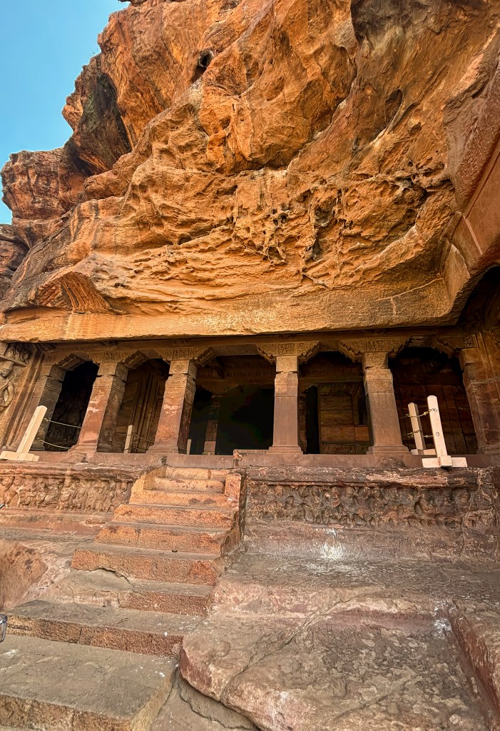
- Badami Cave Temples: The crown jewels of the region, these temples are carved into the cliff face. There are four 6th-century rock-cut temples: three are Hindu and one is Jain. They showcase remarkable sculptures and carvings of deities such as Shiva (as an 18-armed Nataraja) and Vishnu in various avatars. Here is my write up about the caves
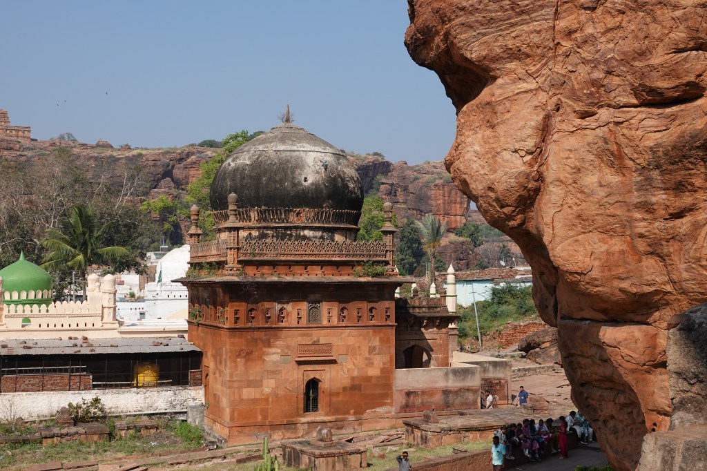
- Jamiya mosque– 17th century mosque erected by Malik Abdul Aziz and displays typical Adil Shah architecture
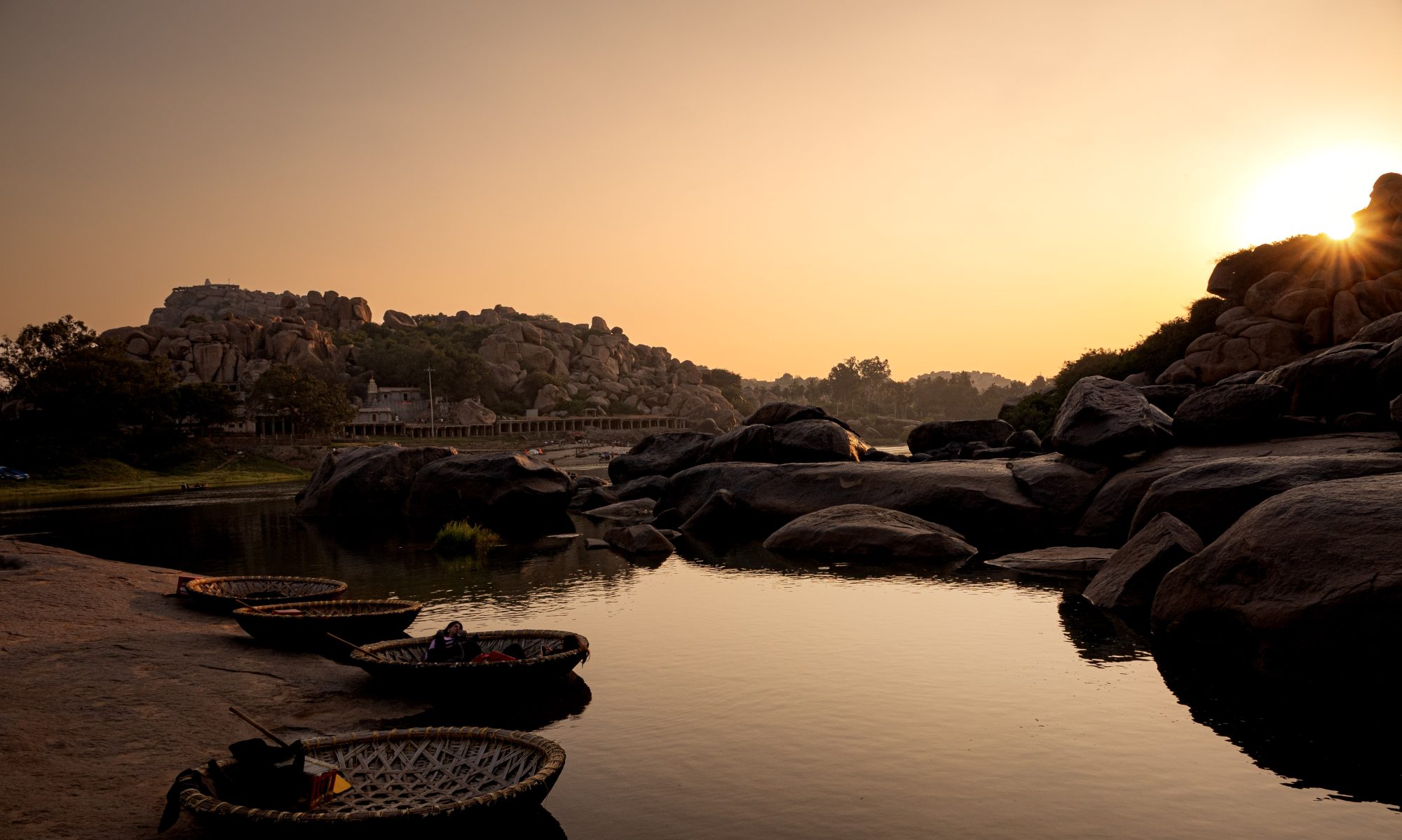
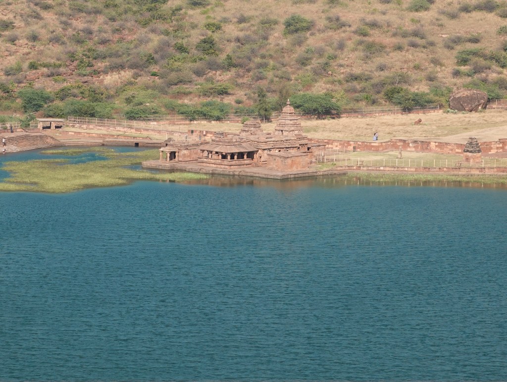
- Agastya Lake: This large, man-made lake is known for its purported healing properties. It provides the picturesque foreground to the cave temples and Badami Fort. The area offers tranquil spots for quiet contemplation. It is also ideal for stunning sunset photography.
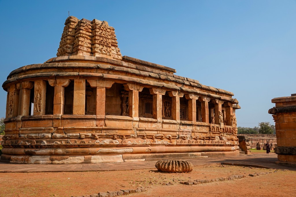
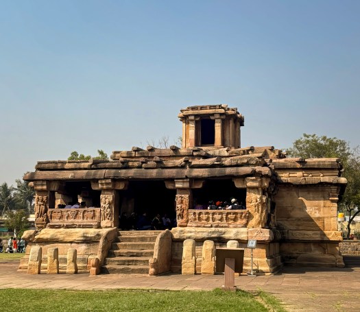
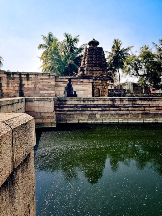
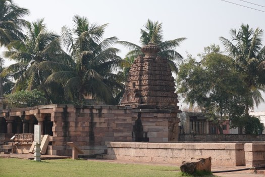
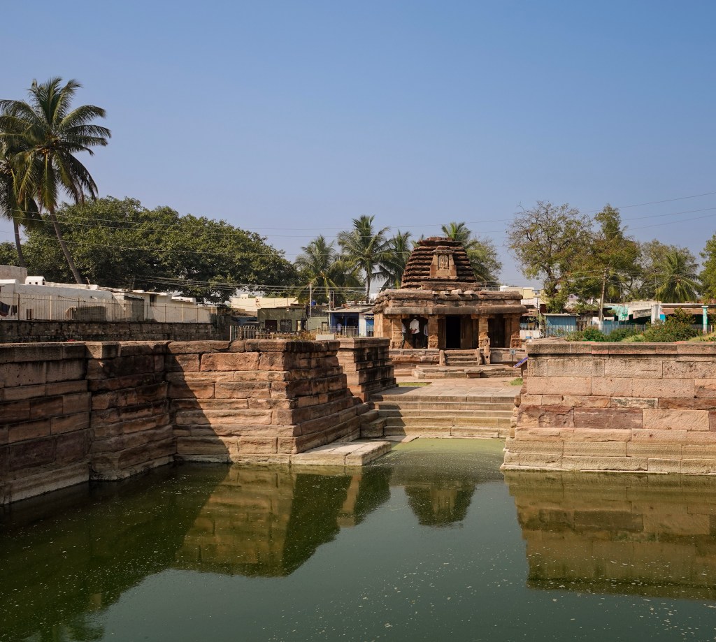
- Bhootnatha Temples: Located on the eastern banks of the Agastya Lake, these sandstone temples are dedicated to Lord Shiva. This temple creates a beautiful reflection in the water, especially a striking sight in the early morning or evening light.
- Badami Fort: The fort is perched on the northern hill. It offers panoramic views of the entire town, the lake, and the surrounding monuments. The trek up passes ancient gateways, granaries, and the well-preserved Malegitti Shivalaya temple.
- Archaeological Museum: Situated near the cave temples, this museum houses a fascinating collection of sculptures. It also contains artifacts excavated from local sites. These items provide essential historical context for the region’s rich past.
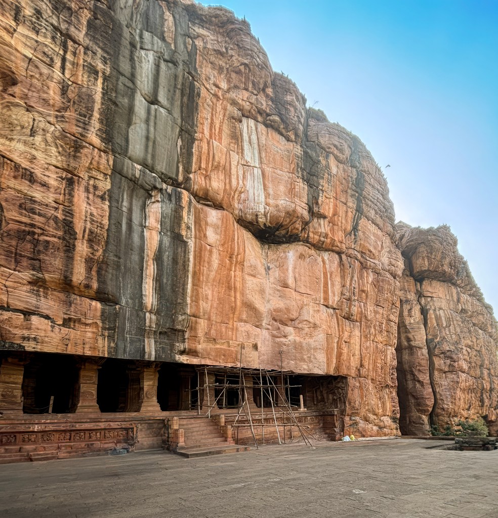
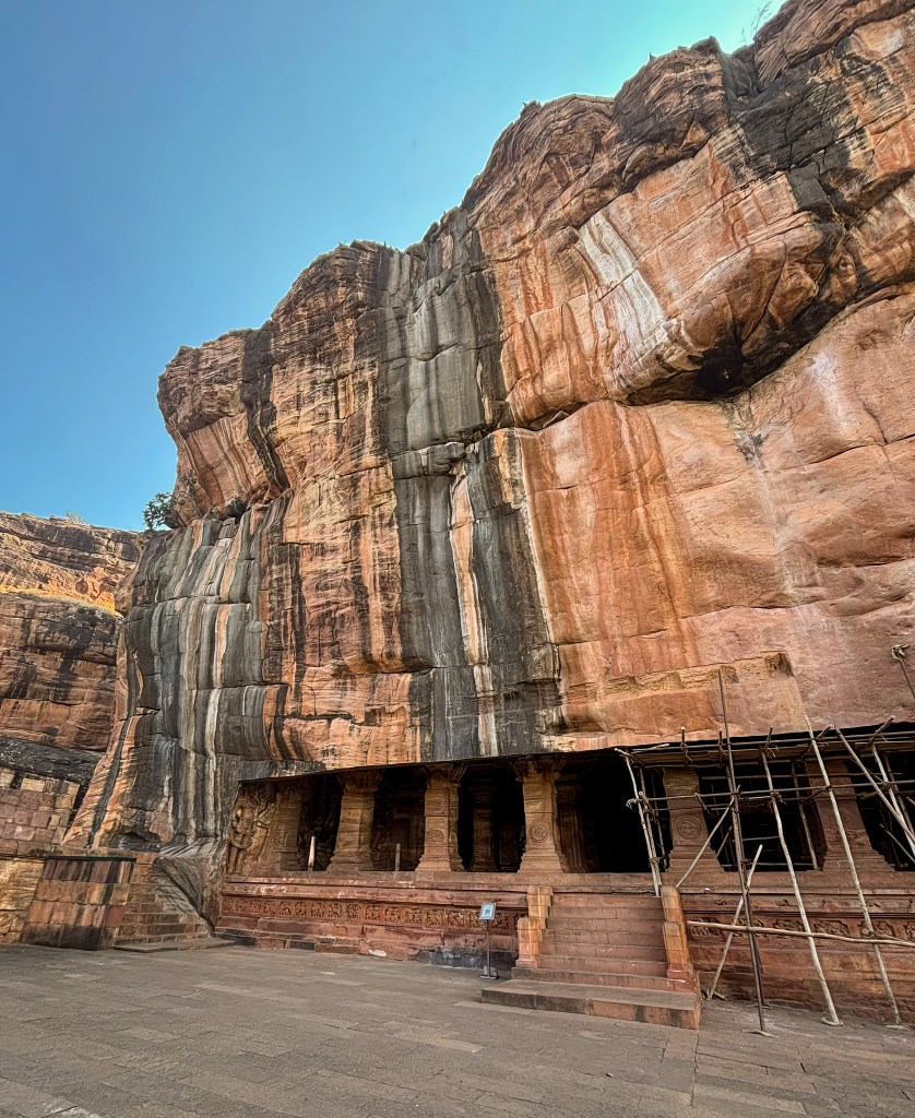
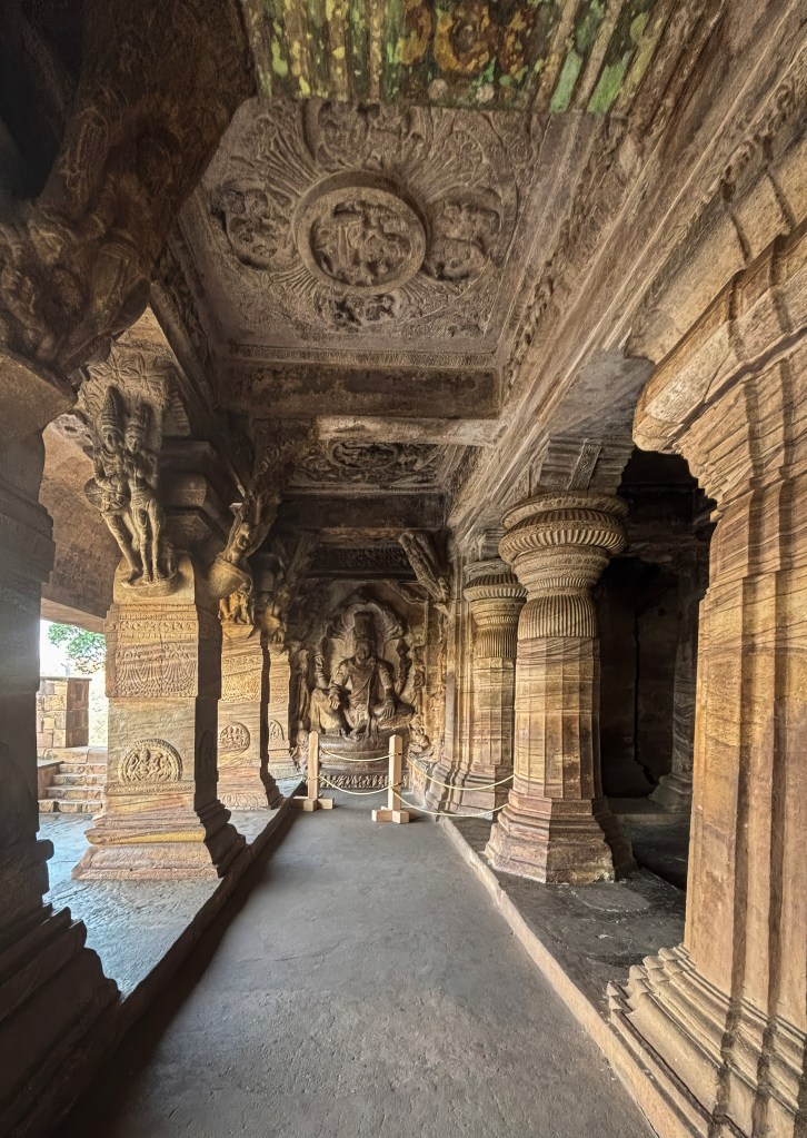
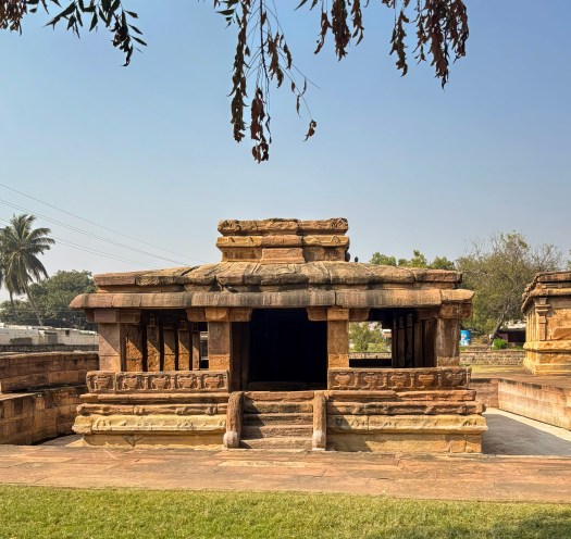
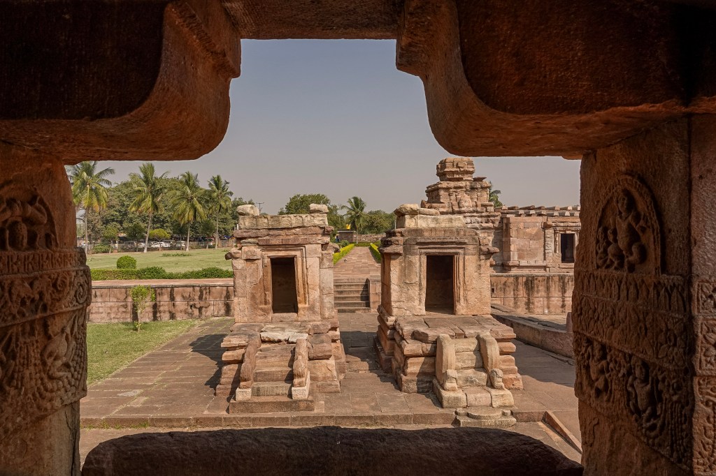
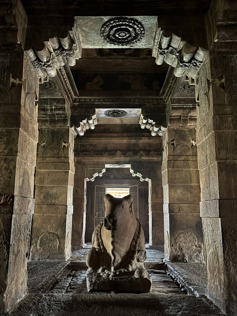
Badami Cave temples-The Four Iconic Caves
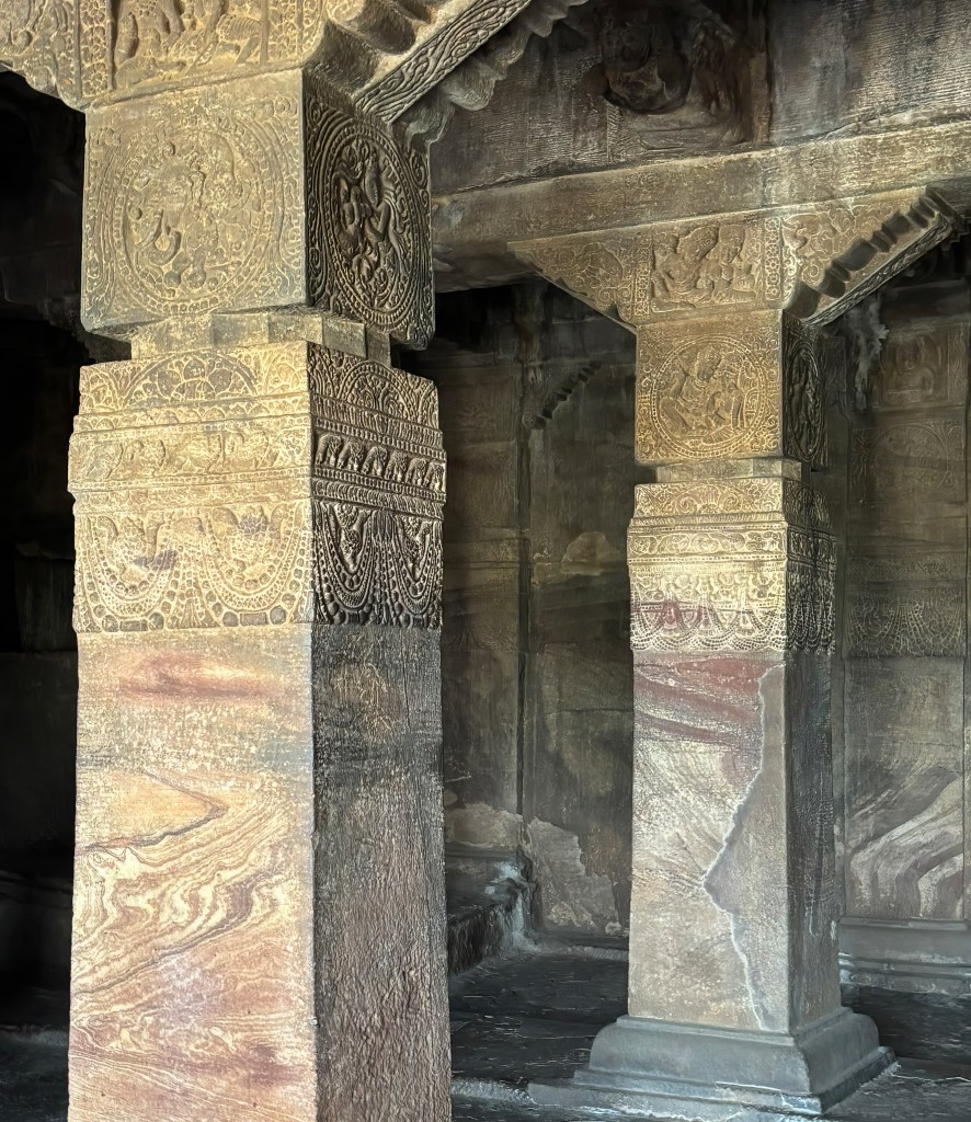
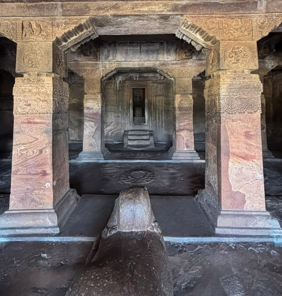
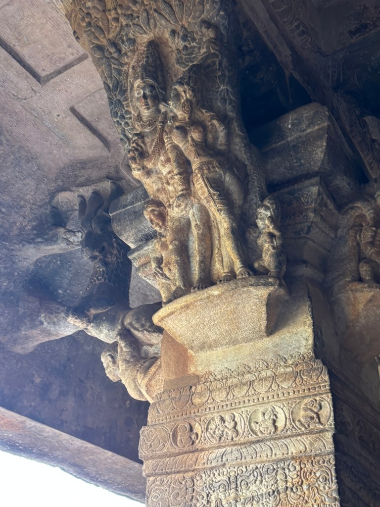
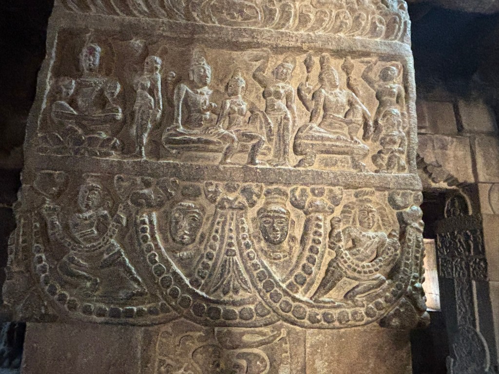
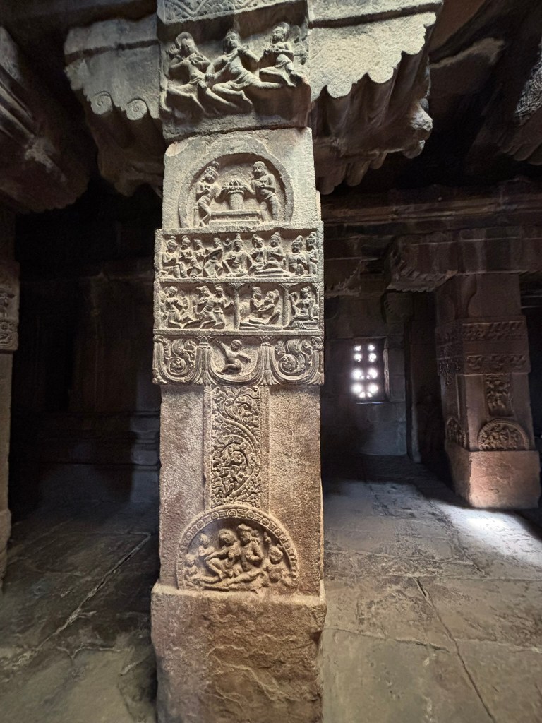
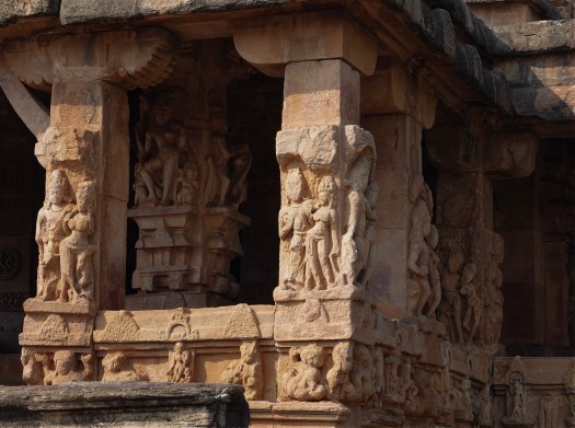
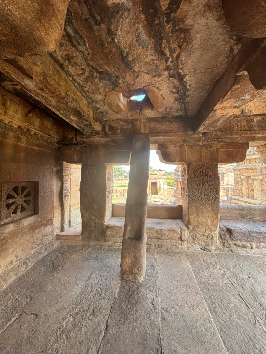
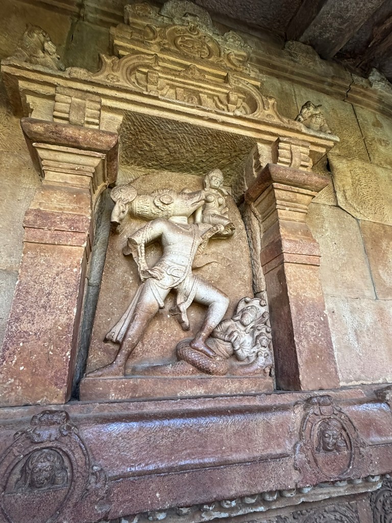
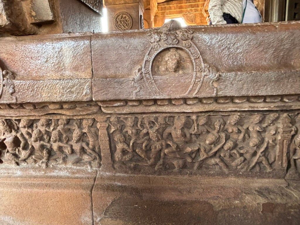
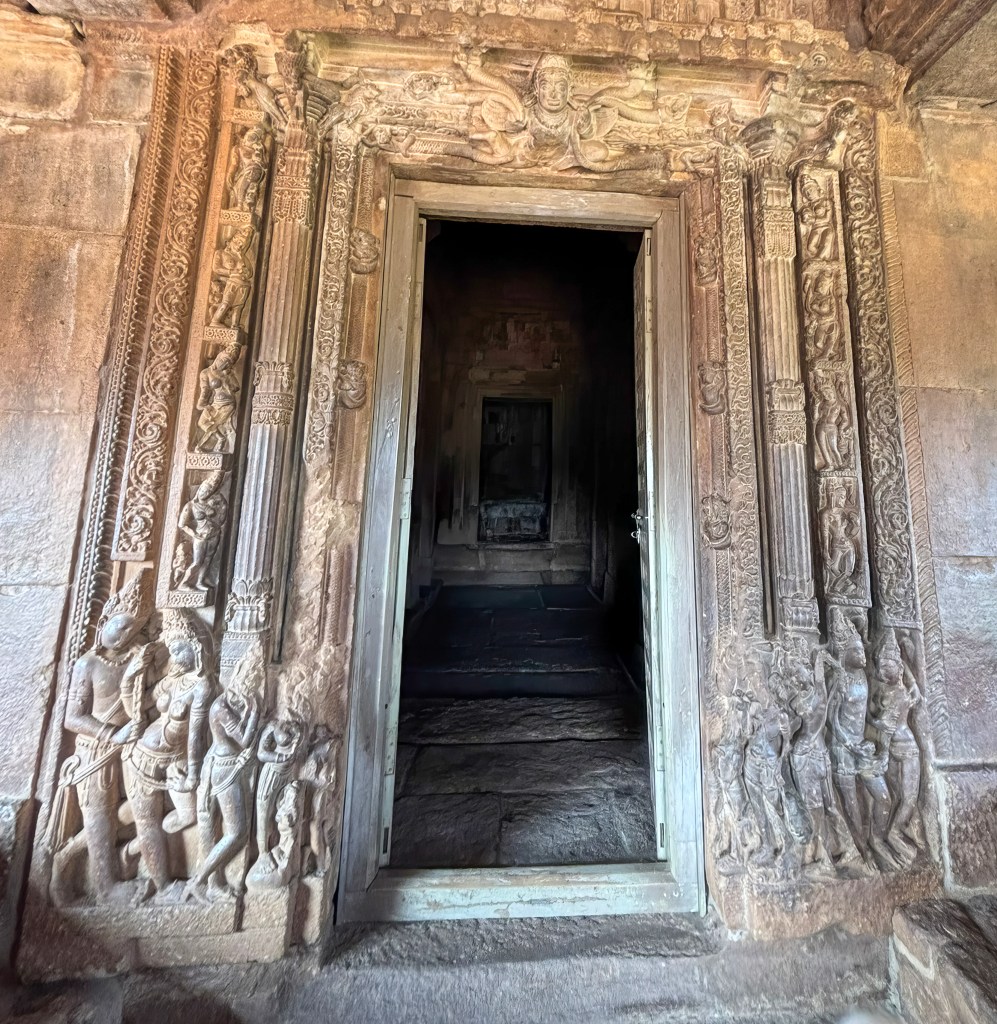
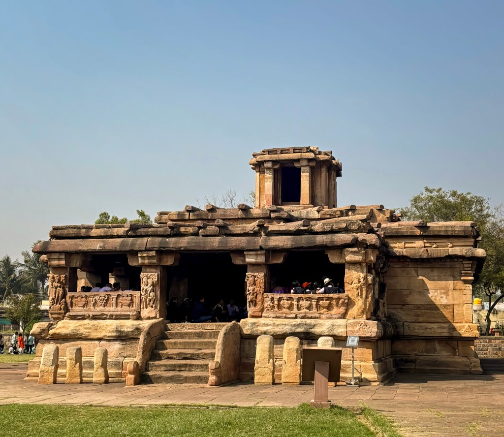
Badami Cave Temples are a stunning complex of four rock-cut shrines. They represent some of the earliest known examples of Hindu and Jain architecture in India. The Chalukya dynasty carved from soft red sandstone cliffs during the 6th and 8th centuries. There are 4 caves to explore, simply labelled Cave 1-4, 1 being at the bottom and 4 at the top. The order in which these caves were carved is unknown. Cave 3 is inscribed, making it one of the earliest dated Hindu cave temples in South India.
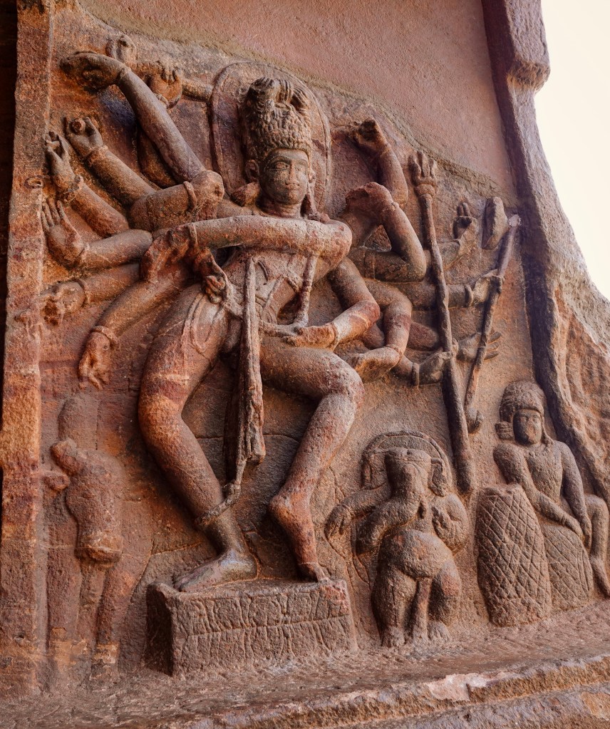
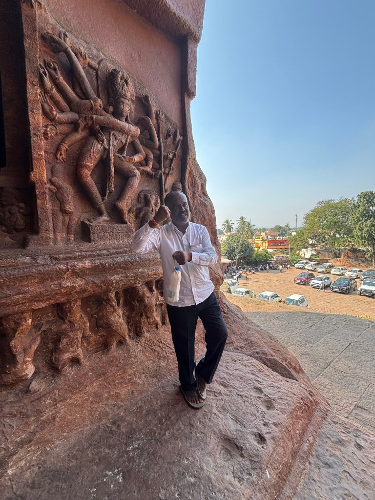
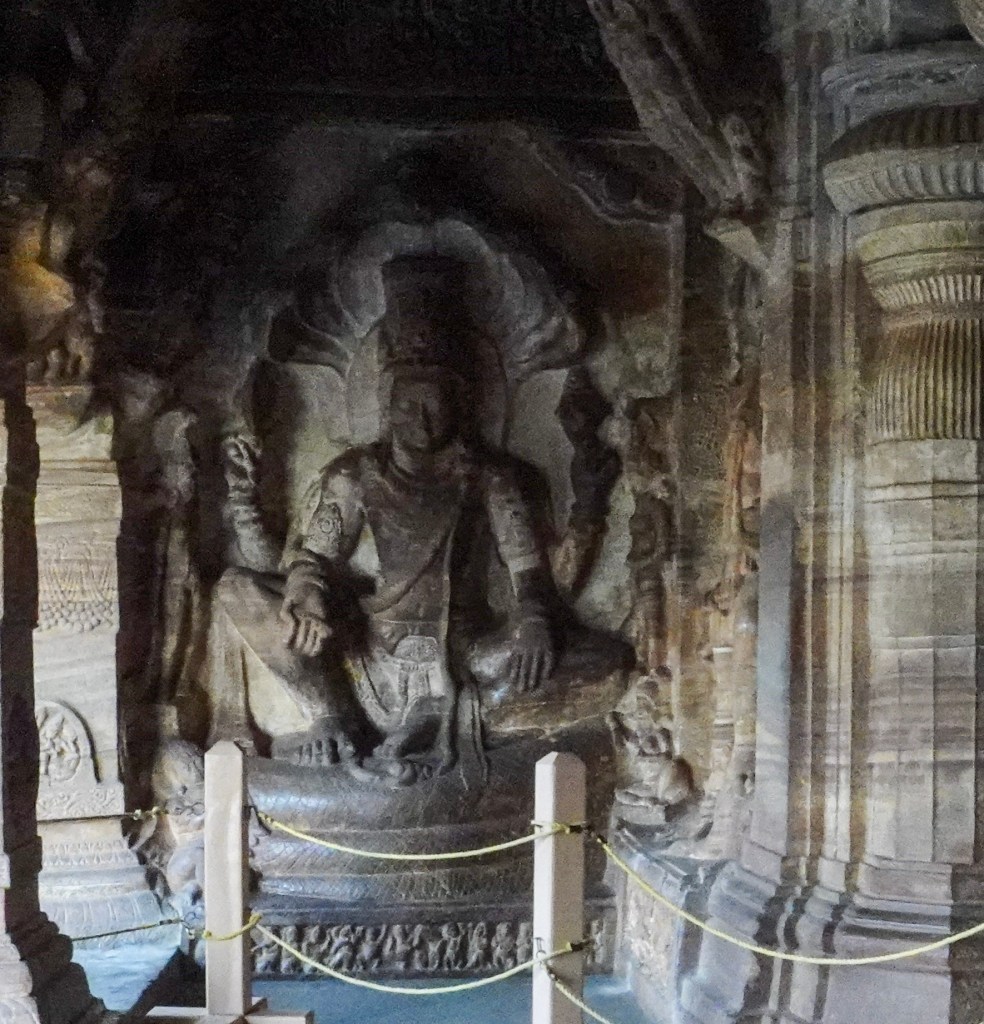
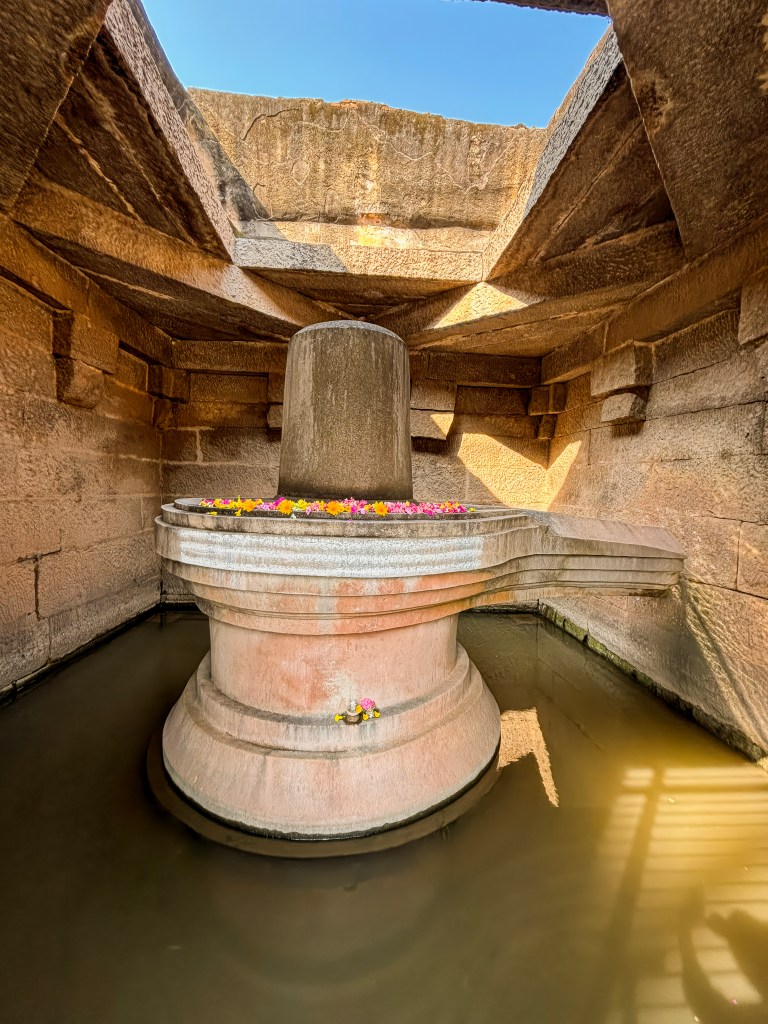
- Cave 1: The lowest cave is dedicated to Lord Shiva.
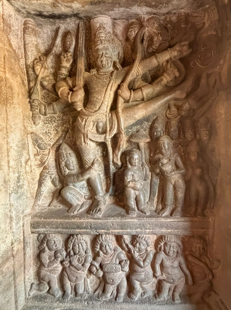
- Interesting Fact: It features a massive 5-foot relief of an 18-armed Nataraja (dancing Shiva). If you pair any left arm with any right arm, you can observe a unique dance pose. Altogether, it depicts 81 distinct Bharatanatyam postures.
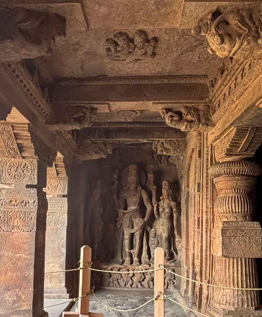
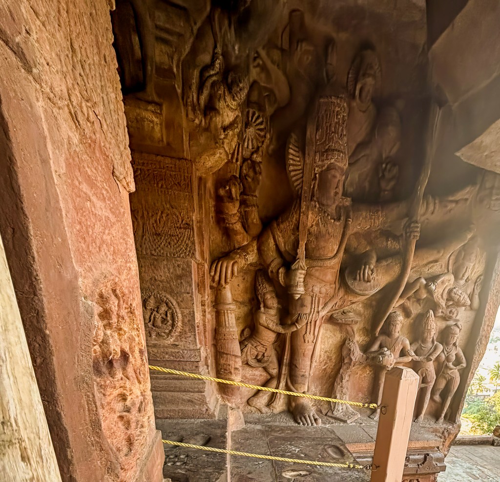
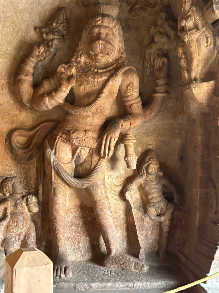
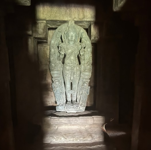
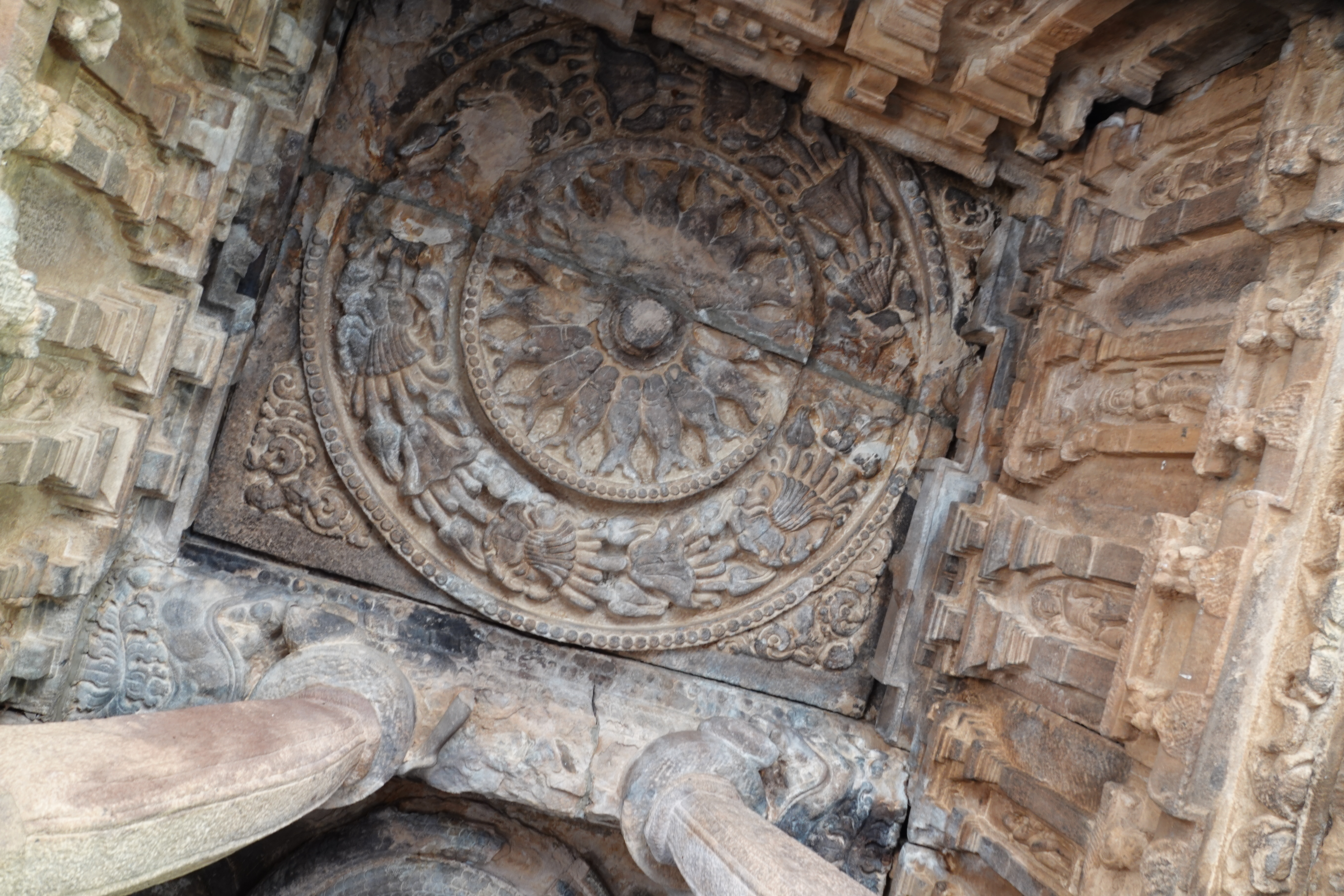
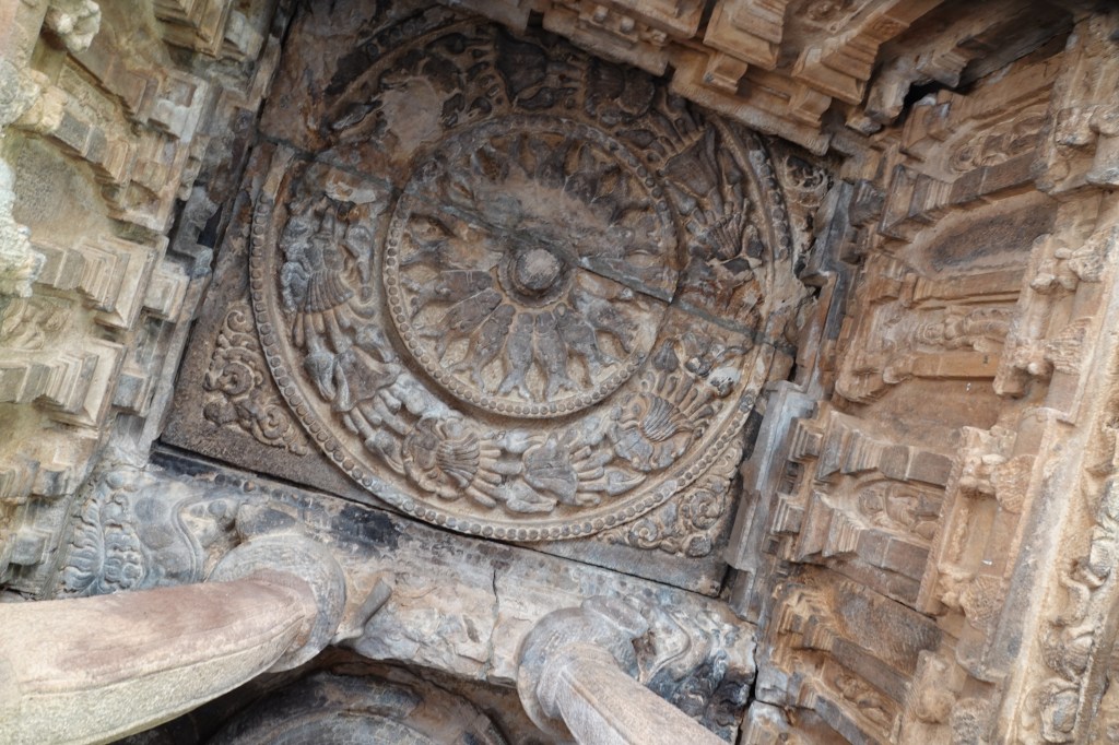
- Cave 2 : Dedicated to Lord Vishnu, this cave is smaller but contains dramatic mythological reliefs.
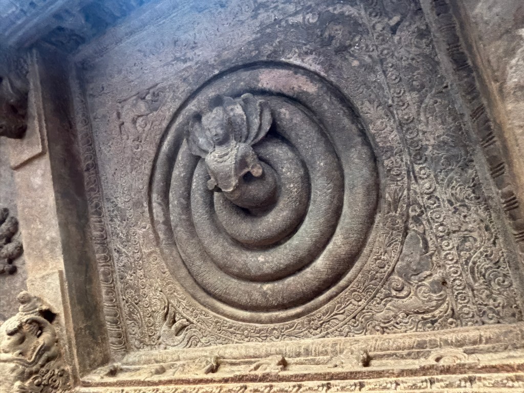
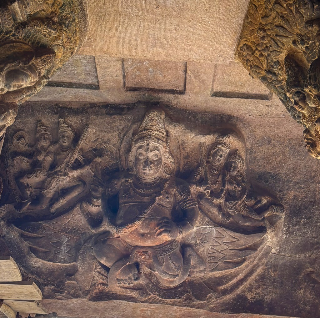
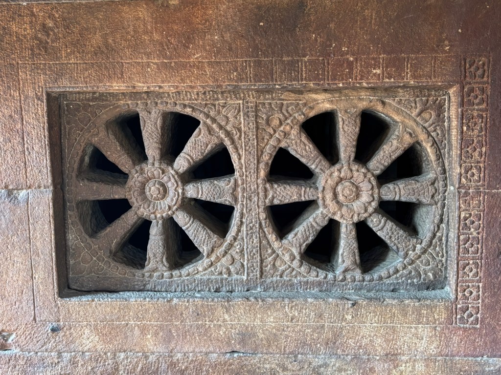
- Interesting Fact: Look up at the ceiling. You will find a unique wheel-like carving. It features sixteen fish spokes arranged in a square frame.
- Cave 3: The grandest and most intricately carved of all. This cave is the only one with an inscription. It confirms its exact dedication date (578/579 CE).
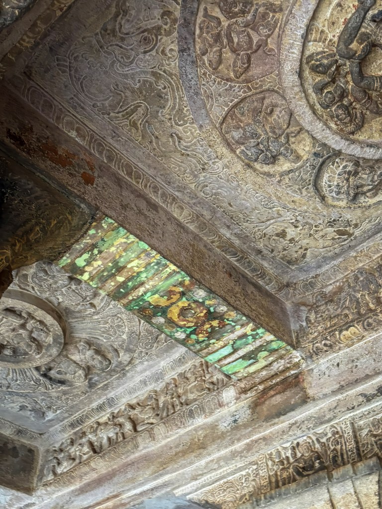
- Interesting Fact: It contains some of the earliest surviving evidence of fresco paintings in India. This includes a faded but beautiful mural of the wedding of Shiva and Parvati.
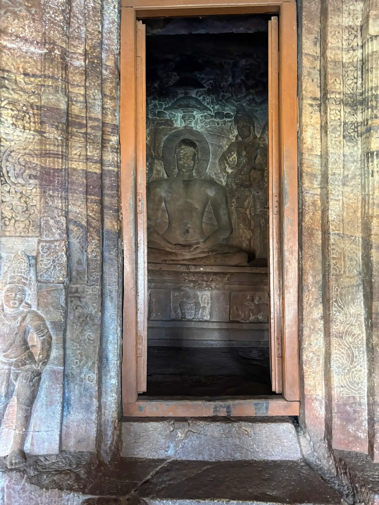
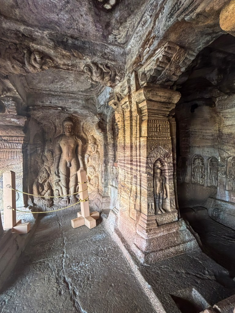
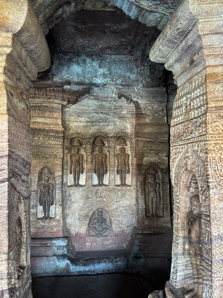
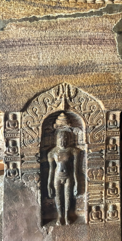
- Cave 4 (Jainism): The highest cave was built in the 7th–8th centuries. It provides a peaceful contrast to the Hindu shrines.
- Interesting Fact: It houses a massive statue of Bahubali in the Kayotsarga (meditating) posture. Vines are intricately carved as if growing around his legs. This symbolises his long period of deep penance.
To read more: Rock cut temples of Badami
Jamiya mosque
It was surprising to see this mosque near the Badami cave temple car park. This is a 17th-century funerary monument was erected by Malik Abdul Aziz in memory of his wife. The prominent feature of the mosque is the red sand stone Domed tomb resembling Gol Gumz of Bijapur. If you have time, it is worth exploring this place that has typical features of Adil Shah architecture (Deccani School of Indo-Islamic architecture)
Exploring Agastya Lake
Agastya Lake is a significant man-made reservoir. It has a rich history and has deep mythological roots. Agastya Lake is central to the ancient town of Badami (formerly Vatapi). This town was the capital of the Early Chalukya dynasty.

Historical Significance
- Construction and Purpose: The lake is an artificial reservoir. It is believed to have been constructed during the 5th-7th centuries CE. This construction took place primarily during the Chalukyan period. It served as a strategic water source for the capital city. The city is protected by rugged sandstone cliffs on three sides.
- Architectural Context: The lake forms the heart of Badami’s architectural landscape. The famous Badami Cave Temples are carved into the red sandstone cliff on its southern side. The Bhootnath temples are situated on its eastern banks. Meanwhile, the Badami Fort is on the northern hill. Together, they create a stunning panoramic view and a cohesive historical circuit. The temples are often reflected in the calm waters, a particularly picturesque sight at sunrise and sunset.
Mythological Significance
- Sage Agastya: The lake is named after the revered Vedic sage Agastya. According to local legend and Hindu Puranas, the sage is credited with bringing the sacred waters to the area.
- Healing Waters: The water is considered holy. It is widely believed to possess healing properties. Locals have historically used it for bathing to cleanse sins and cure ailments.
- Mention in Scriptures: The lake finds mention in the ancient Indian epic, the Mahabharata, which describes the religious merit attained by visiting this sacred water body.
I had grown up hearing the story of Agastya muni. However, I truly connected the dots only when I was in Badami. The city of Badami, formerly known as Vatapi, is steeped in legend. One significant Puranic tale tells of Agastya Muni and the demon brothers, Vatapi and Ilvala. This tale provides the mythological namesake for this ancient city and the lake.
The Deadly Deception– According to Hindu mythology, two demon siblings, Ilvala and Vatapi, harboured a deep hatred for sages and Brahmins. They devised a murderous scheme using their shape-shifting and magical powers:
- The Trap: Vatapi would transform himself into a goat.
- The Invitation: Ilvala often disguised himself as a humble host or holy man. He would invite traveling sages to a meal. He served them the cooked meat of his brother (the “goat”).
- The Resurrection: Once the meal was finished, Ilvala would shout, “Vatapi, come out!”. Using a special mantra or magical ability, Vatapi would then reassemble and tear through the guest’s stomach, killing them instantly.
The Encounter with Agastya– The reign of terror ended when they attempted to trick Sage Agastya. He was a revered Rishi known for his immense spiritual power. He was also famous for his legendary digestive capabilities.
- The Feast: Agastya, aware of their intentions through his divine knowledge, accepted their invitation and ate the entire meal.
- The Counter-Mantra: Immediately after eating, Agastya rubbed his stomach and uttered the words, “Vatapi Jeernobhava” (Vatapi, be digested).
- The End of Vatapi: When Ilvala called for his brother, Agastya calmly informed him that Vatapi had already been digested and would never return.
- The Fate of Ilvala: In various versions, a furious Ilvala then attacked the sage and was either reduced to ashes by a single glance from Agastya’s fiery eyes or transformed into a hill.
Geographical Connection to Badami -The story is physically immortalised in the landscape of Badami:
- Vatapi Hills: The two red sandstone cliffs that flank the town are believed to represent the two fallen demon brothers.
- Agastya Lake: The serene man-made lake nestled between these cliffs is named after the sage who freed the region from the demons.
- Vatapi Ganapatim: This legend is also celebrated in the famous Carnatic song Vatapi Ganapatim, which honours the Ganesha idol supposedly brought from this city to Tamil Nadu following a 7th-century war
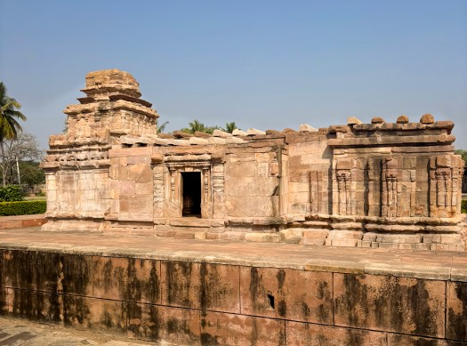
Bhootnatha Temples
Located on the eastern banks of the Agastya Lake, these sandstone temples are dedicated to Lord Shiva. You can see these cluster temples as you climb the cave temples. This complex offers a tranquil and photogenic spot. The view is particularly beautiful during sunrise or sunset. The surrounding red sandstone cliffs and the lake create a breathtaking backdrop.
Architecture and History
The complex actually comprises two main groups of temples, showcasing the architectural evolution under different Chalukya dynasties:
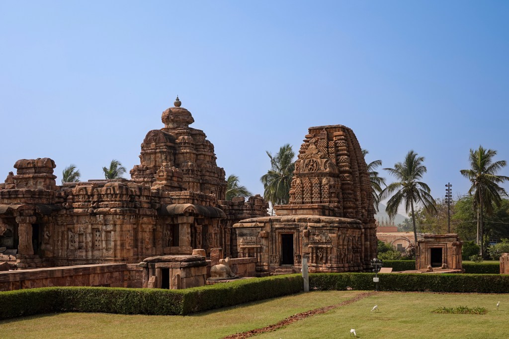
- East Bhootnath Group (Main Temple): This group dates primarily to the 7th-8th centuries CE under the Badami Chalukyas. It is known for its blend of early South Indian Dravidian and North Indian Nagara architectural styles. The open mandapa (hall) of the main temple extends into the lake. This unique design element makes it appear to float during the monsoon season when the water levels are high.
- North Bhootnath Group (Mallikarjuna Group): Located slightly north and built later, between the 11th-12th centuries CE, these temples feature a distinct stepped, pyramidal superstructure in the Kalyani (Western) Chalukya style
Where to stay in Badami
Badami offers a range of accommodation options, from comfortable resorts to budget-friendly guesthouses. The best places to stay are generally close to the town center. They are near major attractions like the Agastya Lake and the Cave Temples. Alternatively, choose places slightly outside the town for a quieter resort experience. We visited Badami from Hampi as a day trip along with Pattadakal and Aihole. It makes for a long day, and you can’t take your time and visit some of the less-visited places. A day trip is good to see the highlights. However, if you want to fully experience the place, I would suggest staying a night. You can explore Badami on day 1. Visit Pattadakal and Aihole on the next day or vice versa. I am hoping to return to Badami. I want to take more detailed photographs and visit other places mentioned here.
Top Hotel Recommendations
Sterling Banashree Badami – This is a highly-rated 4-star resort located a little outside the main town. It is ideal for families and couples seeking a tranquil stay. The resort offers modern amenities. It offers a pool, free Wi-Fi, and a restaurant (though some reviews suggest eating in town).
THE HERITAGE RESORT, Badami – This resort is situated about a 15-minute drive from the main caves. It provides a peaceful atmosphere with spacious, clean rooms amidst greenery. It features a pool and a restaurant serving good vegetarian food.
HOTEL BADAMI COURT(unit of Shreejit Resorts)- This is a popular mid-range option. It is known for its excellent service. Guests also enjoy good food at the on-site restaurant, Pulikeshi. It is conveniently located close to the railway station and Badami caves, making it easy to access the main sites.
Hotel Mayura Chalukya Badami – This government-run hotel is a reliable, budget-friendly option. It is known for its good location near the lake and helpful staff. Rooms are basic but clean and the in-house restaurant offers good food at affordable prices.
Alternative Options
- Clarks Inn Badami: Located in the heart of Badami, this hotel is a convenient base, within walking distance of the bus stop and some attractions.
- Homestays and Guesthouses: For a more local and authentic experience, consider homestays like Krishna Villa or Cave View Homestay. They offer a more intimate setting. You have a chance to interact with local families. These can be excellent for budget-conscious travellers.
Final thoughts
Badami isn’t just a stop on a heritage trail — it’s a place where time feels layered, textured, and alive. From the moment you stand before the Cave Temples carved into rust‑red cliffs, the town starts to show its rhythm. It’s ancient, contemplative, and deeply human. Wander a little further, and each site adds its own voice. Experience the serene sweep of Agastya Lake. Feel the quiet dignity of the 17th‑century Jamiya Mosque. Admire the mirrored beauty of the Bhootnatha Temples glowing in the evening light. Reach the windswept heights of Badami Fort with its sweeping views of the valley. Badami is must visit for anyone who loves History and architecture.