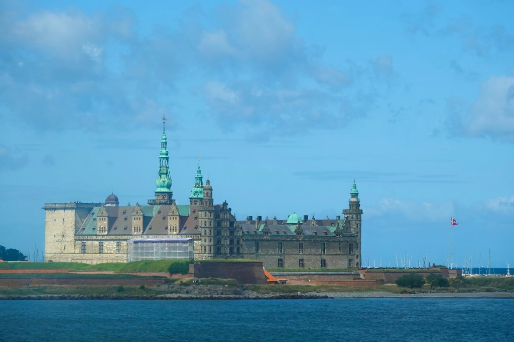
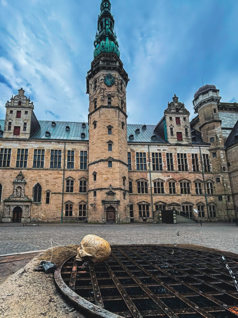
Perched dramatically on the coast of Helsingør, Denmark, Kronborg Castle is more than just a fortress—it’s a stage for history, legend, and literature. Known worldwide as the setting of Shakespeare’s Hamlet, this Renaissance masterpiece has guarded the narrow strait of Øresund since 1585, watching over the entrance to the Baltic Sea with commanding views across to Sweden. “To visit or not to visit” is not the question to be asked when deciding whether to visit this place. It should be on everyone’s list, especially if you like history
UNESCO World Heritage 🌍
Kronborg Castle was inscribed on UNESCO’s World Heritage List in 2000 for its exceptional cultural value. It joins other Danish sites like the Par Force Hunting Landscape in North Zealand, preserving Denmark’s royal and natural heritage.
Must-See Highlights of Kronborg 🏰✨
The Great Hall – One of the largest royal halls in Northern Europe, once the stage for lavish banquets and diplomatic gatherings.
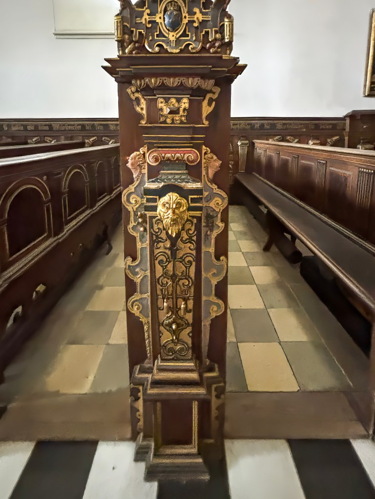
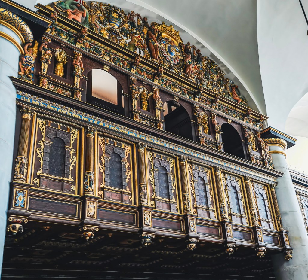
The Chapel – Consecrated in 1582, it survived the devastating fire of 1629 intact, with ornate Renaissance woodwork and gilded details.
Holger the Dane – The legendary Viking warrior who slumbers in the casemates, said to awaken if Denmark is ever threatened.
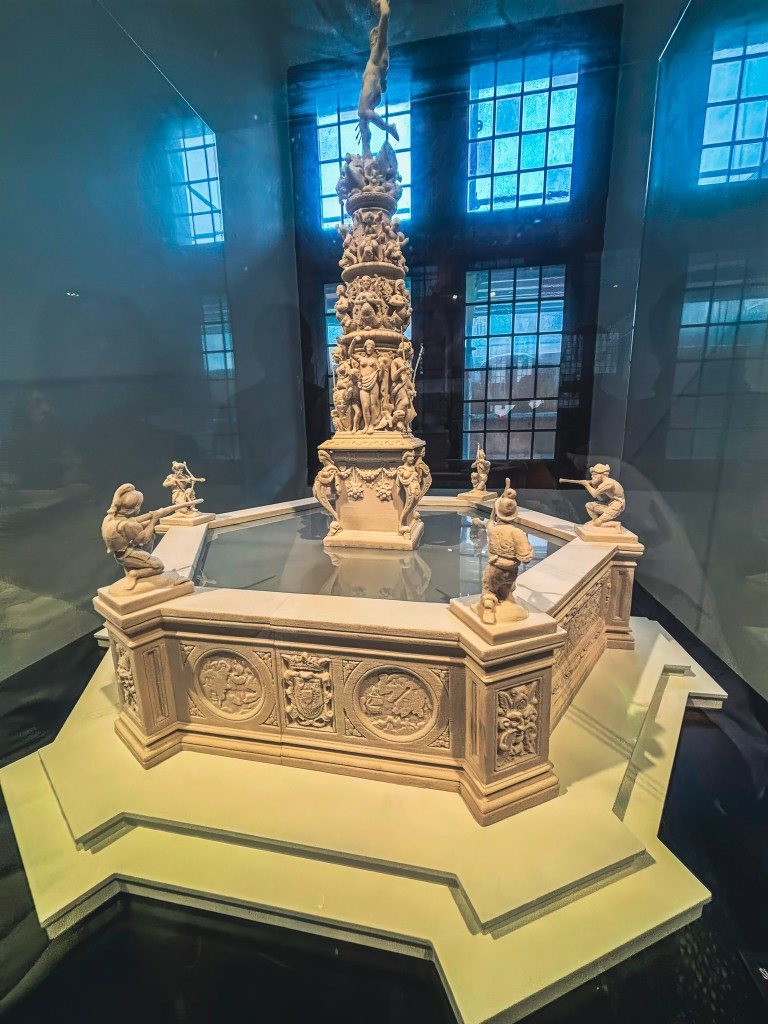
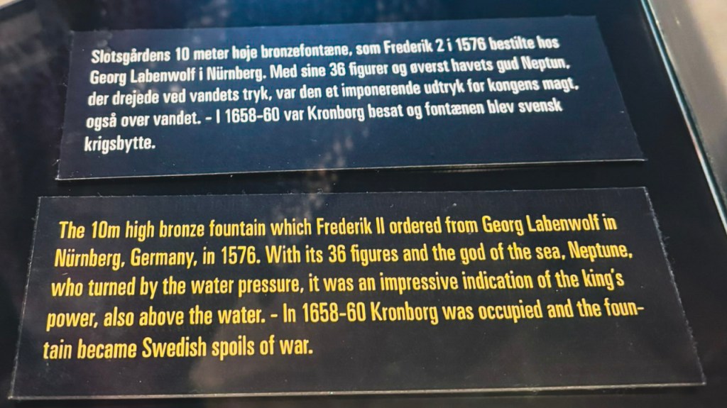
The Courtyard – Imagine the grandeur of the lost Renaissance fountain, melted down during the Swedish invasion of 1658.
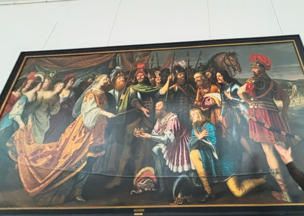
The Painting-Gerard van Honthorst’s 1640 oil painting “King Albrecht Hands Over the Swedish Crown to Queen Margaret I“
Row of cannons-rows of antique cannons outside the castle to watch over the Øresund Strait
- UNESCO World Heritage 🌍
- Must-See Highlights of Kronborg 🏰✨
- A Fortress of Power and Prestige ⚔️
- Fire, War, and Resilience 🔥
- Guardians of the Sound 🔊💥
- Sacred Resilience in Stone ⛪
- Majesty in Stone and Splendor 🏰
- Did you know? Looted Treasures of Kronborg 🏺⚔️
- Royal Power in Paint 🎨
- Hamlet’s Stage 🎭
- Legends in the Casemates 🛡️
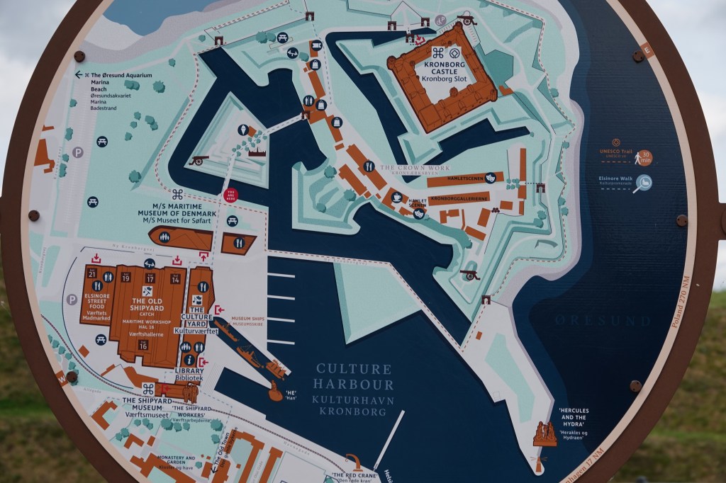
- Explore Elsinore: Beyond the Castle 🏘️🌊
- Getting There 🚆
- Final Thoughts on Kronborg Castle ✨
A Fortress of Power and Prestige ⚔️
For centuries, Denmark controlled the passage into the Baltic, collecting tolls from every ship that sailed by. At times, these taxes financed more than a third of the kingdom’s expenses—a reminder of Kronborg’s immense strategic importance.
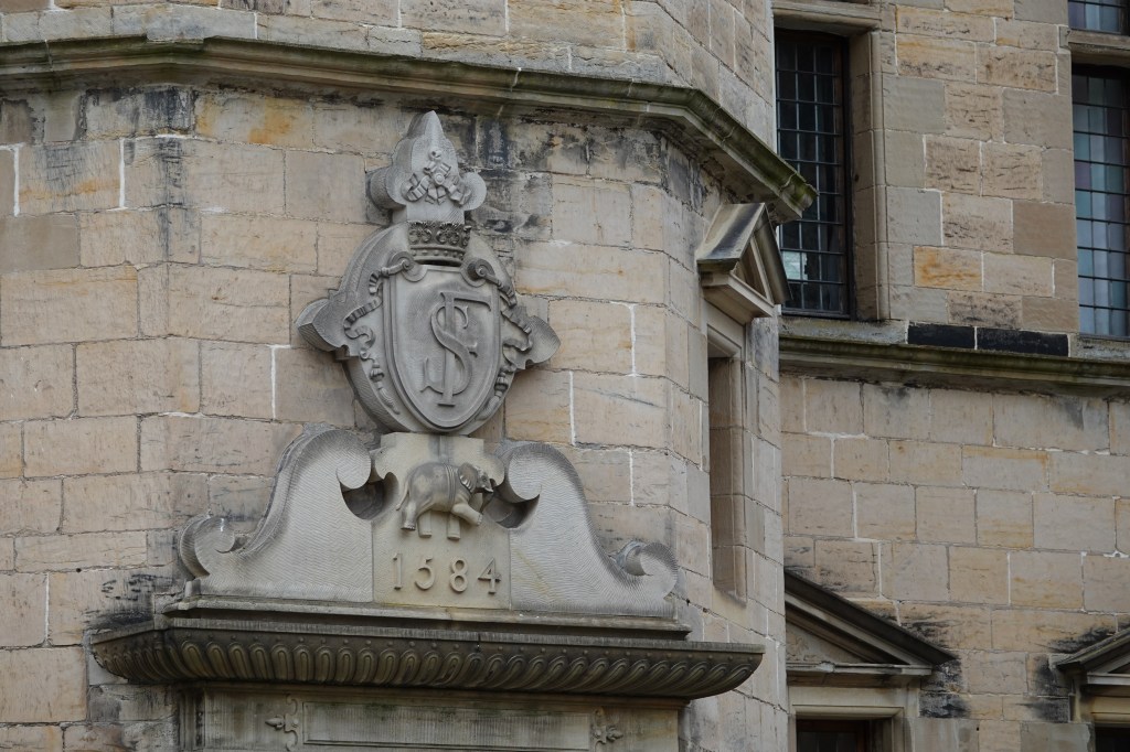
The first castle on this site was built in the 1420s, and when King Frederik II expanded it after Denmark’s victory over Sweden in the late 1500s, he envisioned a Renaissance palace that would outshine Sweden’s Kalmar Castle. The result was Kronborg—literally “Crown Castle”—a symbol of Danish dominance in Scandinavia.
Fire, War, and Resilience 🔥
Though much of the castle’s interior was destroyed by fire in 1629, King Christian IV restored it with ornate ceilings and decorations that still bear his initials, “C4.” But Kronborg’s story took a darker turn in 1658, when Sweden invaded. The army pillaged the castle, looted its paintings, and even melted down the courtyard fountain into cannonballs and church bells. Despite this devastation, Kronborg endured—and today, it remains one of Europe’s most iconic strongholds.
Guardians of the Sound 🔊💥
Outside Kronborg Castle, rows of antique cannons still stand watch over the Øresund Strait, a powerful reminder of the fortress’s strategic importance. In its heyday, Kronborg controlled maritime traffic and collected the lucrative Sound Dues from passing ships. These cannons once defended the narrow waters between Denmark and Sweden, ready to fire in protection of royal interests.
Today, they serve a ceremonial role, often fired during commemorations and national holidays. The thunderous salute, paired with the sight of uniformed guards and the Danish flag flying high, connects visitors to the castle’s military legacy and the drama that once unfolded along its coastal walls.

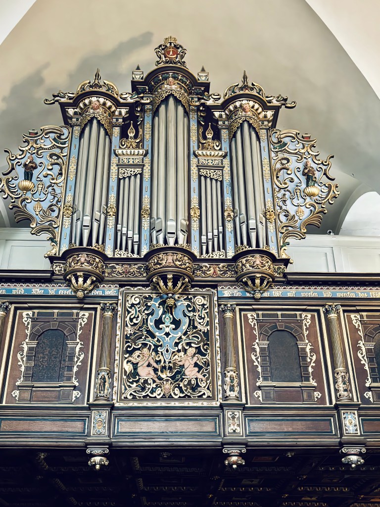
Sacred Resilience in Stone ⛪
Among Kronborg Castle’s most remarkable features is its chapel, consecrated in 1582. This serene space is the only part of the castle that survived the devastating fire of 1629 intact, preserving its Renaissance character through centuries of turmoil. With intricately carved wooden pews, gilded details, and an ornate altar, the chapel reflects the grandeur of Frederik II’s vision and the craftsmanship of the era.
Ironically, while much of the castle’s interior was destroyed and later looted during the Swedish invasion of 1658, the chapel remained untouched. It continued to serve as a place of worship for royals and later soldiers when Kronborg became a military stronghold. Today, it stands as a rare, authentic reminder of the castle’s spiritual heart—offering visitors a quiet moment of reflection amid the fortress’s dramatic history.
Majesty in Stone and Splendor 🏰
Among the most awe-inspiring spaces in Kronborg Castle is the Great Hall, completed under Frederik II in the late 16th century. At over 60 meters long, it was one of the largest royal halls in Northern Europe and a dazzling stage for banquets, ceremonies, and diplomatic gatherings. Its soaring proportions, richly decorated ceilings, and grand windows reflected the king’s ambition to showcase Denmark’s wealth and dominance to visiting nobles and foreign envoys.
Ironically, while the hall’s magnificence symbolized Danish power, it too suffered during the fire of 1629 and the Swedish invasion of 1658, when many of its tapestries and furnishings were looted. Yet the hall was restored under Christian IV, who added Baroque flourishes that still impress visitors today. Standing within its vast expanse, you can almost hear the echoes of Renaissance feasts, Shakespearean drama, and centuries of royal intrigue—making the Great Hall a centerpiece of Kronborg’s enduring legacy.


Did you know? Looted Treasures of Kronborg 🏺⚔️
Kronborg’s grandeur was not only scarred by fire but also by war. When Sweden invaded in 1658, the army stripped the castle of many of its most precious treasures. Paintings, tapestries, and furnishings were carried off, while the magnificent courtyard fountain was dismantled and melted into cannonballs and church bells. According to our guide, the only painting left behind was the Gerard van Honthorst’s dramatic painting “King Albrecht Hands Over the Swedish Crown to Queen Margaret I”. A sword slash can be seen on this painting as a revenge from the Swedes showing the continued animosity between Danish and Swedish royals
Royal Power in Paint 🎨
Among Kronborg Castle’s artistic highlights is Gerard van Honthorst’s 1640 oil painting “King Albrecht Hands Over the Swedish Crown to Queen Margaret I.” This dramatic work captures the pivotal moment in 1389 when Margaret I defeated King Albrecht of Sweden and united Denmark, Norway, and Sweden under the Kalmar Union. Painted with Honthorst’s signature chiaroscuro, the scene emphasizes both the solemnity and grandeur of the transfer of power.
Hamlet’s Stage 🎭
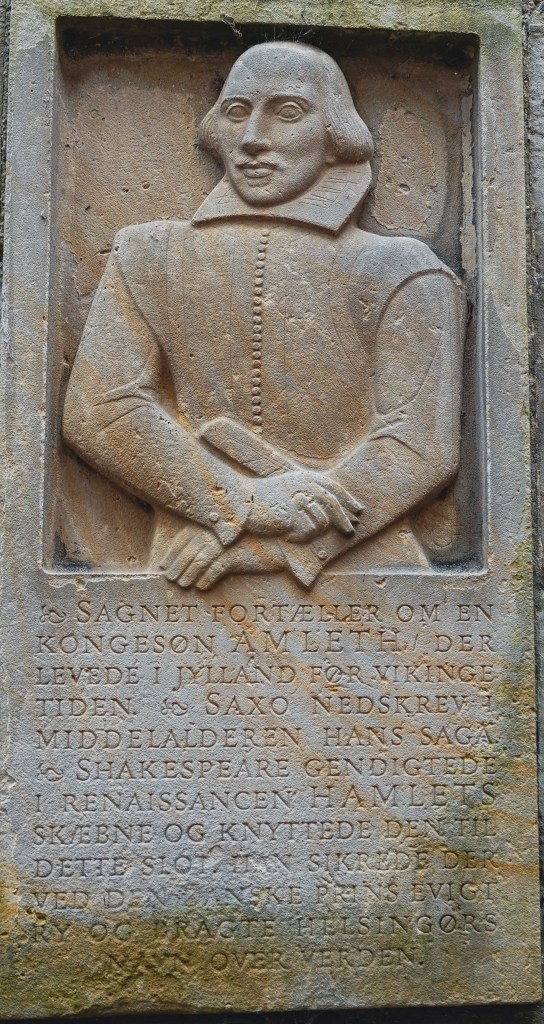
Shakespeare immortalized Kronborg in Hamlet, setting the tragedy in Elsinore (Helsingør). While Shakespeare himself likely never visited, one of his actors had, which may explain the play’s uncanny accuracy in describing the castle. Standing in the grand halls, it’s impossible not to whisper the famous line: “To be or not to be, that is the question.”
Every summer, actors perform Hamlet within the castle walls, bringing the timeless drama to life in its original setting. There is a plaque in the front of the castle which recognizes Shakespeare’s role in making this castle immortal
Legends in the Casemates 🛡️
Deep down in the casemates of Kronborg Castle, you will find a mythical figure known as Holger Danske or Ogier the Dane, as he is also referred to. He is an important national symbol for the Danes, but the myth actually derives from Chanson de Roland, a principal work in French medieval literature.
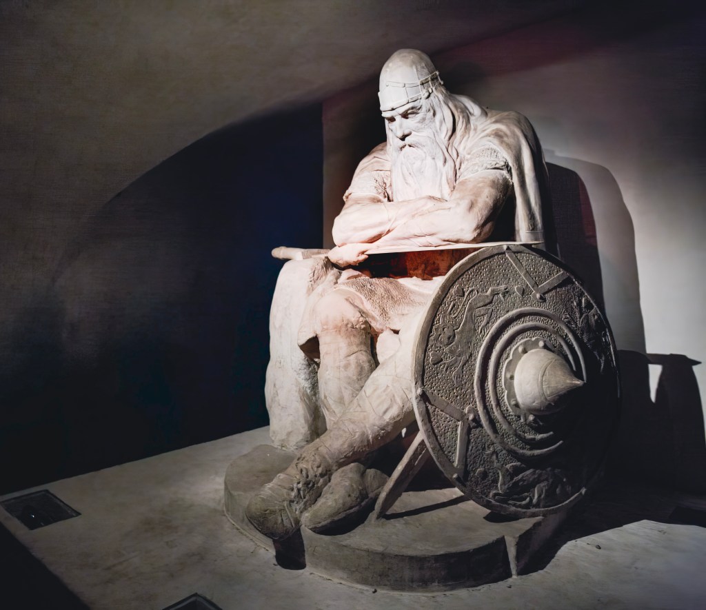
The legend has it that Holger Danske is asleep deep down in the underground passages of Kronborg Castle’s casemates. He has been so for hundreds of years, and he will only wake up if Denmark is threatened by enemies, and he will wake up to defend his country. A Bronze statue was built in 1907, and the plaster model was based on the casemates of Kronborg, which became a very popular sight. In 1985, it was replaced by a concrete statue due to the damp climate in the casemates.
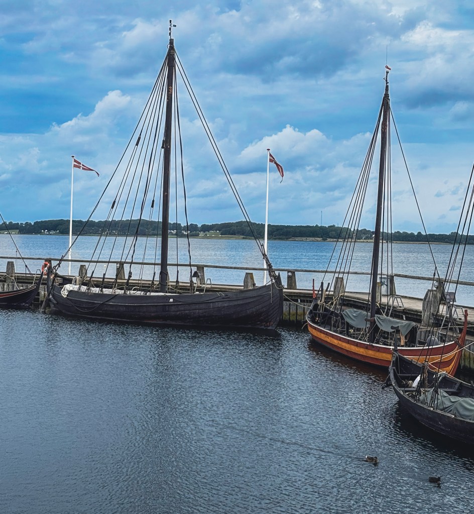
Explore Elsinore: Beyond the Castle 🏘️🌊
After your visit to Kronborg, make time to enjoy the vibrant town of Elsinore:
- 🏘️ Wander the old streets filled with colorful buildings and local charm
- 🍽️ Savor global flavors at Værftet’s international street food market
- ⚓ Dive into maritime history at the M/S Maritime Museum of Denmark
- 🐠 Meet sea creatures at the Øresund Aquarium
- ⛵ Sail the Sound with ForSea and enjoy dinner on the water
Getting There 🚆
Visiting Kronborg Castle is remarkably easy from Copenhagen:
- Distance: 46 km north of the capital
- Train: From Copenhagen Central Station to Helsingør (Elsinore) – about 45 minutes
- Walk: A scenic 15–20 minute stroll from the station to the castle
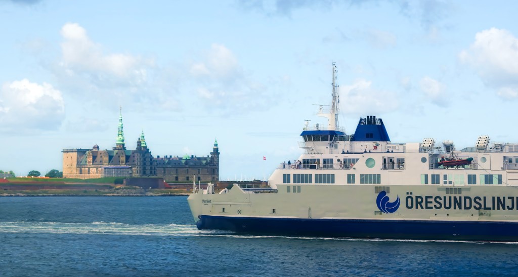
This journey makes Kronborg an ideal day trip, combining history, culture, and coastal charm. I visited Kronborg Castle as part of a tour group with Hamlet Tours. Some of the photos I took of the castle are from the Ferry that goes between Helsingør to Helsingborg. You can combine the visit to Kronborg Castle with a visit to Helsingborg, Sweden. More about this here.
Final Thoughts on Kronborg Castle ✨
Kronborg Castle is more than stone walls and royal halls—it is a living chronicle of Denmark’s power, resilience, and cultural legacy. From its Renaissance grandeur financed by the Sound Dues, to the scars of fire and Swedish looting, the fortress embodies both triumph and tragedy. It is a place where Shakespeare’s Hamlet continues to echo through the courtyards, where Holger the Dane slumbers in myth, and where UNESCO recognition ensures its preservation for generations to come.
Visiting Kronborg is not just a journey into history—it is an immersion into stories of kings, queens, warriors, and playwrights that shaped Scandinavia and inspired the world. Whether you come for the art, the legends, or the sweeping views across the Øresund, Kronborg leaves you with a sense of awe and connection to centuries of drama that unfolded within its walls.