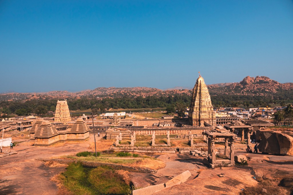
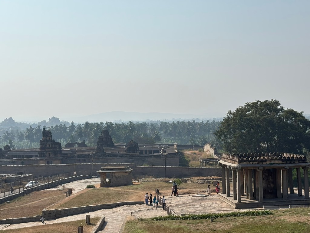
Traveling south from the Virupaksha complex, the road leads to Kamalapura. The landscape then opens into Krishnapura, another historic quarter of Hampi’s sacred center. At its heart stands the Krishna Temple. It is a grand monument commissioned in 1515 CE by the Vijayanagara emperor Krishnadevaraya. This was to commemorate his celebrated victory over the Gajapati rulers of Orissa. The temple once housed a granite icon of the infant Krishna. This icon was seized from the fort at Udayagiri during this campaign. It is now preserved at the Government State Museum in Chennai.
A Temple Anchored in its Urban Landscape
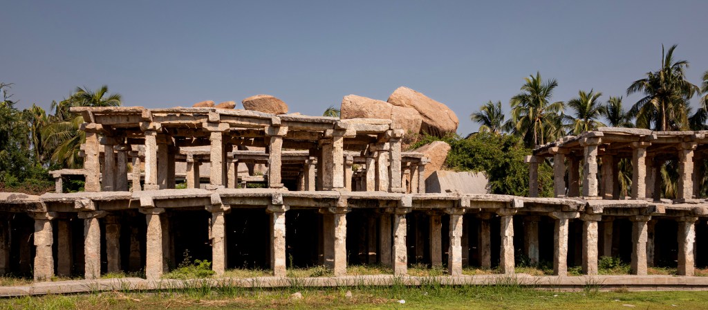
Like other major shrines in Hampi, the Krishna Temple is aligned with a broad bazaar street extending eastward. Today, this street sits at a lower level than the temple itself. Its colonnades are partly engulfed by fields of sugarcane and banana plantations. This setting creates a striking contrast between cultivated greenery and monumental stone.
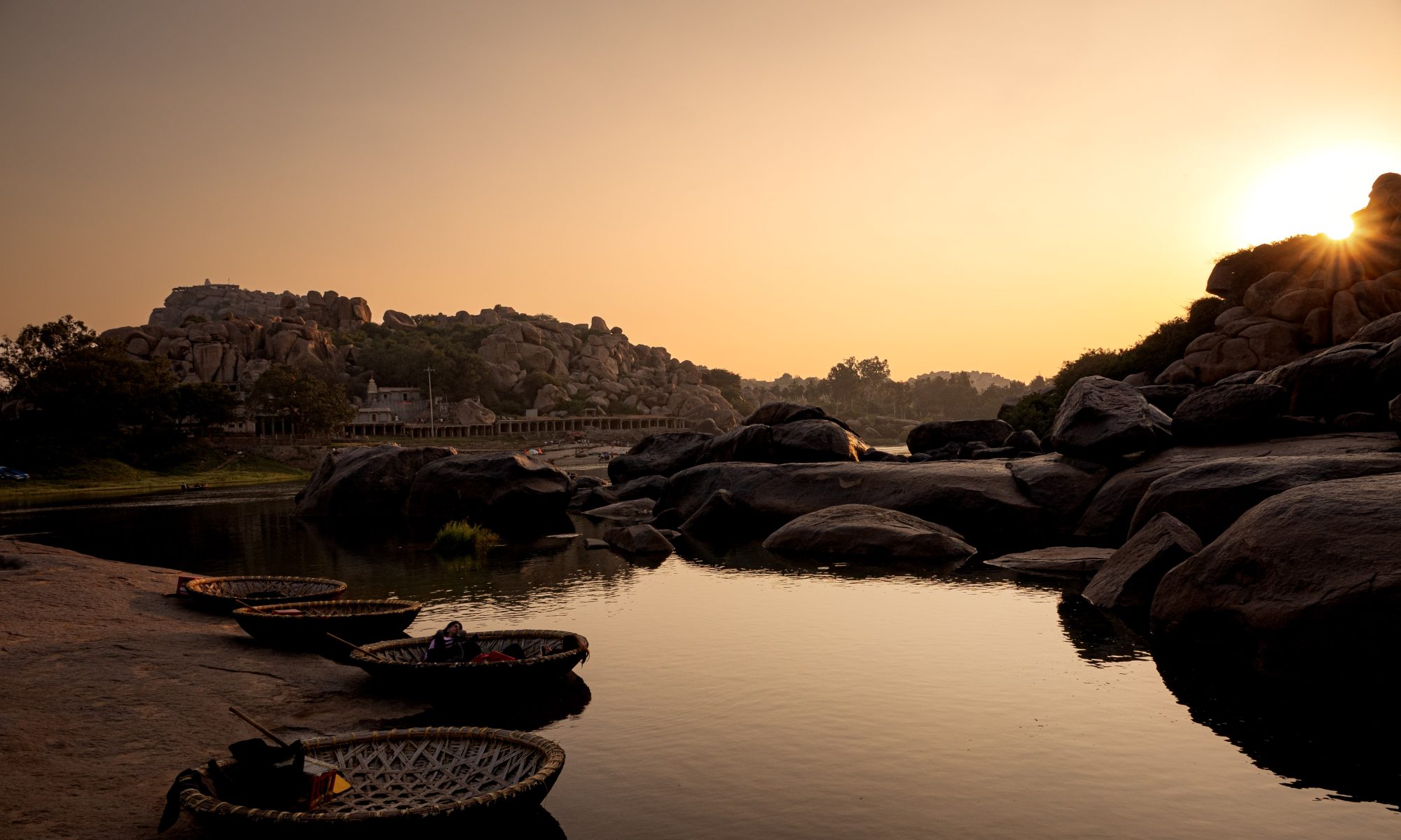
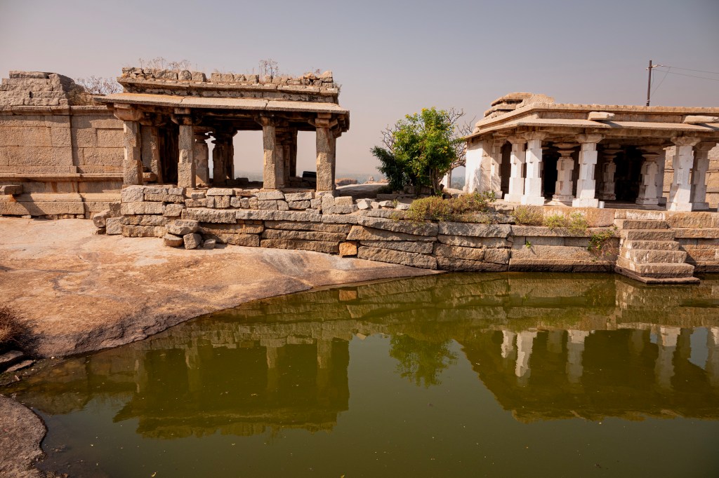
A few metres north of the bazaar lies a rectangular tank. It is framed by additional colonnades and crowned by a small pavilion that rises from the water. This tank is nestled beneath a rocky overhang. It forms one of the most picturesque corners of the complex. If you have time, this is a good place get some nice photos.
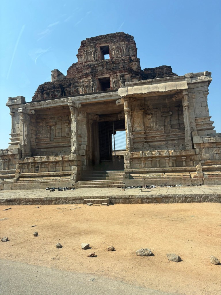
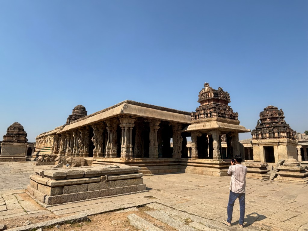
The Grand Gopura: A Royal Statement
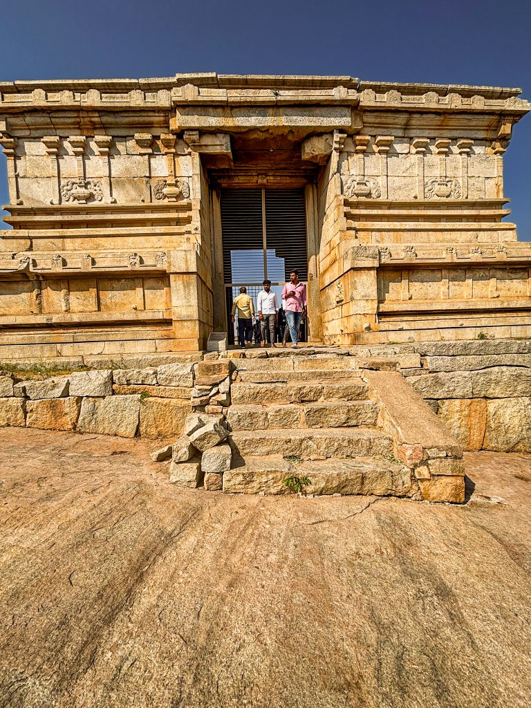
The eastern entrance gopura immediately announces the temple’s royal origins. Though now dilapidated, its frontal portico remains impressive for the sheer height of its granite columns. These columns were recently reset during conservation efforts. Above them rises the brick superstructure, only partially preserved, but still bearing traces of plaster sculptures. Among these are battle scenes on the western face. These scenes possibly depict Krishnadevaraya’s Orissa campaign. Later renovations have simplified many of the original figures.
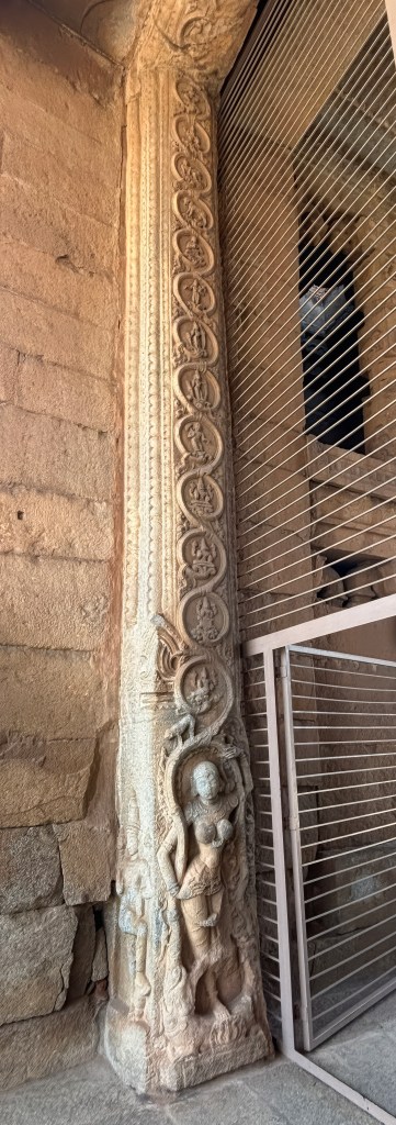
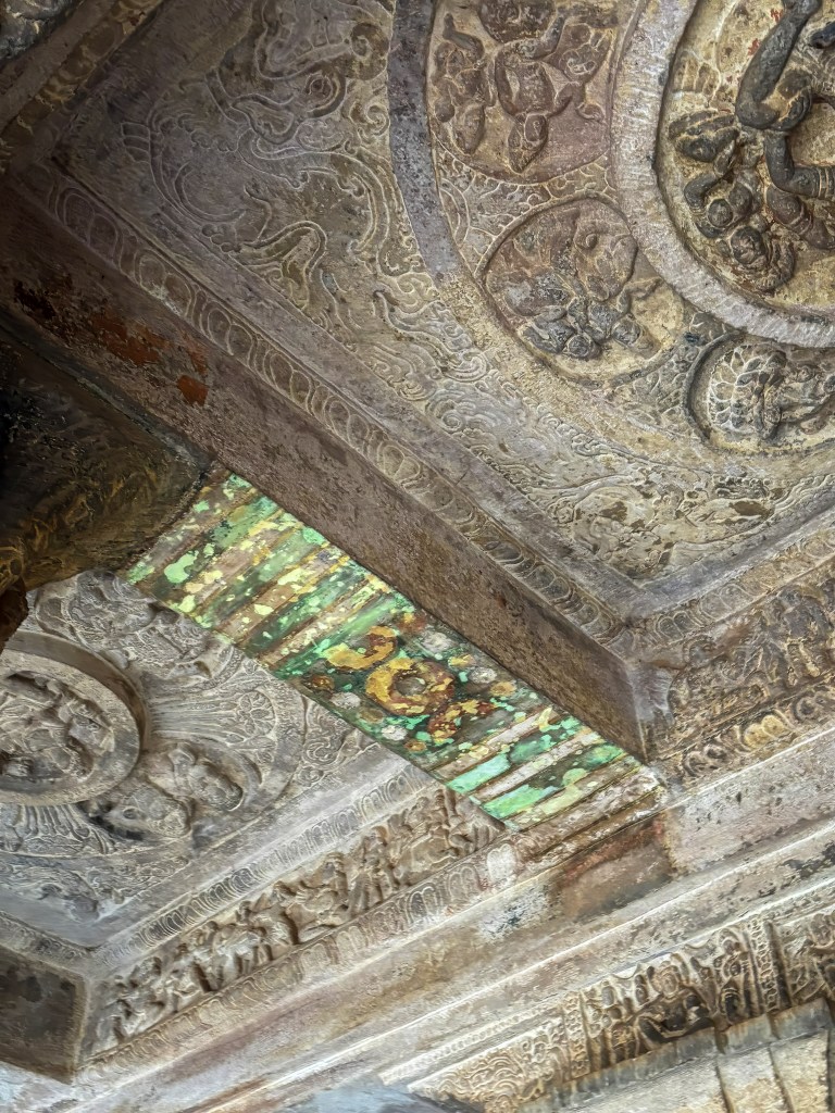
Within the gopura passageway, the doorway jambs are carved with elegant maidens entwined with creepers. A charming hare‑in‑the‑moon motif appears between nagas on the underside of one lintel. This is a delightful detail easily missed by hurried visitors.
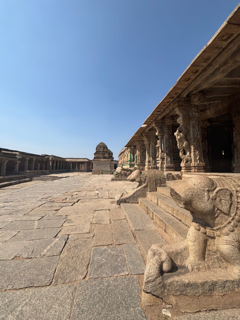
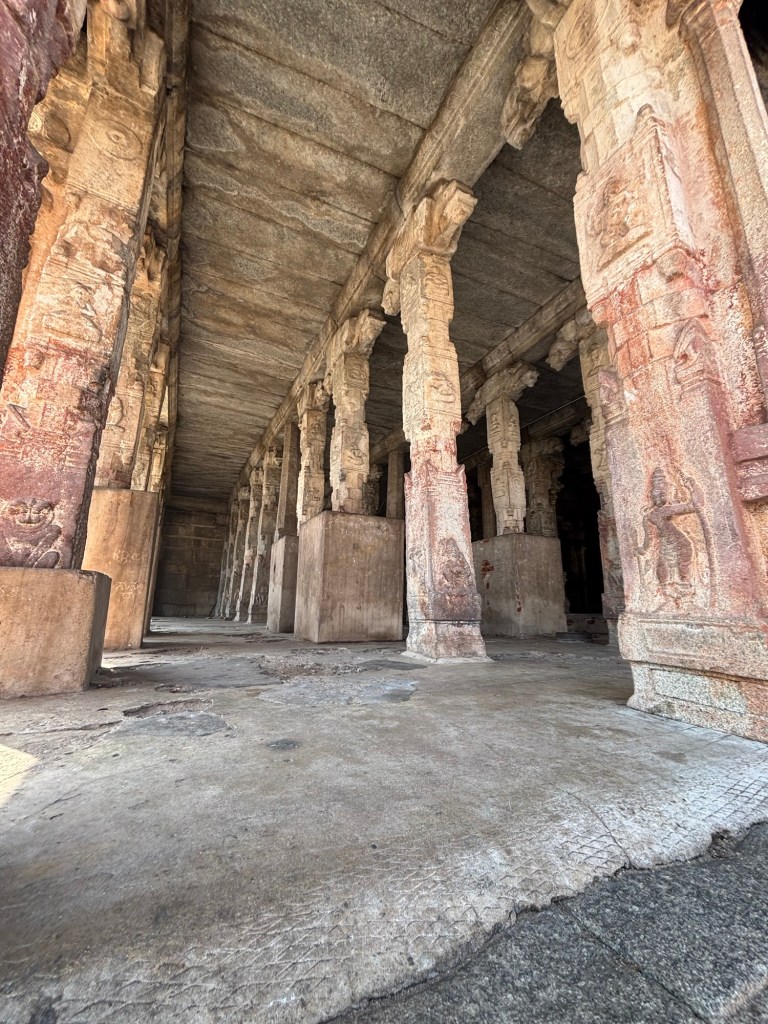
Inside the Temple: Mandapas, Shrines, and Royal Inscriptions
A large inscription slab stands at the centre of the walled compound. Krishnadevaraya himself set it up. It records his military exploits and benefactions. The carving is somewhat hastily executed, but the monument remains a valuable historical record of the emperor’s reign.
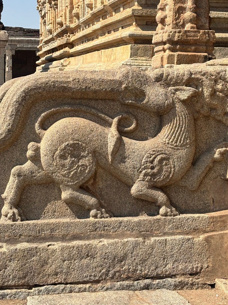
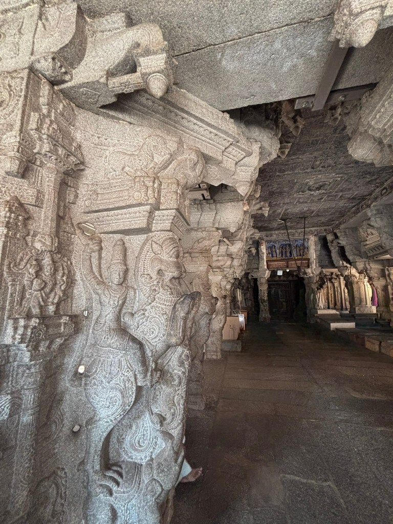
sculpture of a Yali
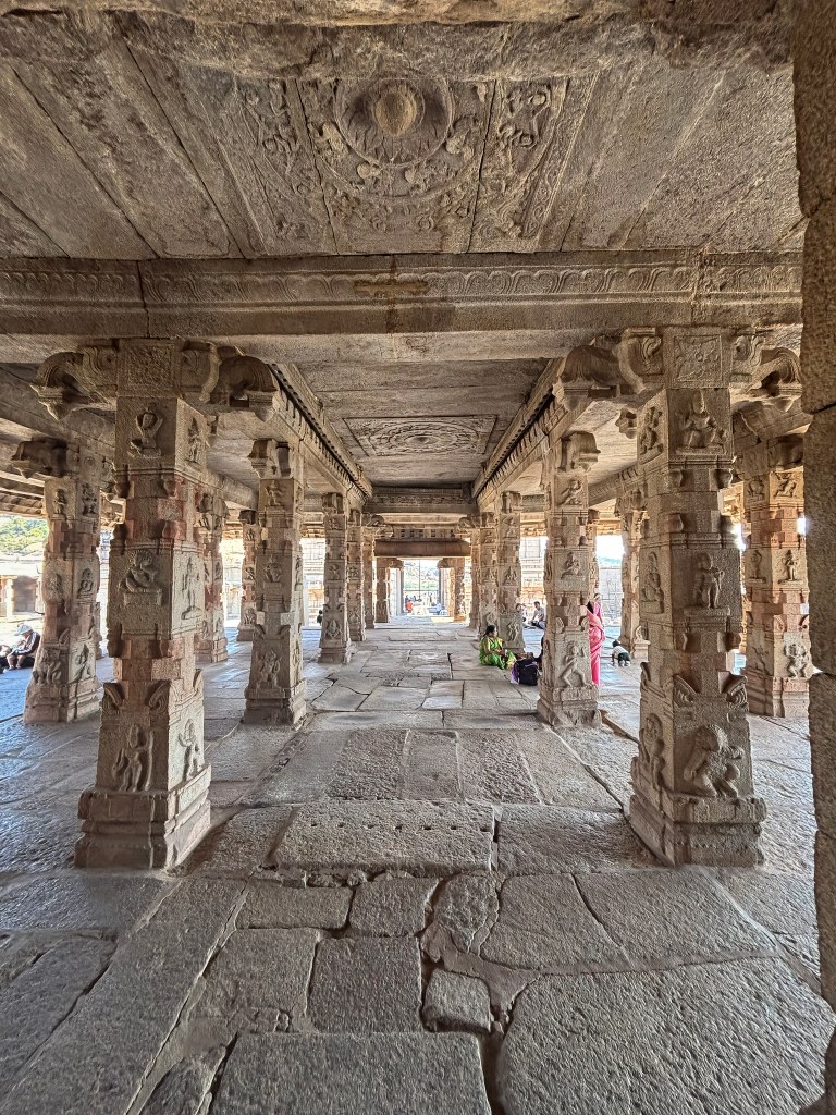
The temple layout follows the classic Vijayanagara sequence:
a 25‑bay open mandapa,
an enclosed nine‑bay mandapa with side porches,
and a towered sanctuary surrounded by an unlit circumambulatory passage.
Minor shrines occupy the outer corners of the enclosure. A double‑sanctuaried goddess temple stands to the north. It adds to the ritual complexity of the site.
Layers of Construction and Adaptation
Along the inner perimeter is a continuous colonnade. It is interrupted on the south side by a passageway. This leads to an earlier pavilion‑like gateway. This older structure became part of the Krishna Temple complex. It was crowned with a brick tower. This illustrates the Vijayanagara habit of integrating pre‑existing buildings into new architectural schemes.
Beyond this lies an outer-walled enclosure, where a curious six‑domed structure stands. The building is built of rubble coated in plaster. It has internal arches and steps leading to the roof. The building features holes in the domes. These are clear evidence that it once served as a granary. Its presence highlights the temple’s significance as a sacred space. It also emphasizes its role as a center of economic and administrative activity.
Final Thoughts on the Krishna Temple
The Krishna Temple is one of those places in Hampi where layers of history feel unusually close to the surface. You sense Krishnadevaraya’s ambition in the soaring gopura. You also feel the devotional pulse that once centered around the now‑empty sanctuary. Even in its ruined state, the complex carries the unmistakable imprint of royal patronage. It is a temple built not only for worship. It commemorates a moment of triumph that shaped the empire’s identity.
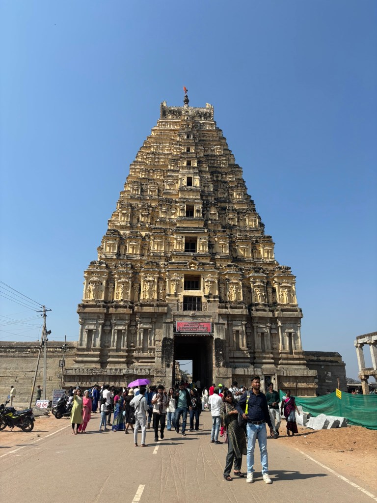
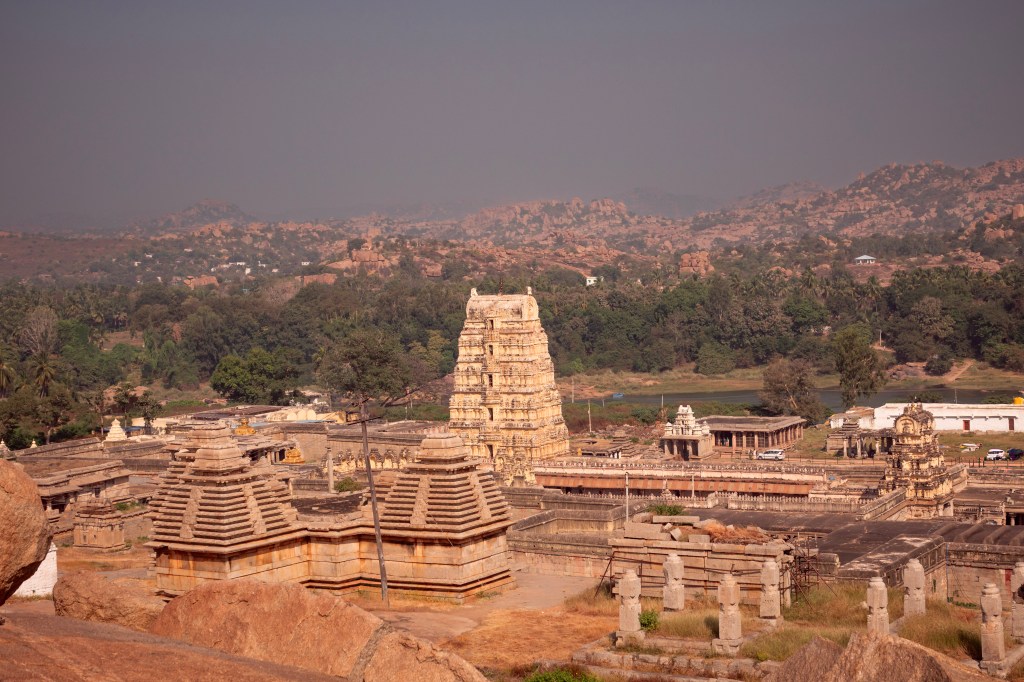
The Virupaksha Temple complex is the main destination for most visitors to Hampi. It forms a natural starting point for any exploration of this sacred landscape. During festivals, thousands gather to worship Virupaksha and his consorts Pampa and Bhuvaneshvari in the temple’s main sanctuaries.
The Bazaar and the Towering Gopura
The village of Hampi clusters around a broad street. This street once functioned as a bustling bazaar. It was a lively corridor of shops, rest-houses, and shrines. These served pilgrims much as they did in Vijayanagar times. Beginning in the 1950s, modern structures gradually obscured the historic colonnades and shrines. Government authorities have now demolished most of these additions and restored the original bazar.
Our guide said that he and his family used to live in one of those houses. These houses were built utilizing the existing pillars and walls of the ancient structures. Later, the government removed them.
Bazar
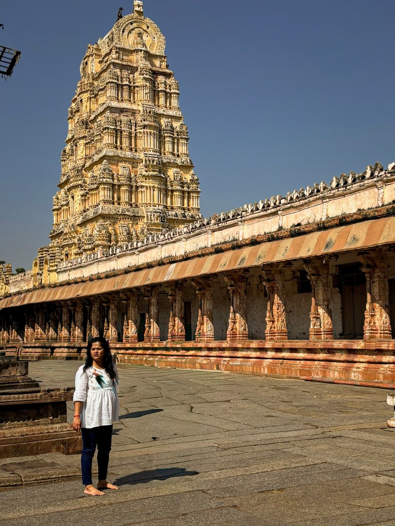
At the western end of this street rises the imposing entrance gopura of the Virupaksha Temple. It is a whitewashed tower soaring more than 50 metres. It gleams under the sun and glows under electric lights at night. Despite its grandeur, the structure is relatively recent. Its granite base and the entire brick-and-plaster superstructure date to the early 19th century. During this time, the temple and bazaar underwent extensive renovation. Curiously, no records survive identifying the patrons or builders behind this post-Vijayanagara makeover.
Architecturally, the gopura follows the classic Vijayanagara formula. It consists of a pyramidal tower of diminishing storeys. The tower is crowned by a shala (barrel-vaulted roof) and gilded kalasha finials. This lineage ultimately traces back to Tamil prototypes of the 11th–12th centuries. Inside, the pointed vault of the passageway instantly signals its later date.
Temple Elephant – You can visit the temple elephant, Lakshmi. She is not only a majestic and gentle creature. Lakshmi also holds a special place in the hearts of many visitors. As you approach her, you can make a donation to her handler. This donation helps support Lakshmi’s care and feeding. In return for your generosity, Lakshmi will bestow her blessings upon you, bringing good fortune and positivity into your life.
Visitors encounter a smaller gopura when stepping into the first enclosure. This structure is authentically from the Vijayanagara period. It was built by Krishnadevaraya during his coronation year, 1510 CE. Its granite base, high molded plinth, and squat brick tower are hallmarks of 16th-century craftsmanship.
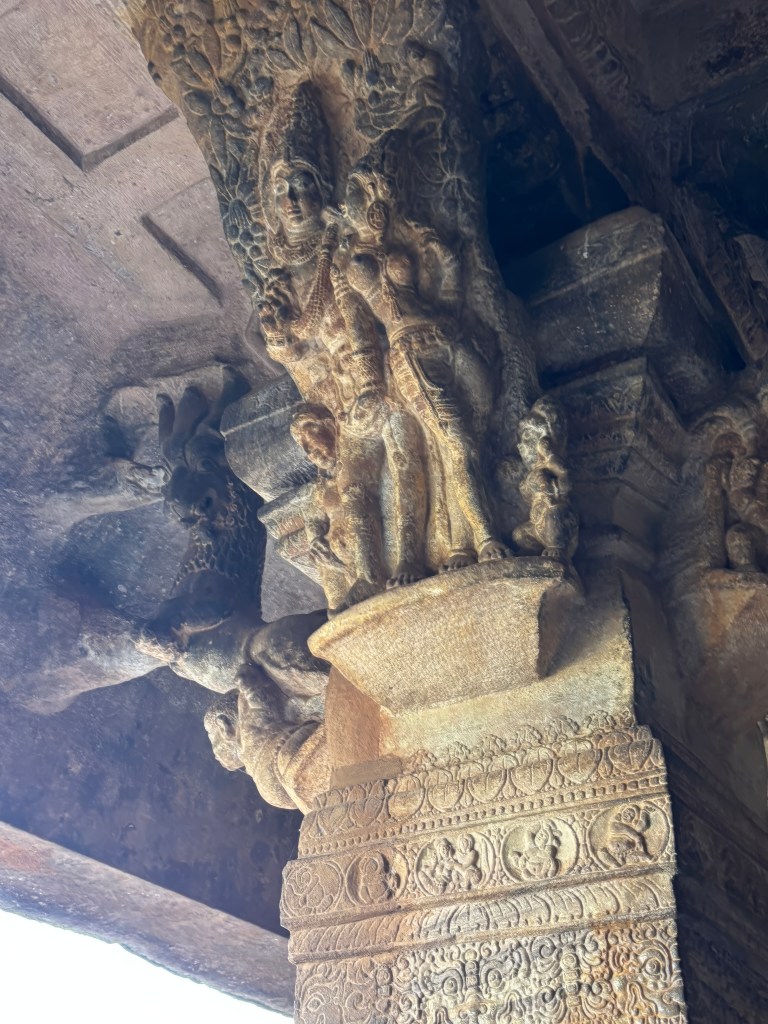
To the southwest stands the 100-columned hall, another of Krishnadevaraya’s contributions. Its three-tiered interior, open central hall, and columns with cut-out colonettes exemplify the dynamism of late Vijayanagara architecture. A small doorway leads to a kitchen. In the kitchen, a water channel is carved directly into the rising bedrock. This is a subtle but fascinating detail.
The Inner Enclosure: Unified, Ornate, and Alive with Symbolism
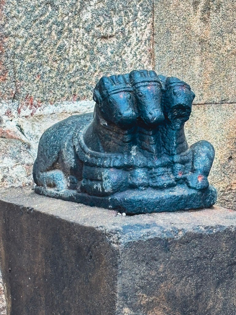
Beyond the smaller gopura lies the inner enclosure. It is more unified in appearance thanks to its colonnades with cut-out colonettes. It also features free-standing altars, dipa-stambhas, and a modest Nandi pavilion.
The open mandapa at the western end is one of the complex’s architectural highlights. Built by Krishnadevaraya in 1510, it introduces several signature Vijayanagara motifs:
Piers with cut-out colonettes
Dramatic rearing yalis with fierce leonine heads and raised forepaws
Makaras with crocodilian snouts beneath the yalis
A deep double-curved eave
A lively brick-and-plaster parapet added during the 19th-century renovation
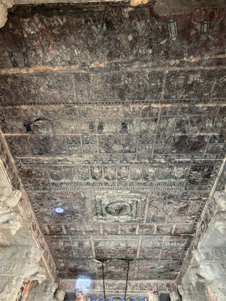
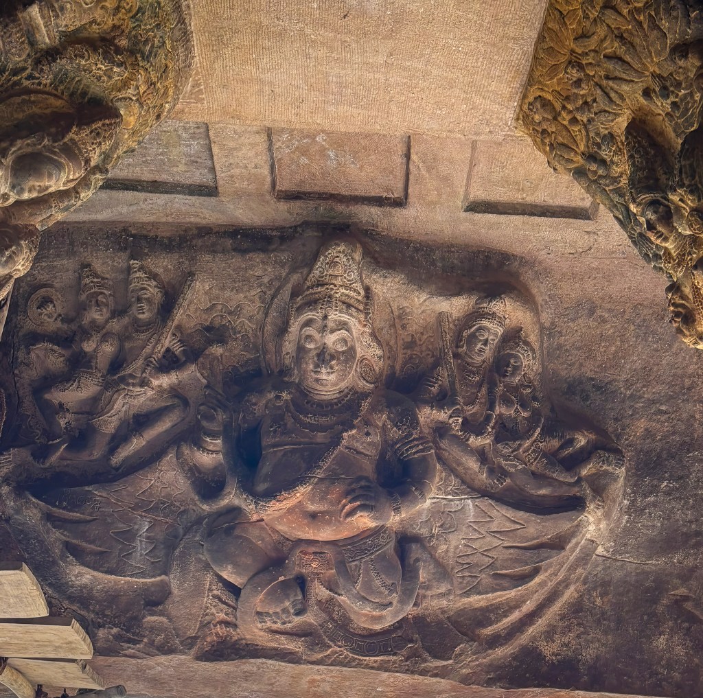
Inside, sixteen animal piers support a ceiling of inverted T-shaped beams spanning over 8 metres. The ceiling is covered with vivid early 19th-century paintings depicting:
The marriages of Virupaksha–Pampa and Rama–Sita
Shiva attacking the triple cities
Kama aiming his arrow at Shiva in meditation
Vidyaranya carried in a palanquin, surrounded by attendants in costumes and weaponry no older than 200 years
These paintings likely replaced earlier Vijayanagara originals.
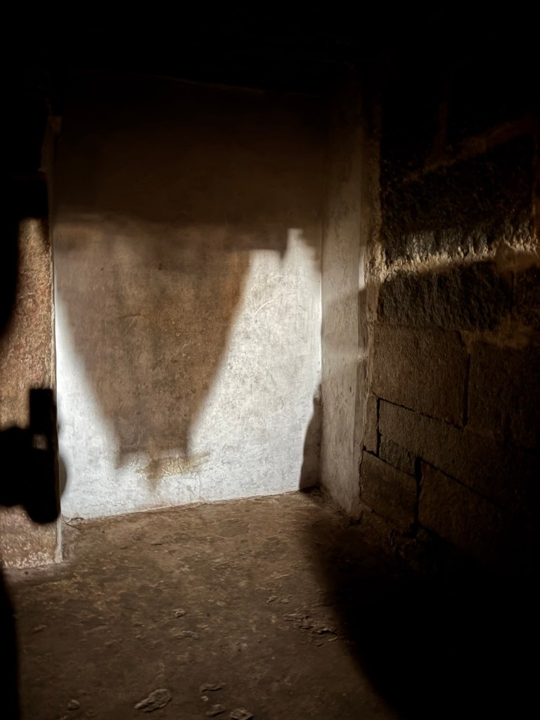
Did You Know? The Temple’s Natural Camera Obscura
Inside the Virupaksha Temple lies one of Hampi’s most magical secrets. It is a natural pinhole camera effect. This effect projects an upside-down image of the main gopura onto the wall of a darkened chamber near the sanctum. Sunlight passes through a tiny aperture in the tower’s structure. It behaves exactly like a camera obscura. This phenomenon casts a crisp, inverted silhouette of the towering whitewashed gopura onto the interior surface. This isn’t a modern trick but a quiet interplay of light, shadow, and centuries-old architecture.
Sanctuaries of Pampa and Bhuvaneshvari
Today, devotees enter through the south porch. They offer prayers to the mukha-linga of Virupaksha, which is adorned with a brass facemask. Then, they exit through the north porch to visit the shrines of Pampadevi and Bhuvaneshvari.
The Bhuvaneshvari shrine is particularly intriguing. Its grey-green chloritic schist columns, beams, and perforated screens date to the 10th–11th centuries. These elements were relocated from an earlier dismantled temple. They were then reassembled during the Vijayanagara period.
Nearby are smaller shrines, including:
Mahishasuramardini (Durga slaying the buffalo demon)
Adishesha, represented by a simple wall recess framed in ornate plaster
Toward the Tungabhadra: The Kanakagiri Gopura
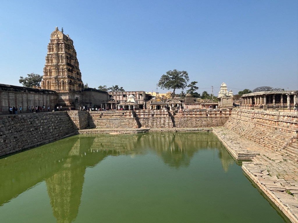
To reach the river, devotees exit through the Kanakagiri gopura on the north side of the inner enclosure. Its whitewashed tower was renovated in the 1830s by F.W. Robinson, the District Collector of Bellary, but its granite base is a genuine 15th-century Vijayanagara structure. Inside the passageway, there are two inscribed slabs from the 12th and 14th centuries. These slabs add another layer to the temple’s long, evolving history.
Manmatha Tank and the Durgadevi Shrine
Stepping through the Kanakagiri gopura, the path descends toward the Manmatha tank — once the principal bathing reservoir for pilgrims arriving at the Virupaksha complex. Today, its stone steps sit in varying states of subsidence, giving the tank a quiet, timeworn character. Along the western edge, a line of modest shrines overlooks the water, guiding visitors northwards toward the Tungabhadra river.
Among these structures, the Durgadevi shrine stands out as the oldest intact monument in the entire Virupaksha precinct. It is built of sandstone, in contrast to the granite used in later Vijayanagara additions. It showcases the 9th‑century Rashtrakuta idiom with plain pilastered walls. A compact pyramidal tower is capped by a kuta (square‑to‑domed) roof. Scholars often suggest that the earliest Virupaksha shrine may have resembled this form. However, it now lies hidden within centuries of later accretions.
The shrine’s granite-columned porch is sheltered by sloping roof slabs. It is a later addition. It is likely contemporary with the inscribed slab dated 1199 CE found here. This inscription is historically significant. It is the earliest known record to mention the worship of Pampa and Virupaksha at Hampi. This anchors the site’s sacred identity long before the rise of the Vijayanagara empire.
Nearby stands a striking three-dimensional sculpture of a warrior battling a lion. It is attributed to the 13th‑century Hoysala period. This sculpture is a rare pre-Vijayanagara survival in this part of the complex. The multi-armed image of Durga currently worshipped inside the shrine is modern. The other small shrines around the tank, dating to the 13th and early 14th centuries, remain relatively understated. They see limited ritual use today.
How to Visit the Virupaksha Temple Complex
⏱ Ideal Duration: 1.5–2 hours for the temple + bazaar street; longer if continuing to the Tungabhadra ghats.
🕉 Temple Timings:
Morning: ~6:00 AM to 12:30 PM
Evening: ~5:00 PM to 9:00 PM (Expect extended hours and larger crowds during festivals.)
🎟 Entry:
No entry fee for the main temple.
Photography is generally allowed in outer areas; restrictions apply inside sanctums.
👣 Footwear:
Footwear must be deposited before entering the inner enclosure.
The designated stand is just before the smaller Vijayanagara-period gopura.
📍 Best Starting Point:
Begin at the western end of Hampi Bazaar, facing the towering 19th-century entrance gopura.
This aligns with the traditional pilgrim route and sets up a natural flow toward the river.
🧭 Suggested Route Inside:
Enter through the main gopura into the outer courtyard.
Walk straight to the 1510 CE Vijayanagara gopura.
Explore the 100-columned hall (southwest corner).
Proceed into the inner enclosure with its colonnades and dipa-stambhas.
Visit the open mandapa with its yali piers and painted ceiling.
Offer prayers at the Virupaksha sanctum.
Continue to the Pampa and Bhuvaneshvari shrines.
Exit through the Kanakagiri gopura to reach the Tungabhadra riverfront.
🌞 Best Time to Visit:
Early morning for soft light on the gopura and quieter sanctums.
Late afternoon for photography along the bazaar colonnades and river ghats.
📿 Festival Note:
During Pampa Devi’s annual festival and major Hindu holidays, expect dense crowds and long queues.
The temple becomes a vibrant, immersive experience — but plan extra time.
💡 Insider Tip:
Look up inside the open mandapa. The early 19th-century ceiling paintings are easy to miss. However, they are incredibly rewarding. Pay special attention to the Vidyaranya panel in the procession.
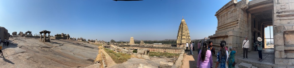
Hemakuta Hill is one of Hampi’s most quietly enchanting landscapes. It’s a place where mythology, early temple architecture, and sweeping granite vistas come together. Rising gently above the Virupaksha Temple complex, this hill holds some of the region’s oldest shrines.
A Sacred Hill of Gold and Fire
Local folklore gives Hemakuta its luminous name. According to mythology, Lord Shiva performed penance on this very hill long ago. This was before he agreed to marry Pampa, who is often identified with Parvati. She was a local goddess whose devotion moved him deeply. When Shiva finally consented to the marriage, it rained gold on the hill. Since hema means gold in Sanskrit, the place became known as Hemakuta, the “Hill of Gold.”
Another legend adds a dramatic layer to this sacred landscape. Kama, the god of love, once tried to distract Shiva from his penance. He wanted to help Pampa win Shiva’s affection. Enraged, Shiva opened his third eye and reduced Kama to ashes right here on Hemakuta. When Kama’s wife Rathi pleaded for mercy, Shiva relented — restoring Kama, but only in spirit, not in physical form. This myth of destruction, compassion, and rebirth deepened Hemakuta’s association with Shiva. It inspired generations to build shrines to him across the hill.
Walking Through Early Vijayanagara History
A modest 15th‑century gopura entrance on the western side marks the beginning of the Hemakuta complex. It opens into a fortified zone of small shrines. These shrines are some of the best-preserved examples of pre‑ and early‑Vijayanagara architecture. These temples sit dramatically on a sloping granite shelf.
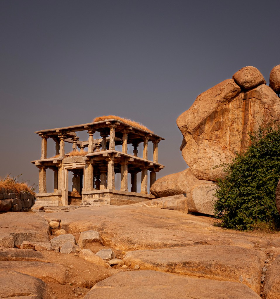
Centuries ago, a processional path connected the Tungabhadra River to the Virupaksha shrine. It then climbed through a series of pavilion-like gateways to the summit of Hemakuta. When Krishnadevaraya expanded the Virupaksha complex in the early 1500s, this ancient route was severed. The gateways persist, including a striking double-storeyed pavilion near the top. This pavilion offers panoramic views of the Tungabhadra valley.
Two storied Mantapa at the top of the Hemakuta hill
Architecture of the Hemakuta Group of Temples
The architecture of the Hemakuta temples is unlike anything else in Hampi. They are deeply rooted in the Deccan traditions of the 13th and 14th centuries. Their clean lines and minimal ornamentation often lead visitors to mistake them for Jain temples.
Most of the temples here are compact, triple‑chambered structures crowned with pyramid‑like granite roofs. On the northern side of the hill, several shrines follow the Trikutachala style. Three sanctums are placed perpendicular to one another. They all open into a shared central hall. This layout creates a sense of balance and quiet symmetry, perfectly suited to the contemplative atmosphere of the hill.
The outer walls are almost entirely plain. A delicate horizontal chain of floral motifs is the only interruption. It wraps around the structures. Other signature features include fluted foundations. The curved eaves gently overhang the walls. These details soften the granite’s stark geometry.
As you wander across the hilltop, you’ll encounter dozens of such shrines, scattered across the undulating sheet of rock. The largest and most elaborate clusters lie on the northern slope, facing the Virupaksha Temple complex. These are among the oldest surviving temples in Hampi, predating the Vijayanagara Empire itself.
Sacred Corners and Hidden Gems
Further south, the landscape shifts. A small pond is next to a shrine known as the Mula Virupaksha Temple. This shrine is believed to be older than the grand Virupaksha Temple below. Its whitewashed hall features cubical pillars typical of pre‑Vijayanagara design. The porch opens directly onto the water. This is one of the few shrines on Hemakuta Hill that remains actively worshipped.
Just behind it stands a tiny chamber-like shrine with a pyramid roof, housing an image of Hanuman. This quiet corner is one of the best spots to watch a Hampi sunrise or sunset.
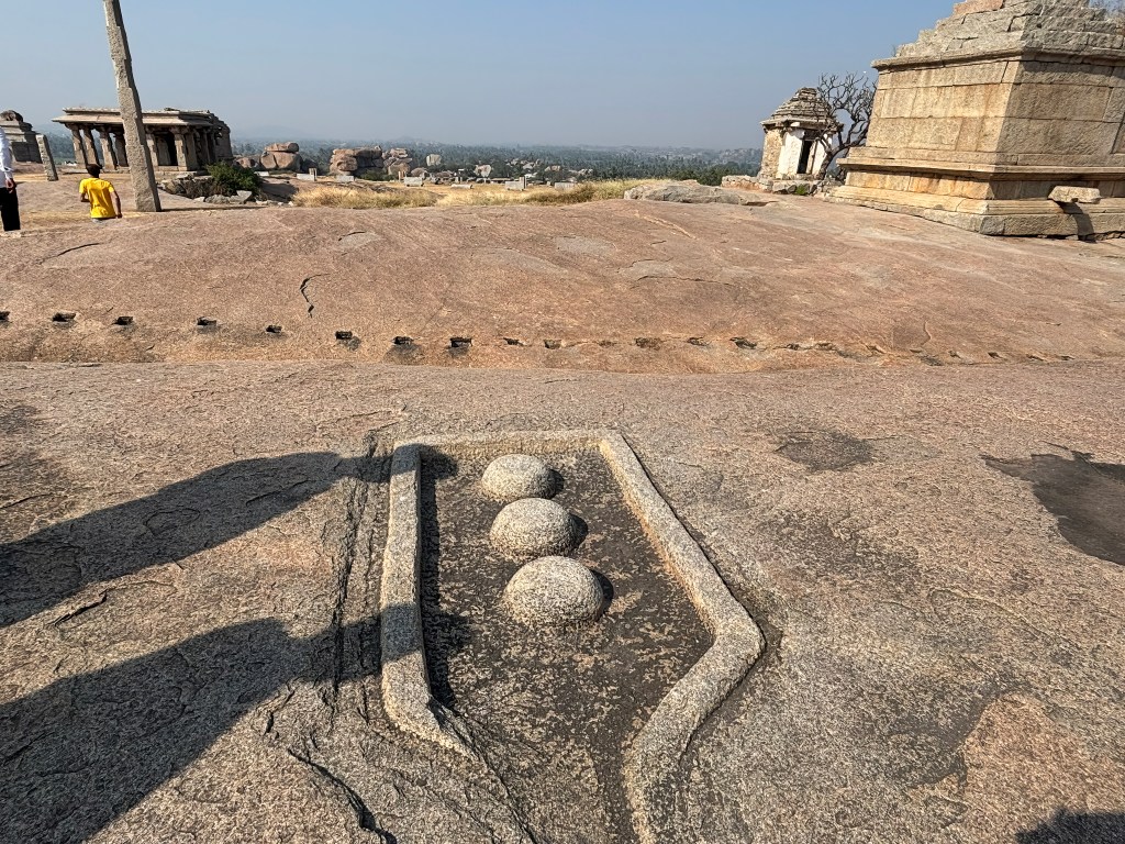
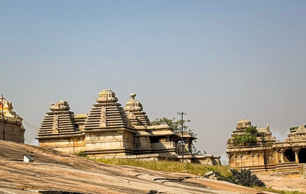
As you continue southward, the hill offers a natural balcony. It overlooks the Krishna Temple and Sasivekalu Ganesha. You can also see the twin monuments of Lakshminarasimha and Badavilinga. Here you’ll also find the two‑storeyed southern gateway, another remnant of the ancient processional path. Several temples in this area feature tall monolithic lamp posts, standing like silent sentinels before the shrines.
Krishna temple and Sasivekalu Ganapathi temple from Hemakuata hill
The entire hill is encircled by an ancient fortification wall. It is now broken in places but still traceable along the granite’s contours. It hints at the strategic and sacred importance Hemakuta once held.
A Hill That Holds Its Stories Lightly
Despite being at the very heart of Hampi, Hemakuta Hill feels surprisingly serene. You can easily spend hours wandering its slopes. Discover shrines tucked between boulders. Absorb the quiet stories etched into every surface.
Hemakuta is not a place of spectacle — it is a place of origins. It is a hill where gods once walked. Kings once prayed there. The earliest architectural whispers of Vijayanagara still linger in the wind.
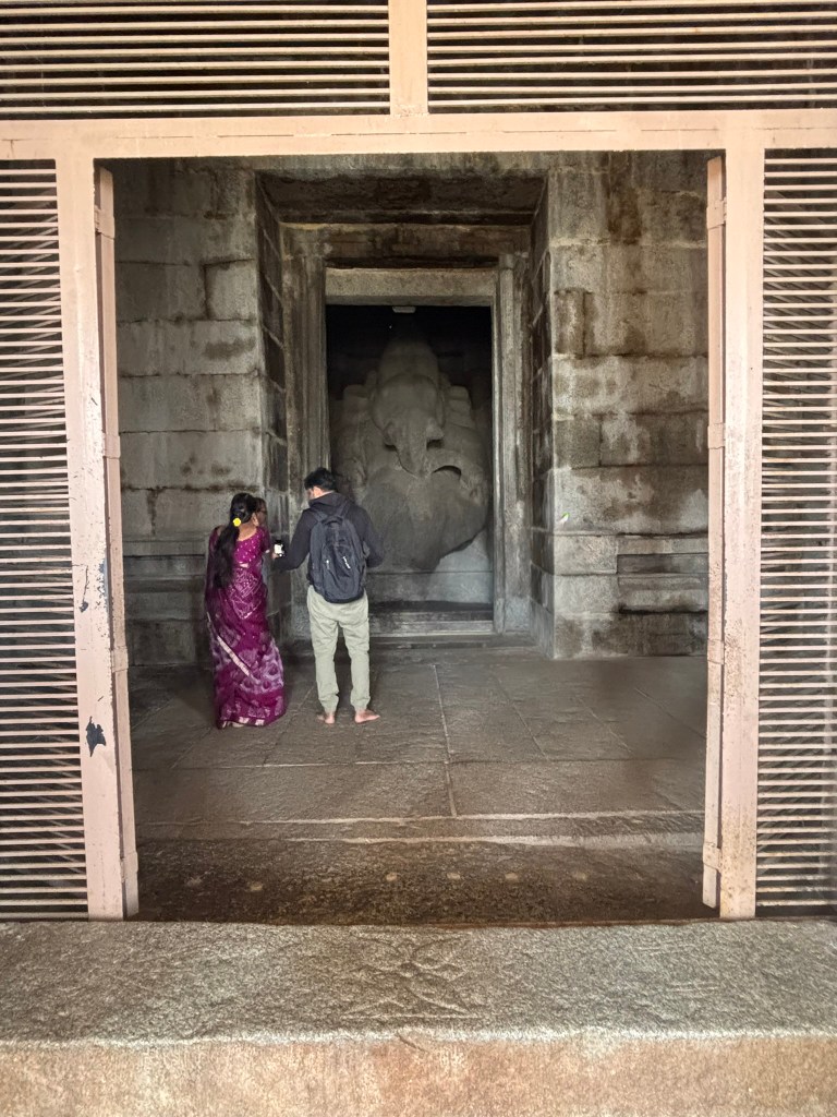
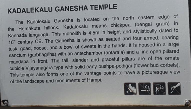
The Sasivekalu and Kadalekalu Ganesha temples are two of Hampi’s most significant monolithic shrines. They are located on the slopes of Hemakuta Hill. Both statues are carved from single granite boulders and exemplify the classical Vijayanagara architectural style.
Sasivekalu GaneshaKadalekalu Ganesha
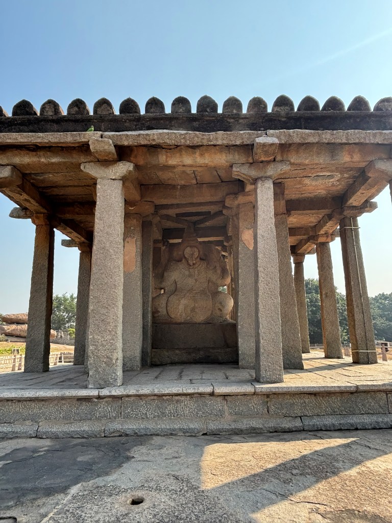
Sasivekalu Ganesha- Meaning Mustard seed Ganesha. Legend has it that it was commissioned by a mustard seed seller and hence the name. Walk behind the open pavilion to see a female form representing the mother of Ganesha.
Physicality: Stands 2.4 meters (8 feet) tall.
Iconography: Depicts Ganesha with a snake tied around his belly to prevent it from bursting after a large meal. He is seated in a half-lotus posture with four arms holding a goad, noose, broken tusk, and modak. A unique feature on the back depicts a giant hand, suggesting Ganesha is sitting in the lap of his mother, Goddess Parvati.
Structure: Housed in an open, 16-pillared mandapa (pavilion) with a brick and mortar roof in the Indo-Saracenic style.
Backside of Sashivekalu Ganesha
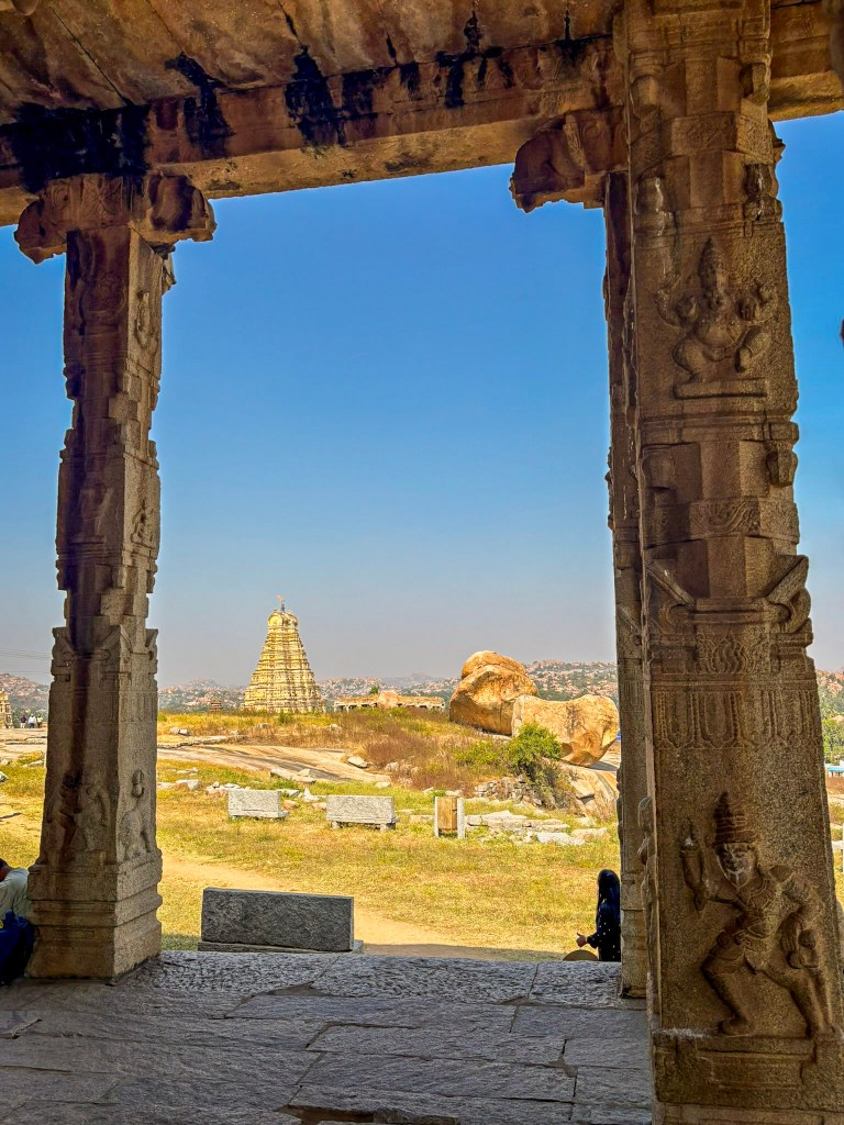
Kadalekalu Ganesha– Meaning Bengal gram Ganesh due to the belly resemblance to Bengal Gram. The open mandapa of this temple has some great views of the surrounding area of Hampi
Physicality: Significantly larger at 4.5 meters (15 feet) tall.
Iconography: Named for its belly’s resemblance to a Bengal gram (Kadalekalu).
Structure: Features a formal temple layout with a large sanctum (garbhagriha) and an open-pillared mandapa with unusually tall, slender granite pillars adorned with intricate mythological carvings
Views from Kalekalu Ganesha Mantapa
Final Thoughts
Standing before the Sasivekalu and Kadalekalu Ganesha statues, it’s impossible not to feel the quiet power that defines Hampi. These monolithic forms are one modest and intimate, and the other towering and majestic. They capture the spirit of a city that once pulsed with royal ambition and artistic brilliance. What moved me most was how effortlessly Hampi blends myth and landscape, history and humanity. A mustard-seed seller commissioning a deity, a mother’s presence carved subtly into stone, a belly shaped like a Bengal gram—these details remind you that even in an imperial capital, ordinary lives and tender stories shaped the sacred,
I was born in a small village in the North Karnataka region, and my earliest memories are steeped in its red earth, quiet lanes, and the comforting aromas of food cooked with love. Returning to Badami after nearly forty years felt like opening a long-forgotten chapter of my own story. As we drove through those familiar villages—names that once shaped my childhood—the vibrant green fields and gentle rhythm of rural life.
When my family moved to South Karnataka at the age of ten, we carried North Karnataka with us in our hearts. We often found ourselves reminiscing about the genuinely kind people, the unhurried pace of life, and of course, the food—bold, earthy, and unique to the region. This trip back wasn’t just a homecoming; it was a rediscovery of the flavors that shaped my childhood.
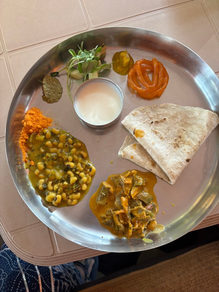
No visit to North Karnataka region is complete without eating in a Khanavali. A khanavali (also spelled khanavali, khanawali, or khanavali mane) is a traditional North Karnataka restaurantjolada rotti oota. Think of it as a no-frills, simple, and unlimited meals. These establishments are characterized by a warm, welcoming ambiance, where guests are often treated like family, enhancing the dining experience. The menu typically features a variety of regional dishes highlighting Karnataka’s rich culinary heritage and includes sides such as saaru, dal, and chutney, all made with locally sourced ingredients. These restaurants are often family-run, ensuring recipes are passed down through generations, creating a sense of continuity and tradition. Very budget-friendly, Khanavalis offer an affordable dining option for both locals and travelers alike, making it a beloved choice for those seeking genuine, home-cooked meals away from home.
Jolada Rotti Oota
The signature meal includes:
Jolada rotti (jowar/Millet roti)
Yennegai (stuffed brinjal/eggplant curry)
Shenga chutney pudi (peanut spice powder)
Hesarukalu / Palya– Lentil Curry
Sambar / Saaru
Curd / buttermilk
Some type of Sweet dish
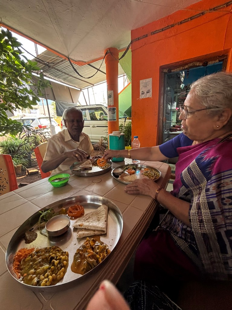
We stopped at a small khanavali in Badami for lunch before heading to the cave temples, and the experience instantly transported me back to the flavors of my childhood. The food was simple, comforting, and made with the kind of care you only find in a home kitchen. The man serving us kept insisting we eat more—bringing extra rotis, more rice, and refusing to take no for an answer. In between all this, he shared stories from his life, telling us he’d been working there for 13 years and genuinely loved feeding people. It didn’t feel like a restaurant at all; it felt like visiting a long-lost relative who’s determined to send you off with a full stomach. As an NRI, I’m usually cautious about eating outside food, but this meal left me only with a happy, satisfied stomach and a heart full of nostalgia.
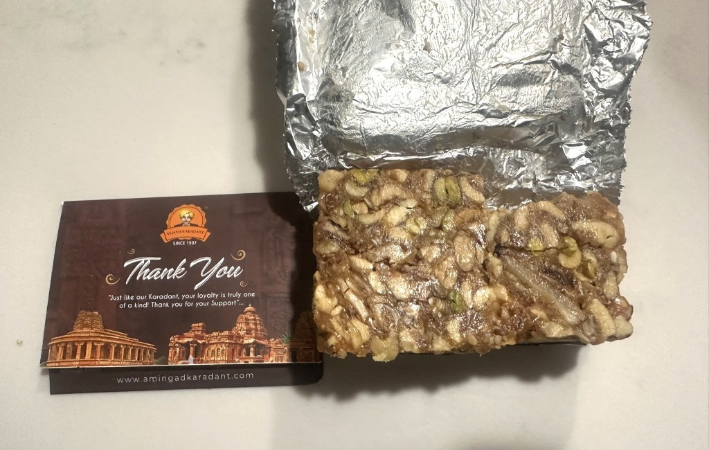
And then, of course, came the sweet that is so unique to this region: Karadantu. This chewy, jaggery-rich delicacy—packed with edible gum, nuts, and dried fruits.
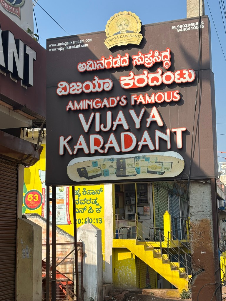
While Gokak and Amingad both claim to make the “best” Karadantu, the real difference lies in their backstories, textures, and secret-ingredient ratios. I swung by Vijaya Karadant, known for whipping up the Amingad version since 1907. Of course, I snagged a few packs to share with my family ( and eat in the car as we travelled) and even brought one back to the US so my husband could enjoy a taste of my childhood nostalgia.
Final Thoughts
As I left Badami that afternoon, traveling through familiar fields and villages, I felt a surprising sense of fullness — not just from my meal, but from the richness this place offers. From the warmth of a khanavali where strangers become family, to the chewy sweetness of Karadantu — every bite tells a story.
Returning after nearly forty years reminded me that some parts of us never truly leave home. They reside in our memories, ready to resurface with the first taste of a familiar dish. Bringing back a small box of Karadantu to the US — a piece of my childhood wrapped in a box — revealed that food beautifully keeps a bit of home with us, no matter how far we go.
I grew up in North Karnataka, and man, going back to Badami after nearly 40 years was such a trip down memory lane! Driving through those quiet villages with their familiar names and vibrant green fields felt both like home and a dreamy fairy tale. The last time I checked out those temples, I was only 10 or 12 and didn’t really get how stunning they were. But now, after traveling to over 30 countries and living in a country that’s just 250 years old, I totally see the incredible history and timeless beauty of these spots in a whole new light!
Northern Karnataka really knows how to keep you on your toes. One minute you’re cruising through sleepy little villages, and the next, BAM—you’re in front of temples that seem frozen in time. Aihole, Badami, and Pattadakal aren’t just old ruins—they’re like chapters in the story of Indian temple architecture, showcasing how the Early Chalukyas experimented with ideas, refined them, and mastered their craft between the 6th and 8th centuries CE.
This journey is a pilgrimage for anyone who loves history, architecture, or the thrill of watching ideas evolve in stone.
Aihole: The Architectural Laboratory
Aihole is where the Chalukyas began dreaming in stone. With more than 120 temples, it feels like a vast workshop where artisans tested forms, proportions, and techniques that would later define South Indian temple architecture.
One of India’s oldest structural temples, the Lad Khan Temple (5th century CE) still carries the memory of wooden prototypes. Its flat, sloping roof and sabha‑mandapa layout make it feel more like an early assembly hall than a shrine—because that’s exactly what it once was.
Architectural Insight Early Chalukyan builders used post‑and‑lintel construction, fitting massive sandstone blocks without mortar. Precision joints—like mortise‑and‑tenon—held everything together.
A short walk away, the Ravana Phadi Cave (6th century CE) showcases the Chalukyas’ growing mastery of rock‑cut architecture. Inside, a magnificent 10‑armed Nataraja commands the space, surrounded by dynamic carvings of Durga and other deities.
Meguti Jain Temple
Perched on a hillock, the Meguti Jain Temple (634 CE) is the only dated monument in Aihole. Its inscription—the famous Aihole Prashasti—records the achievements of Pulakeshin II and offers rare historical clarity.
Badami: Refinement in Red Sandstone
If Aihole is the sketchbook, Badami is the gallery. Once the Chalukyan capital, Badami’s dramatic cliffs cradle some of India’s most exquisite cave temples.
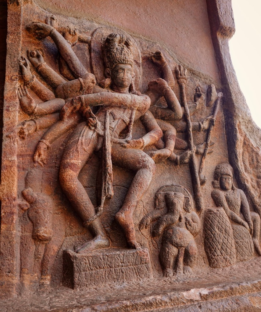
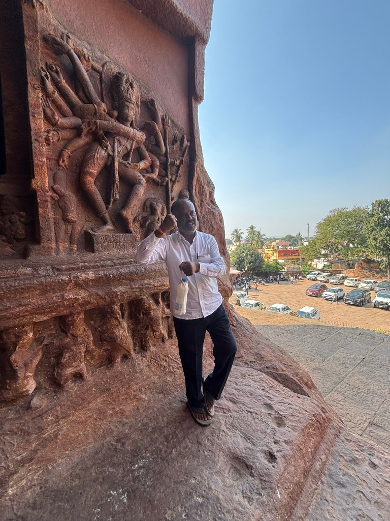
Dedicated to Shiva, Cave 1 features an 18‑armed Nataraja frozen mid‑movement. The sculptural energy is electric.
Cave 2: Vishnu’s Cosmic Form
Here, Vishnu appears as Trivikrama, his leg stretching across the universe. The refinement in carving marks a clear evolution from Aihole.
Cave 3: The Masterpiece
Dated to 578/579 CE, Cave 3 is the largest and most ornate. Its narrative friezes, pillars, and proportions reflect a confident artistic maturity.
Cave 4: Jain Serenity
The final cave honors Jain Tirthankaras, a testament to the region’s religious inclusivity.
Rock‑Cut Technique Badami’s caves were carved using a subtractive method—artisans removed stone to reveal halls, pillars, and sanctums within the cliff face.
A UNESCO World Heritage Site, Pattadakal is where the Chalukyas’ architectural experiments reached their zenith. This was the royal coronation site, and the temples reflect a confident blend of Nagara (North Indian) and Dravidian (South Indian) styles—what we now call the Vesara style.
Virupaksha Temple
Built around 740 CE by Queen Lokamahadevi, the Virupaksha Temple is a Dravidian masterpiece. Its layered vimana, sculpted friezes, and harmonious proportions later inspired the Kailasa Temple at Ellora.
Mallikarjuna Temple
A near twin to Virupaksha, this temple was built by another queen, Trailokyamahadevi. Subtle differences in detailing make it a fascinating companion piece.
Early temples mimic wooden structures(eg. Ladkhan temple), marking a pivotal architectural transition.
Layouts & Plans
Sandhara (with circumambulatory path)
Nirandhara (without)
Square, rectangular, and apsidal plans
Fusion of Styles
Nagara: Curvilinear shikhara
Dravidian: Pyramidal vimana
Vesara: Their harmonious blend
Travel Tips for Visiting the Chalukyan Sites
Best season: October–February – December’s a solid month, but just a heads up, a lot of schools have their trips planned then. The temples get packed with schoolkids, but they don’t stick around for too long. Just hang tight until one group heads out, and snap your pics before the next bunch rolls in!
Carry water—these sites involve walking and open sun
Hire a local guide at Pattadakal for deeper context
Combine all three sites in a 2‑day itinerary or along with Hampi as a 4–6-day itinerary
Suggested Reads
“The Chalukyas of Badami” – K.A. Nilakanta Sastri
“Indian Temple Architecture” – Adam Hardy
Nearby Attractions
Mahakuta Group of Temples
Banashankari Temple
Bhutanatha Temples by the lake in Badami
Final Thoughts
Traveling through Aihole, Badami, and Pattadakal feels like watching an idea take shape—from early sketches to a fully realized masterpiece. The Chalukyas weren’t just building temples; they were building a legacy of experimentation, innovation, and artistic courage.
If you’re drawn to places where history feels textured and alive, this ancient triad of temple towns will stay with you long after you’ve left their sandstone silhouettes behind.
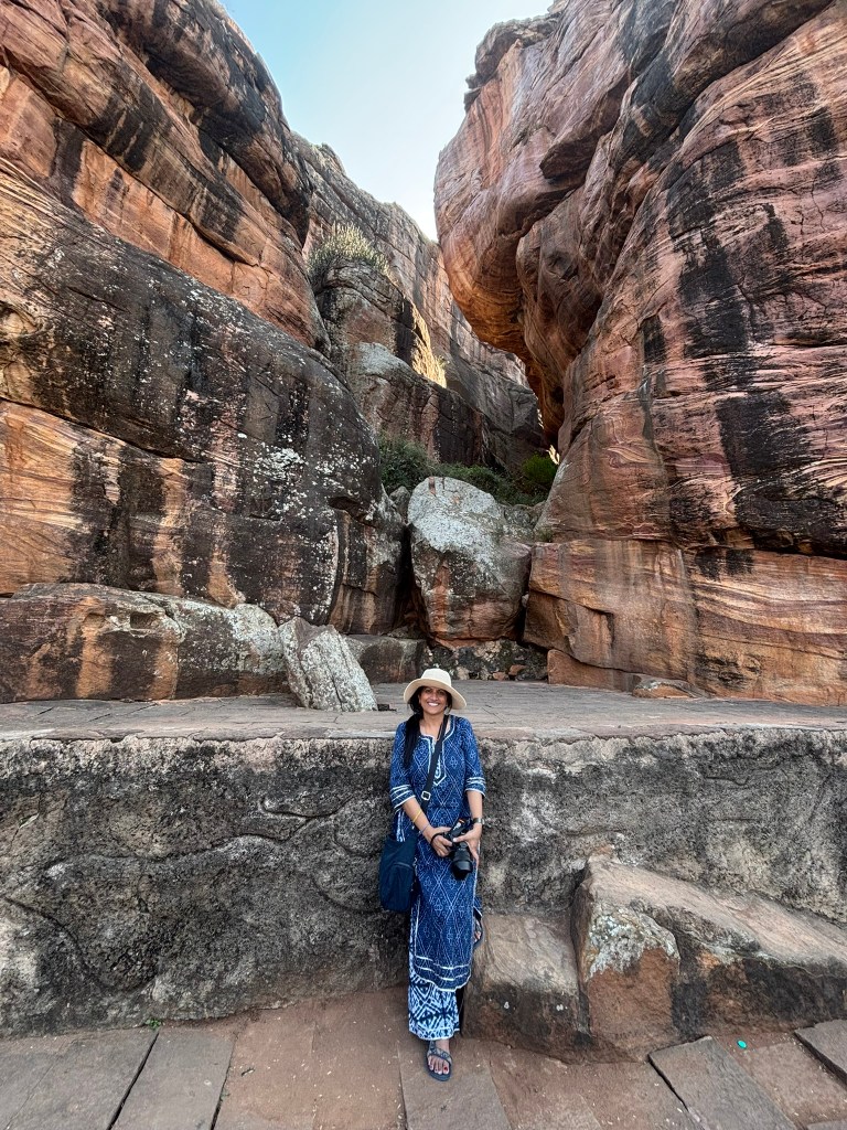
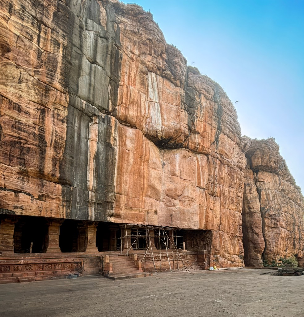
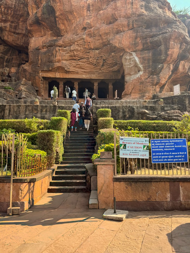
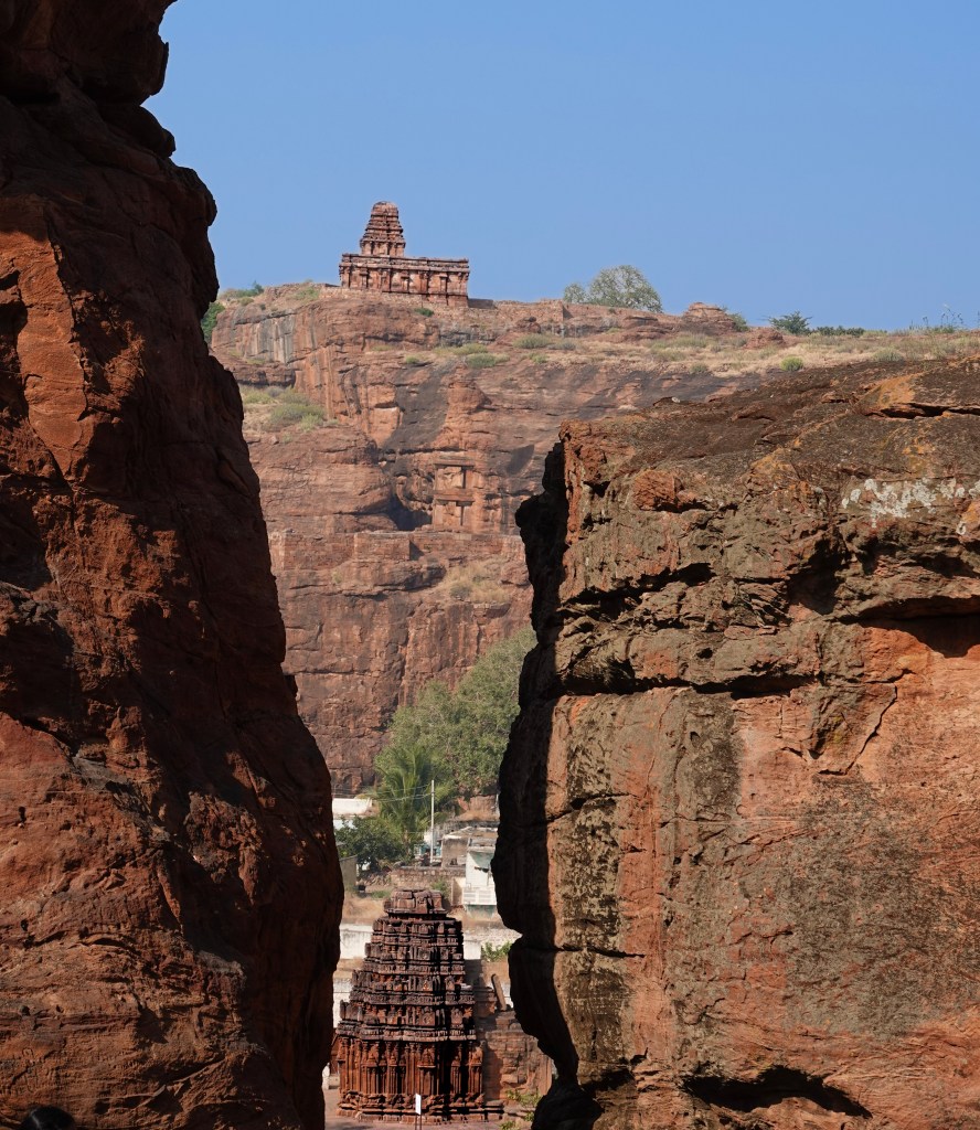
Imagine standing before a wall of fiery red sandstone, where the cliffs don’t just touch the sky—they tell the stories of gods. Welcome to Badami, the 6th-century capital of the Chalukya Empire, where history isn’t found in books, but carved directly into the heart of the mountains.
Carved into dramatic cliffs overlooking the emerald Agastya Lake, the Badami Caves are more than just monuments; they are a masterclass in ancient artistry. From the cosmic dance of Shiva to the serene presence of Jain Tirthankaras and the majestic incarnations of Vishnu, these four rock-cut temples offer a rare window into a time of profound religious harmony.
Are you a history buff chasing the legacy of kings? Maybe you are an art enthusiast marvelling at ceilings that still hold the whispers of ancient paint. You could also be a spiritual seeker seeking peace amid rocky peaks. Badami promises a vibe that is as breathtaking as it is serene. Get ready to explore this “cradle of architecture.” You’ll step into a world where stone truly comes to life. You can add Aihole and Pattadakal to this trip to admire Chalukyan temple architecture.
Badami is located in the Bagalkot district of north-central Karnataka, India. It is situated in a ravine between rugged red sandstone cliffs. You can visit Badami along with Pattadakal and Aihole- the 3 cities known as the “Cradle of Indian temple Architecture” and UNESCO world heritage sites. We visited Badami (and Pattadakal and Aihole) as a day trip from Hampi which makes a perfect 3-5 days trip from Bangalore. I would suggest 2 days in Badami (the only place with decent hotels), if you are a photographer or a history buff. Day 1 spent in Badami and day 2 in Aihole and Pattadakal.
How to Reach Badami
By Train: This is the most convenient way to reach the town. Badami Railway Station (BDM) is roughly 5 km from the town center.
By Road: Badami is well-connected by National and State Highways.
From Nearby Cities: You can take Karnataka State Road Transport Corporation (KSRTC) buses from Hubli (100 km). Private buses are also available. Buses are also available from Belgaum (140 km) and Bijapur (120 km).
From Bengaluru: Private buses depart in the evening (approx. 10-hour journey).
From Hampi: At roughly 140 km away, many visitors hire a taxi or rent a motorbike for a scenic 3.5 to 4-hour drive.
Main Attractions
Badami Cave Temples: The crown jewels of the region, these temples are carved into the cliff face. There are four 6th-century rock-cut temples: three are Hindu and one is Jain. They showcase remarkable sculptures and carvings of deities such as Shiva (as an 18-armed Nataraja) and Vishnu in various avatars. Here is my write up about the caves
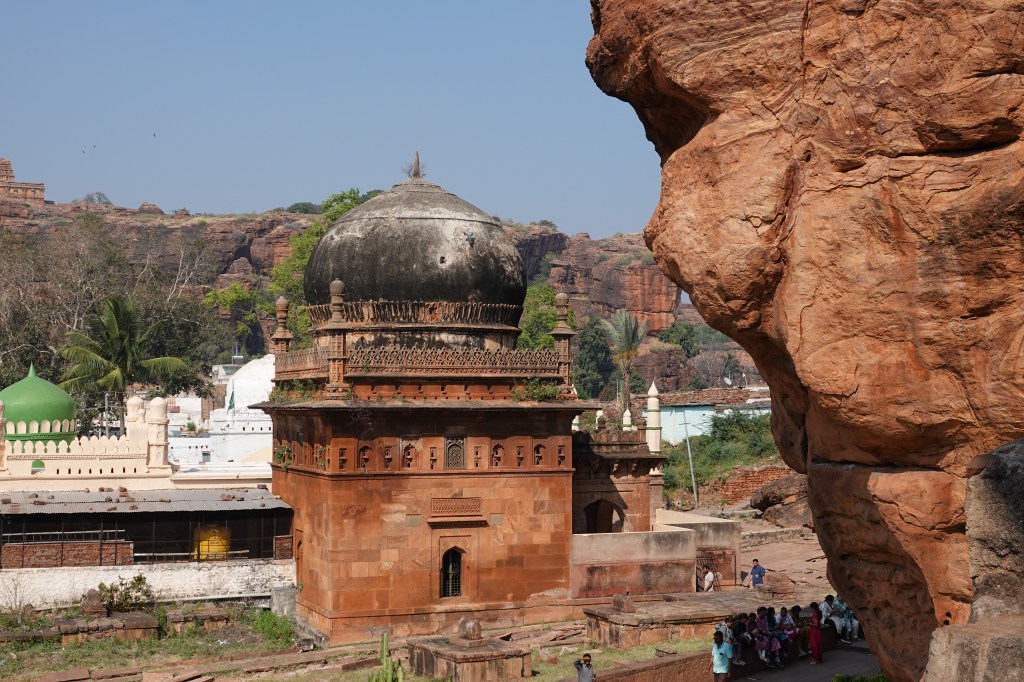
Jamiya mosque– 17th century mosque erected by Malik Abdul Aziz and displays typical Adil Shah architecture
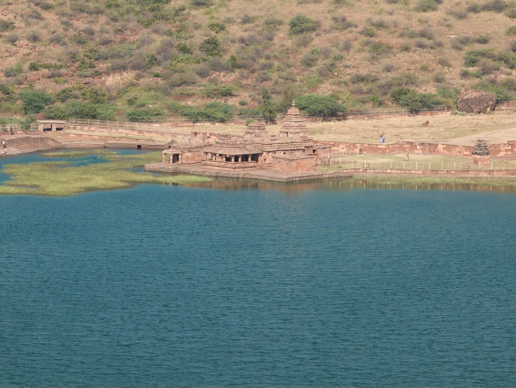
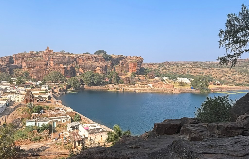
Agastya Lake: This large, man-made lake is known for its purported healing properties. It provides the picturesque foreground to the cave temples and Badami Fort. The area offers tranquil spots for quiet contemplation. It is also ideal for stunning sunset photography.
Bhootnatha Temples: Located on the eastern banks of the Agastya Lake, these sandstone temples are dedicated to Lord Shiva. This temple creates a beautiful reflection in the water, especially a striking sight in the early morning or evening light.
Badami Fort: The fort is perched on the northern hill. It offers panoramic views of the entire town, the lake, and the surrounding monuments. The trek up passes ancient gateways, granaries, and the well-preserved Malegitti Shivalaya temple.
Archaeological Museum: Situated near the cave temples, this museum houses a fascinating collection of sculptures. It also contains artifacts excavated from local sites. These items provide essential historical context for the region’s rich past.
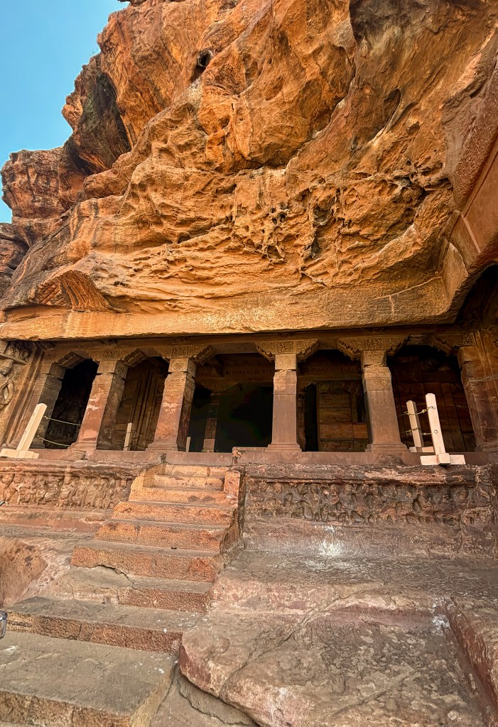
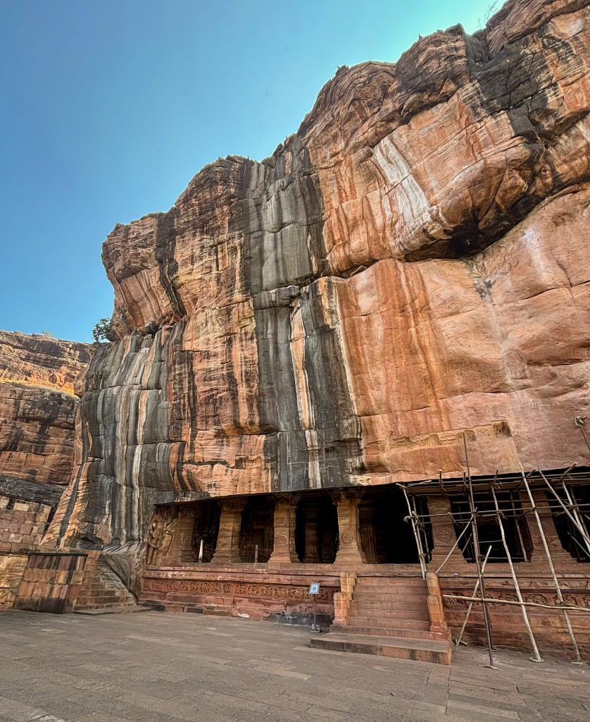
Badami Cave Temples are a stunning complex of four rock-cut shrines. They represent some of the earliest known examples of Hindu and Jain architecture in India. The Chalukya dynasty carved from soft red sandstone cliffs during the 6th and 8th centuries. There are 4 caves to explore, simply labelled Cave 1-4, 1 being at the bottom and 4 at the top. The order in which these caves were carved is unknown. Cave 3 is inscribed, making it one of the earliest dated Hindu cave temples in South India.
Cave 1: The lowest cave is dedicated to Lord Shiva.
Interesting Fact: It features a massive 5-foot relief of an 18-armed Nataraja (dancing Shiva). If you pair any left arm with any right arm, you can observe a unique dance pose. Altogether, it depicts 81 distinct Bharatanatyam postures.
Cave 2 : Dedicated to Lord Vishnu, this cave is smaller but contains dramatic mythological reliefs.
Interesting Fact: Look up at the ceiling. You will find a unique wheel-like carving. It features sixteen fish spokes arranged in a square frame.
Cave 3: The grandest and most intricately carved of all. This cave is the only one with an inscription. It confirms its exact dedication date (578/579 CE).
Interesting Fact: It contains some of the earliest surviving evidence of fresco paintings in India. This includes a faded but beautiful mural of the wedding of Shiva and Parvati.
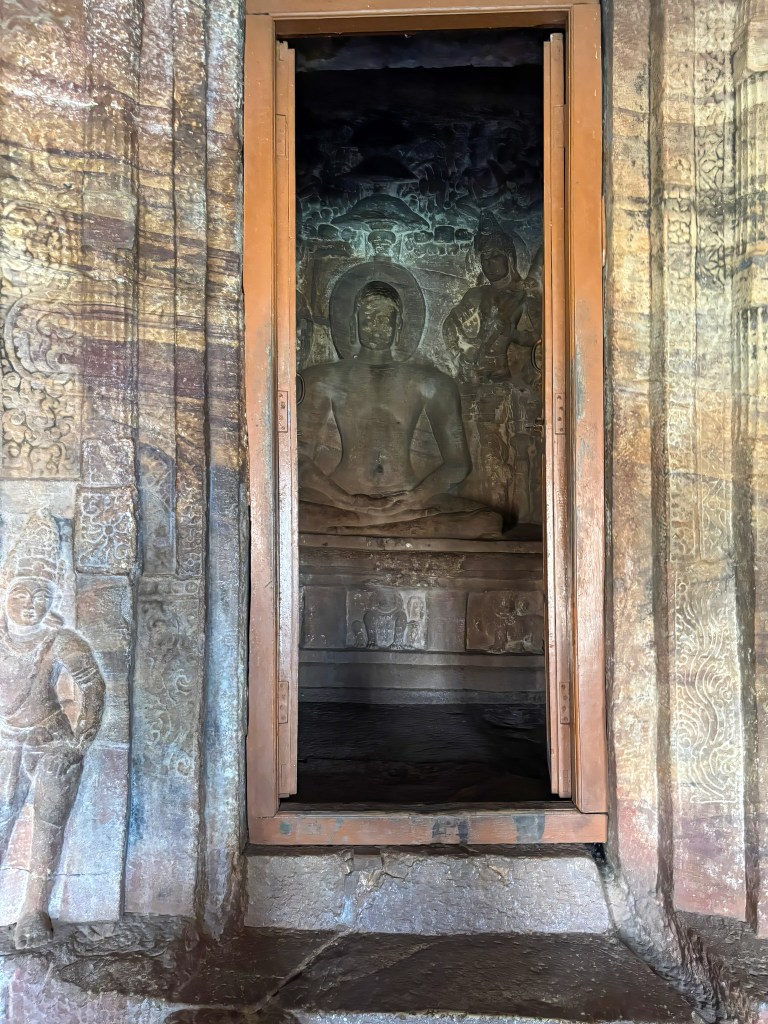
Cave 4 (Jainism): The highest cave was built in the 7th–8th centuries. It provides a peaceful contrast to the Hindu shrines.
Interesting Fact: It houses a massive statue of Bahubali in the Kayotsarga (meditating) posture. Vines are intricately carved as if growing around his legs. This symbolises his long period of deep penance.
It was surprising to see this mosque near the Badami cave temple car park. This is a 17th-century funerary monument was erected by Malik Abdul Aziz in memory of his wife. The prominent feature of the mosque is the red sand stone Domed tomb resembling Gol Gumz of Bijapur. If you have time, it is worth exploring this place that has typical features of Adil Shah architecture (Deccani School of Indo-Islamic architecture)
Exploring Agastya Lake
Agastya Lake is a significant man-made reservoir. It has a rich history and has deep mythological roots. Agastya Lake is central to the ancient town of Badami (formerly Vatapi). This town was the capital of the Early Chalukya dynasty.
Historical Significance
Construction and Purpose: The lake is an artificial reservoir. It is believed to have been constructed during the 5th-7th centuries CE. This construction took place primarily during the Chalukyan period. It served as a strategic water source for the capital city. The city is protected by rugged sandstone cliffs on three sides.
Architectural Context: The lake forms the heart of Badami’s architectural landscape. The famous Badami Cave Temples are carved into the red sandstone cliff on its southern side. The Bhootnath temples are situated on its eastern banks. Meanwhile, the Badami Fort is on the northern hill. Together, they create a stunning panoramic view and a cohesive historical circuit. The temples are often reflected in the calm waters, a particularly picturesque sight at sunrise and sunset.
Mythological Significance
Sage Agastya: The lake is named after the revered Vedic sage Agastya. According to local legend and Hindu Puranas, the sage is credited with bringing the sacred waters to the area.
Healing Waters: The water is considered holy. It is widely believed to possess healing properties. Locals have historically used it for bathing to cleanse sins and cure ailments.
Mention in Scriptures: The lake finds mention in the ancient Indian epic, the Mahabharata, which describes the religious merit attained by visiting this sacred water body.
I had grown up hearing the story of Agastya muni. However, I truly connected the dots only when I was in Badami. The city of Badami, formerly known as Vatapi, is steeped in legend. One significant Puranic tale tells of Agastya Muni and the demon brothers, Vatapi and Ilvala. This tale provides the mythological namesake for this ancient city and the lake.
The Deadly Deception– According to Hindu mythology, two demon siblings, Ilvala and Vatapi, harboured a deep hatred for sages and Brahmins. They devised a murderous scheme using their shape-shifting and magical powers:
The Trap: Vatapi would transform himself into a goat.
The Invitation: Ilvala often disguised himself as a humble host or holy man. He would invite traveling sages to a meal. He served them the cooked meat of his brother (the “goat”).
The Resurrection: Once the meal was finished, Ilvala would shout, “Vatapi, come out!”. Using a special mantra or magical ability, Vatapi would then reassemble and tear through the guest’s stomach, killing them instantly.
The Encounter with Agastya– The reign of terror ended when they attempted to trick Sage Agastya. He was a revered Rishi known for his immense spiritual power. He was also famous for his legendary digestive capabilities.
The Feast: Agastya, aware of their intentions through his divine knowledge, accepted their invitation and ate the entire meal.
The Counter-Mantra: Immediately after eating, Agastya rubbed his stomach and uttered the words, “Vatapi Jeernobhava” (Vatapi, be digested).
The End of Vatapi: When Ilvala called for his brother, Agastya calmly informed him that Vatapi had already been digested and would never return.
The Fate of Ilvala: In various versions, a furious Ilvala then attacked the sage and was either reduced to ashes by a single glance from Agastya’s fiery eyes or transformed into a hill.
Geographical Connection to Badami -The story is physically immortalised in the landscape of Badami:
Vatapi Hills: The two red sandstone cliffs that flank the town are believed to represent the two fallen demon brothers.
Agastya Lake: The serene man-made lake nestled between these cliffs is named after the sage who freed the region from the demons.
Vatapi Ganapatim: This legend is also celebrated in the famous Carnatic song Vatapi Ganapatim, which honours the Ganesha idol supposedly brought from this city to Tamil Nadu following a 7th-century war
Bhootnatha Temples
Located on the eastern banks of the Agastya Lake, these sandstone temples are dedicated to Lord Shiva. You can see these cluster temples as you climb the cave temples. This complex offers a tranquil and photogenic spot. The view is particularly beautiful during sunrise or sunset. The surrounding red sandstone cliffs and the lake create a breathtaking backdrop.
Architecture and History
The complex actually comprises two main groups of temples, showcasing the architectural evolution under different Chalukya dynasties:
East Bhootnath Group (Main Temple): This group dates primarily to the 7th-8th centuries CE under the Badami Chalukyas. It is known for its blend of early South Indian Dravidian and North Indian Nagara architectural styles. The open mandapa (hall) of the main temple extends into the lake. This unique design element makes it appear to float during the monsoon season when the water levels are high.
North Bhootnath Group (Mallikarjuna Group): Located slightly north and built later, between the 11th-12th centuries CE, these temples feature a distinct stepped, pyramidal superstructure in the Kalyani (Western) Chalukya style
Where to stay in Badami
Badami offers a range of accommodation options, from comfortable resorts to budget-friendly guesthouses. The best places to stay are generally close to the town center. They are near major attractions like the Agastya Lake and the Cave Temples. Alternatively, choose places slightly outside the town for a quieter resort experience. We visited Badami from Hampi as a day trip along with Pattadakal and Aihole. It makes for a long day, and you can’t take your time and visit some of the less-visited places. A day trip is good to see the highlights. However, if you want to fully experience the place, I would suggest staying a night. You can explore Badami on day 1. Visit Pattadakal and Aihole on the next day or vice versa. I am hoping to return to Badami. I want to take more detailed photographs and visit other places mentioned here.
Top Hotel Recommendations
Sterling Banashree Badami – This is a highly-rated 4-star resort located a little outside the main town. It is ideal for families and couples seeking a tranquil stay. The resort offers modern amenities. It offers a pool, free Wi-Fi, and a restaurant (though some reviews suggest eating in town).
THE HERITAGE RESORT, Badami – This resort is situated about a 15-minute drive from the main caves. It provides a peaceful atmosphere with spacious, clean rooms amidst greenery. It features a pool and a restaurant serving good vegetarian food.
HOTEL BADAMI COURT(unit of Shreejit Resorts)- This is a popular mid-range option. It is known for its excellent service. Guests also enjoy good food at the on-site restaurant, Pulikeshi. It is conveniently located close to the railway station and Badami caves, making it easy to access the main sites.
Hotel Mayura Chalukya Badami – This government-run hotel is a reliable, budget-friendly option. It is known for its good location near the lake and helpful staff. Rooms are basic but clean and the in-house restaurant offers good food at affordable prices.
Alternative Options
Clarks Inn Badami: Located in the heart of Badami, this hotel is a convenient base, within walking distance of the bus stop and some attractions.
Homestays and Guesthouses: For a more local and authentic experience, consider homestays like Krishna Villa or Cave View Homestay. They offer a more intimate setting. You have a chance to interact with local families. These can be excellent for budget-conscious travellers.
Final thoughts
Badami isn’t just a stop on a heritage trail — it’s a place where time feels layered, textured, and alive. From the moment you stand before the Cave Temples carved into rust‑red cliffs, the town starts to show its rhythm. It’s ancient, contemplative, and deeply human. Wander a little further, and each site adds its own voice. Experience the serene sweep of Agastya Lake. Feel the quiet dignity of the 17th‑century Jamiya Mosque. Admire the mirrored beauty of the Bhootnatha Temples glowing in the evening light. Reach the windswept heights of Badami Fort with its sweeping views of the valley. Badami is must visit for anyone who loves History and architecture.
The Badami Caves are carved into dramatic cliffs overlooking the emerald Agastya Lake. They are more than just monuments; they are a masterclass in ancient artistry. These four rock-cut temples showcase the cosmic dance of Shiva. They also highlight the serene presence of Jain Tirthankaras and the majestic incarnations of Vishnu. Together, they offer a rare window into a time of profound religious harmony.
The temples are directly carved into the hills. It is astonishing to see the precision and the skill of the artists who carved these sculptures. The intricate details etched into the stone reveal a high level of technical ability. They also show a keen eye for detail. They also demonstrate a deep understanding of the spiritual significance of these structures. Each curve and contour seems to breathe life into the rock, showcasing the artists’ dedication and passion for their craft.
Cave 1 is the first and lowest of the cave temples. Carved from soft red sandstone, it is primarily dedicated to Lord Shiva.
The Nataraja Sculpture
The cave’s most iconic feature is a 5-foot-tall relief of Nataraja, the 18-armed dancing Shiva. This masterpiece is noted for its mathematical precision. It depicts roughly 81 Bharatanatyam dance poses through different arm combinations.
The 81 Poses Explained – The sculpture depicts Shiva performing the Tandava dance. Its most remarkable feature is the arrangement of his 18 arms (9 on each side) in a specific geometric pattern:
Permutation & Combination: Art historians note that by pairing any of the 9 hands on the left with any of the 9 on the right, a dancer can visually derive 81 distinct Bharatanatyam dance poses (karanas).
Geometric Precision: The arms are arranged in a pattern that Swiss art historian Alice Boner described as a “cosmic wheel” or time division.
Symbolic Gestures: Each hand either holds a symbolic object—such as a drum, trident, serpent, or axe—or is formed into a specific Natya mudra (symbolic hand gesture) used in classical Indian dance.
It is advised to have a guide when visiting Badami cave temples. Our guide was able to show us the most important features of each cave, including the Shiva idol and its meaning
Our guide demonstrating different mudras
Symbolic Deities
Harihara: A 7.75-foot fused sculpture representing half-Shiva and half-Vishnu, flanked by their consorts, Parvati and Lakshmi.
Ardhanarishvara: A relief depicting the composite form of Shiva and Parvati as half-male and half-female.
Mahishasura Mardini: A striking relief of Goddess Durga slaying the buffalo demon.
Harihara Statue
Ceiling Art
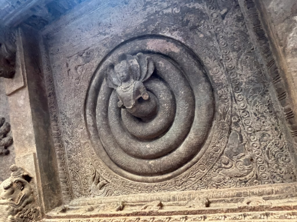
The roof features intricate panels, including a prominent Nagaraja (King of Serpents) motif with a coiled body and human torso.
Nagaraja
Structure
The temple has a traditional layout. It consists of a pillared verandah (mukha-mandapa), a central pillared hall (maha-mandapa), and a small sanctum (garbhagriha) at the back. The sanctum contains a Shiva Linga.
Cave 2 of the Badami cave temples, dating to the late 6th or early 7th century CE. It is primarily dedicated to the Hindu god Vishnu. The temple honors Vishnu and his avatars. It is located above and to the east of Cave 1 and is accessed by climbing approximately 64 steps. Cave 2 is the least refined and resembles a smaller version of Cave 3.
Trivikrama
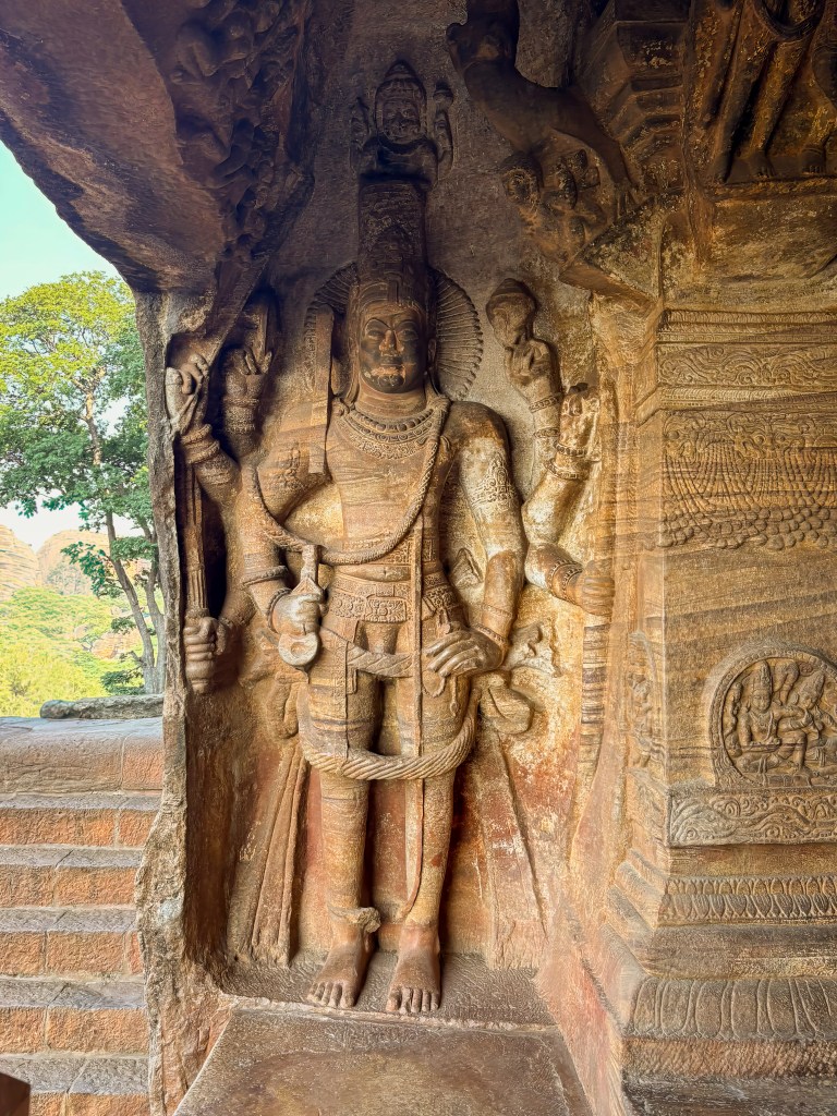
The largest relief in the cave depicts the legend of Vishnu in his Trivikrama form. In this depiction, he is portrayed as a giant taking one of three massive steps. These steps are meant to master the earth, abyss, and sky.
The sculpture depicts Vishnu as Trivikrama, an eight-armed form. Key features visible in the carving include:
The Deity: Vishnu is shown with one foot firmly on the ground. His other foot is raised high in the sky. This depicts him measuring the universe. He is holding various attributes, such as a sword and a shield.
Surrounding Figures: At the bottom left, a figure is believed to be Bali’s son. He is shown holding the lord’s leg in devotion.
Explanation of the Legend of Trivikrama
Vamana Avatar: The legend describes the dwarf Brahmin Vamana. He is an avatar of Vishnu. Vamana approached the generous Asura King Mahabali during a grand ritual.
Three Steps of Land: Vamana requested just three “feet” or steps of land. Mahabali granted this request despite warnings from his preceptor.
Trivikrama Form: Upon receiving the grant, Vamana transformed into the giant, cosmic form of Trivikrama (meaning “three steps”).
Measuring the Universe: With his first step, he covered the entire earth and the netherworlds. With his second step, he covered the heavens.
The Third Step: Overwhelmed, King Mahabali offered his own head for the third step. By doing this, he fulfilled the promise and showed devotion.
Varaha: Another prominent sculpture shows Vishnu in his Varaha (boar) avatar. He rescues the Earth Goddess, Bhudevi, from the cosmic ocean and the demon Hiranyaksha.
Other Deities: The cave features sculptures related to the birth of Lord Krishna. It also includes his childhood and other figures from the Bhagavata Purana.
Architectural Details of Cave 2
Layout: The cave shares a similar layout to Cave 1. It features a pillared verandah (mukha-mandapa). There is also a central pillared hall (maha-mandapa) and a small, square sanctum (garbhagriha) deep inside
Ceiling: The roof features intricate panels with bas-relief carvings. These include a notable “Matsya Chakra” (wheel with sixteen fish spokes). There is also a variety of swastika patterns. Friezes of flying couples (gandharvas and vidyadharas) and the churning of the ocean (Samudra Manthan) are also present.
Style: The artwork in Cave 2 is primarily in the northern Deccan style of architecture. Traces of colored paint on the walls and ceiling suggest that the cave was once adorned with fresco paintings. These paintings are similar to those found in Ajanta.
Photo Ops near Cave 2
You get a great view of the lake and the town from Cave 2. Also, you can take a photo of the North fort and the Yellamma temple. You will see a lot of people taking this photo, but if you stand outside cave 2, you get a really nice shot like below
Cave 3-Key Architectural & Artistic Features
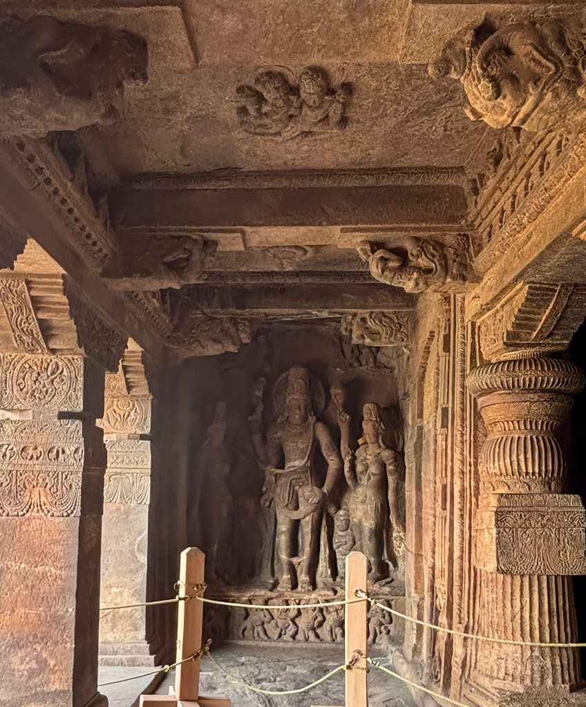
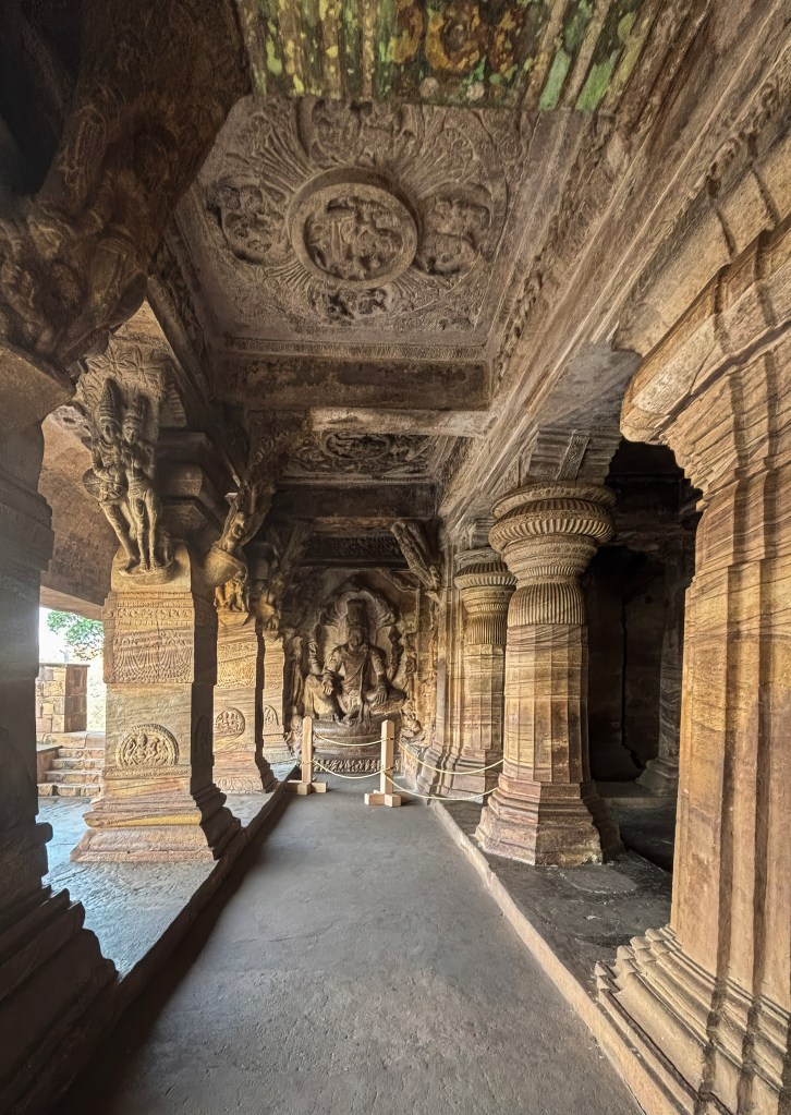
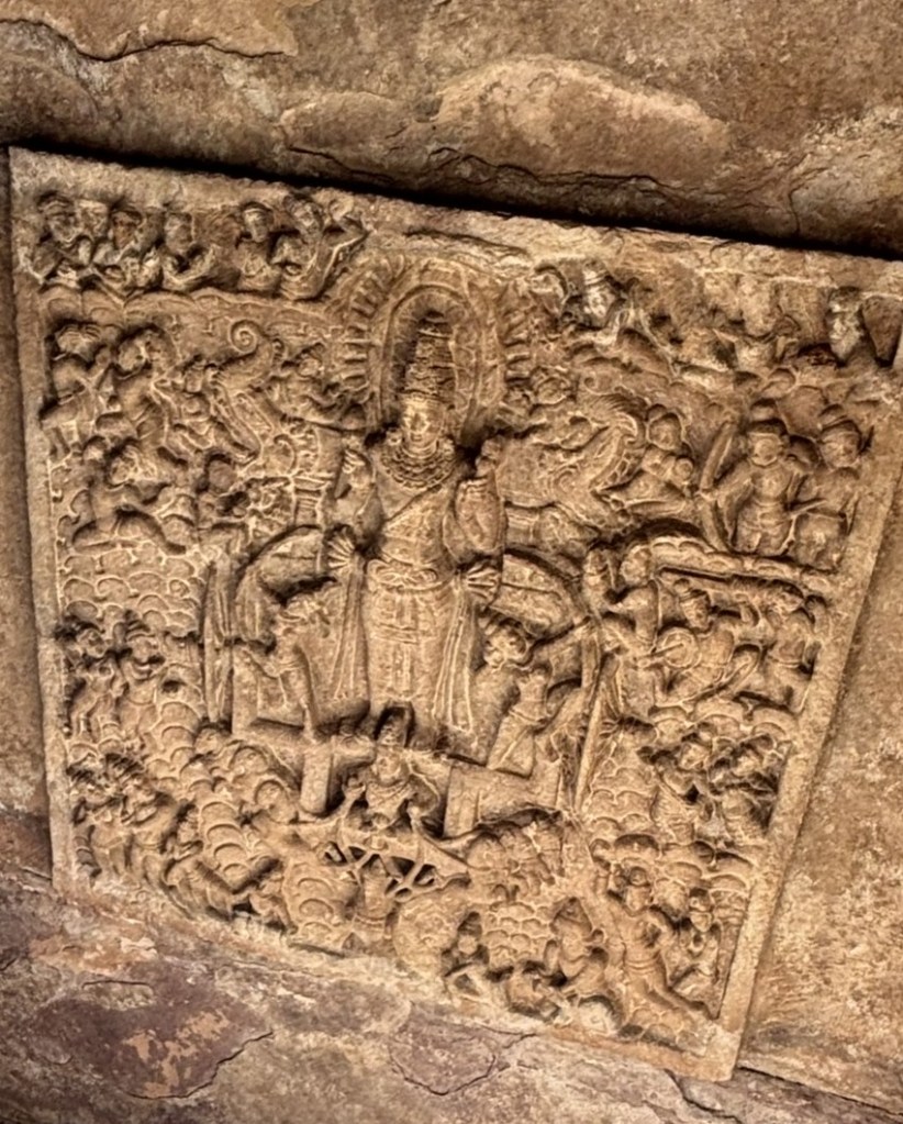
Cave 3 is the largest of the Badami cave temples. It is most intricately carved and dedicated primarily to Lord Vishnu and his various avatars. It is the only cave with a confirmed dedication date of November 1, 578 CE. This date is recorded in an Old Kannada inscription. Thus, it is the oldest firmly dated Hindu cave temple in the Deccan region. The cave showcases a sophisticated blend of northern Nagara and southern Dravida architectural styles. It features a large pillared veranda (mukha-mandapa) and a main hall (maha-mandapa), leading to a small, empty inner sanctum (garbhagriha).
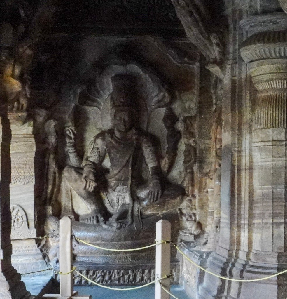
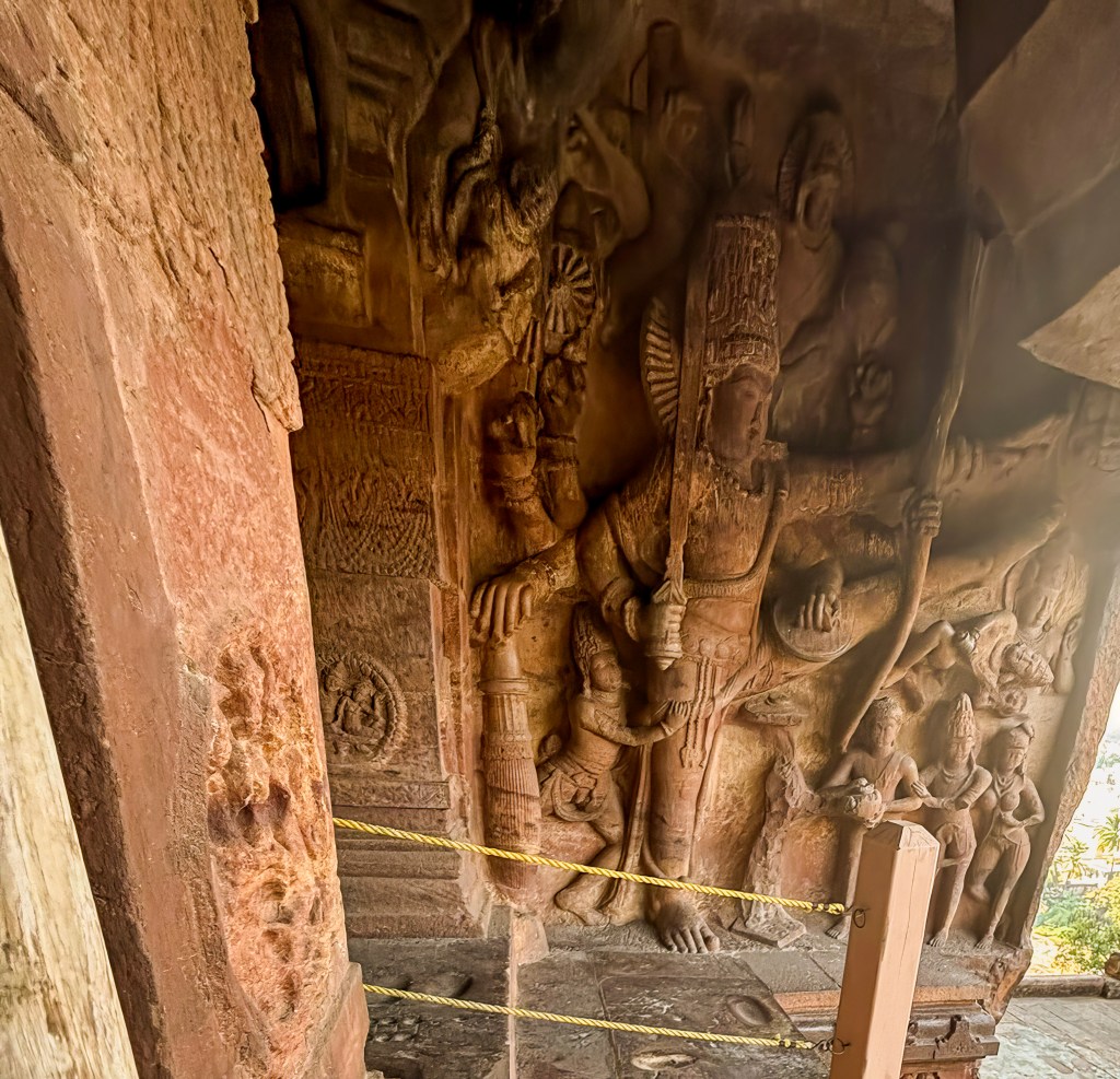
Vishnu as Anantasayana
A unique sculpture of Vishnu shows him in his Anantasayana sitting in a regal posture. The coiled cosmic serpent, Sheshanaga (Ananta), forms the seat and the hood of the canopy. The carving is detailed with other figures; Vishnu’s consorts, Bhudevi and Sridevi, are seen on either side. Garuda (Vishnu’s vehicle) is seated on the floor to the left.
The entire front Veranda is beautiful with great carvings and columns. Don’t forget to look up and appreciate the carvings on the ceiling.
Trivikrama/Vamana
A colossal relief depicting Vishnu in his dwarf avatar, Vamana, transforming into Trivikrama to stride across the universe. This is very similar to the one seen in Cave 2.
Varaha
A massive carving of Vishnu as a boar rescuing the Earth Goddess, Bhudevi can be seen on the opposite wall of the Anantasayana
On the wall column next to Varaha is the inscription giving the name of the royal patrons of the monument. This inscription shows that this cave was consecrated on Nov 1st, 578.
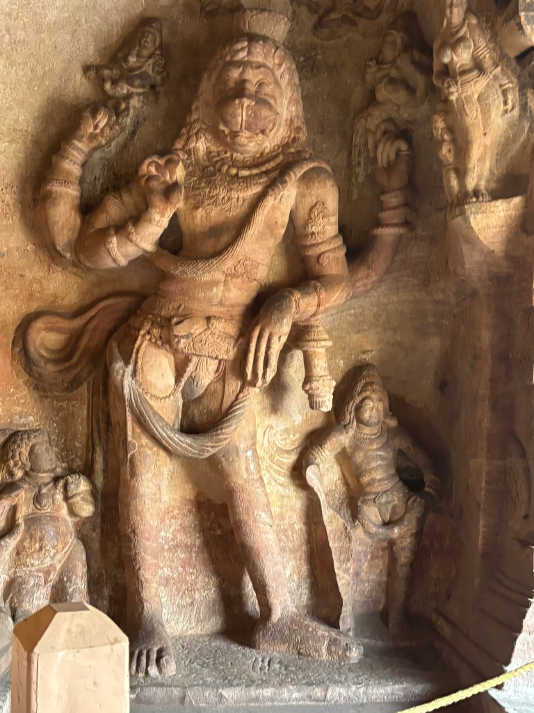
Narasimha
A standing, eight-armed figure of the man-lion avatar, which is depicted in a benevolent form.
Harihara
A powerful seven-foot-tall sculpture of Harihara can be seen in Cave 3.
Harihara is a composite deity in Hinduism, representing the fused form of Lord Vishnu (Hari) and Lord Shiva (Hara). This specific sculpture portrays the left half as Shiva and the right half as Vishnu. he sculpture is shown with four hands, displaying attributes of both gods. The left side (Shiva’s half) is accompanied by the goddess Parvati, and the right side (Vishnu’s half) is accompanied by the goddess Lakshmi
Unique Features of Cave 3
Fresco Paintings: Traces of ancient fresco paintings, some of the earliest surviving evidence in Indian art, are visible on the ceiling panels, which depict deities like Brahma, Indra, and Varuna.
Intricate Pillars: The pillars are highly ornate, featuring detailed carvings of human figures, mythological characters, and mithuna (amorous) couples.
Ceiling Art: The ceiling has a “Navaranga” (nine-section) design with a central lotus medallion on the floor below it, surrounded by carvings of the Ashta Dikpalas (guardians of the eight directions)
Cave 4-Key Architectural & Artistic Features
Cave 4 is the smallest and highest of the four major rock-cut temples in Badami. Unlike the first three, it is exclusively a Jain temple, illustrating the religious pluralism of the Early Chalukya period. The less intricate drawings and crude carvings suggests that the cave-temple might be the latest of the series
Architectural & Historical Context
Dating: It was excavated in the late 7th or 8th century CE, significantly later than the Brahmanical caves. Further embellishments were likely added up to the 11th or 12th century.
Structure: The cave follows a slightly modified layout with an open verandah (mukhamandapa), an oblong antechamber (ardhamandapa), and a main sanctum (garbhagriha).
Major Sculptures
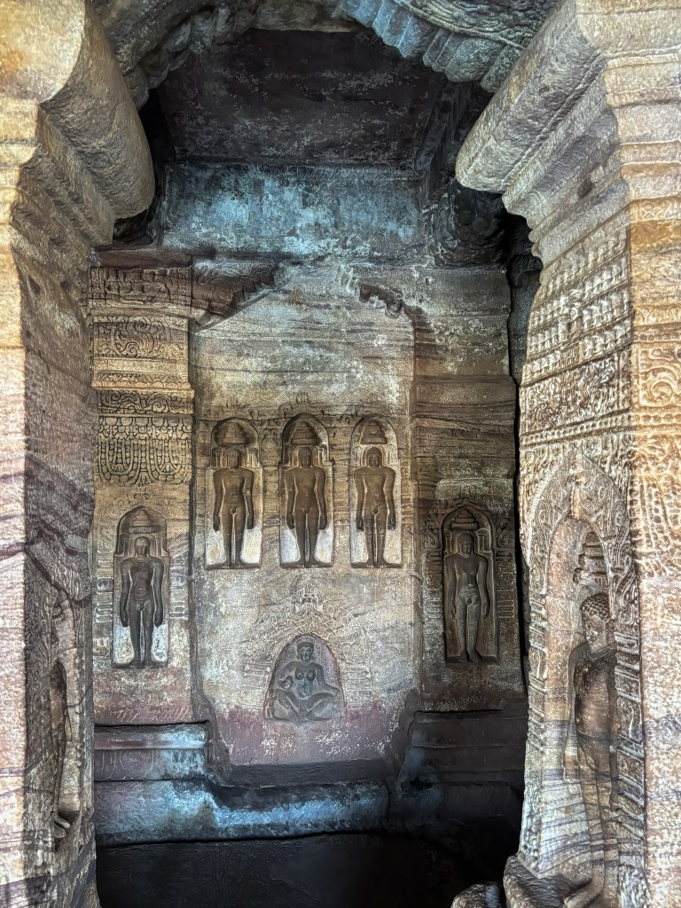
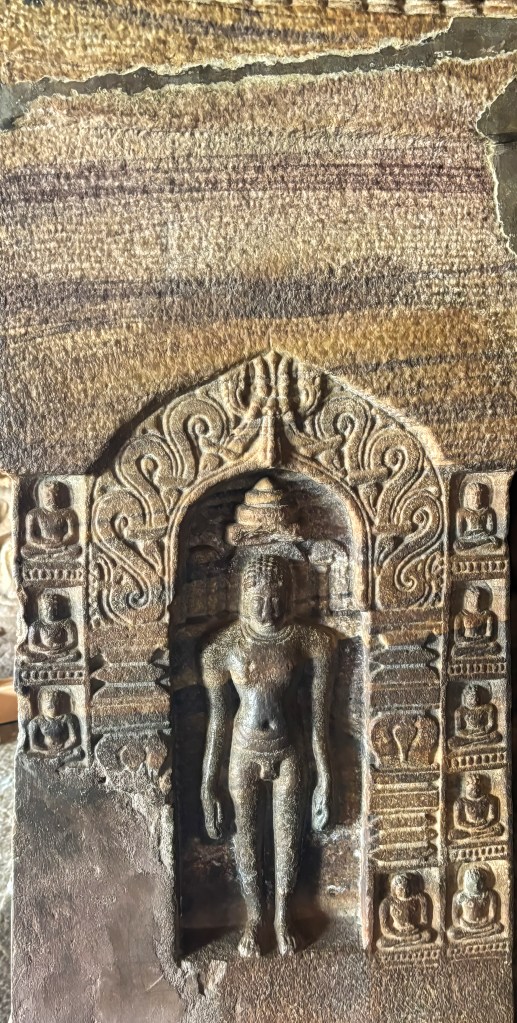
The cave is renowned for its detailed depictions of Jain Tirthankaras and deities in the Digambara (sky-clad) tradition.
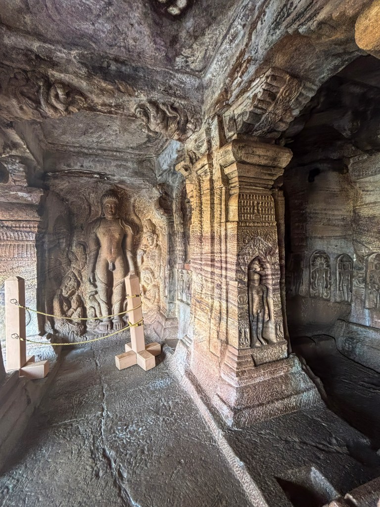
Digambara tradition—one of Jainism’s two primary paths. This sect translates to “sky-clad.” It represents the pinnacle of asceticism. Monks renounce all worldly possessions, including clothing. This renunciation demonstrates total detachment from the material self. For travelers, the serene, nude sculptures of Tirthankaras are the most striking evidence of this faith. The legendary Bahubali is depicted in such deep, motionless meditation that vines wind around his limbs. Beyond the stone carvings, the Digambara philosophy emphasizes a life of extreme non-violence (Ahimsa) and spiritual purity, offering a fascinating glimpse into a culture that views the entire universe—the sky itself—as its only garment
Lord Mahavira: The central shrine houses the 24th Tirthankara, Mahavira, seated on a lion throne. A 12th-century inscription near this image records the death of a pious woman named Jakkave.
Parshvanatha: A life-size relief on the right side of the verandah depicts the 23rd Tirthankara in meditation, protected by a five-headed cobra hood.
Bahubali (Gommateshwara): On the left side, Bahubali is shown in the Kayotsarga (standing) posture. This is one of the earliest known representations of Bahubali in South India. It is notable for the vines (madhavi) shown winding around his legs during his long penance.
Other Figures: Smaller carvings of all 24 Tirthankaras, along with Jain deities such as Padmavati, Indrabhuti Gautama, and the female monks Brahmi and Sundari, adorn the pillars and walls
Final Thoughts
A visit to the Badami Cave Temples is a journey into an underrated gem of Indian architectural history. It offers a rare fusion of natural beauty and ancient human ingenuity. It is highly recommended for history lovers and photographers alike, offering stunning views and intricate carvings that will leave you awestruck.
Essential Travel Takeaways
Plan for a Full Experience: The four main caves can be explored in a couple of hours. However, the area around Badami offers much more. Spend at least a full day in Badami itself. This includes visiting Agastya Lake, the Bhuthanatha Temples, and Badami Fort. Stay for two to three days. Take day trips to the nearby UNESCO World Heritage sites of Aihole and Pattadakal. This will complete the heritage circuit.
Optimal Timing is Key: The best time to visit is between October and March. During this period, the weather is cooler and more pleasant for outdoor exploration. For the best light, aim for an early morning visit to the caves. To avoid crowds, consider planning your ascent for the late afternoon. This way, you can catch a mesmerizing sunset over the lake and cliffs.
Physical Preparation: Be ready for a physical climb. The caves are accessed by a series of steep, uneven rock-cut steps. Sturdy, comfortable footwear with good grip is essential. There is no wheelchair access. The climb is manageable for most people but requires careful navigation, especially with children or the elderly.
Hire a Guide: Hiring a local guide is highly recommended. They can help you truly appreciate the rich history and symbolism. They will also point out the intricate details of the Hindu and Jain carvings.
Mind the Monkeys: The area is home to many monkeys. Do not carry food or water bottles openly, as they can be quite cheeky and snatch items from your hands
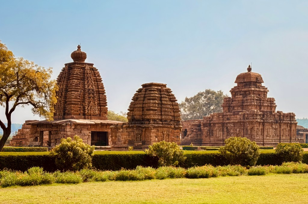
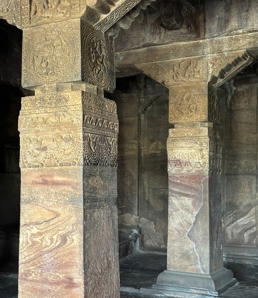
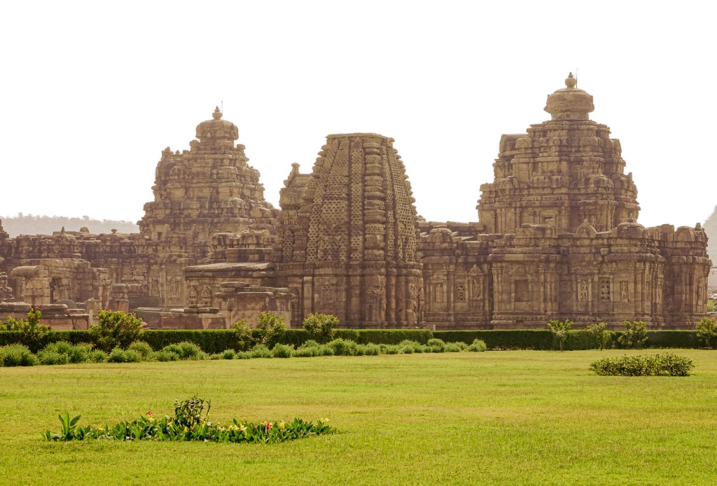
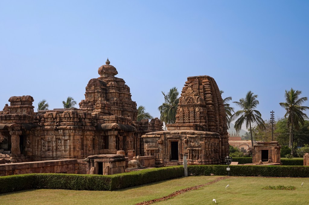
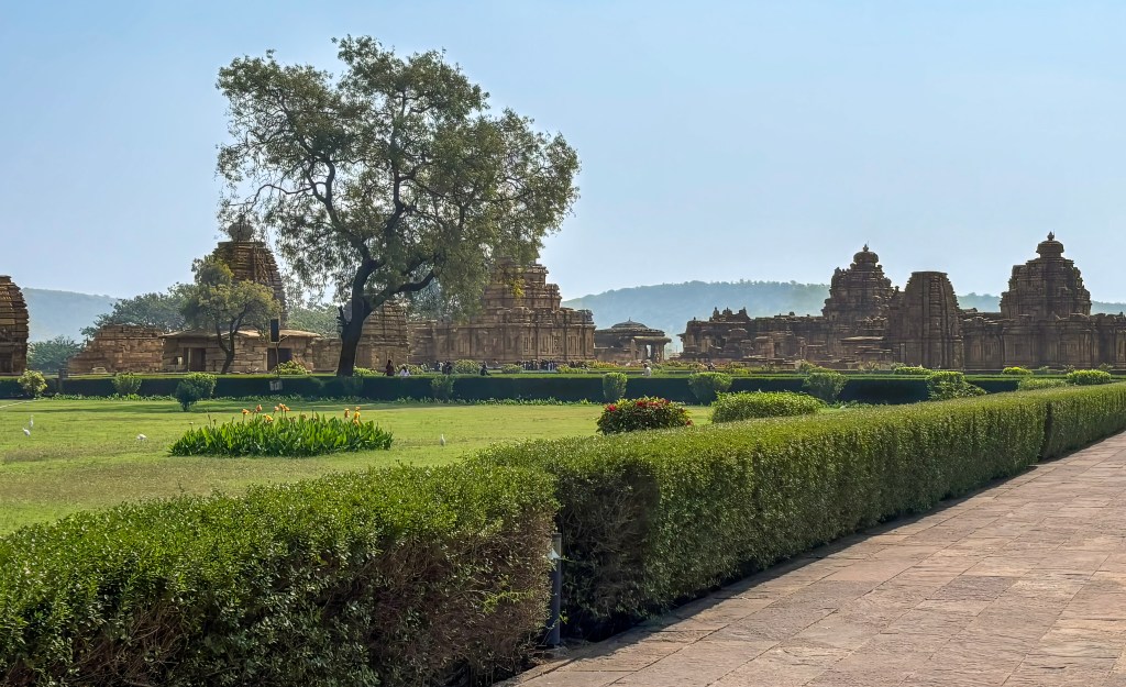
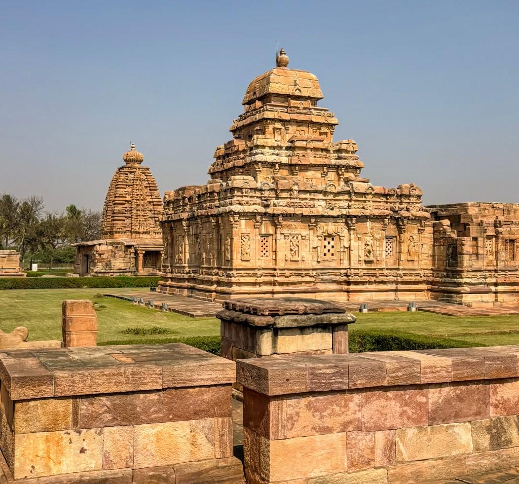
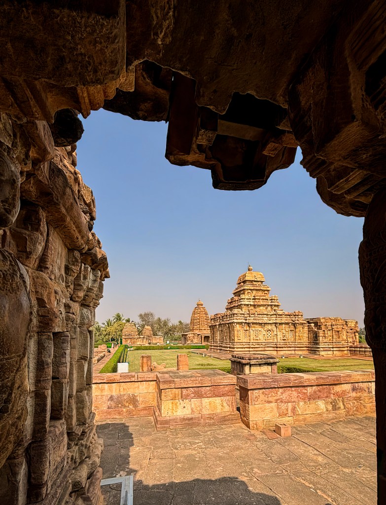
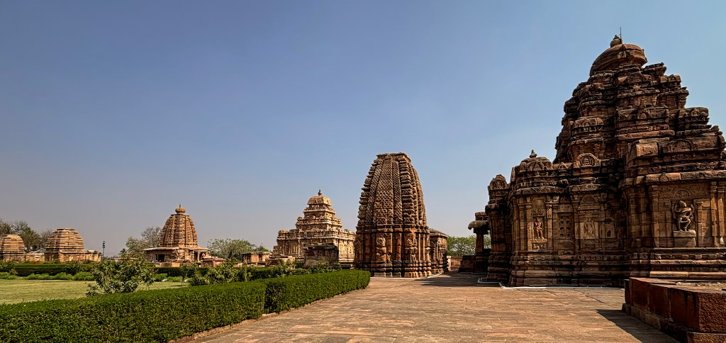
Deep in the heart of Karnataka, where the Malaprabha River curves gracefully, lies Pattadakal. It is a UNESCO World Heritage site. This site is the spiritual “cradle of Indian temple architecture”. Travelers exploring the Chalukyan heartland will find the Virupaksha and Mallikarjuna temples as the most magnificent chapter of this stone-carved story.
A Royal Tale of Two Queens
These “twin” temples were not merely religious structures. They were grand political statements commissioned around 745 CE by two sister queens Lokamahadevi and Trailokyamahadevi. These masterpieces were built to celebrate their husband, King Vikramaditya II’s victory over the Pallavas. They represent the pinnacle of Dravidian (Southern) architecture in northern Karnataka.
What to Expect on Your Visit
The Masterpiece (Virupaksha): This temple is often hailed as the site’s “crown jewel.” The Virupaksha Temple is the only one in the complex that remains an active place of worship today. Its architectural excellence was so profound that it later inspired the world-famous Kailasa Temple at Ellora.
The Delicate Twin (Mallikarjuna): Standing just beside its neighbor, the Mallikarjuna Temple mirrors Virupaksha’s layout. It offers its own unique charm. The charm includes a distinctive hemispherical tower dome. It also has some of the most delicate narrative carvings in the complex.
Stone-Carved Epics: Both temples function as stone libraries. As you walk through their pillared halls, you will discover incredibly detailed friezes. These friezes depict scenes from the Ramayana, Mahabharata, and Panchatantra.
Whether you are a history enthusiast or a casual traveler, these two temples offer a rare opportunity. You can see ancient royal devotion perfectly preserved in red sandstone. They also showcase architectural evolution.
Kashi vishwanatha, Mallikarjuna and Virupaksha temples
Virupaksha Temple Architecture
Style: Primarily Dravidian style, described as a fully developed example that served as a model for later grand temples, including the Kailasa temple at Ellora.
Vimana (Tower): Features a tall, four-story tower with a square top (sikhara). The verticality is emphasized by the structure.
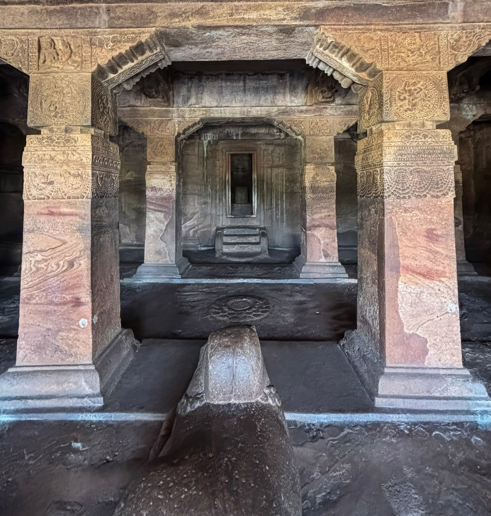
Plan: It has a large, square plan from the base to the sikhara. The complex is extensive, consisting of a main shrine, a large pillared hall (mandapa) with three porches, a Nandi pavilion, and peripheral sub-shrines enclosed by a compound wall with massive gateways (gopurams).
Carvings: Known for highly ornate carvings of Hindu deities and detailed narrative panels from the Ramayana, Mahabharata, and Panchatantra.
Unique Feature: It is the earliest known full temple complex in the Chalukyan series with a fully formed architectural plan.
Mallikarjuna Temple Architecture
Style: Also built in the Dravidian style, it is a slightly smaller version of the Virupaksha temple.
Vimana (Tower): It has a four-story tower, but it is crowned with a hemispherical or circular top (griva and sikhara), a key difference from the Virupaksha temple.
Plan: It shares a similar square plan and layout to its twin, including a large pillared hall and a Nandi mandapa.
Carvings: The temple features equally rich sculptures and friezes depicting stories from the epics, similar in style to the Virupaksha temple.
Both temples represent the peak of Dravidian architecture under the Chalukyas. However, the primary architectural distinction between them is in the shape of their crowning elements. It is square for Virupaksha. It is circular for Mallikarjuna.
Exploring the Virupaksha Temple
We spent considerable time walking around the Virupaksha temple, which is dedicated to Shiva. It is the only functioning shrine in the temple complex. It is also among the popular places to visit in Pattadakal. The temple was constructed in 745 AD. Queen Lokamahadevi, consort of the Chalukyan ruler Vikramaditya, built it. She did this to commemorate his victory over the Pallavas of Kanchi.
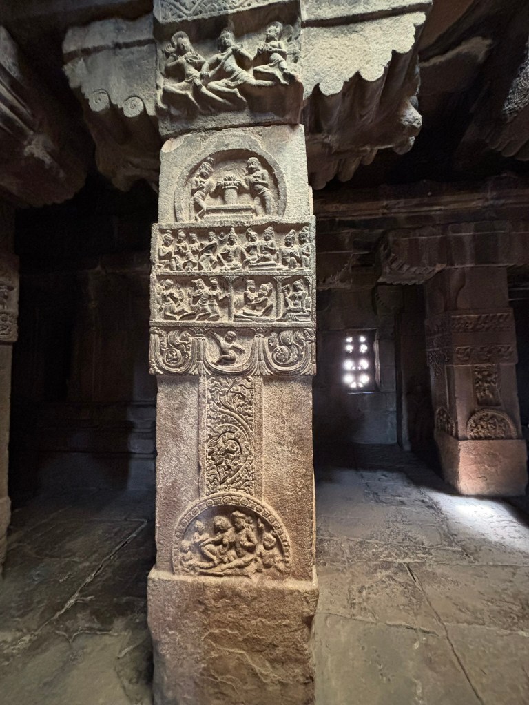
The temple is built in the Dravidian style of architecture. It has three mukhamandapas on three sides. There is a large stone gateway on the East towards Malaprabha River. A large pillared hall is followed by a sanctum with a circular path for pradakshinas. The mukhamandapas and the pillars of the hall have wonderful carvings of gods. They also depict scenes from the Ramayana and the Mahabharata.
Innovative Ceiling Design Solutions
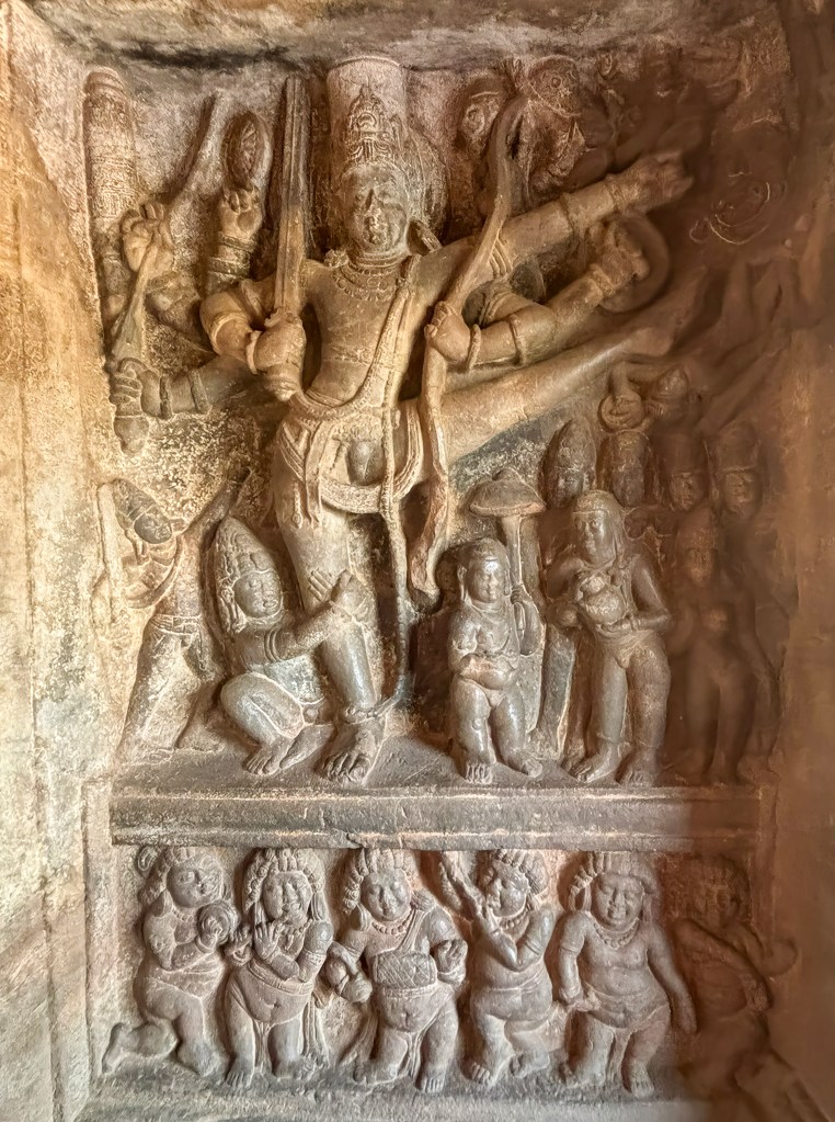
The main highlight is the sculpture of Surya riding a chariot through the clouds. Aruna, his driver, directs the chariot with archers aiming their bows outward to either side. This sculpture is found on the ceiling of the Eastern Mukhamandapa. The details on this intricate carvings are incredible.
Sculptural Narratives and Artistic Edges
Sculptures of various gods and goddesses are prevalent throughout the temple. They include Shiva in different aspects like Nataraja, the dancing Shiva, and Ardhanarishvara, half-Shiva, half-Parvati. There are also Vishnu avatars such as Narasimha and Varaha. Additionally, Durga is depicted slaying the Mahishasura demon. Ganesha and Surya, the Sun god, are also featured.
Puranic themes and Vedic legends include:
Shiva and Parvati with Ravana lifting Mount Kailash.
The churning of the ocean (Samudra Manthan).
Durga slaying the buffalo demon Mahishasura.
Columns with legendary scenesColumns with legendary scenes
Ramayana and Mahabharata: Many scenes from the Ramayana and Mahabharata are carved throughout the halls. The carvings also include stories from the Bhagavata Purana and Panchatantra fables on the exterior walls.
Ramayana episodes shown include the golden deer incident, the abduction of Sita by Ravana, the fight between Ravana and the demigod Jatayu, and Lakshmana cutting off Shurpanakha’s nose.
Mahabharata narratives are also present. For example, there is the confrontation between Arjuna and Karna. Another instance is Bhishma Pitamah lying on a bed of arrows.
Aranya Khanda- Ramanyana
Narrative Friezes: The pillar above illustrates episodes primarily from the Ramayana epic, specifically from the Aranya Khanda section depicting:
Shurpanakha confronting Rama and Lakshmana.
Lakshmana mutilating Shurpanakha’s nose.
Khara and Dushana (demon brothers) fighting Rama and Lakshmana.
The demon Maricha in disguise as the golden deer.
Ravana approaching Sita’s hut in the disguise of a sage
These highly detailed carvings provide a vivid glimpse into the craftsmanship and religious worldview of the 8th-century Early Chalukyan period.
Having a professional guide is advised, as they can show the key structures and share information about various carvings. Below is one of the scenes in the interior mantapa being explained by our guide. The carvings depict scenes from the Hindu epic, the Mahabharata. The middle panel is believed to show Bhishma lying on a bed of arrows. The bottom panel depicts Bhima fighting Duryodhana.
Scene from the Mahabharata being explained by the guide
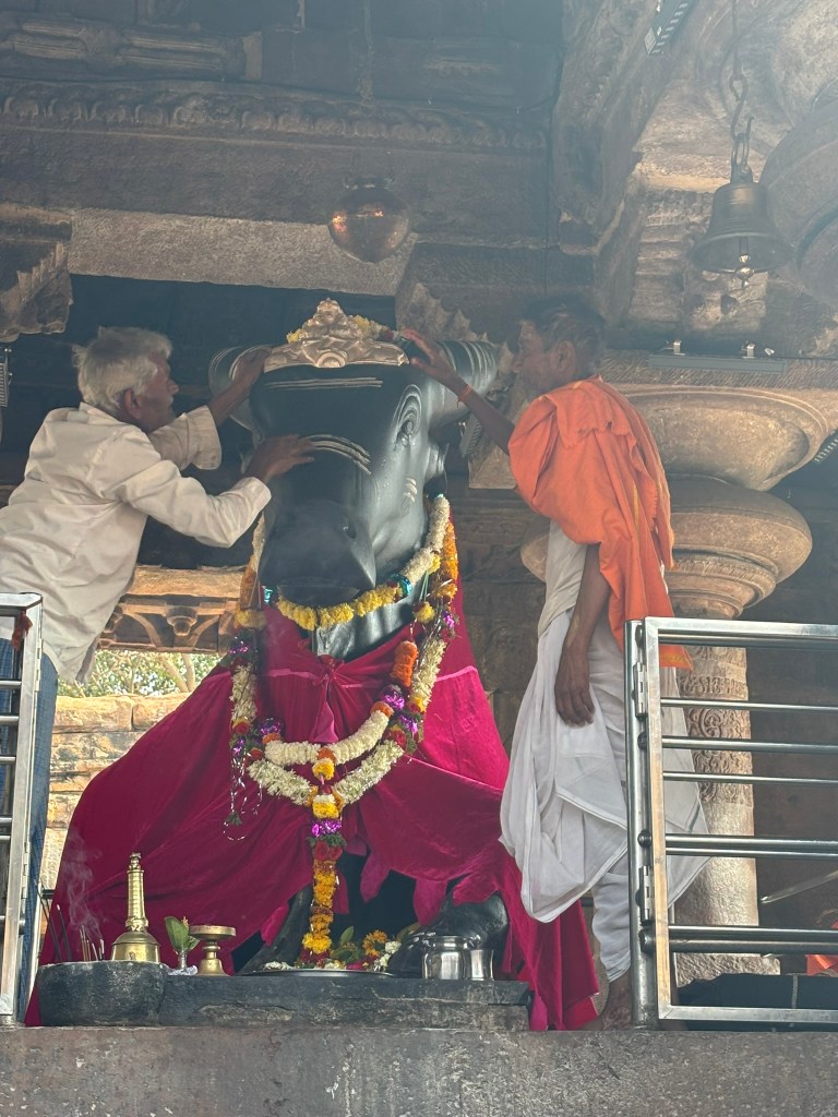
Monolithic Nandi: A large, black stone sculpture of Nandi, the bull vehicle of Lord Shiva. It is housed in a separate mantapa (hall) in front of the Virupaksha temple entrance. Witnessing the craftsmanship and precision needed to carve a single stone into such a detailed form is astonishing.
Mallikarjuna Temple
The Mallikarjuna Temple is also a Shiva temple commissioned by Queen Trailokamahadevi. This temple is similar to the adjacent Virupaksha Temple, but less decorated and weather-worn.
Left Mallikarjuna, Right Kashi Vishwanatha temple
Structural Layout and Composition
Plan: The temple follows an axial layout facing east. It consists of a square garbhagriha (sanctum), an antarala (antechamber), and a large pillared sabha-mandapa (community hall).
Entrances: It features three mukhamandapas (entrance porches) located on the eastern, northern, and southern sides.
Pradakshina Patha: The sanctum is surrounded by a covered circumambulatory path. This was a well-established tradition by the time of its construction.
Nandi Mandapa: A separate, four-pillared pavilion for Nandi stands in front of the main temple complex. However, it is now partially collapsed.
Architectural Elements
Superstructure (Vimana): The temple has a four-storeyed vimana. The Mallikarjuna’s tower is distinctive for its hemispherical (circular) roof. It differs from the square roof of the nearby Virupaksha Temple. The dome is another unique feature.
Tower Cap: The tower is topped by a circular griva (neck). It also has a hemispherical shikhara (dome). The structure is capped with a stupi or kalasha.
Platform (Adhishthana): The structure stands on a high, five-moulded plinth. It is decorated with friezes of animals, including elephants and lions. It also features floral motifs.
Decorative Innovations
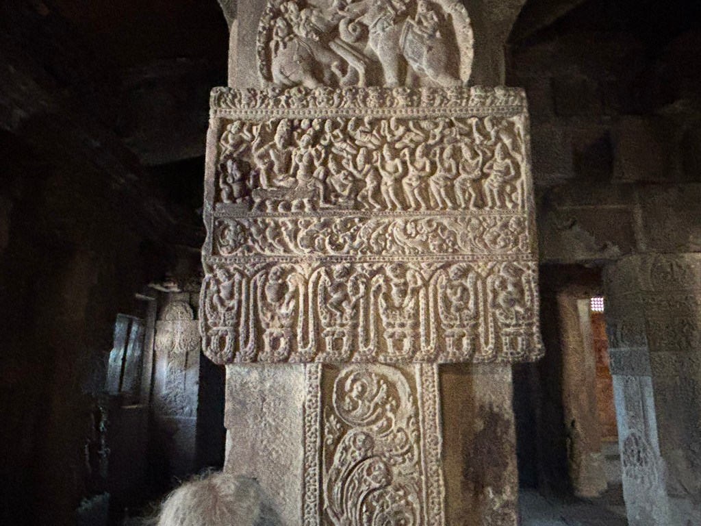
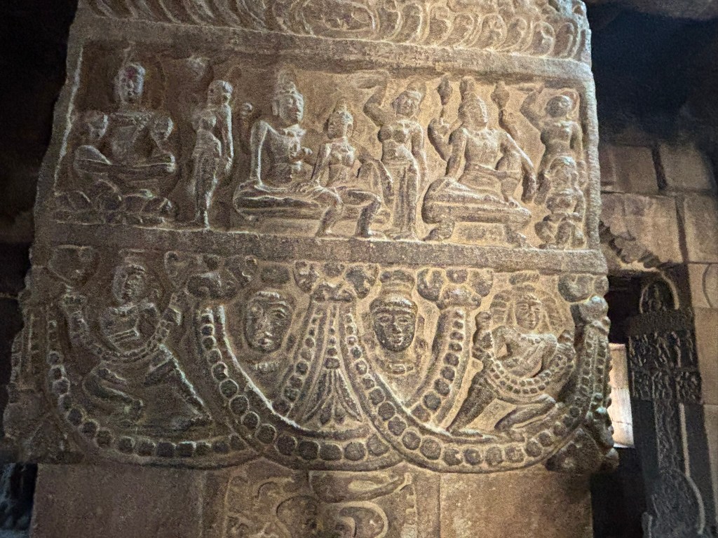
Pillars and Ceilings: The 18 pillars of the inner hall are intricately carved. They feature narrative panels depicting scenes from the Ramayana. Some scenes also come from the Mahabharata and Panchatantra. The ceilings are adorned with beautiful figures of Gajalakshmi and Shiva-Parvati with Nandi.
Sukanasa: The sukanasa is a prominent arched projection on the front of the tower. It houses a relief of Nataraja (dancing Shiva).
External Walls: The exterior walls are divided by pilasters into niches that alternate with perforated windows (pierced stone screens). These niches contain various sculptures of Hindu deities. They also feature detailed friezes of amorous couples (mithuna). Single women are depicted showing diverse emotional expressions.
Final thoughts
The Virupaksha and Mallikarjuna temples stand as the crowning achievements of this historical ensemble. Often called the “twin temples,” they are more than just stone monuments. They are a testament to the artistic rivalry and devotion of two sister-queens, Lokamahadevi and Trailokyamahadevi. Visiting these temples isn’t just about ticking off a UNESCO site. It’s about experiencing the pinnacle of Chalukyan architectural evolution.
Terminologies used in describing temple architecture
Vimana: The pyramidal or stepped-pyramid tower located directly above the main sanctum.
Garbhagriha: Literally “womb chamber,” this is the innermost, windowless sanctum housing the primary deity.
Gopuram: A monumental, ornate gateway tower providing entry into the temple complex. In later periods, gopurams often became taller than the central vimana.
Shikhara: In the Dravida style, this refers specifically to the crowning dome-shaped element at the very top of the vimana. (Note: In North Indian architecture, “Shikhara” refers to the entire tower).
Mandapam: Pillared halls or porches used for public rituals, gatherings, or as a transition to the sanctum.
Prakaram: The enclosed courtyard or circumambulatory path surrounding the main temple structures.
Pushkarini (Kalyani): A ritual bathing tank or reservoir found within the temple complex.
Antarala: A vestibular tunnel connecting the mandapa to the garbhagriha.
Decorative and Vertical Elements
Stupi (Kalasha): The final crowning pot or finial placed on top of the shikhara.
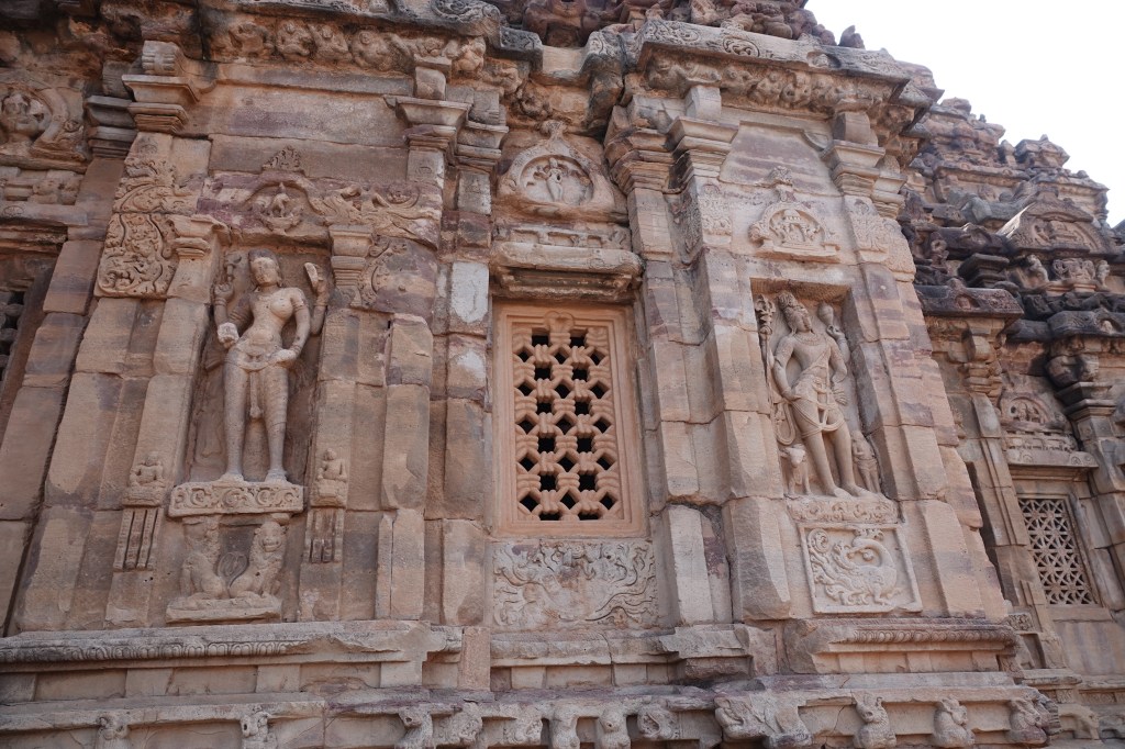
Dvarapalas: Fierce “door-keepers” or guardian sculptures flanking the entrance to the sanctum.
Adhisthana: The highly decorated base or pedestal on which the entire temple structure stands.
Prastara: The entablature or horizontal beam that marks the transition between the walls and the spire.
Yali (Vyala): A mythical creature, often with the face of a lion, used as a decorative pillar motif.
Nasi: A decorative horseshoe-shaped arch motif, often found on the exterior of the vimana.
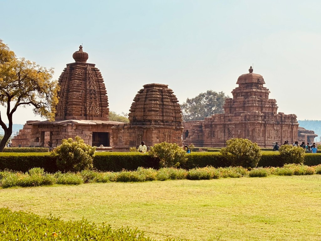
The second stop in our trip to Badami, Pattadakal, and Aihole was Pattadakal. Aihole is the “cradle” of Chalukyan architecture, showcasing early experimentation with various styles (rock-cut & structural). Pattadakal signifies the mature culmination. This UNESCO site features the convergence of North Indian (Nagara) and South Indian (Dravidian) styles. Pattadakal has large, free-standing temples, like the Virupaksha Temple and are more sophisticated than the earlier designs in Aihole.
Visit Pattadakal to step back into the golden age of the Chalukya dynasty. This stunning UNESCO World Heritage site is located by the Malaprabha River in Karnataka. The literal meaning of the city’s name in the local language is “City of Coronations.” The city and its temples date back to the 8th century. Back in the day, the site was sacred. It was where kings were crowned. Their queens commissioned temples in gratitude for their husbands’ glorious return from battle. Pattadakal offers a deep insight into India’s artistic and spiritual heritage.
The Chalukyan rulers were significant patrons of art, fostering a transition from rock-cut to structural temples. At Pattadakal, a royal coronation site, they blended North Indian (Rekha/Nagara) and South Indian (Dravida/Vimana) architectural styles. This work is notable for its unique blend.
The Rekha Prasad (Nagara) style features tall, curvilinear towers (shikharas). These towers rise from a raised platform (mostly seen in North India). In Pattadakal Galagantha, Kashi Vishveswara, and Jumbulinga temples are examples of the Nagara style. The Dravidian style is most commonly seen in South India. It uses stepped, pyramidal towers (vimanas). These are enclosed by walls with grand gateways (gopurams). The Mallikarjuna, Virupaksha, and Sangameshewara temples are good examples of the Dravidian style.
Key Temples and Architectureat Pattadakal
Oldest Temple: The Sangamesvara temple was built by Vijayaditya. It is the oldest and exhibits a square, Pallava-like Dravidian style. This style has no sukanasika (vestibule projection).
Virupaksha Temple: Built by Queen Lokamahadevi, it is the earliest fully developed temple complex at Pattadakal.
It features a large, square plan from base to the top (sikhara) and massive gateways (gopuras).
Its architecture, which includes the sukanasika, influenced the grand Kailasa temple at Ellora.
Mallikarjuna Temple: Built by Queen Trilokyamahadevi immediately after and close to the Virupaksha. It is a smaller, four-story Dravidian temple. The temple has a unique circular top (griva and sikhara).
Other Temples: the Kadasiddhesvara, Jambulingeswara, and Galaganatha temples are in the Nagara style.
Sculptural Art– The sculptures in these temples are known for their grace and detail. Ceiling panels in the temples depict navagrahas and dikpalas, while wall niches showcase deities like Nataraja, Lingodbhava, and Harihara. Narrative reliefs illustrate episodes from the Ramayana, Mahabharata, Bhagavata, and Panchatantra, fitting perfectly within these religious structures.
Queen Lokamahadevi built the largest and most elaborate temple in the complex around 740 CE. She did so to commemorate her husband, King Vikramaditya II’s victory over the Pallavas. This active house of worship features intricate carvings of Hindu deities. It also showcases scenes from the Ramayana and Mahabharata on its pillars. A massive Nandi statue is in the front pavilion.
It is located next to the Virupaksha Temple. Queen Trailokyamahadevi (the king’s second queen) built it around the same time. It is a smaller but similarly designed masterpiece. It is known for its exquisite sculptures. These include panels depicting the Rasa Lila of Krishna. They also depict various fables from the Panchatantra.
The Virupaksha and Mallikarjuna temples at Pattadakal are twin monuments. They epitomize the peak of Early Chalukyan architecture. These structures showcase a harmonious blend of North Indian (Nagara) and South Indian (Dravidian) styles. You can read more about these two temples here
Sangameshwara Temple
The oldest temple in the complex was built by King Vijayaditya between 697 and 733 CE. It is a grand example of early Chalukya Dravidian architecture, though its construction was never fully completed
Shri Galaganaatha Temple
This temple is dedicated to Lord Shiva. It is notable for its well-preserved Rekha Nagara-style tower. It also features a striking sculpture of an eight-armed Shiva killing the demon Andhaka.
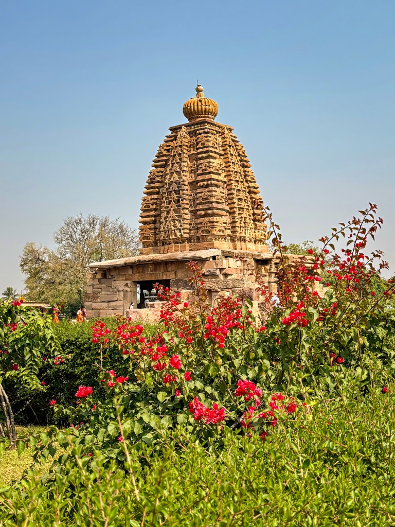
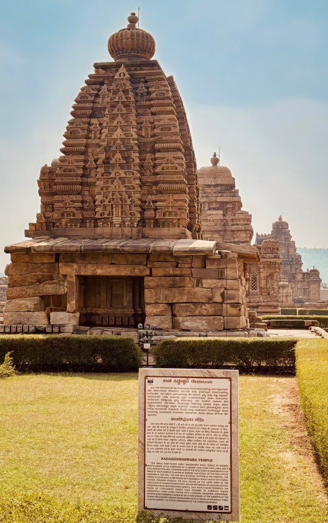
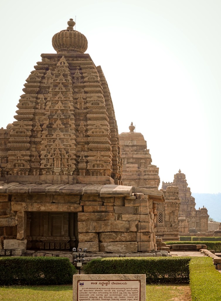
Shri Kadasiddeshwara Temple
The
Kadasiddheshwara Temple in the Pattadakal complex is a small, mid-to-late 7th- or early 8th-century Shiva temple. It is significant because it demonstrates the emerging Nagara (North Indian) architectural style. This example is at a site dominated by Dravidian temples.
Shri Papanaatha Temple
This large, ornate temple is situated outside the main cluster near the river. It is an excellent example of a fusion of both Nagara and Dravidian architectural styles. Its walls are adorned with detailed narrative friezes from the Ramayana.
Jain Narayana Temple
This 9th-century temple is located about a kilometer west of the main complex. It was built by the Rashtrakutas and features the Dravidian style. The temple offers a glimpse into the region’s religious diversity.
We didn’t get to see Papanaatha or the Jain temple due to time constraints. If you have time, they are definitely worth visiting.
Final thoughts
Pattadakal is more than just an archaeological site. It is a “living textbook” of Indian art and architecture. The Pattadakal group of monuments are culmination of centuries of Chalukyan experimentation. The northern Nagara and southern Dravidian styles finally achieved a perfect, harmonious fusion.
A Royal Legacy: Standing among these monuments, you are witnessing a 1,300-year-old celebration of victory and devotion. The rivalry of two sister-queens gave us the Virupaksha and Mallikarjuna masterpieces. This rivalry ensures that the legacy of King Vikramaditya II’s triumphs remains etched in stone forever.
The Soul of the Malaprabha: The location itself—where the Malaprabha River turns north—adds a layer of spiritual gravity. You may be a history buff or a casual traveler. Either way, the “Stone of Coronation” offers a rare connection to the transition in Indian temple design. It evolved from raw experiment to polished perfection.