Visit Quebec City: A French Fairytale in the Heart of North America

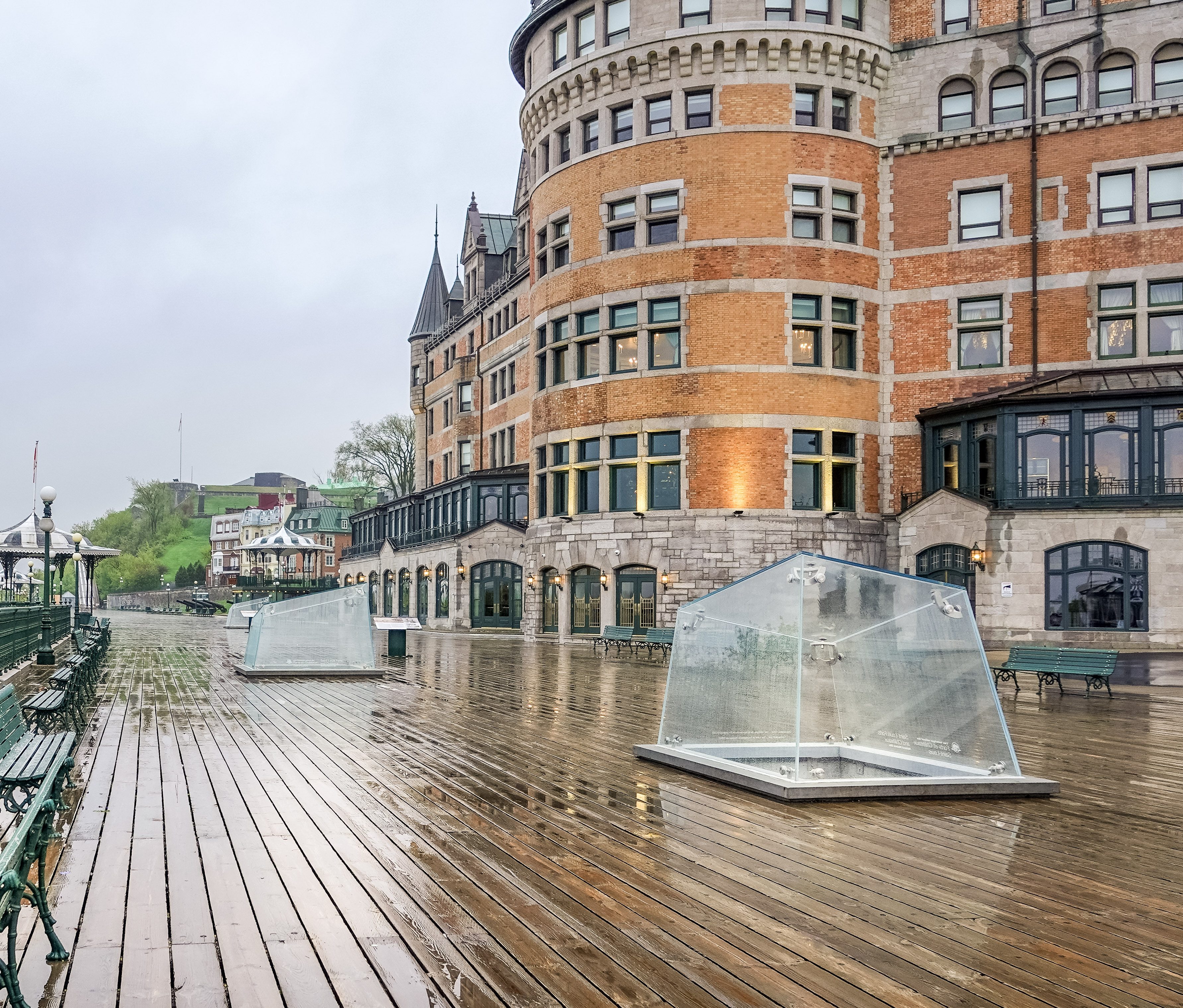
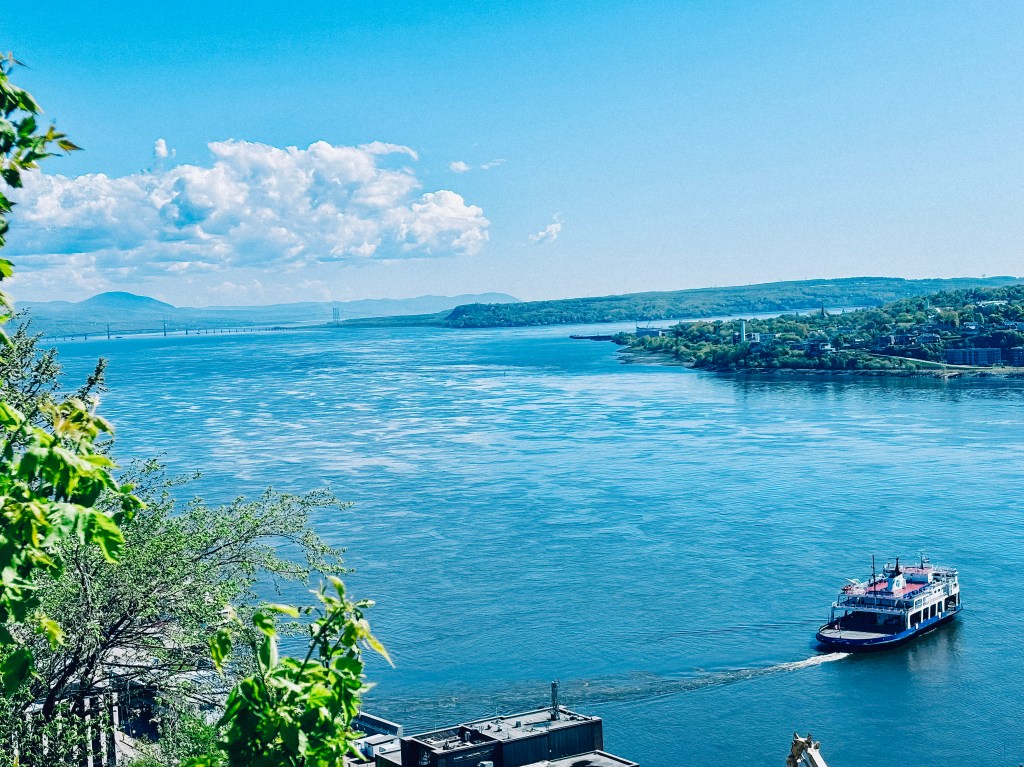
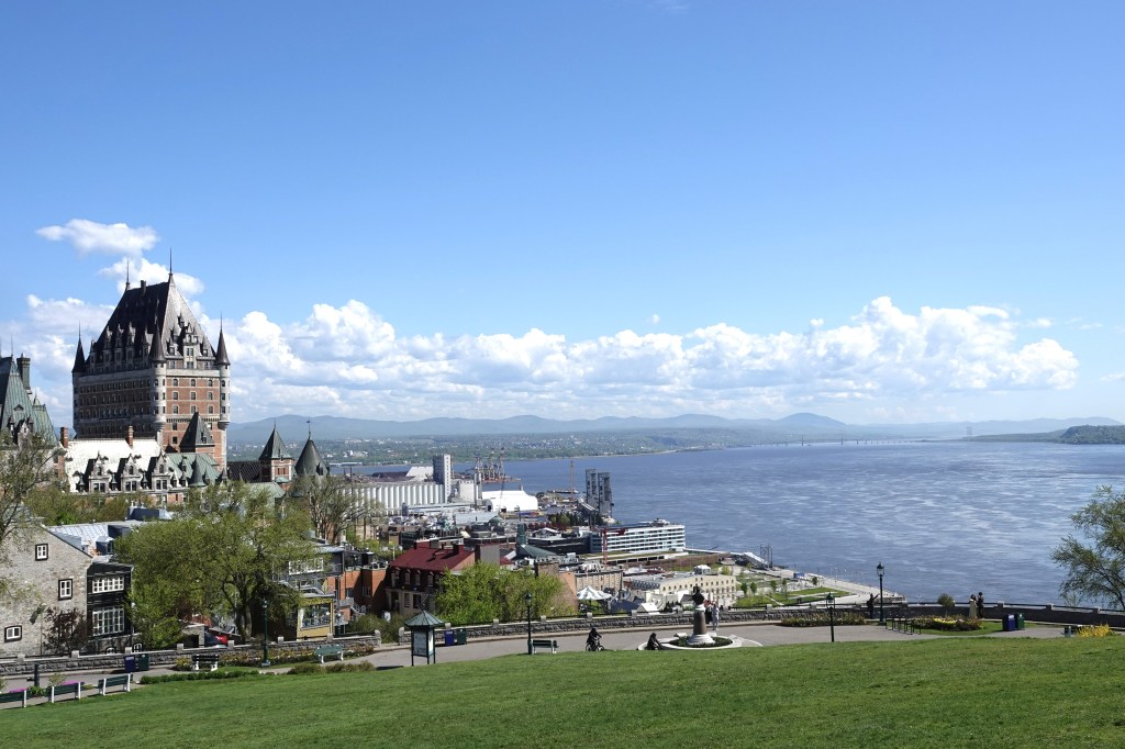
There are cities you visit for a weekend, and then there are cities that make you feel as though you have stepped through a doorway into another century. Quebec City belongs firmly in the second category. With its cobblestone lanes, fortified walls, church spires, French street signs, and the grand silhouette of Fairmont Le Chรขteau Frontenac rising above the St. Lawrence River, Quebec City feels less like a typical North American getaway and more like a European storybook brought to life.

For travelers who love history, architecture, culture, and a touch of old-world elegance, Quebec City is one of the most rewarding destinations on the continent. It is romantic without trying too hard, historic without feeling frozen in time, and proudly French in a way that makes it unlike anywhere else in North America.

A City That Feels Like Europe Without Leaving North America

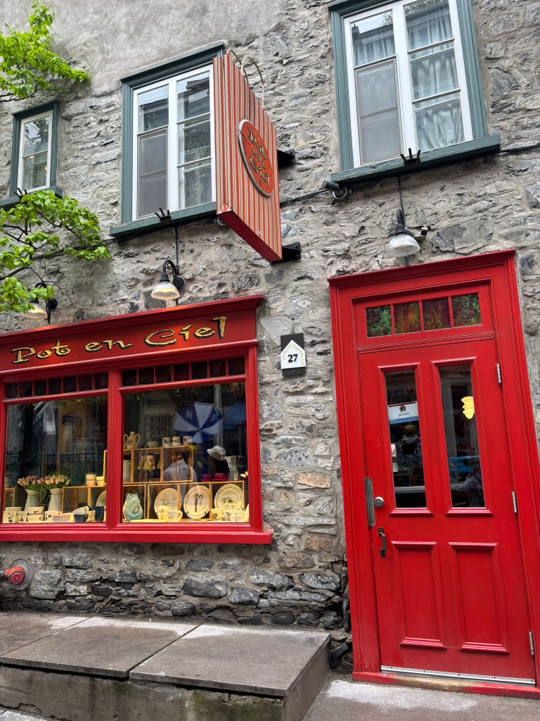
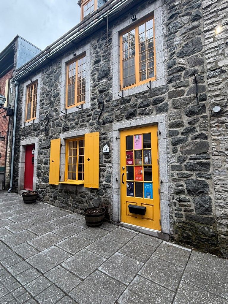
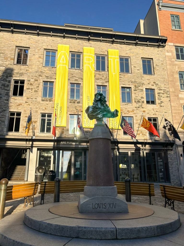
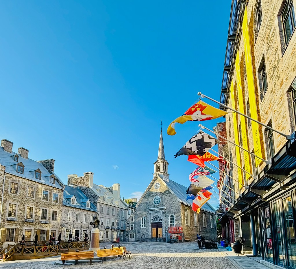
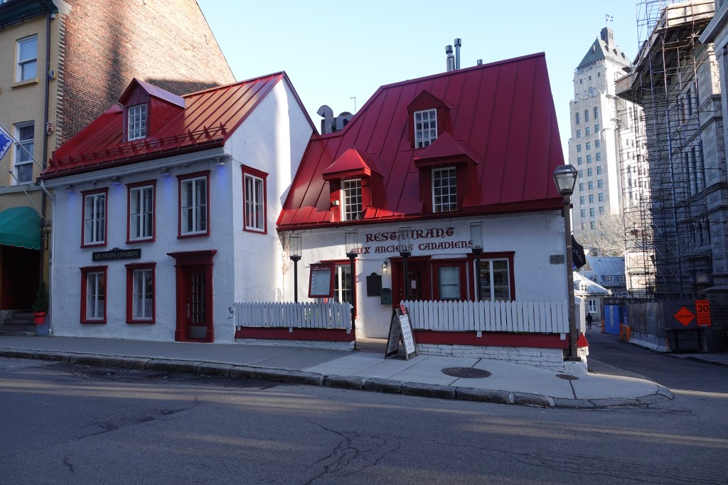
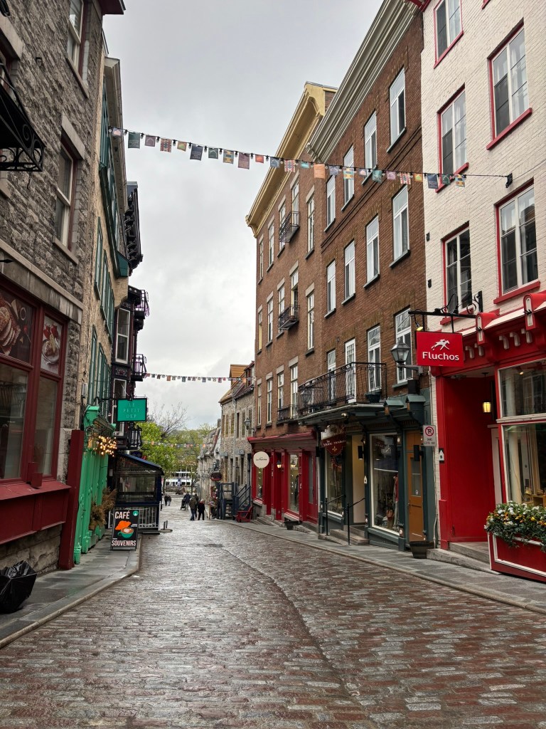
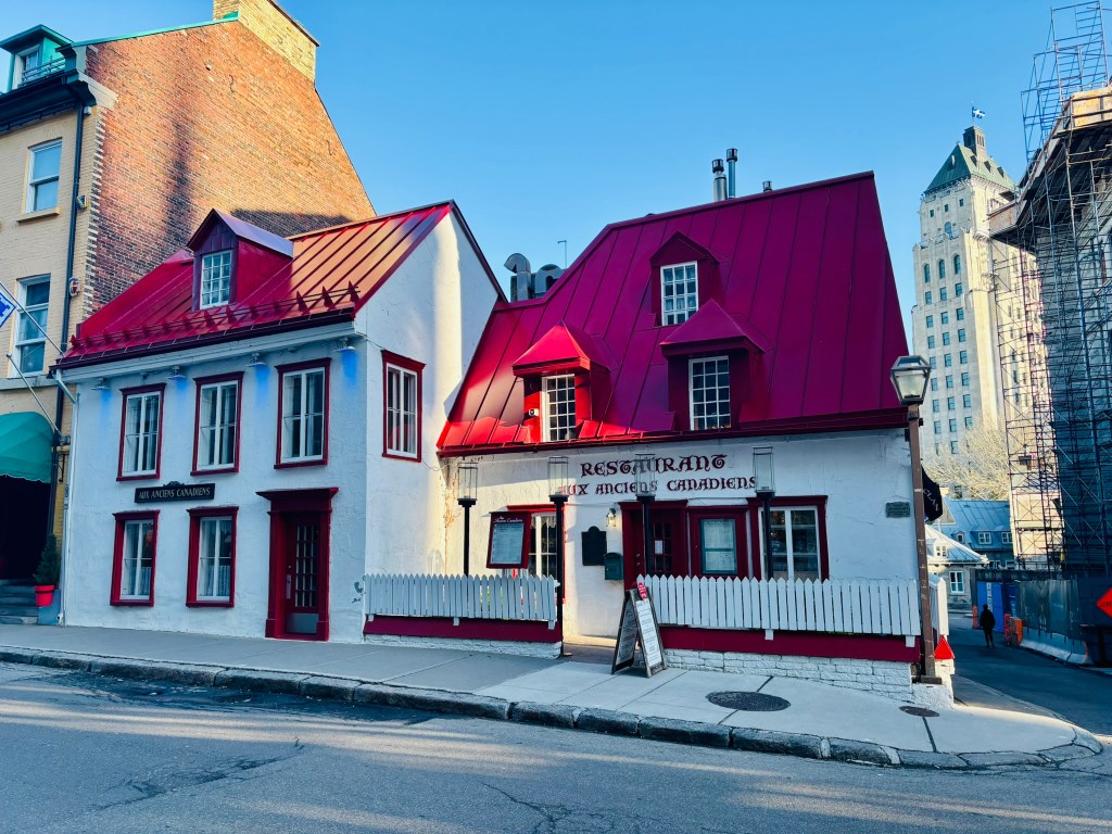
The first thing we noticed about Quebec City is its atmosphere. Inside the walls of Old Quebec, narrow streets curve past stone houses, flower-filled windows, small cafes, boutiques, and centuries-old churches. Musicians play in public squares, horse-drawn carriages pass under old gates, and the smell of fresh pastries drifts from bakeries.

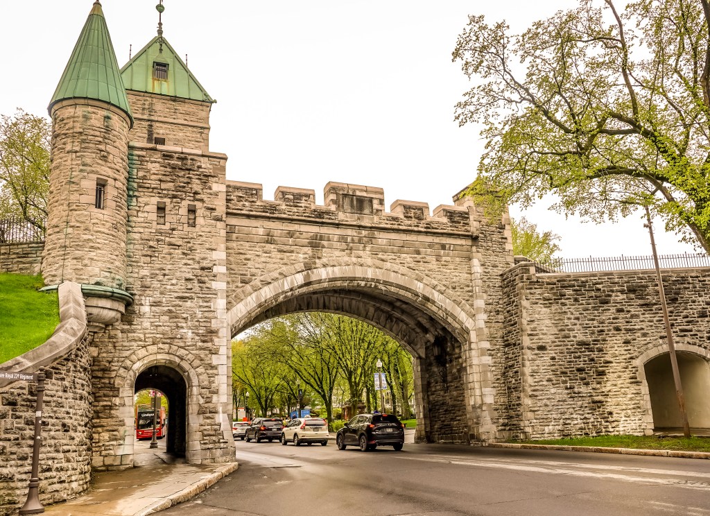
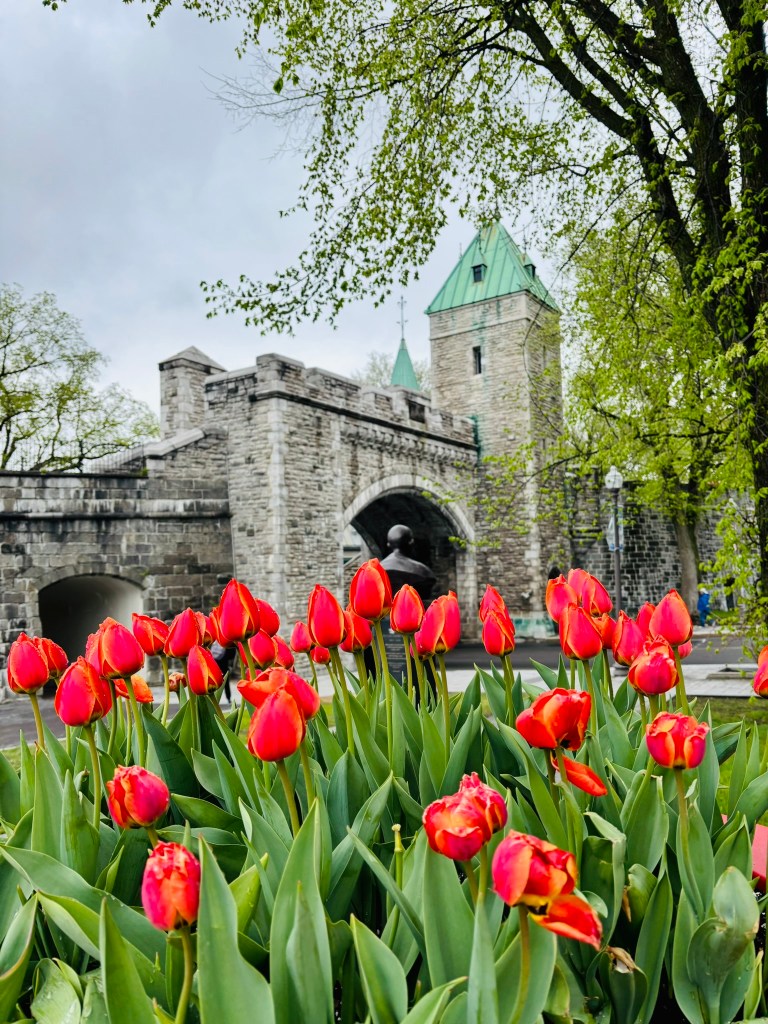
Old Quebec is the only remaining fortified city north of Mexico, and its historic district is a UNESCO World Heritage Site. Walking through it feels wonderfully cinematic. The city has the charm of France, the drama of a cliffside fortress, and the warmth of a deeply lived-in Canadian capital.

Unlike destinations that rely on one or two major landmarks, Quebec City rewards wandering. Every street seems to lead to a terrace, a hidden courtyard, a river view, or a cafe that invites you to slow down. We walked about 30,000 steps every day and felt like we had just scratched the surface what this city has to offer.

A Brief History of Quebec City

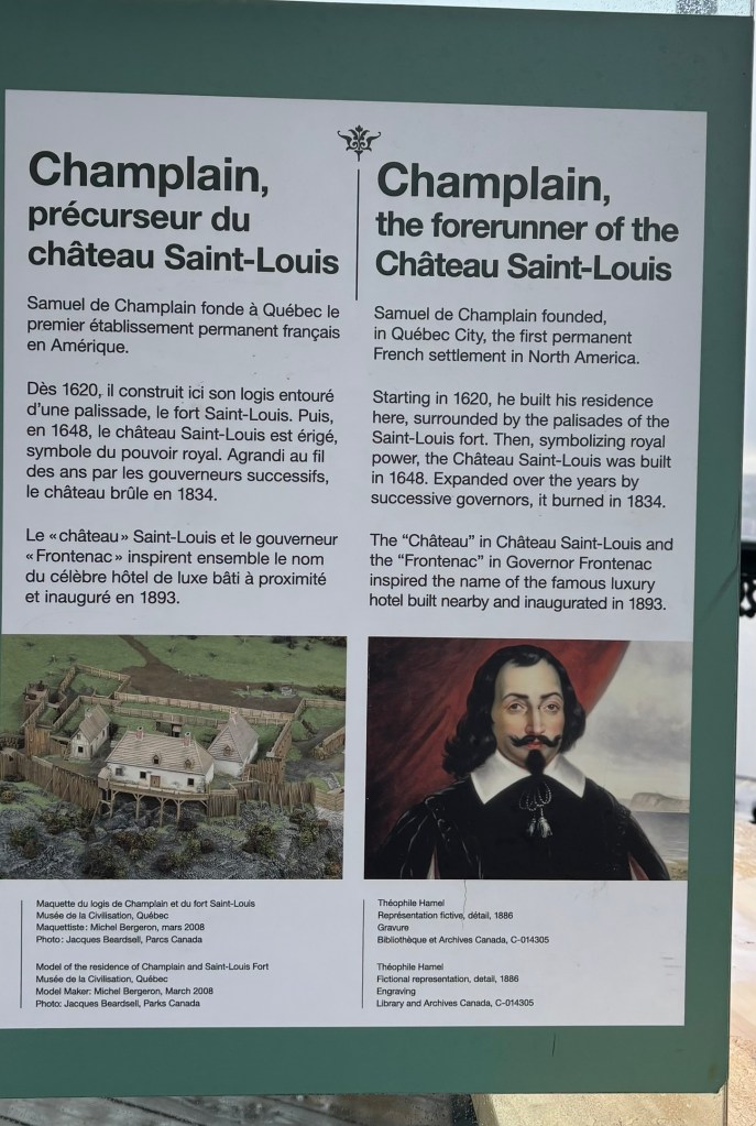
Quebec City was founded in 1608 by French explorer Samuel de Champlain, making it one of the oldest European settlements in North America. Its location above the narrowing of the St. Lawrence River gave it enormous strategic value. In fact, the name โ€œQuebecโ€ comes from an Algonquin word often understood to mean โ€œwhere the river narrows.โ€

For more than a century, Quebec served as the heart of New France, the French colonial empire in North America. From here, French influence spread across vast territories through fur trading networks, Catholic missions, military alliances, and river routes that reached deep into the continent.

The cityโ€™s dramatic history reached a turning point in 1759, during the Battle of the Plains of Abraham, when British forces defeated the French just outside the city walls. This battle helped shift control of Canada from France to Britain, but it did not erase the French identity of Quebec. Instead, it set the stage for one of the most fascinating cultural stories in North America: how a French-speaking society preserved its language, religion, laws, and traditions under British rule.

How Quebec Stayed French in North America

One of the most remarkable things about Quebec City is that it remained deeply French despite being surrounded by an overwhelmingly English-speaking continent. That survival was not accidental. It was shaped by history, geography, law, religion, and cultural determination.

After Britain gained control of New France, the British authorities eventually recognized that governing Quebec successfully meant allowing its French-speaking Catholic population to preserve key parts of its identity. The Quebec Act of 1774 was especially important because it allowed French civil law to continue in private matters and protected the free practice of Catholicism. This helped French language and culture remain rooted in daily life.

Geography also mattered. Quebecโ€™s communities were concentrated along the St. Lawrence River, where families, parishes, and local institutions helped preserve traditions across generations. The Catholic Church played a major role for centuries, operating schools, hospitals, and community life in French. Over time, French became not only a language of heritage, but a defining symbol of identity.

In the 20th century, especially during and after the Quiet Revolution of the 1960s, Quebec modernized rapidly while also strengthening its commitment to protecting French language and culture. Today, French remains the official language of Quebec, and Quebec City is one of the best places to experience that living heritage. This is not a themed version of France. It is a distinct North American French culture with its own accent, cuisine, traditions, humor, and pride.

That is what makes Quebec City so special: it is not a replica of Europe. It is something rarer – a French-speaking city that evolved on its own terms in the heart of North America.

Fairmont Le Chรขteau Frontenac

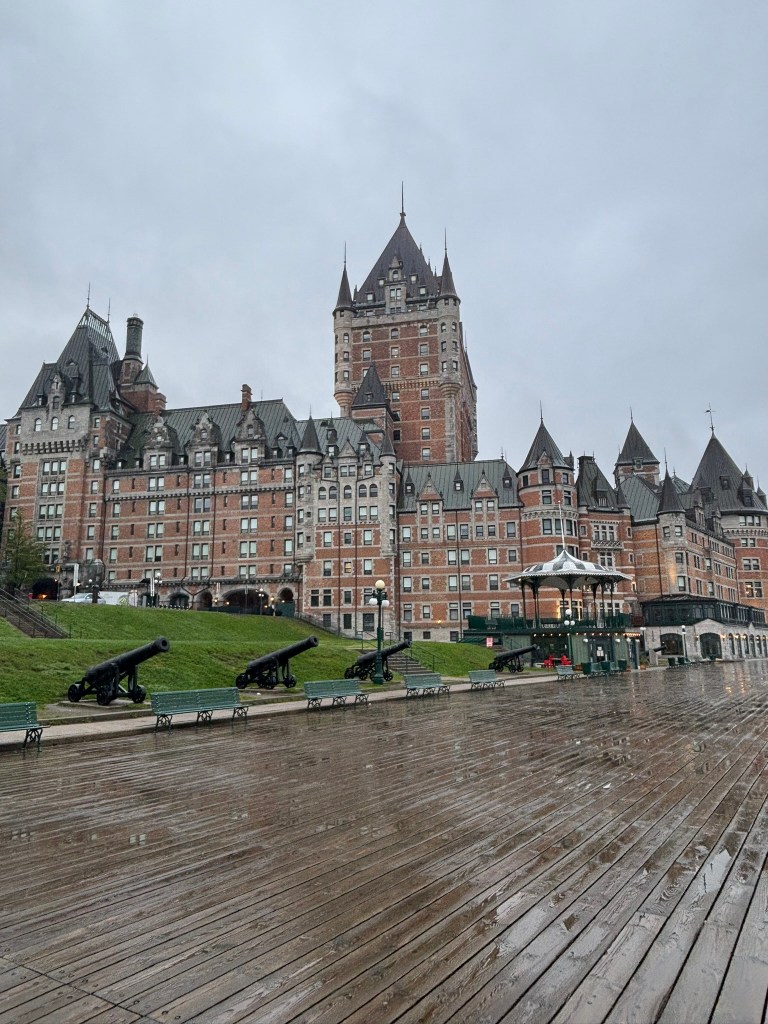
No building defines Quebec City quite like Fairmont Le Chรขteau Frontenac. Perched high above the St. Lawrence River, this grand hotel looks like a castle from a dream. Its copper roofs, turrets, stone facade, and commanding position make it one of the most photographed hotels in the world.

Opened in 1893 by the Canadian Pacific Railway, Chรขteau Frontenac was part of a series of grand railway hotels designed to encourage luxury travel across Canada. More than a place to sleep, it became a symbol of Quebec City itself. Over the years, it has hosted royalty, political leaders, celebrities, and travelers drawn to its historic glamour.

Staying here is an experience in itself. The hotel places you directly in the heart of Old Quebec, steps from the Dufferin Terrace, the city walls, historic churches, restaurants, museums, and river viewpoints. Wake up early and you can walk the terrace before the crowds arrive. Return at night and the illuminated hotel feels almost theatrical against the dark sky.

Even if you do not stay overnight, it is worth visiting the lobby, enjoying a drink, booking afternoon tea, or taking a guided tour to learn about the hotelโ€™s history.

What to See in Old Quebec

Old Quebec is divided into the Upper Town and Lower Town, both worth exploring slowly.

In the Upper Town, you will find the Chรขteau Frontenac, Dufferin Terrace, the city walls, the Citadelle, Notre-Dame de Quรฉbec Basilica-Cathedral, and sweeping views over the St. Lawrence River. This is the grand, fortified side of the city, full of military history and dramatic viewpoints.

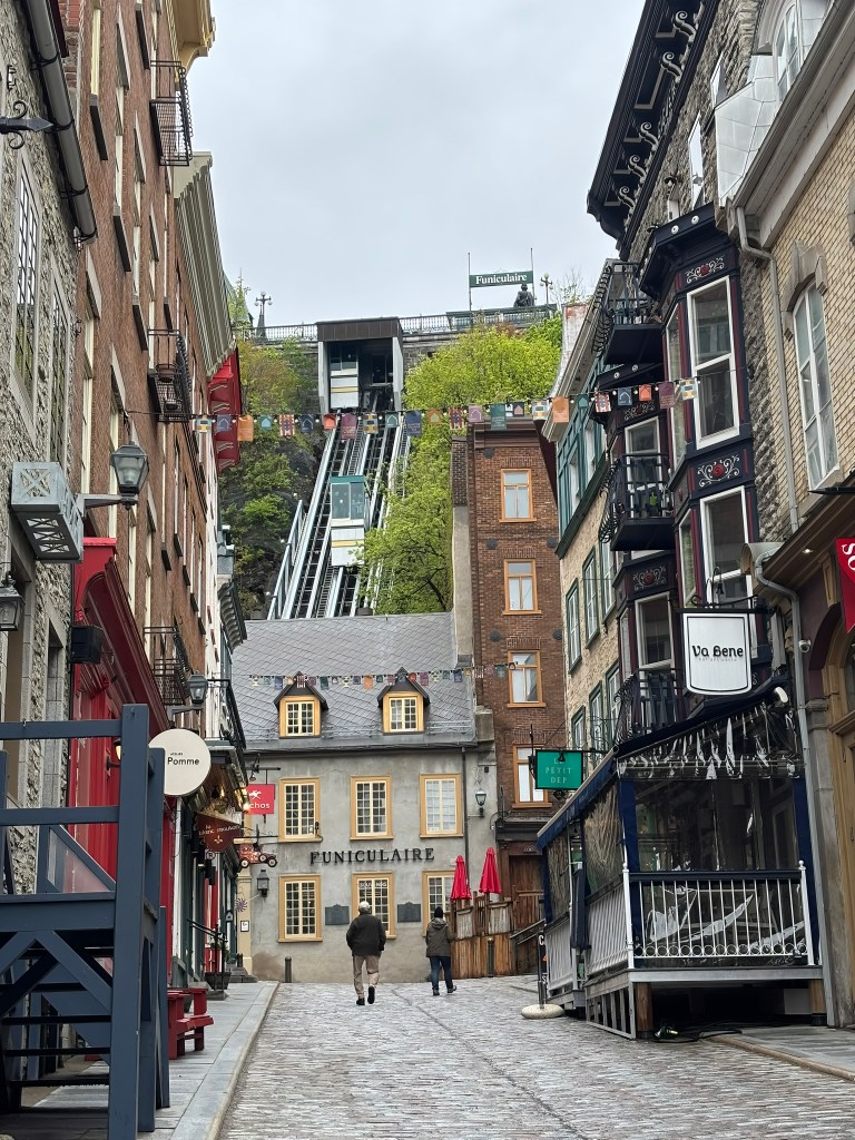
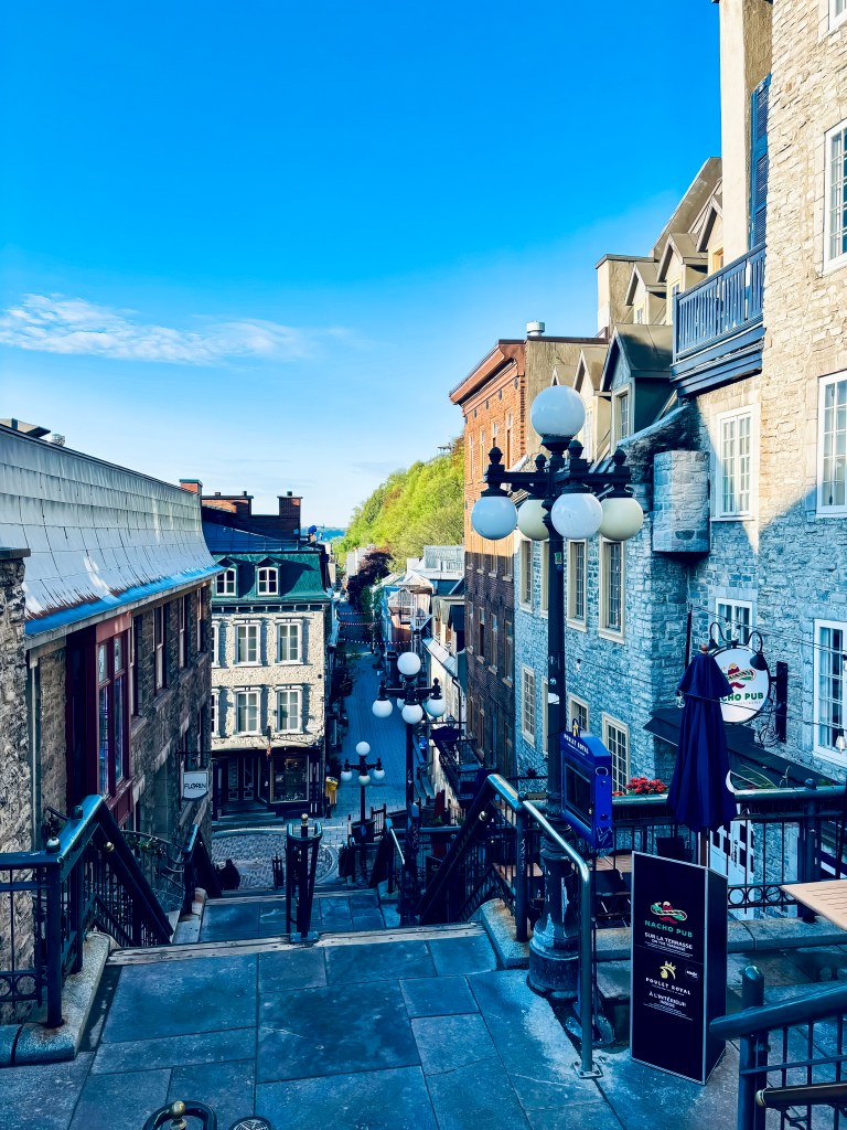
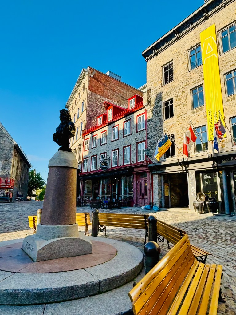
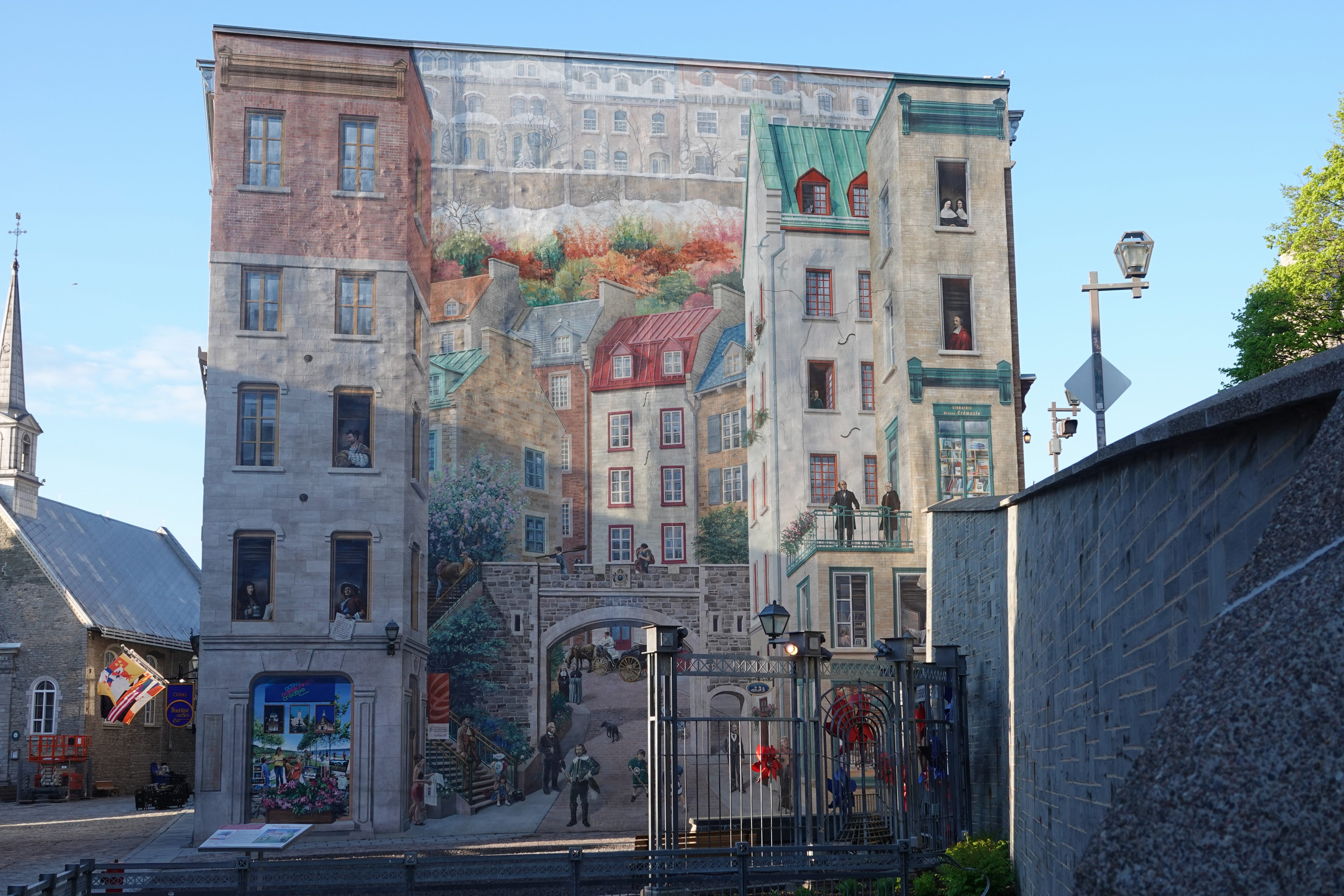
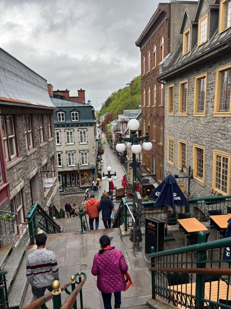
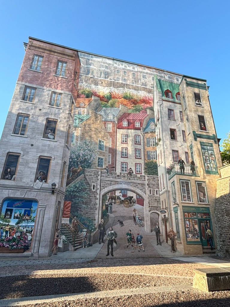
Lower Town feels more intimate and atmospheric. The streets around Place Royale and Rue du Petit-Champlain are among the most beautiful in Canada, with stone buildings, boutiques, cafes, murals, and seasonal decorations. This area is especially magical in winter, but it is charming year-round.

A few highlights include:

PlaceWhy Visit
Dufferin TerracePanoramic river views and the best stroll beside Chรขteau Frontenac
Rue du Petit-ChamplainOne of the prettiest shopping streets in North America
Place RoyaleHistoric square tied to the earliest French settlement
Notre-Dame de QuรฉbecOne of the oldest Catholic cathedral sites in North America
The CitadelleStar-shaped fortress with military history and city views
Old City WallsA rare chance to walk through a fortified North American city

A City Made for Slow Travel

Quebec City is not a place to rush. Its beauty is in the details: blue shutters against stone walls, French conversations floating from cafe terraces, street performers in public squares, old cannons facing the river, and warm lights glowing through restaurant windows.

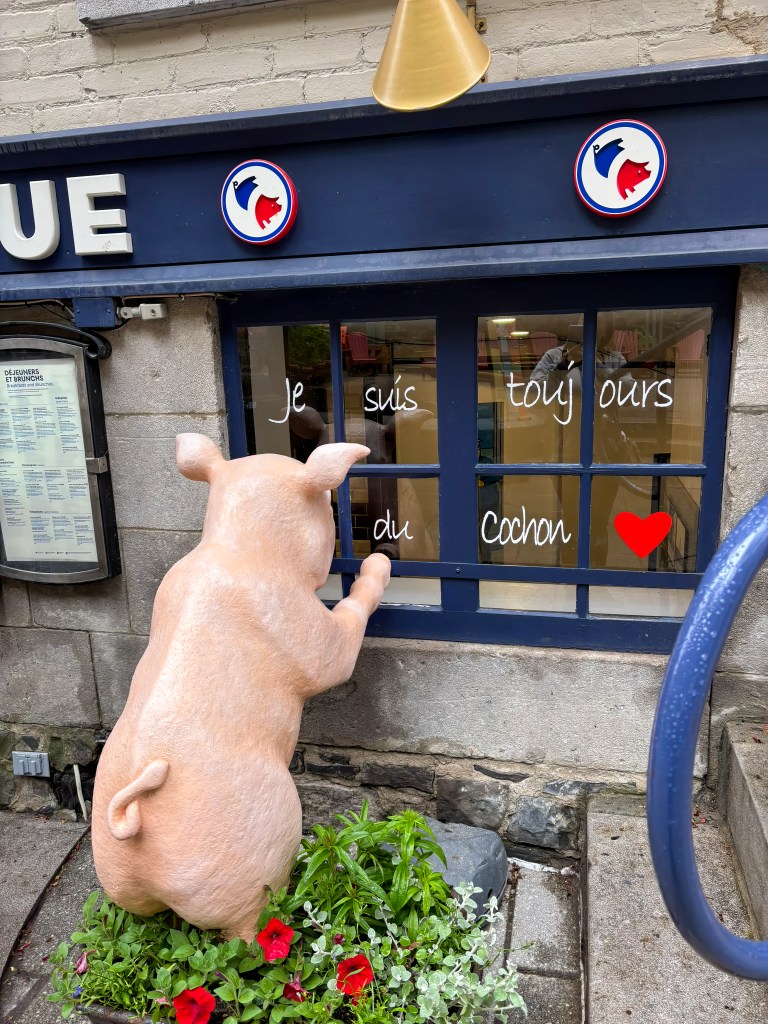
Food is a major part of the experience. Try poutine, tourtiรจre, maple desserts, local cheeses, French pastries, and Quebecois comfort food. The city also has an excellent fine dining scene, along with cozy bistros that feel perfect after a day of exploring.

Seasonally, Quebec City offers completely different moods. In summer, terraces and festivals fill the streets. In autumn, the surrounding landscapes turn gold and red. In winter, snow transforms Old Quebec into one of the most magical cold-weather destinations in North America, especially during the famous Quebec Winter Carnival.

Easy Day Trips from Quebec City

If you have extra time, the region around Quebec City is just as rewarding.

Montmorency Falls is only a short drive from the city and stands even taller than Niagara Falls. รŽle dโ€™Orlรฉans offers countryside charm, wineries, farms, bakeries, and river views. Sainte-Anne-de-Beauprรฉ Basilica is one of Canadaโ€™s most important pilgrimage sites and features impressive architecture and religious art.

These nearby escapes make Quebec City ideal for a long weekend or a slower four- to five-day itinerary. We spent 2 days in Quebec City and felt like 3 days would have been ideal, especially to enjoy at a slower pace.

Why Quebec City Belongs on Your Travel List

Quebec City is one of the rare destinations that feels both accessible and transporting. It gives visitors the romance of Europe, the depth of North American history, and a living French culture that has endured for centuries.

Come for the cobblestones and castle-like skyline. Stay for the food, the language, the river views, the music, the old walls, and the feeling that you have stepped into a place where history is still present in everyday life.

Unlocking the City of the Gods: The Ultimate Guide to the Pyramids of Teotihuacรกn

Rising majestically from the high valley floor just 30 miles northeast of Mexico City, the ancient metropolis of Teotihuacรกn stands as one of the most awe-inspiring archaeological wonders of the ancient world. Flourishing between 100 B.C. and 650 A.D., this massive UNESCO World Heritage site was once home to over 150,000 residentsโ€”making it the largest city in the pre-Columbian Americas and one of the largest cities anywhere on Earth at its peak.

Centuries after its mysterious collapse, the Aztecs discovered the empty stone city and named it Teotihuacรกnโ€””the place where men become gods.” They believed the structures were so monumental that only divine beings could have built them.

Today, walking down its central axis, the Avenue of the Dead, transports travelers back in time to an era when this metropolis controlled trade routes stretching from the Gulf Coast to Guatemala. To help you navigate this massive open-air museum, here is a detailed breakdown of the legendary structures that anchor the complexโ€”plus the mysteries that still haunt its empty streets.

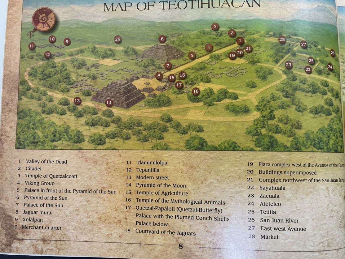
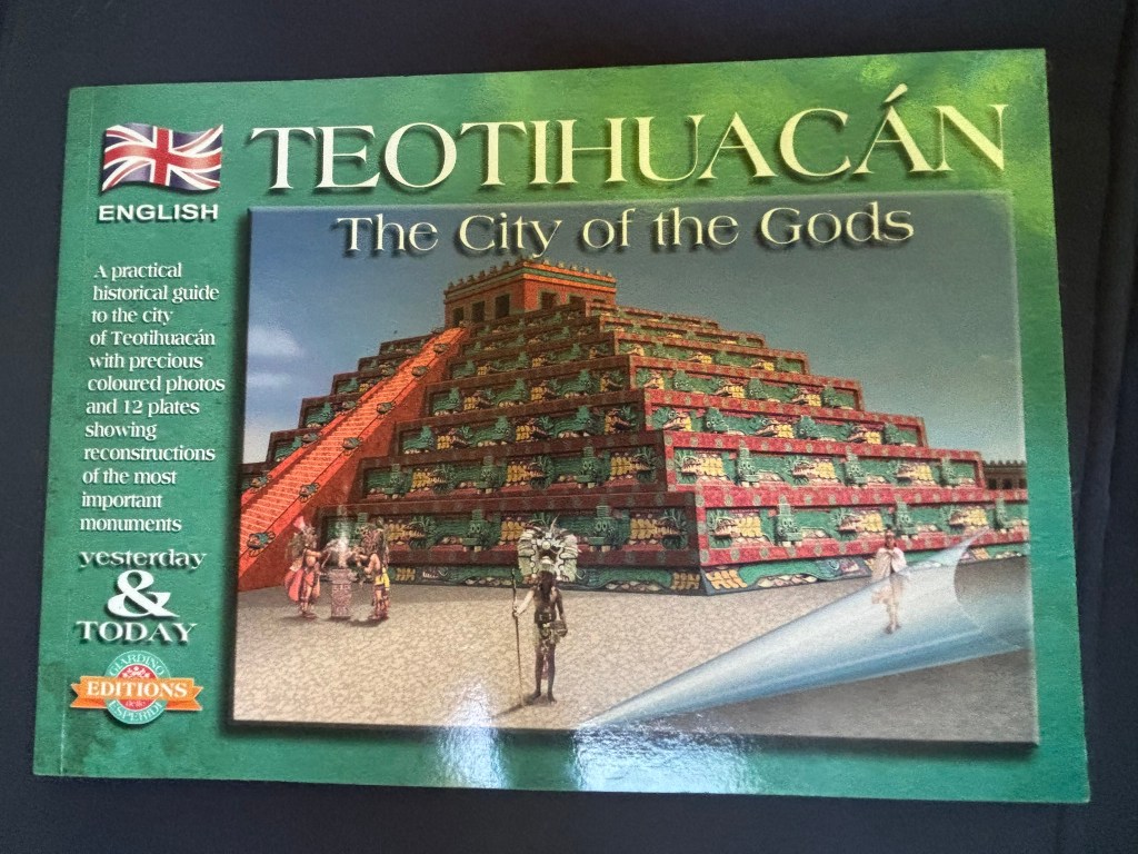
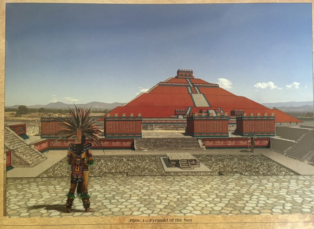
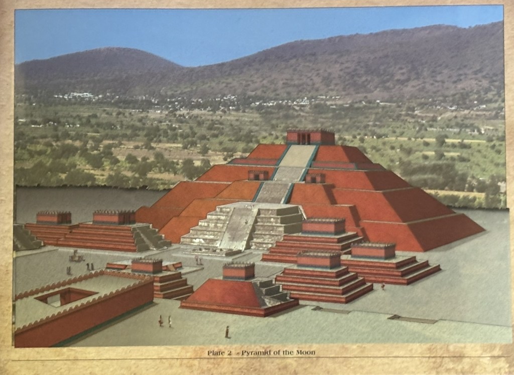
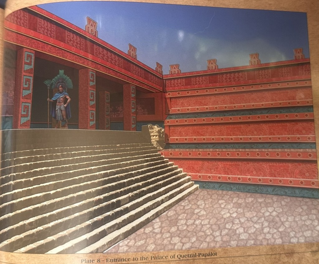
Pro-tip: Before exploring the pyramids, be sure to visit the Museum of Anthropology in Mexico City. This visit will provide you with essential historical context, enhancing your understanding of the pyramids’ importance and the significance of various structures. The book shown below can be purchased at the Anthropology museum and shows how various structures looked and the significance of each. Alternatively, consider hiring a knowledgeable guide at the pyramids to gain invaluable insights into the historical relevance of this remarkable site.

  1. A Brief History of Teotihuacan- A Civilization Without a Name
  2. The Avenue of the Dead: The City’s Ceremonial Spine
  3. The Three Legendary Pyramids
    1. 1. The Temple of the Feathered Serpent (La Ciudadela)
    2. 2. The Pyramid of the Sun
    3. 3. The Pyramid of the Moon
  4. Beyond the Pyramids: What Else to See
    1. The Palace of Quetzalpapรกlotl
    2. Superimposed buildings
    3. Puma Mural
  5. The Residential Quarters: Life Beyond Ceremony
  6. The Mystery of Teotihuacan Funerary Masks
  7. The Site Museums
  8. The Great Mystery: What Happened to Teotihuacรกn?
    1. Internal Revolt
    2. Environmental Catastrophe
    3. Foreign Invasion
    4. Volcanic Disruption
  9. Essential Visitor Logistics (2026)
  10. Final Thoughts

A Brief History of TeotihuacanA Civilization Without a Name

Teotihuacan emerged in the Basin of Mexico around the first century B.C. and grew rapidly over the following centuries into one of the largest and most influential cities in the ancient world. At its height – likely around 450 A.D. – it may have housed between 150,000 and 200,000 people, making it not only the largest city in the pre-Columbian Americas but also a major cosmopolitan center whose influence reached far beyond central Mexico through trade, religion, military presence, and artistic exchange.

Although the city is known today by the Aztec name Teotihuacan, its original inhabitants left behind no clearly deciphered written history, no recorded royal biographies, and no confirmed original name for the city, which means we still do not know exactly what its people called themselves, what language they primarily spoke, or how they identified ethnically. What archaeology has revealed, however, is extraordinary: a highly organized urban civilization with a carefully planned grid layout, apartment-style residential compounds, distinct ethnic neighborhoods that likely included Zapotec, Maya, and Gulf Coast migrants, advanced engineering such as citywide drainage systems and the deliberate rerouting of the San Juan River, and a cultural legacy that shaped art, architecture, religion, and politics across Mesoamerica for centuries.

Even after decades of excavation, Teotihuacan remains as compelling for what is still unknown as for what has already been uncovered – a monumental city that continues to feel less like a closed historical chapter and more like an enduring and magnificent puzzle.

The Avenue of the Dead: The City’s Ceremonial Spine

The Avenue of the Dead is the grand ceremonial road that runs through the heart of Teotihuacan, linking its most important plazas, pyramids, and architectural complexes. The name comes from later Nahua peoples, who believed the ruins lining the road were burial mounds. In reality, the avenue served as the structural and symbolic backbone of the city, organizing the surrounding streets, squares, and multi-family residential compounds. Stretching for almost 5 kilometers and measuring roughly 50 meters wide, it was the main axis of urban and ceremonial life – a place walked by residents, pilgrims, traders, and visiting elites alike.

It may also have served as a major processional route, reinforcing Teotihuacan’s importance as a religious, political, and economic center. One of the most memorable experiences here is acoustic rather than visual: many visitors stop in the middle of the avenue and clap, only to hear the sound bounce back in a strange, sharp chirping echo. Some describe it as a quack, others as a birdlike call. The effect likely comes from the stepped architecture of the surrounding pyramids and platforms, which scatter sound waves in unusual ways. Whether intentional or accidental, it adds to the feeling that Teotihuacan was designed not just to impress the eye, but to shape the entire sensory experience of ritual space.

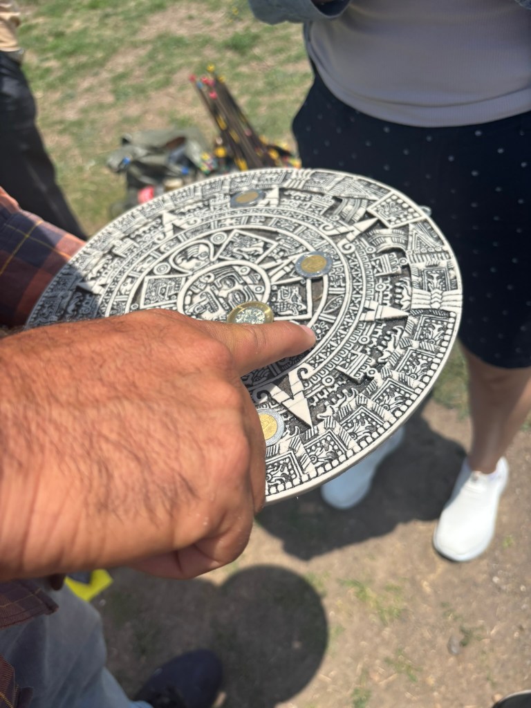
Guide showing the quacking noise in the middle of avenue of the dead

The Three Legendary Pyramids

1. The Temple of the Feathered Serpent (La Ciudadela)

Located at the southern end near Gate 1, the Temple of the Feathered Serpent sits inside a massive, sunken courtyard known as La Ciudadela (The Citadel). While smaller than its northern neighbors, this pyramid is the most intricately decorated and politically significant structure on the site.

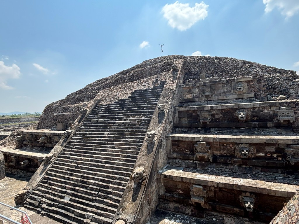
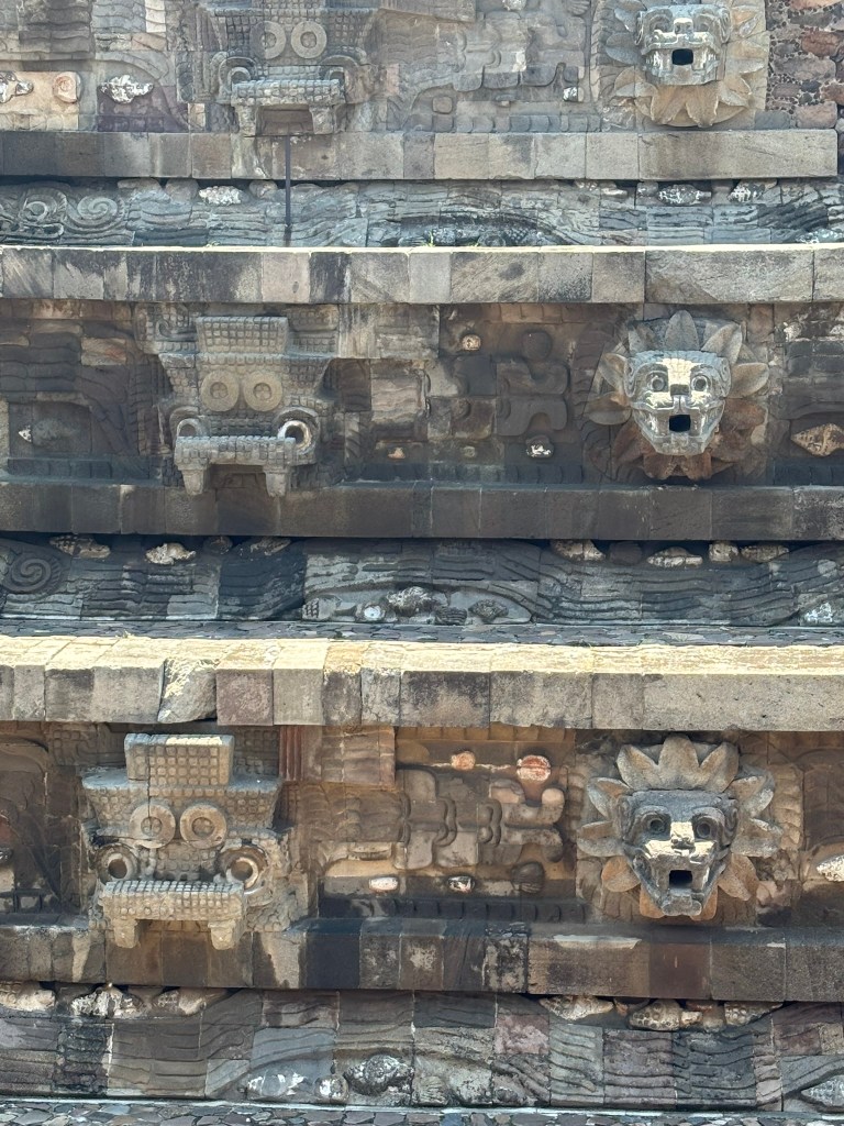
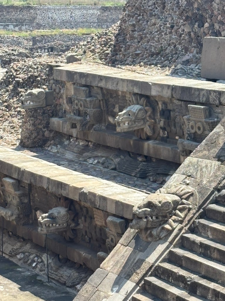
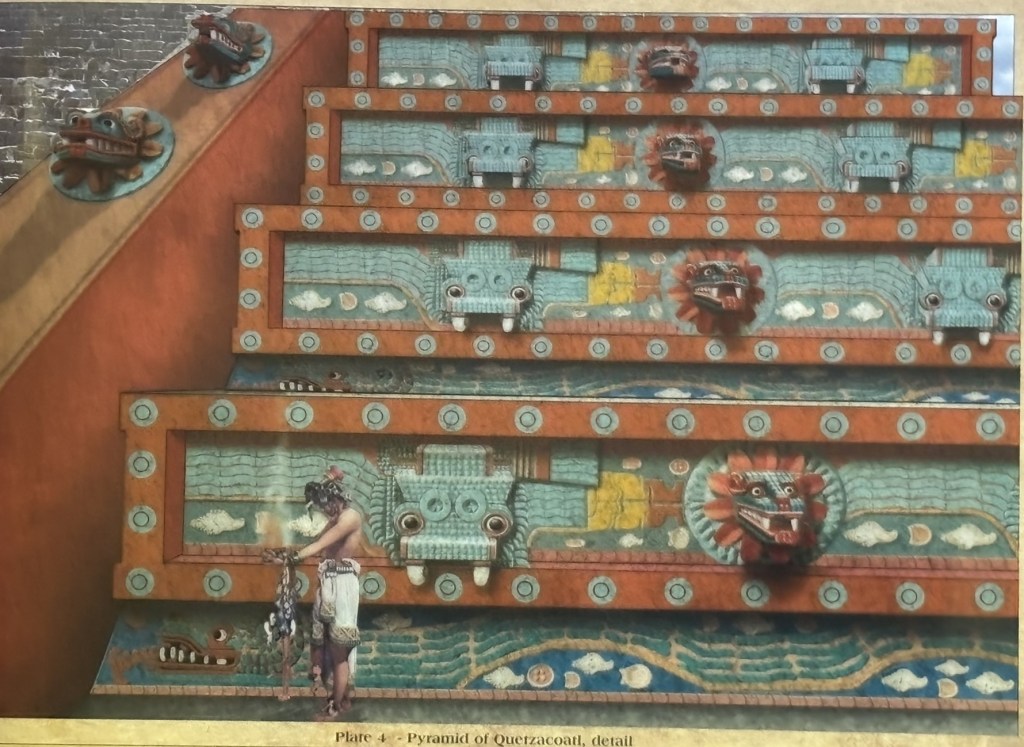
The Architecture Built in the iconic Mesoamerican talud-tablero (slope-and-panel) style, the pyramid’s facade is adorned with dozens of three-dimensional stone carvings that would have been painted in vivid polychrome colorsโ€”reds, blues, greens, and yellows gleaming under the highland sun.

The Imagery Alternating sculpted heads jut dramatically from the walls, depicting the undulating Feathered Serpent (later known to the Aztecs as Quetzalcรณatl) navigating among seashells and marine motifs. These are paired with enigmatic, goggle-eyed visages, often associated with the rain and warfare deity Tlalocโ€”though some scholars now believe they may represent an earlier, primordial crocodilian creature or even a war-serpent headdress.

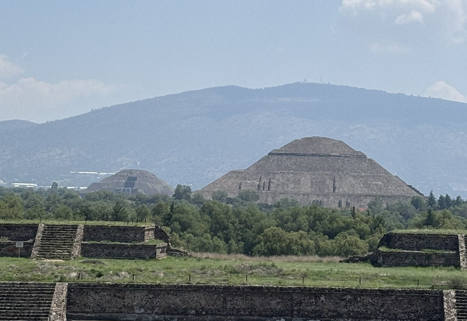
Pyramid of the Feathered Serpent is a good place to get panoramic photos of the complex with sun and moon pyramids

The Dark History of The Temple of the Feathered Serpent (La Ciudadela)

Archaeologists discovered mass graves of over 260 sacrificed individuals buried beneath the foundations, arranged in patterns corresponding to the Mesoamerican calendar. Most were young adult males, many with their hands bound behind their backs, accompanied by obsidian blades, shell ornaments, and jaw bones of sacrificial victims. This grim discovery suggests the grand temple served as the epicenter of military power and state-sanctioned rituals designed to legitimize a new ruling dynasty.

2. The Pyramid of the Sun

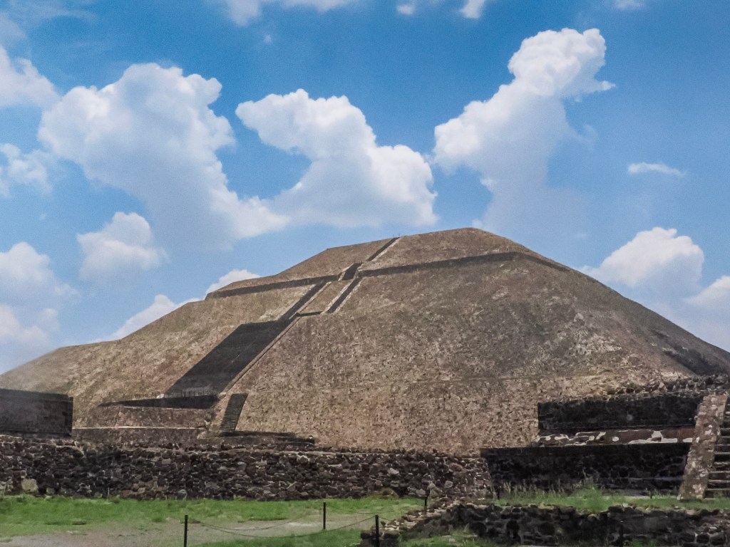
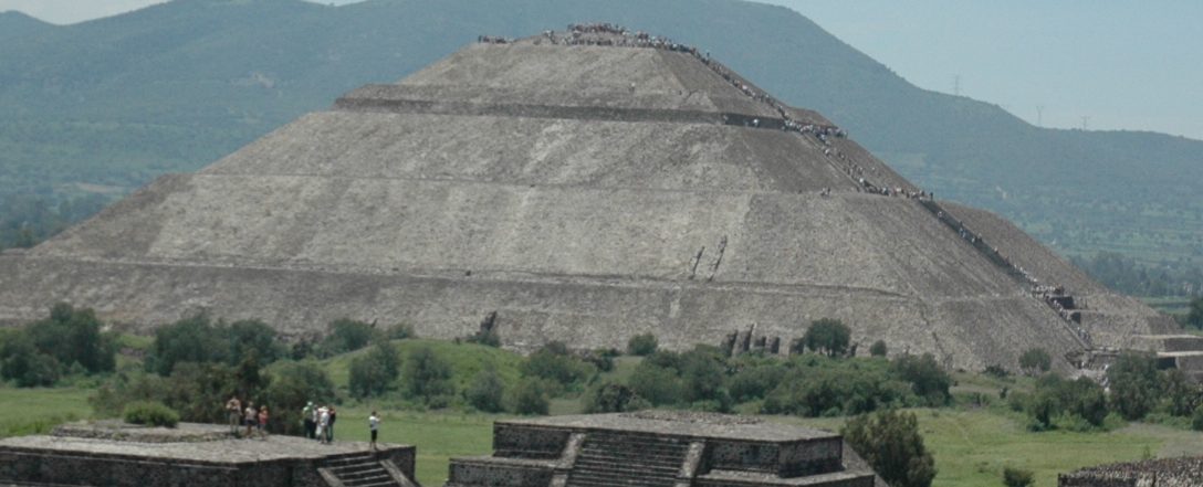
Positioned halfway down the Avenue of the Dead near Gate 2 and Gate 5, the Pyramid of the Sun is the undisputed giant of Teotihuacรกn. It ranks as one of the largest ancient structures in the Western Hemisphereโ€”and the third-largest pyramid on Earth by volume.

The Dimensions Constructed around 200 A.D. using millions of tons of hand-quarried volcanic stone (primarily tezontle) and compacted earth, the pyramid features a massive footprint measuring roughly 230 meters (750 feet) on each side and towering over 65 meters (213 feet) into the sky. An estimated 10,000 workers labored for decades to complete it.

The Cosmic Purpose Oriented perfectly westward to align with the setting sun on two specific daysโ€”August 12 and April 29โ€”the pyramid marks the beginning of the agricultural cycle in the Mesoamerican calendar. It was originally covered in smooth lime plaster and painted in brilliant, vibrant reds, creating a monument that would have been visible for miles across the valley floor.

The Hidden Tunnels

In 1971, archaeologists discovered a natural clover-shaped cave system stretching directly beneath the center of the pyramid, accessed by a 100-meter-long tunnel. This discovery was groundbreaking: it indicated the entire structure was intentionally built over a sacred primordial site. In Mesoamerican cosmology, caves were portals to the underworld, birthplaces of humanity, and sources of life-giving water. The pyramid, it seems, was designed to mark this axis mundiโ€”the cosmic center of the universe.

Since 2020, visitors are no longer allowed to climb the Sun Pyramid, which was permitted in 2008 (my first visit to the pyramids). This significant policy change arose from concerns about the safety and preservation of the ancient structure, as increasing foot traffic was causing wear and tear on the monument. Prior to the restriction, many tourists enjoyed the exhilarating experience of ascending the pyramid to take in breathtaking views of the surrounding area and to appreciate the site’s historical significance. Now, while visitors can still explore the base of the pyramid and learn about its rich history through guided tours, the lack of access to the summit has sparked discussions among both tourists and local historians about the balance between tourism and conservation.

3. The Pyramid of the Moon

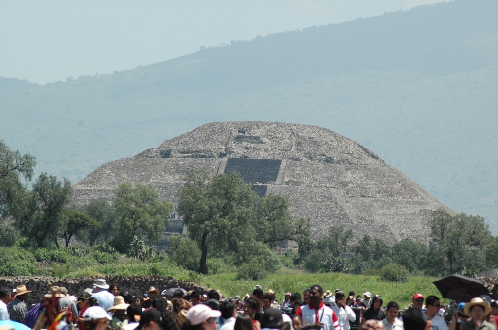
Anchoring the far northern terminus of the Avenue of the Dead near Gate 3 and Gate 4, the Pyramid of the Moon serves as the visual climax of the entire city layout.

The Visual Illusion

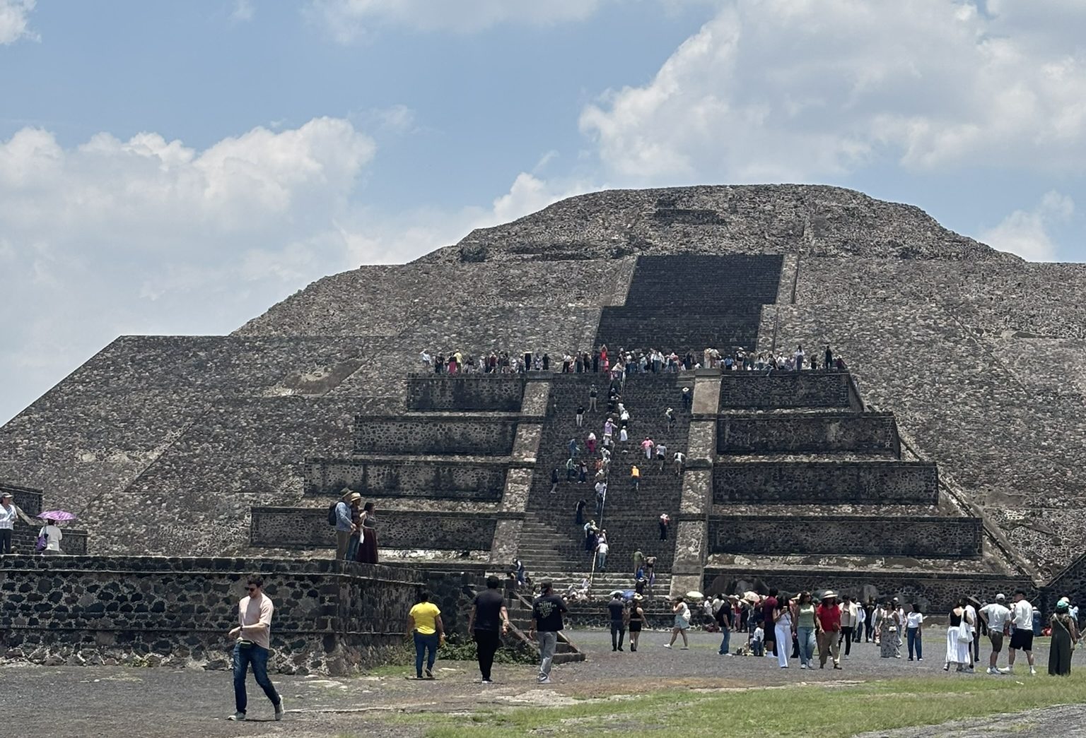
Although it stands shorter than the Pyramid of the Sun at 43 meters (141 feet) tall, it appears to be the exact same height because it was strategically built on naturally higher ground. Its slope perfectly mirrors the silhouette of Cerro Gordo, the sacred mountain rising directly behind itโ€”a deliberate architectural choice that unified the built environment with the natural landscape in a way that still astonishes visitors today.

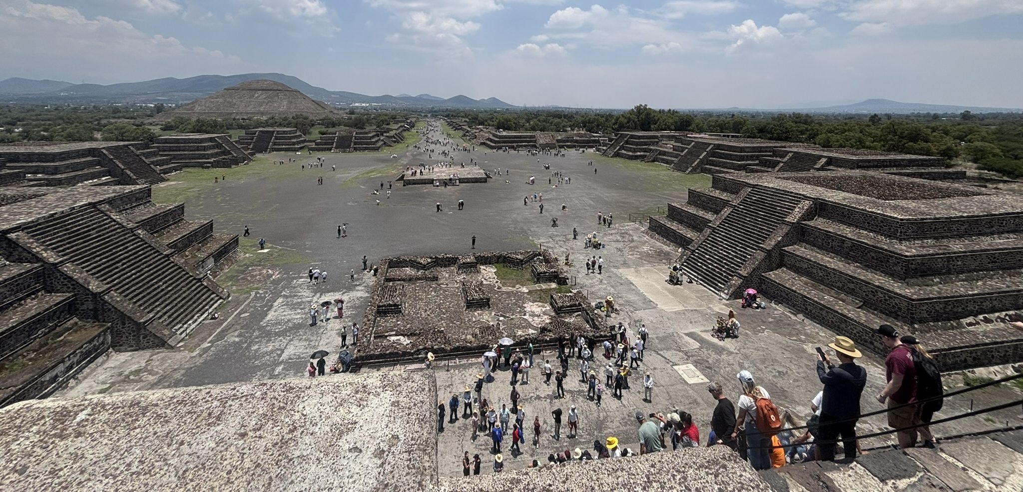
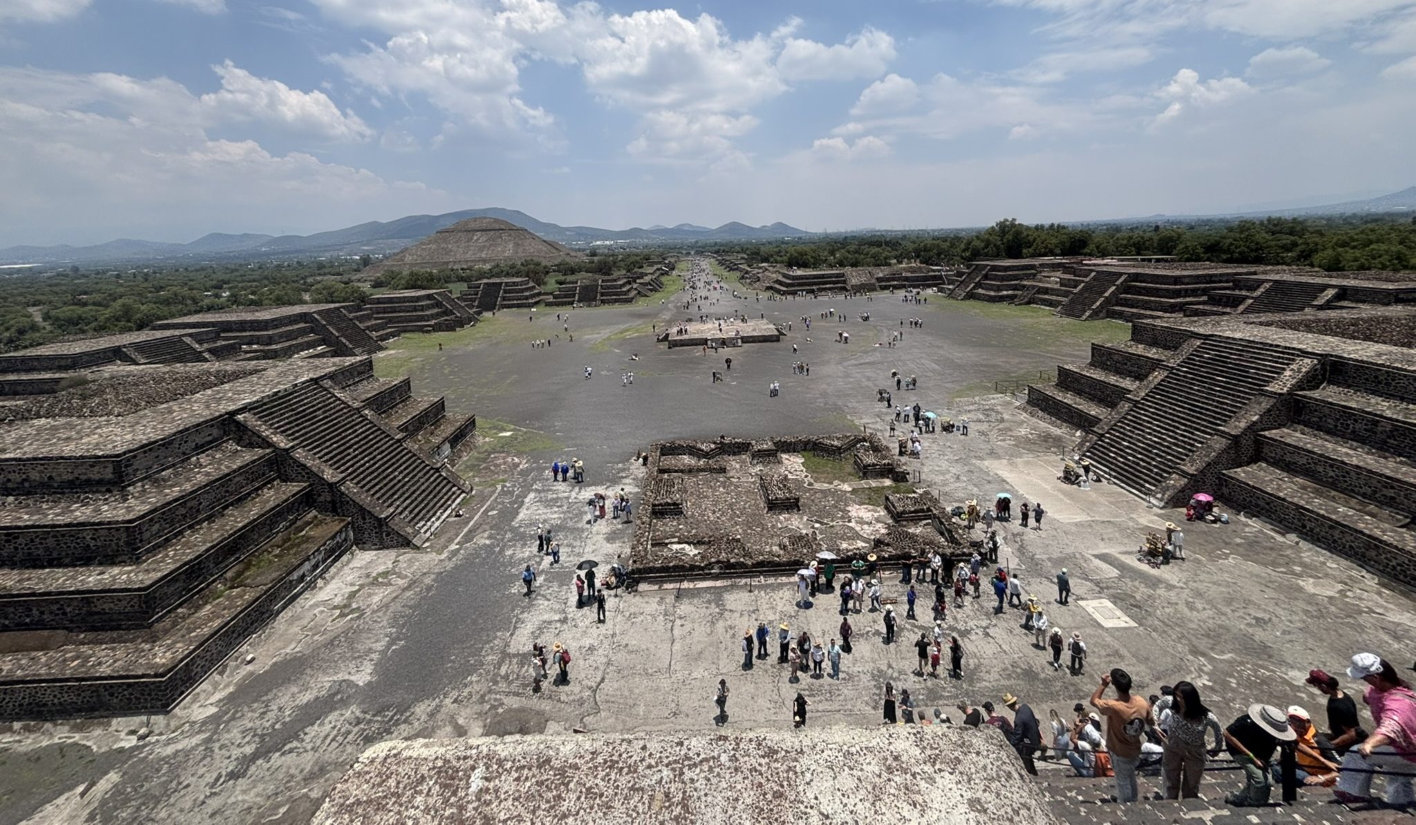
The Plaza of the Moon The pyramid faces a grand, symmetrical plaza surrounded by 12 smaller temple platforms arranged in a U-shape. This public arena was designed for highly orchestrated theatrical and religious ceremonies, with the ruling elite performing rituals visible to thousands of assembled citizens.

The Sacred Sacrifices Excavations inside the multi-layered interior walls have revealed tombs containing sacrificed animalsโ€”jaguars, pumas, wolves, eagles, and rattlesnakesโ€”alongside bound human captives, some of foreign origin. These dedicatory offerings, deposited during successive construction phases between 200 and 450 A.D., signify the temple’s role in celebrating state triumphs, foreign conquests, and cosmic renewal ceremonies.

You can climb halfway to the top of Moon Pyramid, and you’ll enjoy a panoramic view of the entire valley and archaeological site.

Beyond the Pyramids: What Else to See

The Palace of Quetzalpapรกlotl

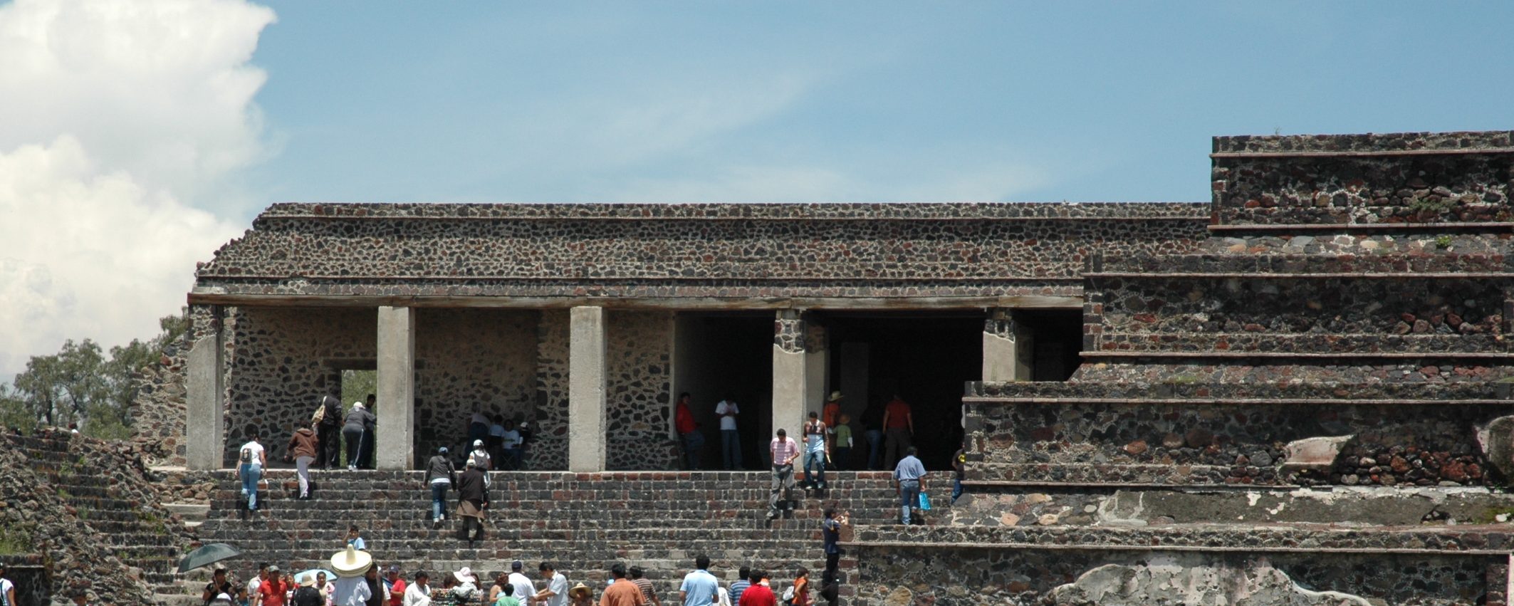
Located just southwest of the Plaza of the Moon, this reconstructed palace complex offers a glimpse into elite residential life. Its courtyard features intricately carved pillars depicting the quetzal-butterfly (a mythological creature combining bird and insect), with traces of original pigment still visible. The adjoining Palace of the Jaguars contains well-preserved murals of feathered jaguars blowing conch shell trumpets.

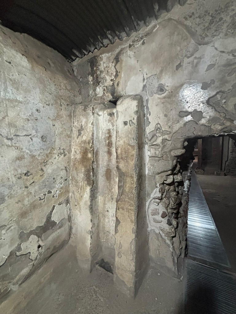
Superimposed buildings

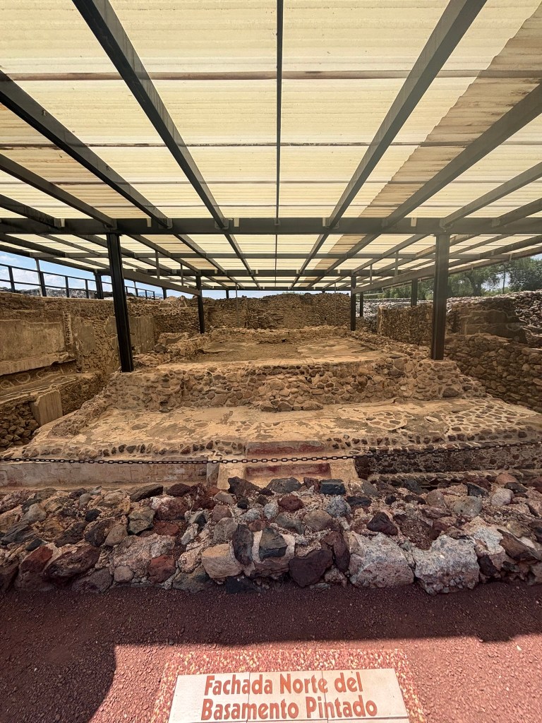
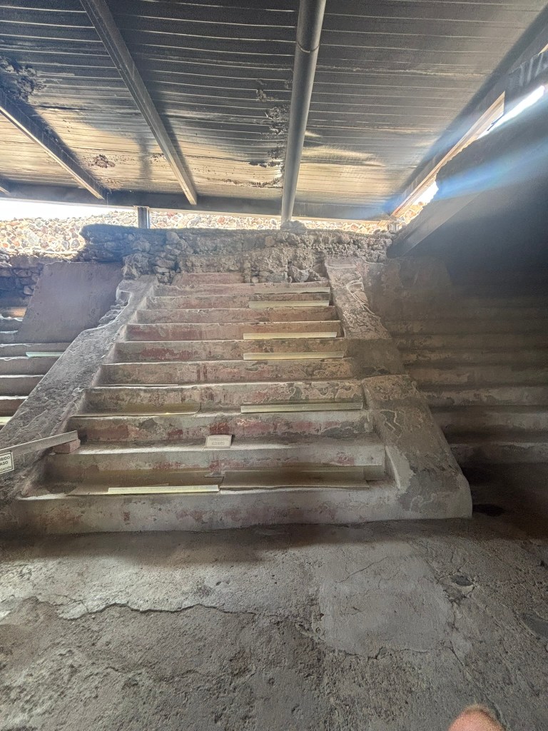
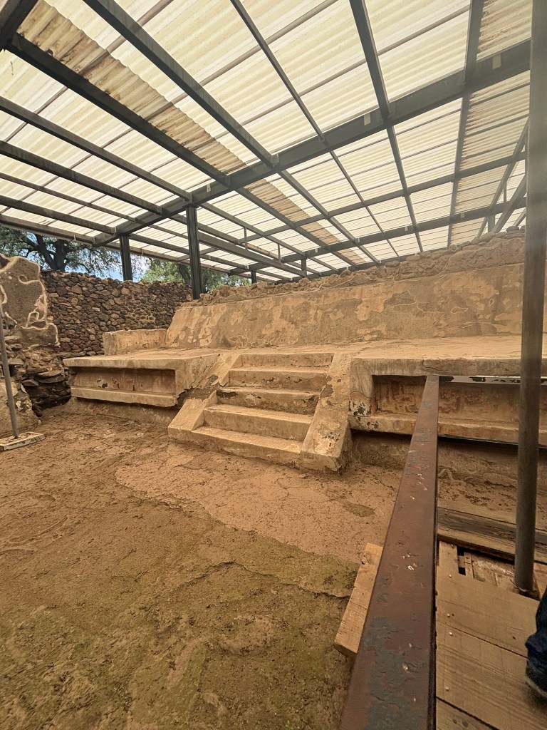
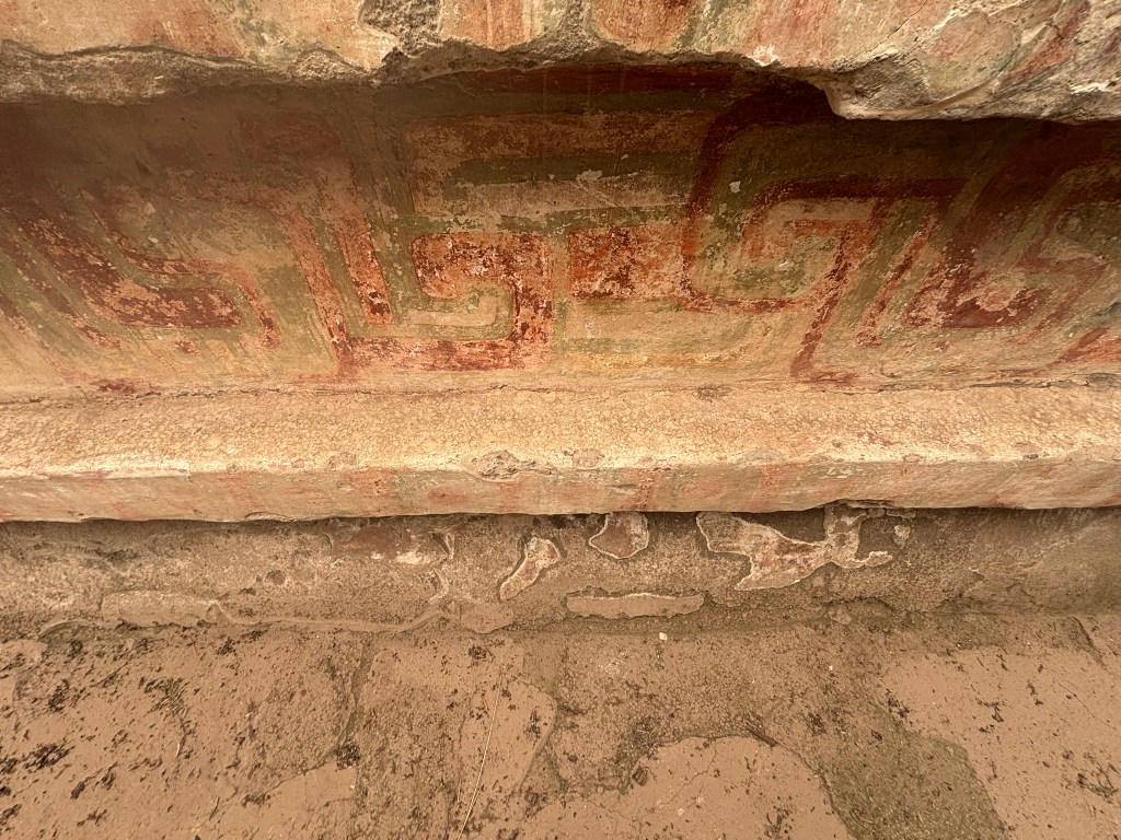
Another fascinating stop along the Avenue of the Dead is the complex known as the Superimposed Buildings, where archaeologists uncovered several layers of construction from different periods of occupation. Within this area lies the North Facade of the Painted Platform, where traces of murals still survive on stairways, moldings, and walls. These faded red and green geometric motifs, circular forms, and floral designs reveal how richly painted even exterior architectural surfaces once were. The layered architecture here is especially revealing, because it shows how Teotihuacan constantly rebuilt, expanded, and reshaped its ceremonial spaces over time.

Puma Mural

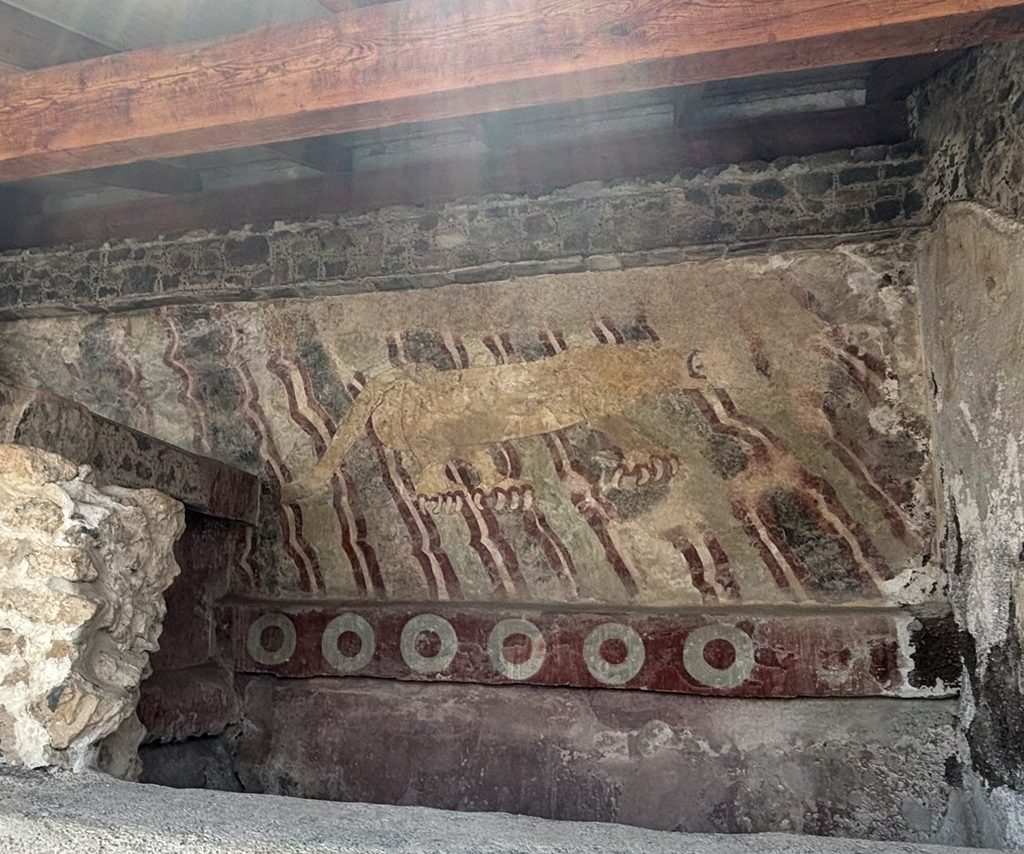
As you continue walking toward the Pyramid of the Moon, keep an eye out for the remarkable Puma Mural on the east side of the Avenue of the Dead. Described on-site as the largest mural yet found at Teotihuacan, it depicts a puma rather than a jaguar, identified by the absence of the black spots that would mark a jaguar’s coat. With extended claws, a long tail, and diagonal bands of red, white, and blue beneath its legs, the animal appears to be crossing a rushing current. According to the site’s interpretation, the puma may have been associated with the sun in Teotihuacan’s urban cosmogram, while the green circles along the lower frame may symbolize “precious liquid.” Together with the nearby painted platforms and layered buildings, the mural shows how deeply color, sacred meaning, and architectural symbolism were woven into the city’s ceremonial core.

The remains of murals across the site make one thing clear: Teotihuacan was once a city saturated with color. Walls, stairways, platforms, and inner chambers were not simply structural elements – they were active surfaces of meaning, turning architecture itself into a form of visual storytelling.

The Residential Quarters: Life Beyond Ceremony

One of the most remarkable things about Teotihuacan is that it was not only a ceremonial center – it was also a highly organized city built for daily life. Its residential quarters were arranged in large apartment-style compounds that housed families, artisans, merchants, and perhaps communities organized by ethnicity, occupation, or social rank.

These compounds were often built around central courtyards and included living spaces, altars, drainage systems, storage areas, and work zones. Some were decorated with murals and architectural details that suggest domestic life was closely intertwined with ritual and identity. Archaeologists have also found evidence of workshops within these compounds, showing that many residents lived and worked in the same spaces.

This urban layout reveals a surprisingly sophisticated model of city planning. Teotihuacan was not a place of scattered huts overshadowed by temples; it was a dense, structured metropolis where everyday life unfolded within an environment shaped by religion, craftsmanship, and social order.

The Mystery of Teotihuacan Funerary Masks

Among the most haunting objects associated with Teotihuacan are its funerary masks, sometimes called death masks. These carved stone faces, often inlaid with turquoise, shell, obsidian, and other precious materials, are among the most striking artifacts from the city.

They were likely not realistic portraits of specific people. Instead, they seem to have served ritual and symbolic purposes tied to transformation, sacred identity, and the journey between the human world and the divine realm. Many have been found in burial or offering contexts, suggesting they may have accompanied elite individuals into the afterlife or played a role in ancestor veneration.

Their smooth, idealized features tell us something important about Teotihuacan itself. Unlike cultures that celebrated named rulers through portrait sculpture, Teotihuacan appears to have emphasized collective sacred power over individual glorification. These masks are beautiful, mysterious, and deeply revealing: they suggest a civilization preoccupied with ritual, sacrifice, spiritual protection, and the unseen forces that shaped life and death.

You can purchase funerary masks from the vendors along the Avenue of the Dead. I have twoโ€”one that I bought in 2008 and a new one from this visit. They make for great souvenirs from the pyramids.

The Site Museums

Two museums bookend your visit:

  • The Teotihuacรกn Site Museum (near Gate 5) houses artifacts recovered from decades of excavation, including obsidian tools, ceramic figurines, and a remarkable 1:1000 scale model of the city at its peak
  • The Beatriz de la Fuente Mural Museum displays actual murals removed from excavated structures, preserved in climate-controlled conditions

The Great Mystery: What Happened to Teotihuacรกn?

Around 550โ€“650 A.D., the great city met a violent endโ€”and the circumstances remain one of archaeology’s most tantalizing cold cases. Several theories compete to explain the collapse:

Internal Revolt

Evidence suggests the city’s ceremonial center was deliberately burned and destroyedโ€”but only specific buildings associated with the ruling elite were targeted. Residential neighborhoods were largely spared. This selective destruction points to an internal uprising, perhaps by oppressed citizens or rival factions overthrowing a dynasty that had held power for centuries.

Environmental Catastrophe

Pollen analysis and climate data indicate that severe droughts struck central Mexico during the 6th century, coinciding with the city’s decline. Deforestation to fuel lime plaster production may have accelerated soil erosion and water shortages. A stressed population facing crop failures would have been primed for social upheaval.

Foreign Invasion

Some researchers propose that external enemiesโ€”possibly rising powers from the Gulf Coast or western Mexicoโ€”sacked the city. However, there is limited evidence of foreign military occupation, making this theory less widely accepted.

Volcanic Disruption

The massive eruption of Ilopango in present-day El Salvador around 535 A.D. triggered a volcanic winter that disrupted agriculture across Mesoamerica. Combined with local environmental pressures, this regional catastrophe may have delivered a final blow to an already weakened state.

The most likely scenario? A convergence of all these factorsโ€”environmental stress, resource depletion, social inequality, and political instabilityโ€”creating a perfect storm that brought down one of the ancient world’s greatest civilizations in a fiery internal revolution.

What we know for certain is haunting: after the collapse, the city was never reoccupied as a living metropolis. It became a pilgrimage site, a place of reverence and mystery, visited by the Toltecs and later the Aztecs, who incorporated its gods and symbols into their own traditions. The Aztec emperor Moctezuma himself made pilgrimages here to honor the old gods.

Essential Visitor Logistics (2026)

CategoryDetails
HoursOpen 365 days a year, 8:00 AM โ€“ 5:00 PM (last entry 4:30 PM)
General Admission$210 MXN for international visitors / $105 MXN for Mexican nationals
Sunday EntryFree for Mexican citizens and legal residents with valid official ID
Climbing AccessUpper stairs of the main pyramids currently restricted for preservation
Getting ThereAutobuses Teotihuacรกn depart every 15 minutes from Mexico City’s Terminal del Norte (1-hour ride, ~$60 MXN each way)
Best Time to VisitArrive at opening (8:00 AM) to beat crowds and midday heat; weekdays are significantly less crowded than weekends
What to BringSunscreen, hat, water, comfortable walking shoesโ€”the site spans over 2 square kilometers with minimal shade

Final Thoughts

Teotihuacรกn is more than an archaeological siteโ€”it’s a window into a vanished world whose builders remain anonymous yet whose influence echoed across Mesoamerica for a millennium. Standing atop the Plaza of the Moon, gazing south along the Avenue of the Dead as the morning sun illuminates the Pyramid of the Sun, you’ll understand why the Aztecs believed only gods could have built such a place.

The city’s original inhabitants may be lost to history, but their vision endures in stone. And the mysteries they left behindโ€”who they were, what they believed, and why their civilization ended so abruptlyโ€”continue to draw archaeologists, historians, and travelers seeking to understand one of humanity’s most enigmatic achievements.

By the time you finish seeing all the important sites at the pyramids, you will be very hungry. The best place to get food is La Gruta restaurant, close to Gate 5. This is a unique cave restaurant that is set in an underground cave and serves great Mexican food and drinks

The Ultimate Teotihuacรกn Guide: Which of the 5 Gates Should You Choose?

Planning a day trip to the ancient pyramids of Teotihuacรกn can feel overwhelming, especially when you realize this massive UNESCO World Heritage site stretches over two miles. Most travelers donโ€™t realize that the complex has five distinct gated entrances (puertas). Picking the wrong gate means adding miles of walking under an intense, shade-free Mexican sun. Whether you are arriving by car, taking a public bus from Mexico City, or chasing the morning hot-air balloons, choosing the right starting point will save your feet and maximize your time. My overall pick would be Gate 5, which lets you enter near the middle of the complex and puts you close to La Gruta restaurant for lunch after the visit.


What is at each of the 5 Gates?

Gate Key Nearby Landmarks & AttractionsBest Used For
Gate 1La Ciudadela (The Citadel), Temple of the Feathered Serpent (Quetzalcรณatl), and the main site museum.Public bus arrivals and starting the classic, linear chronological walk.
Gate 2The lower section of the Avenue of the Dead, centered directly in front of the colossal Pyramid of the Sun.A direct approach to the main pyramid
Gate 3The northern end of the complex, immediate access to the Pyramid of the Moon and the Quetzalpapรกlotl Palace.Drivers looking for quick parking near the northern plaza and avoiding the crowd bottleneck.
Gate 4The rear of the Pyramid of the Moon, the Jaguar Palace, and the spectacular Teotihuacรกn Mural Museum.Independent art lovers or specialized tours focusing heavily on the preserved paint fragments and ancient palaces.
Gate 5The eastern side of the complex, offering a direct pathway leading right up to the Pyramid of the Sun.Early risers watching the hot air balloons or anyone staying overnight in the neighboring town. This entrance is also close to the famous nearby cave restaurant, La Gruta, where you can grab lunch.

The Verdict: Which Entrance is the Best?

The “best” gate depends completely on your travel style and how you plan to navigate the ancient city.

My choice, even though we took Gate 1 on this trip, would be Gate 5

  • The Overall Best Choice for Backpackers & Public Transit Users: Gate 1
    If you take the public bus from Mexico City’s Autobuses del Norte terminal, this is where you will naturally be dropped off. It forces a long walk, but starting here allows you to experience the site as the ancients didโ€”walking linearly down the Avenue of the Dead from the Temple of Quetzalcรณatl straight toward the great northern pyramids. We did follow this path for our visit. The only drawback is the long walk back to the parking lot in the hot sun after visiting the Pyramid of the Moon
  • The Best Choice for Photographers & Early Birds: Gate 5
    If you manage to arrive right at the 9:00 AM opening time, entering through Gate 5 puts you in prime position. It provides the shortest path to the Pyramid of the Sun, letting you experience its massive scale in peace before the massive tour bus crowds pour in from the city. As a bonus, it aligns perfectly with the path of early-morning hot air balloons floating over the landscape. This entrance is also close to La Gruta, the famous cave restaurant.

Practical information for visiting

Admission to the Teotihuacรกn pyramids is completely free on Sundays for all Mexican nationals and legal foreign residents.

To claim free entry on Sunday, you must present a valid official ID (such as an INE card, passport, or official residency card) at the ticket booth.

General Entrance Fees (Non-Sundays)

If visiting Monday through Saturday, the National Institute of Anthropology and History (INAH) enforces the following standard ticket prices:

  • Mexican Nationals & Legal Residents: $105 MXN
  • Foreign Visitors: $210 MXN

Everyday Free Admission Categories

Regardless of the day of the week, entry remains entirely free for the following individuals (proof of status required):

  • Children under 13 years old
  • Mexican students and teachers with a valid institutional ID
  • Senior Mexican citizens holding an INAPAM card
  • Persons with disabilities

A Warning for Sunday Travelers

While Sunday free admission saves money, it also means Sunday is consistently the most crowded and hectic day of the week. Long lines form quickly at all five gates, and the paths fill up with local families and large tour groups. If you plan to go on a Sunday, it is highly recommended to arrive exactly at the 8:00 AM opening time to beat both the massive crowds and the intense midday su

Walls That Speak: Diego Rivera and the Mexican Muralism Revolution-Guide to seeing Diego Riveraโ€™s Murals in Mexico City

Skip the long ticket lines at the National Palace. If you want to experience the raw power of the Mexican Muralism movement without fighting crowds of tourists, you need to head to a functioning government building just blocks from the Zรณcalo: the Ministry of Public Education (Secretarรญa de Educaciรณn Pรบblica, or SEP).

Here is everything a traveler needs to know to visit this hidden-in-plain-sight masterpiece

  1. Why This Belongs on Your Mexico City Itinerary
  2. What to Look For: Navigating the Courtyards
    1. The Courtyard of Labor (Patio de los Trabajos)
      1. Tehuantepec Women (Mujeres tehuantepecas)
      2. Leaving the Mine (Salida de la mina)
      3. Tehuana Women with Fruit (Mujeres tehuantepecas)
      4. The Sugar Mill (El trapiche)
      5. The Dyers (Los tintoreros)
    2. The Courtyard of Fiestas (Patio de las Fiestas)
      1. La Zandunga
      2. The Market (El mercado)
      3. The Little Bull (El torito) by Amado de la Cueva
      4. Ribbon Dance (La danza de los listones)
      5. The Day of the Dead โ€“ The Street (El Dรญa de Muertos โ€“ La calle)
    3. The Top Floor (The Political Manifesto)
  3. Essential Travel Logistics
  4. The Ultimate Monday Travel Hack
  5. Quick Tips for Your Visit
  6. Where to find other murals of Diego Rivera
  7. Final thoughts on Diego Rivera and his art

Why This Belongs on Your Mexico City Itinerary

Most travelers pack into the Palacio de Bellas Artes or wait hours in the sun to see Rivera’s work at the National Palace. The SEP offers something completely different: peace, quiet, and unprecedented access.

Because this is an active government headquartersโ€”not a traditional museumโ€”it remains largely undiscovered by mass tourism. You can stand inches away from 120 original fresco panels painted by Diego Rivera between 1923 and 1928, completely alone, listening only to the faint echo of footsteps across the stone courtyards.


What to Look For: Navigating the Courtyards

The building features two massive, three-story open-air courtyards. Rivera structured them like a physical book of Mexican identity.

The Courtyard of Labor (Patio de los Trabajos)

The Court of Labor murals convey a powerful post-revolutionary narrative that celebrates the dignity, strength, and foundational power of the Mexican working class while critiquing their exploitation under corporate capitalism. By depicting laborers as Christ-like martyrs and anonymous cogs in industrial assembly lines, Diego Rivera exposed the brutal physical toll of foreign-owned mining and agro-industries. Concurrently, he elevated traditional Indigenous crafts and agricultural practices into monumental high art, framing native knowledge and communal labor as inseparable from the Mexican soil. Strategically placed on the building’s ground floor, these panels visually argue that the raw sweat and manual labor of the common worker form the literal structural foundation supporting the entire nation’s intellectual, cultural, and political progress.


Some of the murals that caught my eyes were

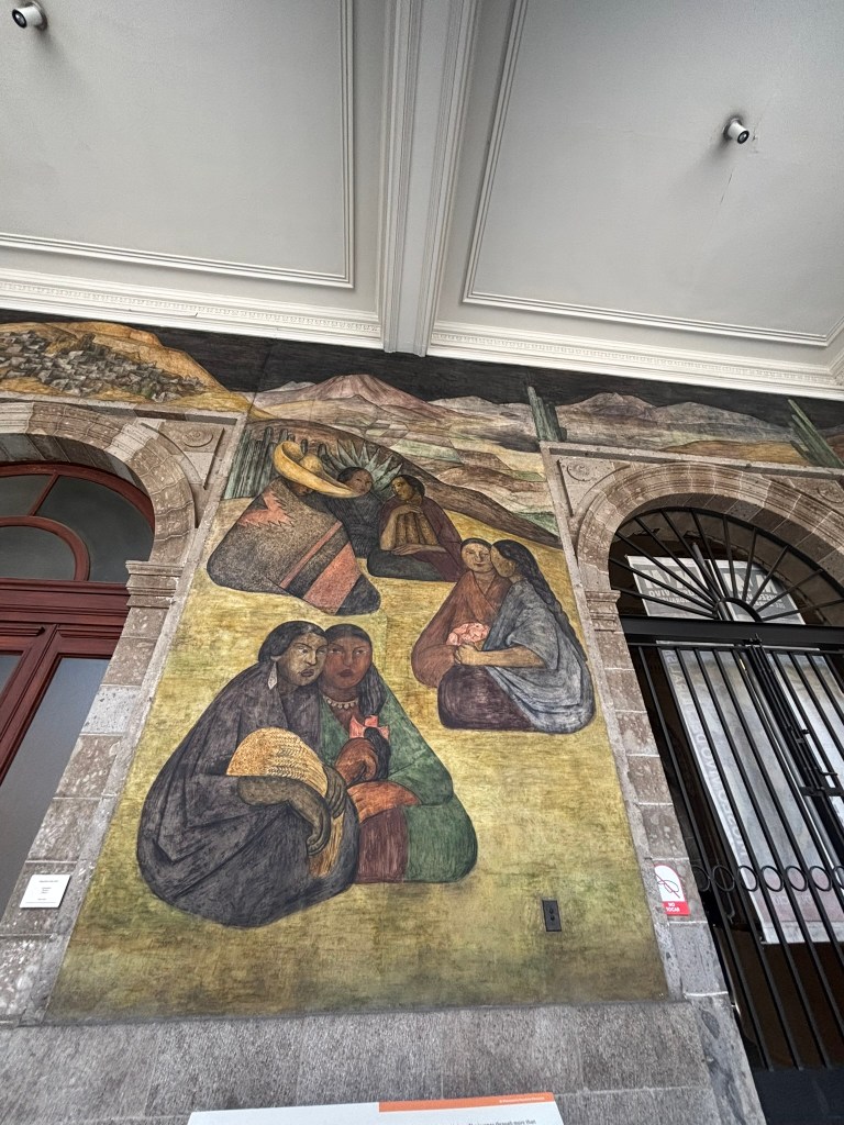
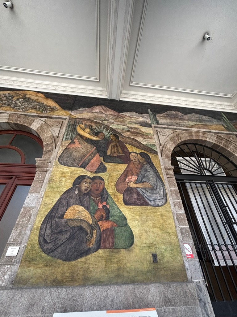
Tehuantepec Women (Mujeres tehuantepecas)

  • Where to Find It: On the ground floor of the Court of Labor corridor, along the south wall.
  • What It Shows: This panel honors the Indigenous Zapotec women (Tehuanas) from the Isthmus of Tehuantepec in Oaxaca, Mexico. Two women sit prominently in the foreground; one cradles a woven straw basket, while the other holds a bright flower. Behind them, other community members sit against a backdrop of rolling, arid hills and tall cacti. Diego Rivera used this composition to celebrate the dignity, strength, and traditional clothing of Mexicoโ€™s southern Indigenous cultures, turning everyday regional life into monumental public art. We can also see the influence of Pablo Picasso’s cubism in this mural

Leaving the Mine (Salida de la mina)

  • Where to Find It: On the ground floor of the Court of Labor, sitting directly adjacent to the Entrada a la mina (Entry into the Mine) panel.
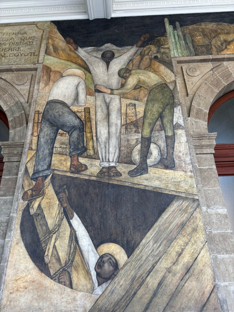
  • What It Shows: This powerful fresco exposes the harsh exploitation of the Mexican working class by foreign corporate interests. It depicts a miner standing on a wooden platform at the end of his grueling shift, holding his hands out to be searched by an armed guard to ensure no silver ore is being stolen. Rivera intentionally painted the miner in an open, Christ-like crucifixion pose to frame the laborer as a tragic martyr sacrificing his body for industrial greed, while the dark mine opening below resembles a gaping maw demanding human sacrifice. Pablo Picaso’s cubism in this mural.

Tehuana Women with Fruit (Mujeres tehuantepecas)

Where to Find It: On the ground floor of the Court of Labor, forming a thematic pair with the first Oaxacan-themed mural.
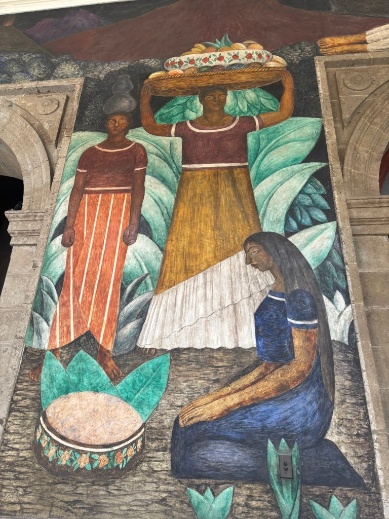
What It Shows: This panel focuses on the agricultural abundance and physical grace of the women of Tehuantepec. A central woman stands tall and proud, balancing a massive woven basket overflowing with tropical fruitsโ€”including pineapples, melons, and bananasโ€”directly on her head. To her left, another woman balances a clay water jug on her shoulder, while a third woman kneels in the foreground beside a traditional painted gourd vessel resting on vibrant green banana leaves, illustrating the rich bounty of Mexico’s tropical south.

The Sugar Mill (El trapiche)

Where to Find It: On the ground floor of the Court of Labor along the north wall of the building.
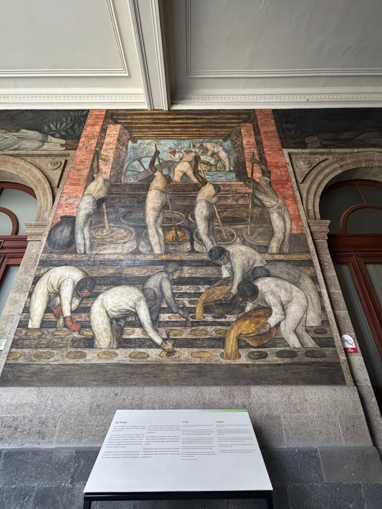
What It Means: This stark, geometric mural critiques the physical toll of agro-industrial processing by documenting the grueling, repetitive grind of workers refining sugarcane. The composition is divided into two rhythmic rows: the top tier shows four laborers using long poles to stir boiling vats of raw cane juice beneath a heavy wooden milling wheel, while the bottom tier depicts five workers hunched completely in half to pour molten golden syrup into small, circular floor molds to solidify into piloncillo. Rivera deliberately rendered the figures as anonymous, uniform cogs dressed in identical white cotton garments to illustrate how modern corporate machinery transforms individual human beings into a collective production line, functioning as a powerful visual twin to his nearby silver mining panels

The Dyers (Los tintoreros)

What It Means: This vibrant fresco honors pre-industrial, Indigenous economic traditions by detailing three textile artisans processing fabrics with natural pigments in the tropical, southern region of Tehuantepec, Oaxaca. In the foreground, two men bend deeply over massive, dark ceramic boiling vats to saturate fabrics in rich indigo dyes, while a woman to the right carefully hangs a wet, dark blue textile to dry on a clothesline strung between trees against a background of rolling hills and thatched-roof huts. Diego Rivera purposely placed these historic artisan trades on the same monumental scale as heavy industrial mining to send a clear political message: the masterful craftsmanship of rural Indigenous communities is just as vital and heroic to the foundation of modern Mexico as modern factory labor.

Where to Find It: On the ground floor of the Court of Labor along the south wall of the main headquarters.

The Courtyard of Fiestas (Patio de las Fiestas)

The Courtyard of Fiestas (Patio de las Fiestas) contrasts the hardships of labor by celebrating the vibrant spiritual, seasonal, and communal traditions that bind the Mexican identity together. Through crowded, dynamic scenes like The Day of the Dead and The Maize Festival, the murals capture the chaotic energy, music, and colorful pageantry of traditional street celebrations. Diego Rivera and his contemporaries modeled these festivalgoers after monumental pre-Columbian sculptures, visually anchoring the idea that indigenous rituals and community joy are deeply rooted in the nation’s history.

La Zandunga

Where to Find It: On the ground floor of the Court of Fiesta along the south wall of the building.

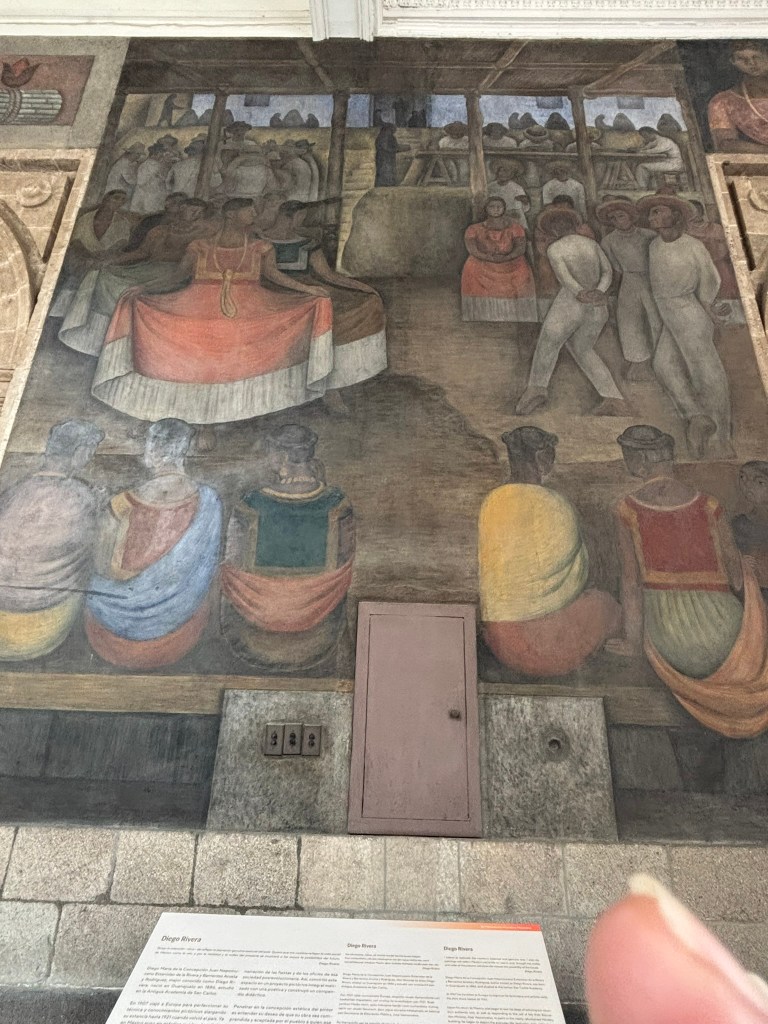
What It Means: This vibrant, culturally rich mural celebrates the resilient regional traditions and indigenous pride of southern Mexico by documenting the lively festive spirit of the Isthmus of Tehuantepec. The composition is divided into a deep, tiered gathering space: the central focus highlights a group of elegant Tehuana women in their iconic flowing, wide-brimmed skirts performing alongside male partners in traditional white garments, while the foreground depicts a row of seated onlookers watching the scene from below with reverent attention. Rivera deliberately organized this section of the courtyard geographically to honor rural culture, rendering the collective celebration as an assertion of communal solidarity and a powerful visual testament to post-revolutionary Mexican identity.

The Market (El mercado)

Where to Find It: On the ground floor of the Court of Fiestas along the north wall of the building.

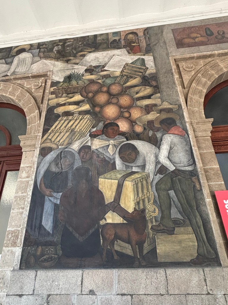
What It Means: This bustling, dense mural celebrates the foundational role of indigenous commerce and agrarian production by documenting a traditional open-air tianguis market. The composition is built on a heavily crowded, layered vertical arrangement: the upper sections feature baskets overflowing with pineapples, maize, and stacks of regional produce beneath rows of broad-brimmed straw hats, while the central foreground zooms in on a family arranging a large wooden slat crate secured with woven straps, alongside a loyal hairless Xoloitzcuintli dog. Rivera deliberately used this space to pivot away from industrialized, foreign-owned factories, rendering this sensory marketplace as an alternative center of economic autonomy, communal unity, and authentic pre-Hispanic mexicanidad that sustained rural Mexican societies across generations

The Little Bull (El torito) by Amado de la Cueva

Where to Find It: On the ground floor of the Court of Fiestas along the north wall of the building.

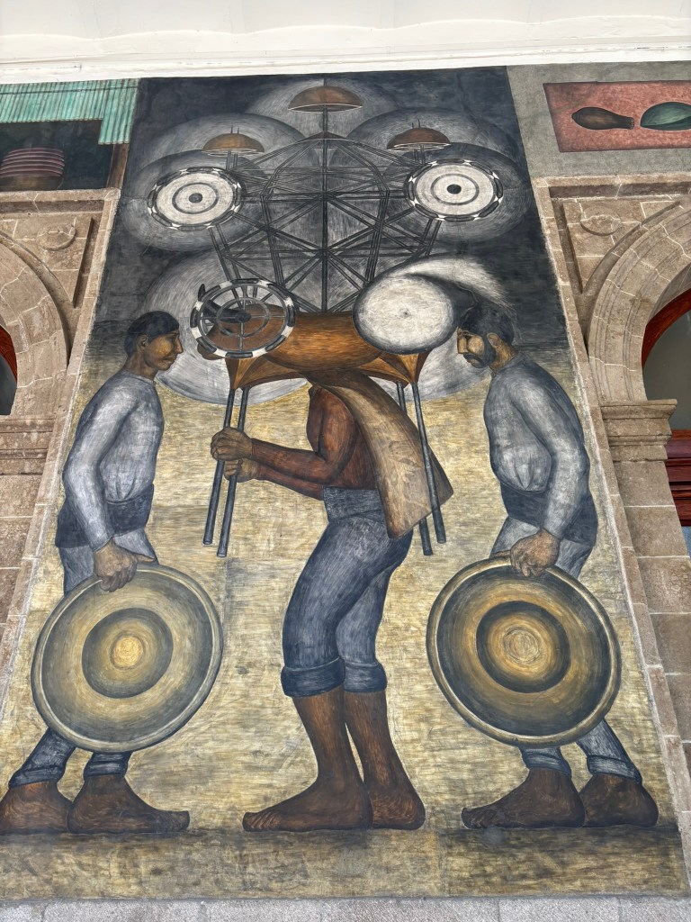
What It Means: This hypnotic, dynamically geometric mural celebrates the vibrant ephemerality of Mexican festive folklore by documenting the traditional pyrotechnic custom of el torito (the little bull). The composition is constructed around a towering, symmetric mechanical armature: the upper background features an intricate network of metal frameworks holding sparking Catherine wheels and exploding firework pinwheels against a dark night sky, while the central focal point highlights a brave bearer lifting the heavy, bull-shaped wicker framing over his head as two flanking figures shield themselves with large circular wooden targets. Amado de la Cuevaโ€”one of the few early muralists commissioned to contribute alongside Rivera’s vast projectโ€”deliberately focused on the raw, explosive energy of communal celebrations, rendering this dangerous folk performance as an assertion of ancestral memory, popular ingenuity, and the fiery spirit of post-revolutionary community bonding.

Ribbon Dance (La danza de los listones)

Where to Find It: On the ground floor of the Court of Fiestas along the north wall of the building.

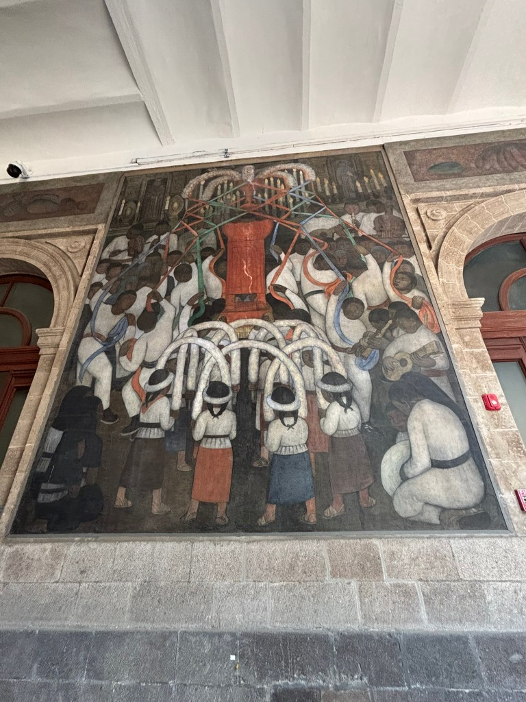
What It Means: This vibrant, ritualistic mural celebrates agricultural fertility and communal harmony by documenting the festive symbiosis of nature and traditional folklore. The composition is constructed around a soaring, layered ceremonial arrangement: the upper section centers on a tall, radiant orange Maypole radiating colorful ribbons like solar rays, held aloft by dynamic lines of workers weaving beneath it, while the foreground showcases young dancers holding curved, floral-wrapped archways aloft in perfect rhythmic unison. Rivera deliberately fused two distinct regional traditionsโ€”the dance of the ribbons (listones) and the dance of the arches (arcos)โ€”to represent humanity’s ancestral desire to integrate with natural cycles, rendering this synchronized performance as a profound statement of social unity, mutual respect, and post-revolutionary collective pride.

The Day of the Dead โ€“ The Street (El Dรญa de Muertos โ€“ La calle)

Where to Find It: On the ground floor of the Court of Fiestas along the east wall of the building.

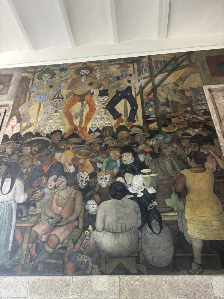
What It Means: This complex, deeply satirical mural explores the socio-political undercurrents of Mexican society by documenting the public celebrations of the Day of the Dead. The composition is built on a layered, contrasting arrangement: the upper register features a mariachi band of skeletal calaveras playing guitars beneath crossbones, while the dense, claustrophobic foreground gathers a cross-section of Mexican society including working-class laborers, indigenous children wearing skull masks, and wealthy, caricatured bourgeoisie figures indulging in food and drink. Rivera deliberately used this iconic festival as a great equalizer, weaving a sharp critique of post-revolutionary class divisions to show how death unites all strata of society, rendering this popular urban gathering as a profound statement on social justice, cultural resilience, and the unique Mexican philosophy toward mortality.

The Top Floor (The Political Manifesto)

Walk up the stone staircases to the highest level. Here, Rivera illustrated revolutionary folk songs. Look closely at the facesโ€”Rivera painted his famous wife, Frida Kahlo, into the mural The Insurrection, depicting her as a fierce revolutionary handing out weapons to soldiers. I didn’t get a chance to go upstairs on this trip, but I’m hoping to go back and see more on my next trip to Mexico City.


Essential Travel Logistics

Where Is It?

The building is located at Repรบblica de Argentina 28 in the Historic Center (Centro Histรณrico). It is a quick 5-minute walk northeast of the Zรณcalo or the Metropolitan Cathedral.

How to Get In (The Security Process)

Because it is a working government office, getting in requires a minor security check:

  • Bring a physical ID: You must present a valid passport or driver’s license to the armed guards at the gate. Digital copies on your phone will not work.
  • The Exchange: Security will keep your ID at the front desk and give you a plastic visitor’s badge. You will swap the badge back for your ID when you leave.
  • Cost: Entrance is completely free.

The Ultimate Monday Travel Hack

Almost every major museum in Mexico Cityโ€”including the Anthropology Museum, Frida Kahloโ€™s Blue House, and Bellas Artesโ€”is closed on Mondays. The SEP murals are open on Mondays.

  • Hours: Monday, and Wednesday through Sunday from 10:00 AM to 5:30 PM.
  • Weekly Closure: The building is closed on Tuesdays.

Quick Tips for Your Visit

  • Look up at the stairwells: Rivera didn’t just paint the courtyard walls; the main stairwell features sweeping landscapes of Mexico’s tropical regions.
  • Accessibility note: The ground floor courtyards are flat and easy to navigate, but the historic elevators to the upper floors are often restricted for official use only.
  • Guide: It is good to have a guide with you to explain the different murals. I went with City Unscripted, booked through Viator as a private tour

Where to find other murals of Diego Rivera

To truly grasp the complex, layered soul of Mexican history, traveling through Diego Riveraโ€™s monumental murals is an absolute necessity. Across his massive frescoes, Rivera transformed public walls into living history books, weaving together thousands of years of indigenous resilience, the trauma of the Conquest, and the fiery triumphs of the Revolution into a singular, breathtaking narrative. I didn’t get to see all of his murals on this trip, but hoping the cover more next time I am in Mexico

Downtown (Centro Histรณrico)

  • Palacio Nacional (National Palace): Located on the main Zรณcalo plaza, the grand stairwell houses his masterpiece, “The History of Mexico” (Epopeya del pueblo mexicano). Spanning three massive walls, it chronicles thousands of years of Mexican history from pre-Hispanic Mesoamerica through the Conquest and Revolution.
  • Note: Entry usually requires booking a free guided tour and presenting an official government ID/passport. You need to stand in line early to get the tickets to enter the parliament building
  • Palacio de Bellas Artes (Palace of Fine Arts): Located on the edge of Alameda Central, the top floors host “Man, Controller of the Universe” (El hombre controlador del universo). This is Rivera’s meticulous recreation of the infamous Man at the Crossroads fresco, commissioned by the Rockefeller family in New York and subsequently destroyed for its inclusion of Vladimir Lenin.
  • Museo Mural Diego Rivera: This dedicated museum was built specifically to house just one breathtaking masterpiece: “Dream of a Sunday Afternoon in the Alameda Central” (Sueรฑo de una tarde dominical en la Alameda Central). The 15-meter fresco acts as a surreal timeline of Mexican history featuring iconic historical figures, a self-portrait of Rivera as a child, Frida Kahlo, and the elegant skeleton La Catrina.
  • Antiguo Colegio de San Ildefonso: Considered the cradle of the Mexican Muralism movement, the Amphitheater Simรณn Bolรญvar inside this former college houses Rivera’s very first mural, “Creation” (La creaciรณn, 1922). It features a unique blend of religious symbolism and Greek muses painted before he fully adopted his signature revolutionary, indigenous style.
  • Mercado Abelardo L. Rodrรญguez: A bustling public market where Rivera’s students painted expansive social-realist scenes under his direct supervision.
  • Cรกrcamo de Dolores (Dolores Waterworks): Located in the second section of Chapultepec Park, this unique indoor-outdoor installation features the mural “Water, the Source of Life” (Agua, el origen de la vida). Painted entirely inside a deep-water basin, it is paired with a massive outdoor tiled mosaic fountain of the Aztec rain god, Tlaloc.
  • Teatro de los Insurgentes: Located along Avenida de los Insurgentes Sur, the entire facade of this mid-century theater features a massive, 46-meter long glass mosaic mural designed by Rivera. It chronicles the History of Theater in Mexico and centers around a prominent portrait of the iconic Mexican comic actor, Cantinflas.
  • Estadio Olรญmpico Universitario (UNAM): The main exterior wall of the university’s Olympic stadium features a relief mural made from colorful natural stones titled “The University, the Family and Sport in Mexico”.
  • Anahuacalli Museum: Designed by Rivera himself out of dark volcanic stone to hold his massive collection of pre-Columbian artifacts, the museum also showcases several of his early sketches, drafts, and layout designs for his most famous murals.

Final thoughts on Diego Rivera and his art

Standing before the monumental murals of Mexico City, it is incredibly easy to experience a sharp tug-of-war between loving the art and disliking the man behind the brush. It is a well-documented sentiment that my tour guide settled perfectly: like any monumental artist, Diego Rivera had layers. While it is easy to condemn his tumultuous personal life and legendary infidelity, digging into his history reveals an artist deeply shaped by early psychological fracturing. Being raised by his indigenous Tarascan nanny, Antonia, after experiencing emotional abandonment by his mother, instilled in him a profound reverence for native women that radiates from his vibrant canvases, even as it manifested as a deep-seated resentment and disrespect toward white women later in life. This stark emotional contrast breathes an uncomfortable, human reality into his masterpieces. You don’t have to excuse Rivera’s personal flaws to be deeply moved by his work; instead, understanding the childhood traumas that molded his brushstrokes allows you to appreciate how a deeply broken man could still elevate Mexico’s indigenous working class to an unrivaled peak of artistic dignity.

Layers of History: Why Templo Mayor is the Most Mind-Blowing Stop in Mexico City

Imagine walking down a busy street in modern Mexico City and discovering the heart of the Aztec Empire. Visiting the Templo Mayor is more than stop in Zocalo. itโ€™s a trip through history, myths, and amazing archaeological finds. As you get closer to the ruins, the tall buildings and detailed carvings tell stories from long ago, highlighting a civilization that honored many gods and held important ceremonies.

As you explore, you might feel a deep respect for the spirits of ancestors watching over the ruins. The Templo Mayor reminds us of the richness and complexity of Mesoamerican cultures, sparking curiosity that goes beyond time and place. You leave not just with a greater appreciation for Mexico Cityโ€™s history, but with a better understanding of how the past influences todayโ€™s lively culture.

  1. ๐Ÿ›๏ธ Practical Guide for Your Visit
  2. From Imperial Capital to Hidden Ruins
  3. The Electric Discovery That Changed Everything
  4. Visualizing the Ancient Valley
  5. A Metropolis Built on Water
  6. Recreating the Sacred Precinct
  7. Stepping Onto the Sacred Grounds
  8. What to Expect When You Visit Today
  9. ๐ŸŒŸ The Verdict: Why It Can’t Be Missed

๐Ÿ›๏ธ Practical Guide for Your Visit

To ensure your journey into the Aztec past goes seamlessly, keep these essential travel details in mind:

  • Location: Right in the heart of the Centro Histรณrico, located at Seminario 8, immediately northeast of the Zรณcalo main plaza and right next to the Metropolitan Cathedral.
  • How to Get There: Take the Mexico City Metro Line 2 directly to the Zรณcalo/Tenochtitlan station. The museum entrance is just a brief walk from the exit.
  • Hours: Open Tuesday through Sunday from 9:00 AM to 5:00 PM. The site is strictly closed on Mondays.
  • Admission Fees: General entry is 95 MXN (approximately $5.50 USD), which grants access to both the open-air ruins and the indoor museum rooms. It is completely free for children under 13, students, teachers, and senior citizens with valid IDs.
  • Pro-Travel Tip: Avoid visiting on Sundays if you want to dodge massive crowds; Sunday is the free admission day for Mexican residents and expats.
  • Security & Baggage: You must clear a security checkpoint upon entry. Large bags, backpacks, food, and water bottles are not allowed into the exhibition areas. You can use the museum’s secure on-site baggage locker service for free to hold your items while you tour.
  • What to Wear: The first half of the tour takes place completely outdoors on elevated metal and wood boardwalks. Wear comfortable walking shoes, a hat, and sunscreen, as there is very little shade over the ruins before you enter the air-conditioned museum.

From Imperial Capital to Hidden Ruins

In 1325, the Mexica (Aztec) people founded their capital, Tenochtitlan, on an island in the middle of Lake Texcoco (Now Mexico City). At its center stood the Templo Mayorโ€”the literal and spiritual core of their universe.

After the Spanish Conquest in 1521, the temple was destroyed. The conquistadors used its monumental stones to build the massive Metropolitan Cathedral that still stands next to the site today. For centuries, the remains of the Aztec empire lay completely buried and forgotten beneath the growing capital of New Spain.

The Electric Discovery That Changed Everything

The temple stayed hidden until 1978, when a crew of electrical workers digging near the city’s main plaza struck something hard. It was a massive, finely carved stone monolith depicting the dismembered goddess Coyolxauhqui (Bells-Her-Cheeks). Finding the monument pinpointed the exact, long-lost location of the Templo Mayor, the main religious and political center of the Aztec capital, Tenochtitlan. This discovery subsequently launched one of Mexico’s largest and most significant archaeological excavation projects.

According to myth, her brotherโ€”the patron god Huitzilopochtliโ€”killed her when she attempted to assassinate their mother. This single, accidental discovery sparked a massive excavation, revealing that the grand Aztec temple was waiting just beneath the pavement.

Today, visitors can view the original monolith at the on-site Museo del Templo Mayor, which stands immediately adjacent to the open-air archaeological ruins where it was first found

Visualizing the Ancient Valley

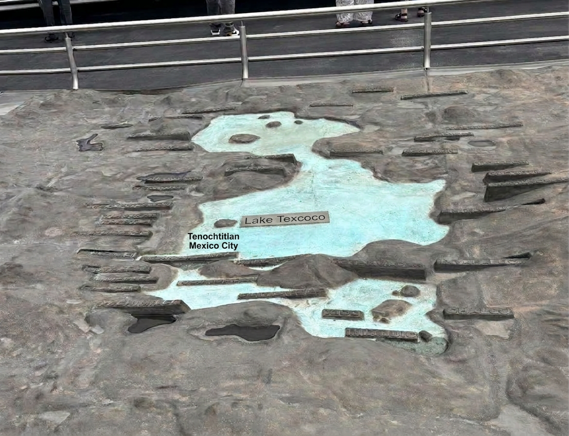
Before you even step into the ruins, your visit begins with an incredible perspective shift. Out on the viewing platforms, you will encounter a large topographical scale model that recreates the ancient Valley of Mexico and Mexico City.

The model highlights the vast turquoise expanse of the historical Lake Texcoco system, contrasting sharply against the surrounding mountainous terrain. Looking at this map, you can clearly see how Tenochtitlan was meticulously engineered right out of the water, connected to the mainland only by narrow causeways. It serves as a powerful visual reminder of how drastically this geography has changed to become the concrete metropolis you are standing in today.

A Metropolis Built on Water

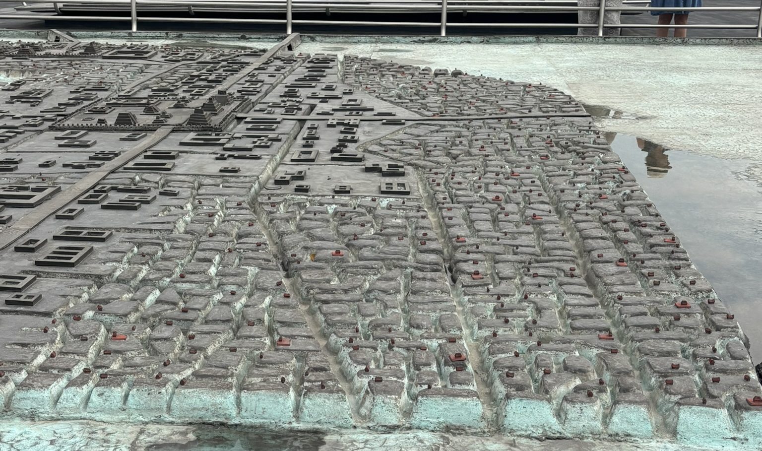
Getting a closer look at the city layout on the scale model reveals the sheer brilliance of Aztec urban planning. The city wasn’t just a random cluster of buildings; it was a highly organized, dense grid of residential neighborhoods (calpullis) stretching across the water.

In this detailed view, you can see how the streets were a combination of packed earth walkways and turquoise water canals. These canals acted as the main highways of Tenochtitlan, allowing thousands of canoes to navigate daily between homes, markets, and agricultural plots. Standing there and comparing this highly advanced Venice-like water city to the modern traffic of Mexico City is an unforgettable experience.

What Happened to the Lakes?

  • Spanish Siege (1521): Conquistadors intentionally destroyed Aztec floodgates and filled canals with debris to build standard European roads.
  • The Great Drainage (1607โ€“1900s): To stop catastrophic colonial flooding, engineers built massive tunnels to permanently divert water out of the mountain valley.
  • The Concrete Overhaul: By the mid-20th century, the final lakebeds were completely drained to pave the way for urban mega-expansion.

The Sinking Modern Legacy
Because modern Mexico City sits on this soft, empty clay lakebed, the historic center is actively sinkingโ€”dropping up to 10 meters (33 feet) over the past century!

Where to See the Canals Today

  • Destination: Xochimilco (Southern Mexico City)
  • What it is: The last remaining UNESCO-protected network of original Aztec canals and chinampas (floating gardens).
  • The Experience: Rent a vibrant, flat-bottomed wooden boat called a trajinera to cruise the historic waterways.

Recreating the Sacred Precinct

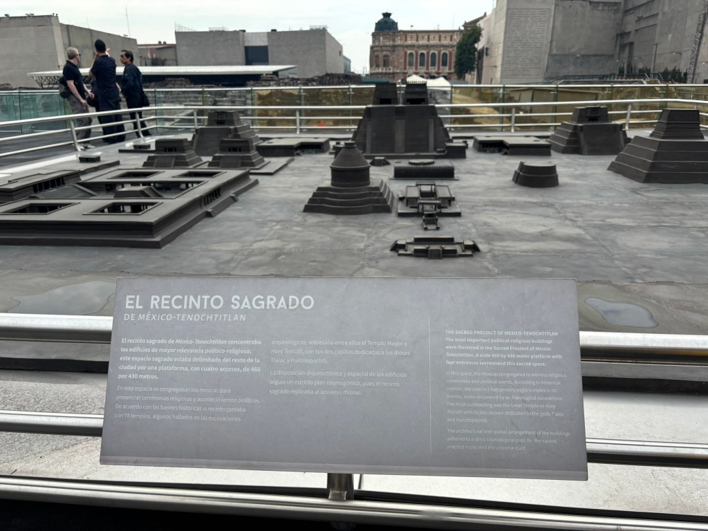
As you continue along the outdoor walkways, you will come across another fascinating display: a detailed architectural model of the Sacred Precinct (El Recinto Sagrado). This dark, geometric miniature brings the core of the ancient city to life right before your eyes.

Historical sources note that this entire sacred space was an immense 460 by 430-meter platform enclosed from the rest of the city, featuring four main entrances. The precinct held around 78 temples and religious structures, laid out according to a strict cosmological plan meant to replicate the universe itself. Towering over the model is the main Templo Mayor (Huey Teocalli), crowned by its distinctive twin shrines dedicated to the rain god, Tlaloc, and the patron war god, Huitzilopochtli.

Stepping Onto the Sacred Grounds

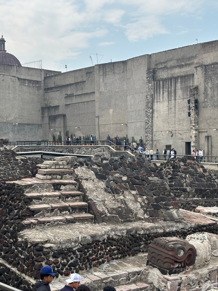
Moving past the models, you finally step onto the raised walkways directly over the excavated ruins. The physical reality of the site is breathtaking. You are confronted with steep, layered stone staircases built primarily out of dark, porous reddish-black tezontle (volcanic rock) and covered in stucco.

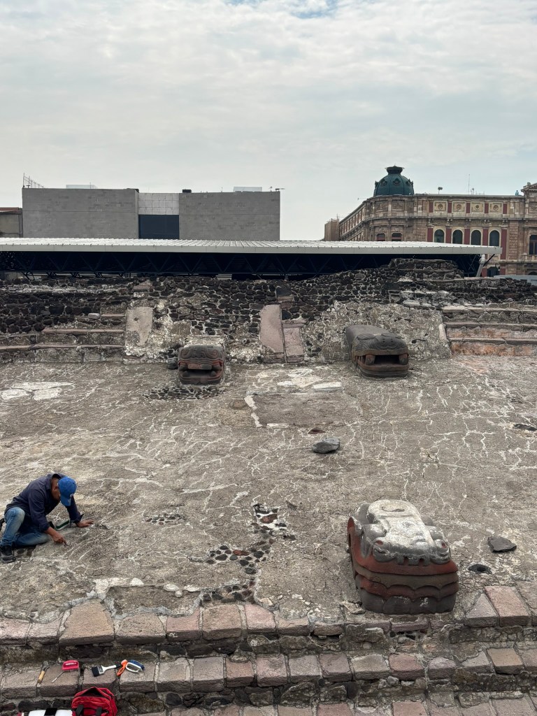
Guarding the base of these ancient structures are massive, masterfully carved stone serpent heads. In Mexica culture, serpents were deeply sacred, representing the earth, fertility, and the heavens. Seeing these formidable carvings resting exactly where Aztec priests once stoodโ€”juxtaposed against the towering concrete walls and colonial domes of modern Mexico City right behind themโ€”is a surreal visual clash of two entirely different worlds.

Serpent imagery was central to Aztec spirituality, but it triggered immediate, severe friction with the Spanish due to deep cultural misunderstandings.

The Christian Association with Satan

In Christian theology and the Bible, the serpent is the ultimate symbol of evil, deception, and Satan (tempting Eve in the Garden of Eden). When the Spanish arrived in Tenochtitlan and saw massive stone carvings of feathered and fire serpents adorning every temple wall and staircase, they did not see art or cultural symbols; they believed they had walked into a kingdom openly worshipping the Devil

What to Expect When You Visit Today

Today, you can walk directly through the open-air archaeological zone on raised platforms, viewing the surviving foundations of the temple layers.

Right next to the ruins is the onsite Templo Mayor Museum. It is packed with exquisitely crafted objects found during the excavations, including shell mosaics, monumental stone sculptures, and colorful ceramics.

The crown jewel of the collection is the recent discovery of the Tlaltecuhtli monolith. This earth deity carving is the largest Mexica monolith ever found, and seeing its scale in person is worth the trip alone.

๐ŸŒŸ The Verdict: Why It Can’t Be Missed

Templo Mayor is a striking reminder that history is never truly erasedโ€”it simply waits beneath the surface. Walking through this active archaeological wonder, sandwiched between a centuries-old Spanish cathedral and a bustling modern capital, offers a humbling perspective on the passage of time. It is a rare chance to look directly down into the bedrock of Mexican identity and witness history being reclaimed, one volcanic stone at beveled stone. If you want to understand the true, raw soul of Mexico City, your journey has to begin right here at its ancient core.


Standing on Sacred Ruins: Inside the Mexico City Metropolitan Cathedral

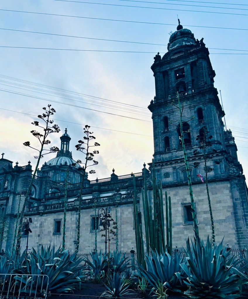
Rising like a stone titan over the northern edge of the historic Zรณcalo, the Mexico City Metropolitan Cathedral (Catedral Metropolitana) is not just an architectural marvelโ€”it is the raw, beating heart of Mexican history. As the oldest and largest cathedral in Latin America, it has towering twin bell towers and a massive stone facade that has borne witness to nearly five centuries of conquest, rebellion, and spiritual devotion. To step through its heavy wooden doors is to walk through a literal timeline of a nation in transition.

The Dark History: Recycled Aztec Stones

The cathedral is a physical manifestation of Spanish colonial imposition. Following the fall of Tenochtitlan, Spanish conquistador Hernรกn Cortรฉs ordered the construction of a grand church to anchor the new colonial capital. Built between 1573 and 1813, the cathedral was deliberately erected directly atop the sacred Aztec precinct adjacent to the Templo Mayor.

To hammer home the spiritual conquest, the Spanish pulled down the surrounding Aztec pyramids, utilizing those exact, hand-carved ancient stone blocks to lay the cathedral’s massive foundations. If you look closely at some of the older exterior walls today, you are looking at the very stones that once formed the temples of Aztec gods.

Because construction spanned nearly 250 years, the building serves as a living museum of architectural evolution. It is a stunning crossroad of styles, shifting seamlessly from its deep Gothic foundations into heavily ornate Baroque facades, and finally culminating in a majestic Neoclassical dome designed by renowned architect Manuel Tolsรก.

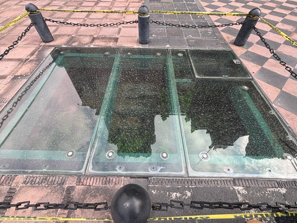
Windows into the past: Glass panels embedded in the stone plaza outside the Metropolitan Cathedral reveal the original Aztec foundations lying directly beneath the building. It is a stunning visual reminder of the literal layers of history making up the heart of Mexico City.

Practical Information for Visitors

Planning a visit to the spiritual heart of Centro Histรณrico is straightforward, but a few local tips will make your experience seamless:

  • Getting There: Take the Metro Blue Line directly to the Zรณcalo station. The cathedral sits right outside the station exit gates on the main plaza.
  • Hours: Open daily from 9:00 AM to 5:30 PM.
  • Admission: Entry to the main nave and side chapels is entirely free. However, checking out the rooftop views or taking a guided bell tower tour requires a small ticket fee paid inside (approx. $100 MXN / $6 USD).
  • Visitor Rules: Non-flash photography is fully permitted for personal use. Because it remains an active house of worship, dress respectfully (avoid overly revealing clothing) and maintain a quiet demeanor during ongoing religious service

The Exterior Architecture and Towering Facades

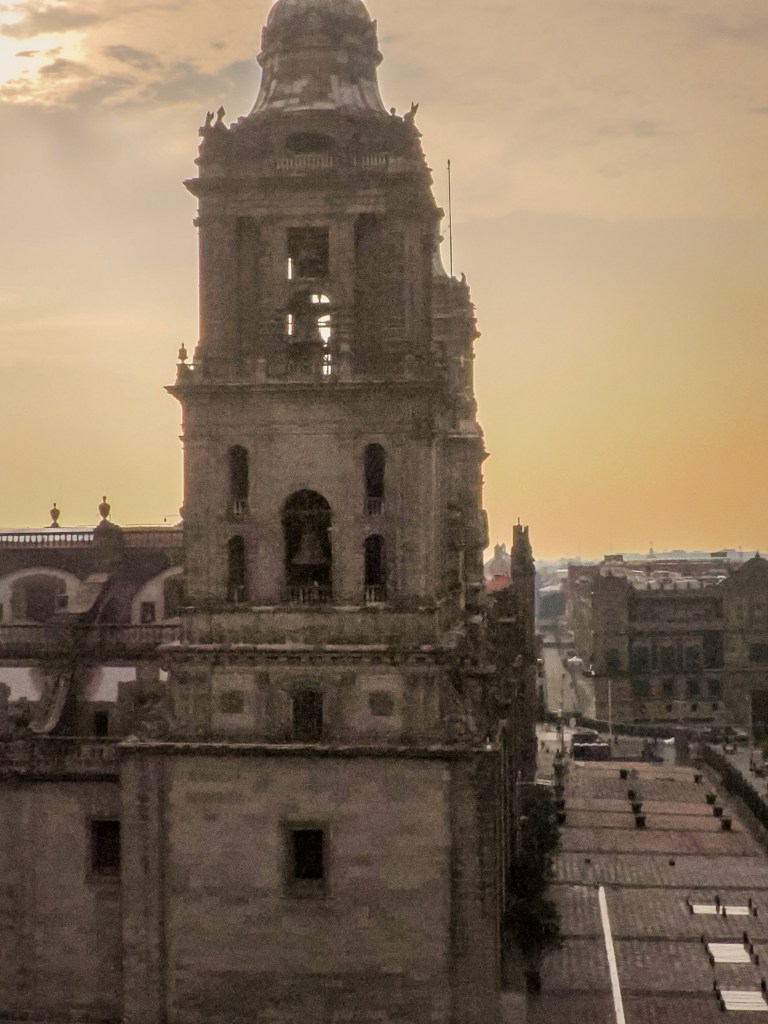
When viewed from the open expanse of the Zรณcalo, the cathedral’s exterior presents a block-wide stone tapestry that dominates the city’s northern horizon. The primary visual anchor of this massive facade is the pair of towering twin bell towers, which soar nearly 220 feet (67 meters) into the sky. Designed in a restrained Neoclassical style by architect Manuel Tolsรก, these multi-tiered gray limestone structures feature stately columns, rhythmic arches, and distinct, bell-shaped caps topped with stone spheres.

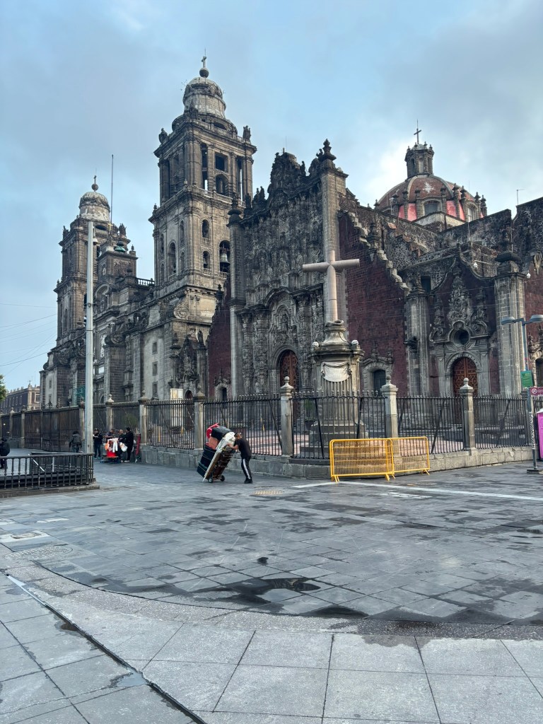
Housed within these open-air belfries are more than 30 historic bronze bellsโ€”including the massive, 13-ton Santa Marรญa de la Guadalupeโ€”which have rung out over the valley for centuries. These solid, geometric towers stand in sharp, dramatic contrast to the attached Sagrario Metropolitano (Metropolitan Tabernacle) directly to the right. While the main cathedral is wrapped in smooth, gray limestone, the tabernacleโ€™s exterior walls are built from a porous, deep-red volcanic rock called tezontle, acting as a vibrant canvas for the central portal’s dizzying, hyper-intricate white limestone (chiluca) carvings. Framed by highly decorated estรญpite columns (inverted, tapered pyramids) and heavy, relief-carved wooden doors, this Ultra-Baroque facade mimics a magnificent church altarpiece brought outdoors, rising majestically above a geometric, checkerboard-paved stone courtyard.


The View from Above

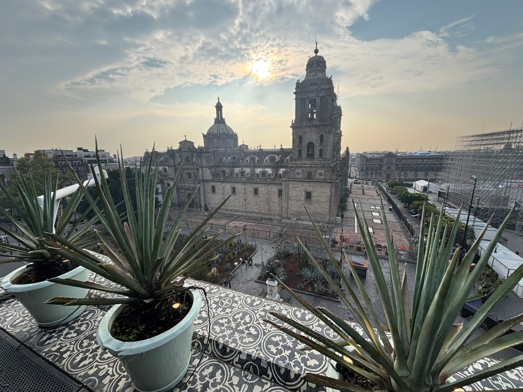
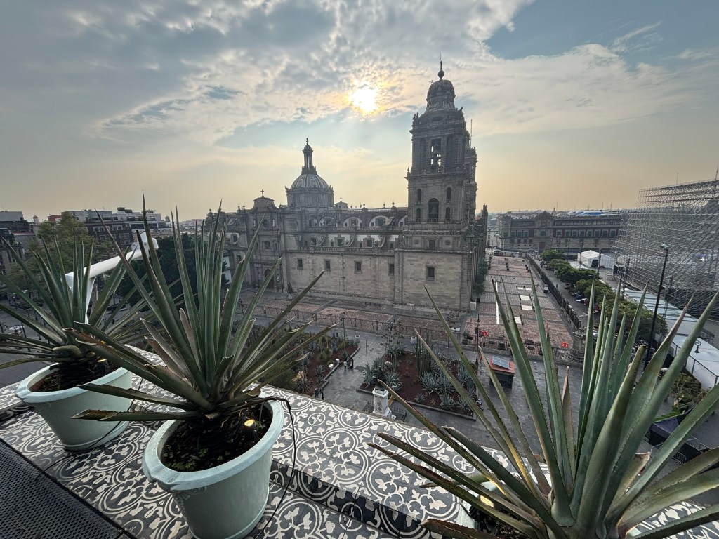
Ascending to a nearby rooftop terrace reveals an entirely different, three-dimensional world. From above, the rigid flat lines of the plaza disappear, replaced by a sweeping landscape of Manuel Tolsรก’s grand Neoclassical dome capped with a lantern. Looking down from a birds-eye vantage point, framed beautifully by potted agaves and native organ pipe cacti, the cathedral transforms into an intricate maze of rolling stone vaults, ornate lanterns, and balustrades. I took the photo from the rooftop restaurant at Hotel Zocalo Central.

๐Ÿ›๏ธ What to See from the Inside: Interior Highlights

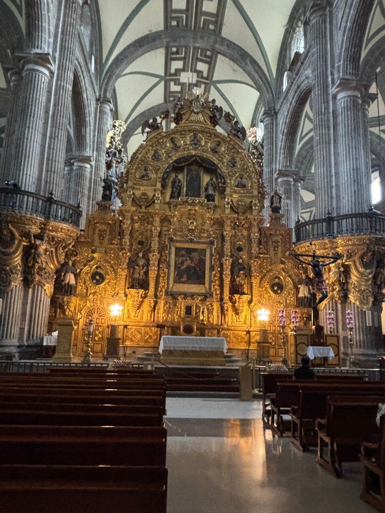
The interior of the cathedral is a soaring, cavernous expanse of stone, wood, and gold. As you wander down the monumental central nave, make sure to seek out these essential features:

The Altar of Forgiveness (Altar de Perdรณn)

Positioned right inside the central entrance doors, this beautifully carved altar greets visitors immediately. It features an immense gold-leaf altarpiece and houses a dark-colored crucifix called Seรฑor del Veneno (Lord of the Poison). Local folklore claims the crucifix miraculously turned pitch-black after absorbing a lethal dose of poison from the lips of a holy clergyman targeted by an assassin.

The 14 Side Chapels

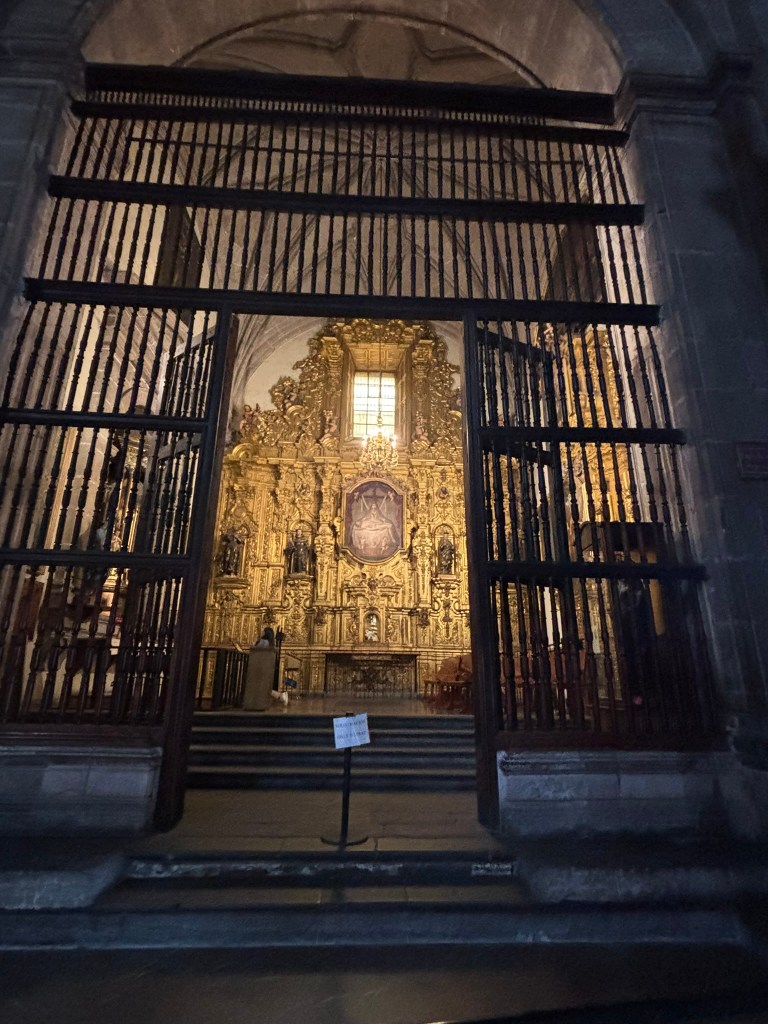
Flanking the monumental nave are 14 distinct chapels, each sponsored by colonial guilds and dedicated to different saints. Peering through their towering wrought-iron gates (rejas) reveals independent, gold-drenched sanctuaries filled with historic colonial retablos and religious iconography that function as private vaults of historical art.

The Vaulted Nave and Historic Organs

Walking down the central perimeter aisle reveals the building’s immense structural mastery. Massive fluted stone columns march down the length of the hall, rising up into soaring, elegant ribbed cross-vaults. Interspersed along the ceiling are grand circular domes that drop natural shafts of dramatic sunlight straight down onto the polished stone floor.

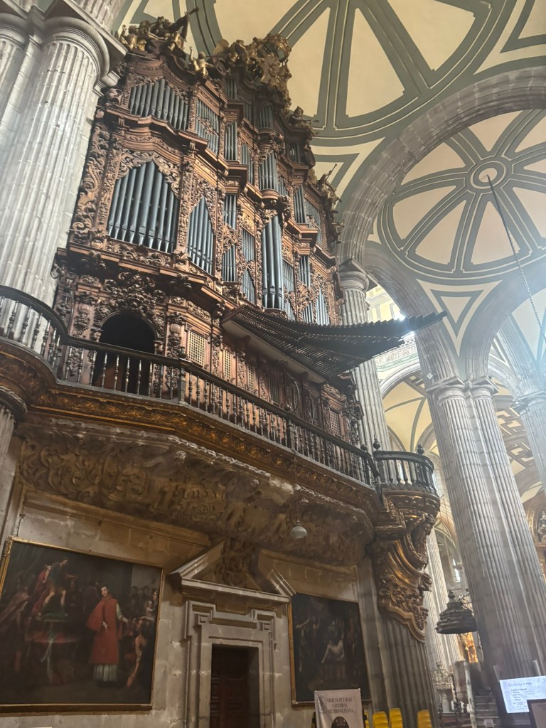
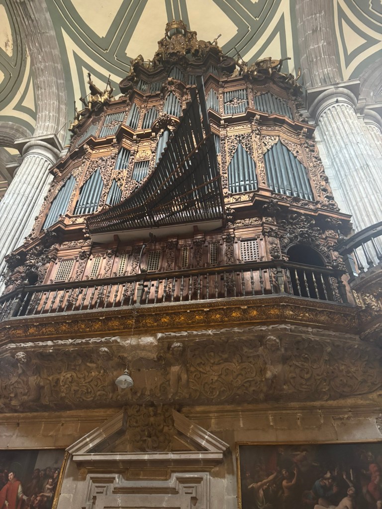
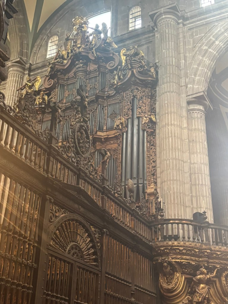
Mounted along the choir galleries stand the cathedral’s two legendary 18th-century pipe organs. These instruments are encased in heavily carved, gilded woodwork that erupts from the stone pillars, featuring a dramatic fan of horizontal trumpet pipes (trompeterรญa) designed to fire sound directly over the congregation.

Grandeur from within: Looking down the side aisle of the cathedralโ€™s interior. Soaring fluted stone columns branch out into elegant ribbed cross-vaults, while natural light streams down from the high dome windows to illuminate the historic pipe organs on the left.[IMAGE: CLOSE-UP OF THE SPANISH COLONIAL PIPE ORGAN]

A wall of sound: A close-up view of one of the cathedral’s historic 18th-century pipe organs. The intricate, gilded Baroque woodwork frames a dramatic fan of horizontal trumpet pipes projecting directly out into the grand stone nave.

The Sinking Foundation Pendulum

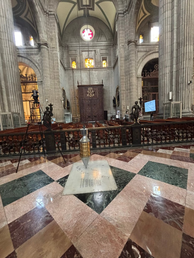
Look toward the center of the nave floor to find a fascinating modern additionโ€”a massive brass pendulum suspended by a long cable from the cathedral ceiling. Because the complex was constructed on the soft, clay-heavy lakebed of ancient Lake Texcoco, the colossal stone structures have spent centuries unevenly sinking into the earth. This pendulum was installed over a calibrated tracking diagram to chart the building’s shifting tilt in real time, serving as a testament to the massive engineering rescue projects of the late 20th century.

As your camera tilts upward to photograph the high vaulted ceilings, you will notice an intense structural network of massive steel cables stretching horizontally across the stone arches of the nave. These tension rods are a visible reminder of the cathedral’s fight against gravity and mud.
As you walk through the cathedral, you can also feel the ground sloping in one direction or the other. This is because different parts of the heavy stone structure began sinking at vastly different rates. The central nave began bowing outward, causing severe structural fracturing that threatened to split the roof down the middle.
During the historic 1990s engineering rescue project, engineers did not just stabilize the ground below using underpinning shafts; they also wrapped the cathedral’s upper skeleton in an invisible “corset.” These high-tensile steel cables were carefully bored through the massive stone columns and tensioned to literally pull the leaning walls back inward, locking the shifting arches together. For photographers, these stark, industrial steel lines provide a fascinating, raw contrast cutting directly through the historic 18th-century stone design.

The Altar of the Kings (Altar de los Reyes)

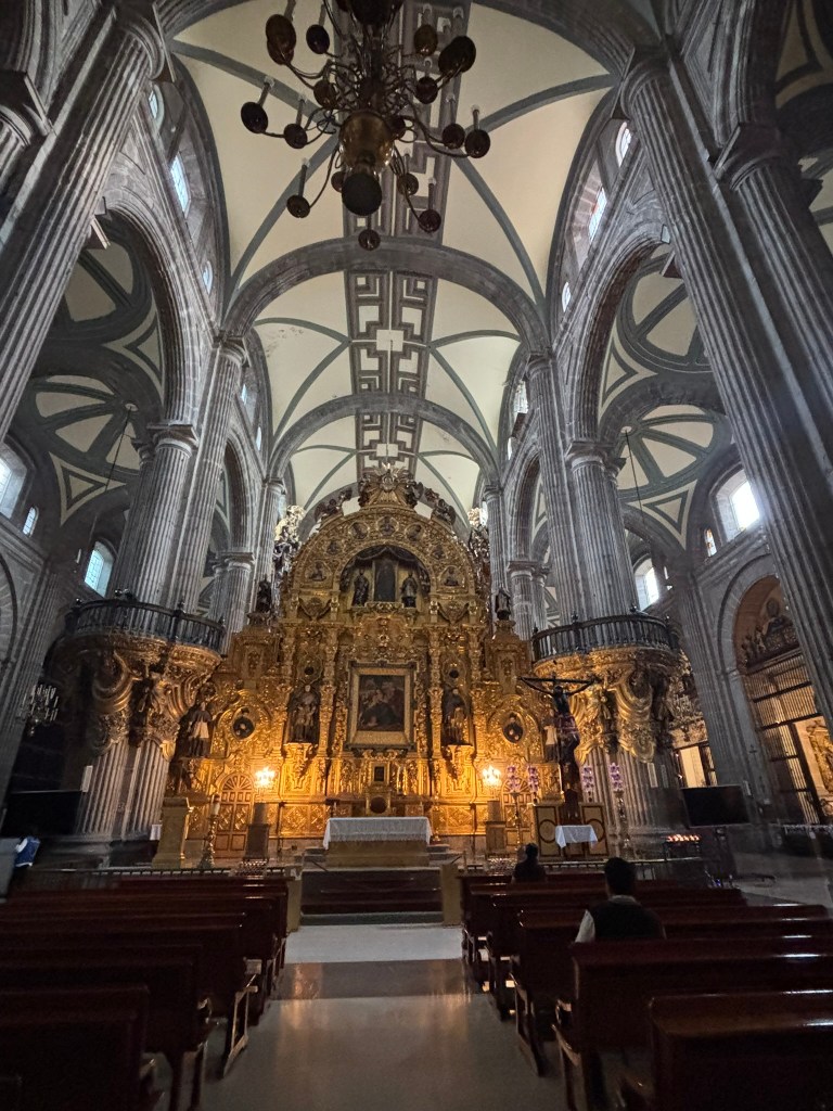
Located at the very back of the apse, this breathtaking 18th-century altarpiece is the definitive crown jewel of the cathedral complex. Towering toward the ribbed ceiling like a golden wall, the entire structure is blanketed in shimmering gold leaf and executed in the hyper-intricate Churrigueresque style. It frames a stunning central liturgical stage adorned with the Mexican and Vatican flags, surrounded by rows of beautifully framed, dark colonial oil paintings that depict biblical narratives, kings, and saints.

The Tomb of Emperor Agustรญn de Iturbide

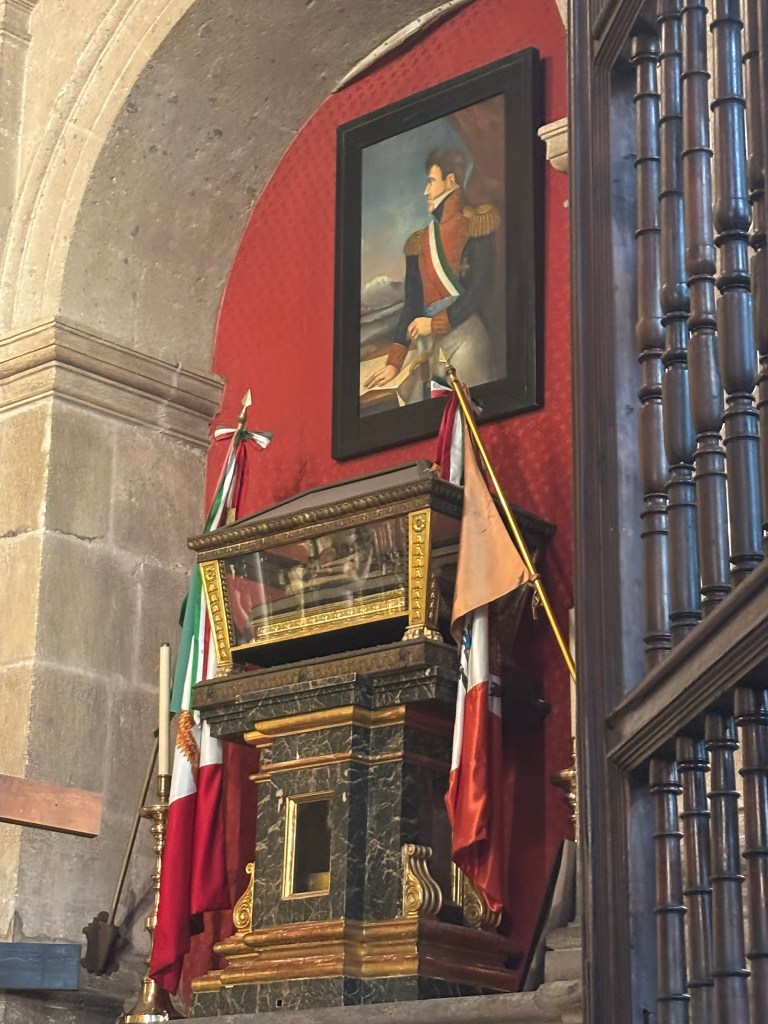
Located within the Chapel of San Felipe de Jesรบs, this corner contains a deeply significant chapter of Mexico’s political history. It houses the glass-and-gilded-bronze reliquary containing the remains of Agustรญn de Iturbide (Emperor Agustรญn I). Directly beneath his crystal urn, the green-and-gold marble pedestal permanently holds another national relicโ€”the preserved heart of Mexican President Anastasio Bustamante, placed here, according to his final wish in 1853, to rest beside his commander.

Final Thoughts: A Monument of Defiance and Endurance

To stand in the center of the Metropolitan Cathedral complex is to feel the sheer weight of Mexico Cityโ€™s layered identity. It is a place where two empires collided, leaving behind a structure that is equal parts beautiful and tragic. It is an architectural marvel that refused to collapse into the ancient lakebed beneath it, mirroring the unshakeable endurance of the city itself. Surrounded by the ringing of its historic bells and the faint scent of incense, you realize this isn’t just a monument to the pastโ€”it is a living, breathing testament to the capital’s soul.


In the Shadow of the Giant: How Frida Kahloโ€™s Art Eclipsed Diego Riveraโ€™s Empire- Tracing the footsteps of Frida and Diego in Mexico City

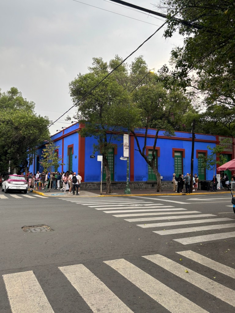
Preparing for an upcoming business trip to Mexico City, I reached out to my local Mexican colleagues for recommendations on how to spend my free time. One coworkerโ€”a self-proclaimed, ultimate Frida superfan whose Zoom background always features the artist and whose dog is even named Fridaโ€”offered a critical piece of advice: book tickets to La Casa Azul (The Frida Kahlo Museum) immediately. Because the historic home operates strictly on timed entry, tickets routinely sell out weeks in advance and cannot be purchased at the gate.

Her warning highlights a broader cultural reality of the capital. It is virtually impossible to navigate Mexico City without running into the massive legacy of this artistic power couple. From Diego Riveraโ€™s monumental public frescoes gracing historic government buildings to contemporary street art reinterpreting Fridaโ€™s iconic image, their radical love story and creative genius are permanently woven into the very fabric of the city.

Tracing Frida Kahlo and Diego Rivera across Mexico City

This omnipresent cultural footprint is the modern echo of a profound historical shift. For decades, the global art world viewed Frida Kahlo as little more than a colorful footnoteโ€”the eccentric, fragile wife of Diego Rivera, the monolithic giant of Mexican Muralism whose towering political frescoes literally reshaped the walls of post-revolutionary Mexico City. But history has a brilliant way of correcting its focus. Today, while Diegoโ€™s massive public murals remain celebrated historical masterworks, it is Fridaโ€™s deeply intimate, painfully raw, and fiercely independent universe that captures the global imagination, transforming her face into an international icon of resilience, feminism, and style.

To truly understand this volatile, creative collision, you cannot just look at prints in a bookโ€”you have to experience Mexico City itself. The cityโ€™s distinct geography, its clanging morning street noises, and the high-altitude sunlight filtering through ancient trees are completely inseparable from their art. Traveling through the capital today offers a physical, three-dimensional map of their romance, their battles, and the ultimate architectural evolution of how Frida stepped out from Diego’s shadow to build a legacy that completely surpassed his fame.


1. La Casa Azul: The Cradle and Citadel of Frida’s Universe

My journey began where Fridaโ€™s life started and ended:ย La Casa Azul (The Blue House). Located in the quiet, cobblestoned southern neighborhood ofย Coyoacรกn, a visit here feels like stepping entirely out of the hyper-modern rush of central Mexico City and back into a slower, deeply traditional era.

While Diego was busy painting the world outside on grand government walls downtown, Frida was confined to this brilliant cobalt-blue fortress. Stricken by polio as a child and later impaled in a catastrophic bus accident at age 18, her physical world was agonizingly small.

Step inside her preserved day-and-night bedroom. Positioned directly over her day bed is the mirror her mother installed so Frida could paint her own image while pinned to a plaster body cast. This room proves why her legacy has outlasted Diego’s: while Diego painted the external, fleeting politics of a nation, Frida turned her vision inward. She mined the universal depths of human suffering, identity, and heartbreakโ€”themes that remain timeless and accessible to any traveler who walks through these doors today.

To read more about my visit to Casa Azul and what to see inside, check out this post

2. The Twin Houses of San รngel: Architecture of Fragile Independence

To understand the volatile shift in their power dynamic, leave Coyoacรกn and take a short, leafy drive 15 minutes west to theย Museo Casa Estudio Diego Rivera y Frida Kahloย in the affluent neighborhood ofย San รngel. Designed by pioneering functionalist architect Juan Oโ€™Gorman in 1931, this site consists of two separate, stark concrete houses connected only by a narrow, fragile rooftop bridge.

The architecture perfectly mirrors their relationship:

  • Diegoโ€™s House:ย Massive, terracotta-colored, and boasts towering floor-to-ceiling industrial windows designed to flood his enormous canvases with light. It screams dominance and public ambition.
  • Fridaโ€™S House:ย Smaller, painted in her signature intense cobalt blue, served as her private sanctuary.

The single bridge connecting the roofs symbolizes their codependency and their need for absolute separation. It was here, in her own space, that Frida began producing works that rejected Diegoโ€™s traditional, grand style and asserted her own surreal, raw artistic voice.

3. Painting the Pain: Decoding Fridaโ€™s Critical Masterpieces

While exploring these spaces, you will gain a deeper appreciation for the masterpieces she painted during her years split between San รngel and Coyoacรกn. Three critical works define her artistic triumph over Diegoโ€™s style:

  • The Two Fridasย (Las dos Fridas, 1939):ย Painted during her divorce from Diego, this large-scale canvas shows two versions of herself holding hands, their hearts exposed and connected by a single, bleeding vein. One Frida wears a traditional European dress (the version Diego rejected); the other wears a Tehuana costume (the version Diego loved).
  • The Broken Columnย (La columna rota, 1944):ย A brutal masterpiece where her torso is split open to reveal a crumbling, iconic ionic column replacing her spine. Her flesh is pierced with dozens of nails, yet her eyes look straight forward with fierce defiance.
  • Henry Ford Hospitalย (1932):ย Painted after a devastating miscarriage in Detroit, this raw, surrealist sheet-metal painting broke all art world taboos by depicting the visceral reality of female trauma and reproductive griefโ€”a subject Diegoโ€™s heroic public murals never could have touched.

4. The Ghost of Carlos: Diegoโ€™s Childhood Trauma and the Sabotage of Women

To fully understand the chaotic, pathologically unfaithful man Frida loved, one must look beneath Diego’s massive bravado to a profound childhood wound. Born a fraternal twin, Diego watched his brother, Carlos Marรญa, die at just fourteen months oldโ€”a tragedy that threw his mother into deep, prolonged grief and left young Diego under the constant, suffocating fear that he would be next. This early brushing with death left Diego with an insatiable, almost manic appetite for consumptionโ€”of food, of space, and crucially, of women.

Art became his survival mechanism; his parents famously lined his childhood walls with blackboards to keep him from drawing on the furniture, anchoring his lifelong identity to the act of conquering empty wall space. Yet the ghost of his twin haunted his work, physically manifesting as a recurring motif in major frescoes such asย Dream of a Sunday Afternoon in Alameda Park.

Psychologically, this unresolved trauma twisted his adult relationships into a pattern of compulsive emotional sabotage. He treated women less like equal partners and more like life-giving muses to be consumed, dominated, and abandoned before they could abandon himโ€”a toxic cycle of narcissistic protection that subjected Frida, and nearly every woman before her, to relentless emotional cruelty.

Faced with a partner who consumed everything and everyone in his path, Frida had to construct an entirely new version of herself just to survive the marriage. She needed an armor that could withstand both her failing physical body and Diegoโ€™s crushing psychological weight.

5. The Armor of Identity: Fridaโ€™s Personal Style as Radical Art

Frida did not just paint her identity; she wore it as a political shield and a personal declaration of independence. In an era when upper-class Mexican women aspired to wear sophisticated, delicate European fashions, Frida deliberately adopted the heavy, traditional dress of the matriarchalย Tehuantepecย region of Oaxaca.

This wardrobe, which you can see beautifully exhibited in the rotating fashion galleries at La Casa Azul, served two vital purposes:

  1. Physical Armor:ย The long, flowing skirts hid her withered right leg, while the loose, boxyย huipilย blouses perfectly concealed the bulky medical back braces she wore daily.
  2. Cultural Defiance:ย It was a radical rejection of Western colonialism. By crowning herself with heavy braided yarn, fresh marigolds, and massive pre-Columbian jade necklaces, she transformed her body into a walking canvas of Mexican indigenous pride.

6. The Ultimate Eclipse: Why Frida Outshone the Giant

Diego Rivera spent his life painting for the masses, yet his murals are firmly rooted in the specific political propaganda of early 20th-century Marxism. To fully comprehend his work, you need a history textbook.

To understand Frida, you only need a heart.

Fridaโ€™s fame ultimately eclipsed Diego’s because her work deals with the timeless, unvarnished human condition: loneliness, physical agony, toxic love, betrayal, and the unyielding strength to survive. Diego painted the history of Mexico on grand concrete walls, but Frida painted the history of the human soul on small, intimate panels. When you leave the bright blue walls of Coyoacรกn and venture back out into the roar of modern Mexico City, you realize that the giant wasnโ€™t the man standing on the high scaffoldingโ€”it was the woman painting from her bed, staring directly into her own reflection.

Hampi the city lost of Splendor- Spending 4 days in Hampi and the surrounding areas

Hampi, a mesmerizing UNESCO World Heritage Site in Karnataka is a blend of surreal boulder-strewn landscapes and ancient history. Once the thriving capital of the 14th-century Vijayanagara Empire, it was one of the world’s largest cities. This was before its devastating fall in 1565. I grew up in this part of the country. I had often heard the ruins somberly called “Halu Hampi” (literally “Ruined Hampi” or “Destroyed Hampi” in the local language). This term shows the city’s tragic transformation. It changed from a “City of Victory” to a sprawling “City of Ruins.” This change followed its six-month pillage by the Deccan Sultanates. Today, you can wander through the remnants of once-grand bazaars. You can witness the iconic Stone Chariot at the Vitthala Temple. You can explore the active Virupaksha Temple. All of these stand as hauntingly beautiful testaments to a lost golden age.

  1. Quick Architectural Glossary: Vijayanagara Temples
  2. Our Itinerary
    1. Virupaksa Trail
      1. Urga Narasimha / Lakshmi Narasimha temple and Badava Linga
      2. Sasivekalu and Kadalekalu Ganesha
      3. Hemakuta hill
      4. Virupaksha Temple
      5. Sri Krishna temple
    2. Thungabhadra Trail
    3. Vittala Trail
    4. Raya Trail
      1. Hazara Rama temple
    5. ANEGUNDI TRAIL
    6. Geology of Hampi: An Ancient Landscape Sculpted by Time
      1. A Foundation Older Than Time
      2. The Deccan Traps Connection
      3. Inselbergs: Hampiโ€™s Signature Land forms
      4. A Landscape Shaped by Nature and Culture
      5. A Geological Backdrop to an Empire
    7. Final thoughts

Quick Architectural Glossary: Vijayanagara Temples

Gopura

The monumental gateway tower marking the entrance to a temple complex. Usually built of stone at the base and brick above, often decorated with stucco figures.

Mandapa

A pillared hall used for gatherings, rituals, and processions.

  • Open mandapa: airy, columned pavilion.
  • Enclosed mandapa: walled hall with doorways and side porches.

Sanctuary / Garbhagriha

The innermost chamber housing the main deity. Usually small, dark, and accessed through a series of mandapas.

Pradakshina Patha

The circumambulatory passage around the sanctuary, sometimes unlit, used for ritual clockwise movement.

Kuta Roof

A squareโ€‘toโ€‘domed roof form used in South Indian temple architecture. In Hampi, it appears on smaller shrines and early structures like the Durgadevi shrine.

Shikhara / Vimana

The tower above the sanctuary.

  • Dravida vimana: stepped, pyramidal tower typical of the south.
  • Brick shikhara: often seen in Vijayanagara temples, decorated with plaster sculptures.

Bazaar Street

A long, colonnaded avenue aligned with major temples, once lined with shops and festival pavilions. Krishna Temple and Virupaksha both have prominent bazaar streets.

Colonnade

A row of stone pillars supporting a roof or canopy. In Hampi, colonnades frame bazaar streets, temple tanks, and enclosure walls.

Tank / Pushkarini

A sacred water reservoir associated with ritual bathing and temple ceremonies. Often surrounded by pillared corridors and pavilions.

Inscribed Slab

A stone record set up by kings or patrons, documenting victories, donations, or temple endowments. The Krishna Temple inscription of Krishnadevaraya is a key example.

Peripheral Shrines

Small subsidiary temples placed along the inner corners or walls of a larger complex, dedicated to attendant deities or guardian figures.

Outer Enclosure

The larger walled compound surrounding the main temple. In the Krishna Temple, this includes a unique sixโ€‘domed granary structure.

Stucco Sculpture

Plaster figures applied to brick towers, often depicting deities, dancers, warriors, or mythological scenes. Many Vijayanagara gopuras once had elaborate stucco decoration.

Our Itinerary

The entire city of Hampi is indeed huge. Itโ€™s possible to wander around the suburbs of the city for hours without bumping into anyone else. Seeing everything in Hampi would take several days. However, two to three days are enough to see the major monuments without it being repetitive. We saw Hampi in 4 segments with our guide. I will blog about each segment and its key monuments separately. Here is how we divided our itinerary of Hampi

Virupaksa Trail

This trail includes Virupaksha Temple, Hampi Bazaar, and Manmantha Tank. Other sites are Kampilaraya Temple, Sasivekalu Ganesha, and Kadalekalu Ganesha. The trail also covers the Krishna Temple, Lakshmi Narasimha, and the Badavi Linga. All of these are close together and can be done in 3-4 hours. We started at the Shri Lakshmi Nagashima temple and finished at the Krishna temple.

Here are more details and my commentary on each of these monuments, along with some photographs

Urga Narasimha / Lakshmi Narasimha temple and Badava Linga

Sasivekalu and Kadalekalu Ganesha

Hemakuta hill

Virupaksha Temple

Sri Krishna temple

Thungabhadra Trail

After the morning visit to Virupaksha trail, we took a much-needed break and had lunch. We headed back out around 3.30 PM to start our evening itinerary at Chakra Thirtha. We visited the riverside ruins and took a coracle ride. This was the highlight for me on this trip.

Vittala Trail

Walk through the ancient market and temples of Vithalapura โ€“ a Hampi suburb known for the famous Vijaya Vithala temple that houses the renowned

Stone Chariot and musical pillared mantapa.

โ€‹

Monuments Covered: Gejja Mantapa, Kudure Gombe Mantapa, Vithalapura Bazaar, Kalyani, Vijaya Vithala Temple

Raya Trail

This trail takes you back 500 years to the life and times of the Rayas or Kings of the Vijayanagara Empire. Learn about their lifestyle, culture, social and political lives while you gaze upon the royal cityโ€™s magnificent architecture.

Monuments Covered: Devarayaโ€™s Palace, Royal Mint, Audience Hall, Secret Chamber, Stepped Tank, Mahanavami Dibba (Great Platform), Hazara Rama Temple, Queenโ€˜s Bath & Palaces, and Elephant Stables

Hazara Rama temple

ANEGUNDI TRAIL

Venture across the Tungabhadra River to where the story of Hampi first began. Discover fortified villages and medieval forts. Explore sacred lakes and ancient temples. Experience a mesmerizing landscape of paddy fields and rock formations dating back 2.5 billion years.

Geology of Hampi: An Ancient Landscape Sculpted by Time

Hampiโ€™s landscape looks almost mythical at first sight. Endless piles of rounded boulders are balanced impossibly on one another. They stretch across farmlands and river valleys like the remnants of a forgotten world. Yet the true story of this terrain is even more astonishing, rooted in billions of years of Earthโ€™s geological history.

A Foundation Older Than Time

Hampi sits atop the Dharwar Craton. It is one of the oldest and most stable pieces of continental crust on the planet. It was formed between 3.6 and 2.5 billion years ago. This ancient foundation underlies parts of Karnataka, Goa, and Andhra Pradesh. It provides the bedrock upon which Hampiโ€™s granite hills stand.

The Deccan Traps Connection

Geographically, the region lies on the broader Deccan Traps, one of the worldโ€™s largest volcanic provinces. These traps were created around 66 million years ago. At that time, the Indian Plate drifted over the Rรฉunion hotspot. This movement produced vast layers of basalt that cooled into stepโ€‘like formations. The term โ€œtrapsโ€ itself comes from the Swedish word for โ€œstairs.โ€

Inselbergs: Hampiโ€™s Signature Land forms

Despite the volcanic origins of the Deccan Traps, Hampiโ€™s dramatic boulder hills are not volcanic cones or remnants of eruptions. Instead, they are inselbergs โ€” โ€œisland mountainsโ€ formed through deep, prolonged weathering of granite. Over tens of thousands of years, rainwater seeped into cracks in the rock, breaking it down from within.

  • Corestones (rounded granite blocks) remained intact.
  • Grus (weathered material) eroded away.
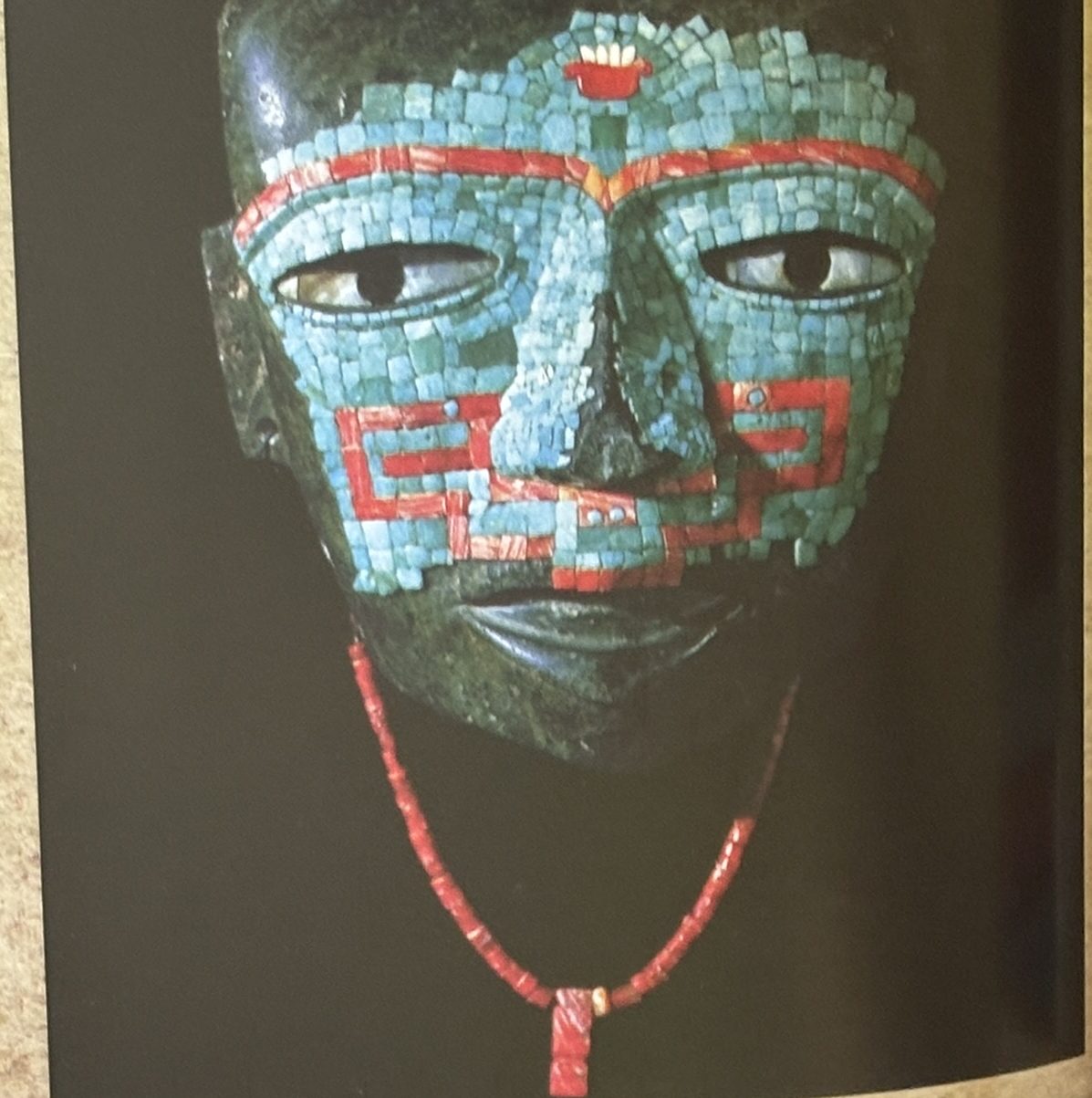
  • What remained were the surreal piles of rounded boulders we see today.
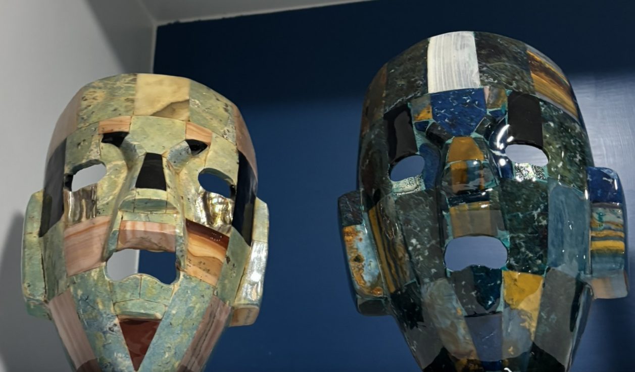
This slow sculpting created the balancing rocks, tors, koppies, and nubbins that define Hampiโ€™s skyline. These formations look precarious, but they have stood for millennia.

A Landscape Shaped by Nature and Culture

While inselbergs elsewhere are often remote and untouched, Hampiโ€™s have been part of human life for thousands of years.

  • Iron Age settlements used the runoff from these hills for farming.
  • Pastoral communities grazed animals here, enriching the soil with seedโ€‘rich droppings.
  • Temples, shrines, and hill forts were built atop the granite outcrops.
  • Vijayanagara architects quarried local stone to build their empireโ€™s monuments.

This interplay of geology and culture makes Hampi unique: a place where natural history and human history are inseparable.

A Geological Backdrop to an Empire

The Vijayanagara Empire chose Hampi as its capital in the 14th century for several reasons. It wasnโ€™t solely for its sacred associations. The fertile river valley was also a factor. The inselbergs provided natural fortification, strategic vantage points, and an endless supply of building material. The same granite that weathered into ancient boulders became the pillars, mandapas, and chariots of Hampiโ€™s architectural wonders.

Hampiโ€™s geology is not just a backdrop. It is the silent architect of the regionโ€™s culture, mythology, biodiversity, and imperial legacy.
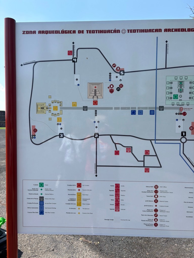
Final thoughts

Hampi is worth visiting if you love history and architecture. I didn’t expect to fall in love with Hampi, but I walked away with 500+ photographs and memories. I can’t wait to go back and explore more.
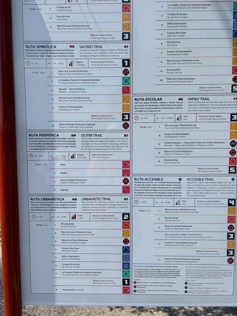
Hampi Itinerary: Sacred Trails, Ancient Kingdoms & River Magic

Our itinerary was 4 days, covering Hampi, Badami, Aihole, and Pattadakal. We made Hampi our base and stayed at Evolve Back, Hampi. The hotel is one of the best in terms of accommodation, food, and service. My review of Evolve back will be a separate blog post.

  1. Arrival: Night Train to Hospet
  2. ๐ŸŒ… Morning: Virupaksha Trail (4โ€“5 hours)
  3. ๐ŸŒ‡ Evening: Tungabhadra Trek + Coracle Ride at Sunset
  4. ๐ŸŒ„ Morning: Vittala Trail
  5. ๐Ÿฐ Evening: Raya Trail (3-4 hours)
  6. ๐ŸŒ… Morning: Sunrise Hike to Anjanadri Hill
  7. ๐Ÿงต Late Morning: Banana Silk Saree Shopping in Anegundi
  8. ๐Ÿš† Afternoon: Departure from Hospet
  9. Suggested Itinerary:1,2, and 3-day in Hampi

Arrival: Night Train to Hospet

We boarded the Hampi Express from Bengaluru. We reached Hospet at 7AM. A car and driver from Evolve Back, Hampi were there to pick us up. After a scenic 30โ€‘minute drive through banana plantations and boulder hills, we arrived at the resort. The resort is a luxurious homage to Vijayanagara architecture. All the excursions were arranged with the hotel and the driver, and were pulled off perfectly by the hotel staff. We had a guide at each experience. They told us about the history. They also helped us take the perfect photos.

Day 1 โ€” Virupaksha Trail & Tungabhadra Sunset

๐ŸŒ… Morning: Virupaksha Trail (4โ€“5 hours)

A perfect introduction to Hampiโ€™s sacred core โ€” mythology, early temple architecture, and sweeping boulder views.

Stops include:

  • Ugra Narasimha โ€” the fierce monolith of Vishnu
  • Hemakuta Hill โ€” scattered shrines and panoramic views
  • Krishna Temple โ€” elegant Vijayanagara carvings
  • Sasivekalu Ganesha โ€” mustardโ€‘seed Ganesha
  • Kadalekalu Ganesha โ€” peanutโ€‘shaped Ganesha carved from a single boulder
  • Virupaksha Temple โ€” Hampiโ€™s living temple, active since the 7th century

This trail sets the tone for Hampi โ€” a landscape where geology, devotion, and empire intertwine.

๐ŸŒ‡ Evening: Tungabhadra Trek + Coracle Ride at Sunset

A gentle riverside walk that reveals Hampiโ€™s quieter, more contemplative side. This was our favorite experience, and I would highly recommend doing a coracle ride at sunset

Highlights:

  • Coracle ride at sunset โ€” drifting past boulders glowing gold
  • Kotilinga Temple โ€” a riverside shrine carved directly into rock
  • Riverside ruins โ€” pavilions, carvings, and ancient steps leading into the water

The river feels almost mythical at dusk โ€” a perfect ending to your first day.

Day 2 โ€” Day Trip to Badami, Pattadakal & Aihole (12 hours)

A full-day excursion into the cradle of Chalukyan architecture. This journey includes rock-cut caves, early temple experiments, and UNESCO-listed masterpieces. We left Hampi at 6AM and were back at the resort by 6PM. A long day, but really worth it. If you can afford a 5 day Itinerary, plan to do this visit on day 4. Stay overnight at Badami and continue the visit on day 5.

๐Ÿชจ Badami

  • Cave temples carved into red sandstone cliffs
  • Sculptures of Vishnu, Shiva, and Jain Tirthankaras
  • Agastya Lake shimmering below the cliffs

๐Ÿ›• Pattadakal (UNESCO World Heritage Site)

  • A harmonious blend of Dravidian & Nagara styles
  • Virupaksha Temple, Mallikarjuna Temple, and more

๐Ÿ›๏ธ Aihole

  • Known as the โ€œCradle of Indian Temple Architectureโ€
  • Durga Temple, Lad Khan Temple, and dozens of early experiments in stone

You return to Evolve Back by evening, carrying with you the story of how temple architecture evolved before reaching its zenith in Hampi.

Day 3 โ€” Vittala Trail and Raya Trail(3-4 hours)

๐ŸŒ„ Morning: Vittala Trail

A deep dive into the architectural brilliance of the Vijayanagara Empire.

Stops include:

  • Vittala Temple โ€” the empireโ€™s finest monument
  • Stone Chariot โ€” Hampiโ€™s most iconic structure
  • Musical Pillars โ€” resonant columns carved from single stones
  • Riverside walk โ€” mandapas, carvings, and quiet river views

This trail is a photographerโ€™s dream โ€” long corridors, ornate carvings, and the river shimmering nearby.
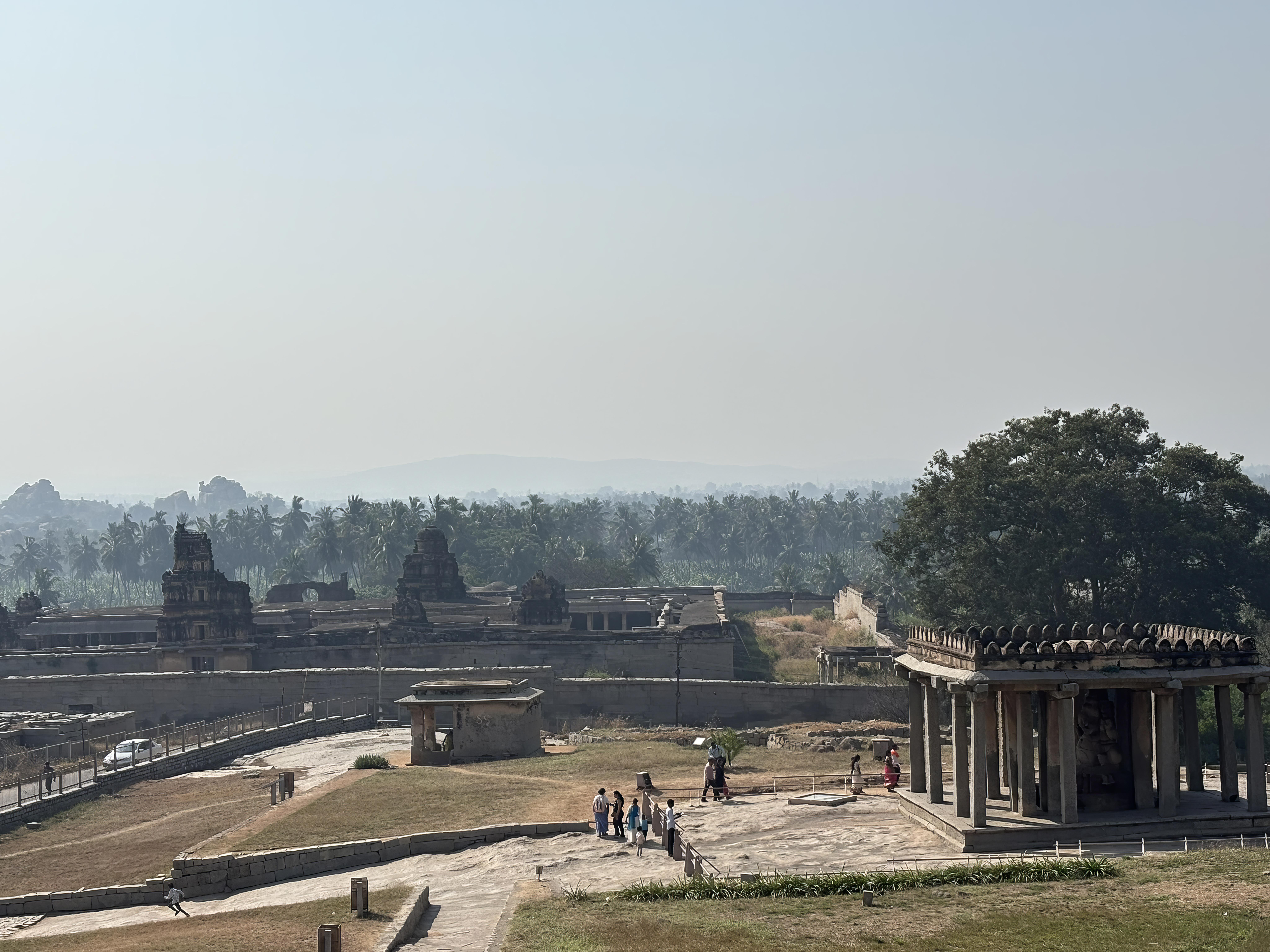
๐Ÿฐ Evening: Raya Trail (3-4 hours)

Explore the imperial heart of the Vijayanagara capital.

Stops include:

  • Royal Enclosure โ€” Mahanavami Dibba, Stepped Tank
  • Queenโ€™s Bath โ€” Indoโ€‘Islamic elegance
  • Lotus Mahal โ€” delicate arches and domes
  • Hazara Rama Temple โ€” Ramayana carved in stone

This trail reveals the administrative, ceremonial, and residential world of the Vijayanagara royals.

Day 4 โ€” Anjanadri Sunrise, Banana Silk Shopping & Departure

๐ŸŒ… Morning: Sunrise Hike to Anjanadri Hill

Cross to Anegundi before dawn and climb 570+ steps to the birthplace of Lord Hanuman.

At the summit:

  • A 16thโ€‘century Hanuman temple
  • Shrines to Rama and Sita
  • A breathtaking 360ยฐ view of Hampiโ€™s boulder landscape

The sunrise here is supposed to be unforgettable. The granite hills turn pink and gold. Below, the Tungabhadra glimmers. We had a foggy morning and did not get to fully appreciate the landscape

๐Ÿงต Late Morning: Banana Silk Saree Shopping in Anegundi

Anegundi is known for its bananaโ€‘fibre weaving tradition, revived by local womenโ€™s collectives.

  • Shop for banana silk sarees, stoles, and handcrafted textiles
  • Meet artisans and learn about the weaving process

๐Ÿš† Afternoon: Departure from Hospet

We took 2.30 PM train back to Bengaluru, carrying with us the stories of empires, epics, rivers, and rocks that shaped Hampi.

Suggested Itinerary:1,2, and 3-day in Hampi

1 day Itinerary- If you just have 1 day to spend in Hampi, this is my suggestion. It will be a long day with an early-morning start. You can hit all the must visit spots, and get an idea of what Hampi has to offer. I believe Hemakuta Hill and Vitalla temple are must-do. Don’t miss Hazara Rama temple either. The Royal enclosure is also essential, as well as the Coracle (Teppa) ride in Hampi.

Start the day at Hema Kuta hill and visit Virupaksha temple. Then visit Vitalla temple. In the afternoon, visit the Royal enclosure and Hazara Rama temple. End the day with a coracle ride at sunset from Chakra Thirtha.

2 day Itinerary- Same places, but much more relaxed, and you linger at various spots

3 Day itinerary – This will give you enough time to enjoy the various spots. You can also add Anegunddi and Anjanadri hill to the mix.

Anjanadri Hill & Anegundi: A Journey Through Myth, Memory, and Timeless Landscapes

Visiting Anjanadri Hill and the ancient village of Anegundi is like stepping into a living epic. The Ramayana breathes through the hills. The Vijayanagara Empire whispers through fort walls. The Tungabhadra River carries centuries of stories in its gentle curves. We visited Anjanadri Hill for sunrise. It was a foggy morning, and visibility wasn’t that great. Still, we enjoyed the hike and visiting the temple.

  1. Anjanadri Hill: Birthplace of Lord Hanuman
    1. The Climb
    2. The Temple at the Peak
    3. The View
  2. Anegundi: The Ancient Heart of Kishkindha
  3. A Legacy Older Than Empires
  4. Gagan Mahal: Where the Royals Took Refuge
  5. A Geological Wonder: One of the Oldest Plateaus on Earth
    1. Prehistoric Traces
  6. Pampa Sarovara: A Sacred Lake of the Ramayana

Anjanadri Hill: Birthplace of Lord Hanuman

Rising above the boulder-strewn plains of Anegundi, Anjanadri Hill is one of the most sacred sites in the Ramayana trail. The hill is believed to be the birthplace of Lord Hanuman. It is named after his mother, Anjana, and has been a pilgrimage site for centuries.

The Climb

Reaching the summit means ascending 570+ steep steps, but the journey is part of the experience. As you climb, the world opens up around you. You see paddy fields glowing in the sun. Coconut groves sway in the breeze. The Tungabhadra River shimmers like a silver ribbon. Pilgrims chant Hanumanโ€™s name, bells ring softly in the wind, and the granite landscape glows in warm hues.

Halfway through, you need to bend to go under the boulders

The Temple at the Peak

At the top stands a 16th-century white-washed temple, simple yet powerful in its presence.

  • A rock-carved idol of Hanuman forms the sanctum.
  • Shrines dedicated to Rama and Sita stand nearby.
  • Saffron flags flutter against the sky, adding to the spiritual energy of the place.

The View

From the summit, you get a 360-degree panorama of Hampiโ€™s ruins. You can also see banana plantations and the surreal boulder hills that define this UNESCO World Heritage Site. Sunrise and sunset here are unforgettableโ€”moments when the land feels suspended between myth and reality. Unfortunately, the day we went up the hill, it was very foggy to truly appreciate the scene before us.

Anegundi: The Ancient Heart of Kishkindha

Across the river from Hampi lies Anegundi. It is a village older than Hampi. Anegundi is believed to be the cradle of Kishkindha, the monkey kingdom of Vali and Sugriva. This is where mythology, geology, and royal history converge in a landscape that feels untouched by time.

A Legacy Older Than Empires

Anegundiโ€™s history stretches back to the 3rd century BCE, when it was part of the Ashoka Empire. Over the centuries, it saw the rise of the Satavahanas, Kadambas, Chalukyas, Rashtrakutas, and other royal dynasties that ruled Hampi and the surrounding area . By the 10th century, it became a fortified settlement. Later, it served as the mother city of the Vijayanagara Empire.

Even today, the 19th generation of Krishnadevarayaโ€™s descendants lives here, keeping the royal lineage alive.

We didn’t have time to explore Anegundi, but if you do, the following places are worth visiting.

Gagan Mahal: Where the Royals Took Refuge

In the heart of Anegundi stands Gagan Mahal, the 16th-century palace that once housed the royal family during turbulent times. Painted in a warm yellow-ochre hue, the palace blends Indo-Islamic architecture with vernacular charm.

  • Four slender towers rise above its faรงade.
  • Arched windows and carved balconies overlook the village.
  • A central pool and ancient drainage system reveal ingenious cooling techniques.

Walking through its halls, you can almost hear the echoes of queens, ministers, and royal children who once lived here.

A Geological Wonder: One of the Oldest Plateaus on Earth

Anegundi sits on a plateau believed to be over four billion years old, making it one of the oldest exposed geological formations on Earth. Its landscapeโ€”endless boulders, wind-sculpted hills, and ancient rock sheltersโ€”feels primordial.

Prehistoric Traces

  • Maurya Mane reveals early settlement patterns.
  • Onake Kindi showcases prehistoric rock paintings and engravings.

These sites add archaeological depth to a region already rich in myth and history.

Vernacular Architecture That Still Breathes

A walk through Anegundiโ€™s narrow lanes is a walk through living heritage.

  • Homes have two-foot-thick stone walls that keep interiors cool.
  • Carved wooden doors show motifs passed down through generations.
  • Skylights, pillared verandahs, and flat terraces show a design language shaped by climate and craft.

This is architecture that isnโ€™t preserved in museumsโ€”it is lived in, cherished, and passed on.

Anegundi Fort: Echoes of a Warrior Past

Within the ancient fort walls lie the Durga Temple and the Ganesha Cave Temple, both steeped in centuries of worship. Local lore says Vijayanagara kings sought blessings here before going to war.

Walking through the fortโ€™s gateways, you feel the weight of historyโ€”soldiers marching, priests chanting, kings preparing for battle.

Pampa Sarovara: A Sacred Lake of the Ramayana

One of Anegundiโ€™s most sacred sites is Pampa Sarovara, one of the five holy lakes in Hindu tradition. This is believed to be where Shabari met Lord Rama, offering him berries with pure devotion.

The lake, surrounded by hills and shrines, feels serene and timelessโ€”a place where mythology feels close enough to touch.

The Revival of Anegundi

Anegundi is not just a relic of the pastโ€”it is a thriving example of sustainable rural tourism.

  • Organic farming initiatives
  • Performing arts education
  • Revival of banana-fibre crafts
  • Adventure activities around Sanapur Lake

Much of this transformation is led by The Kishkinda Trust, which has helped preserve Anegundiโ€™s heritage while empowering local communities.

As the sun sets over the ancient plateau, Anegundi glows in shades of gold. Its temples, boulders, and riverbanks illuminate like a living chronicle of Indiaโ€™s past.