Talk about a trifecta of national parks to visit….
🌍 Into the Wild Beauty of the Canadian Rockies
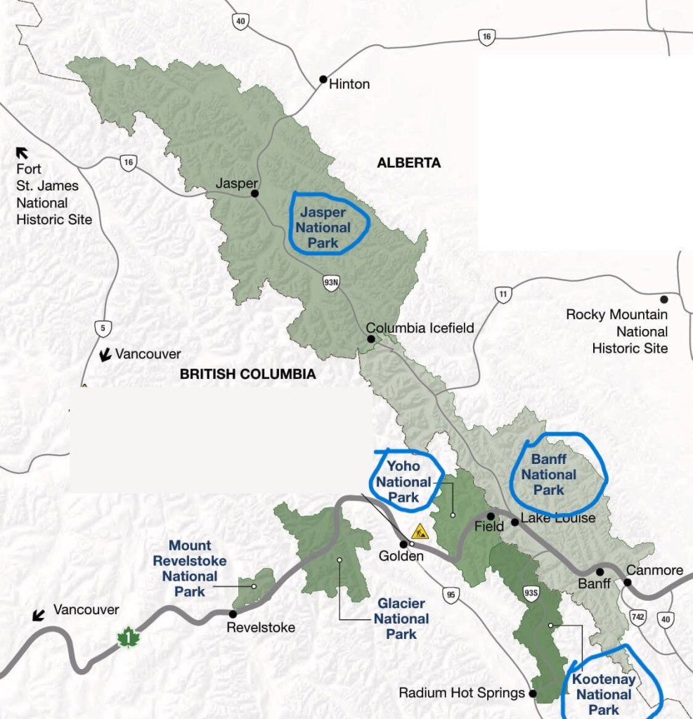
If you’ve ever dreamed of stepping into a postcard, the Canadian Rockies are where that vision comes to life. Straddling the provinces of Alberta and British Columbia, this mountain wonderland is breathtaking. It is home to some of the most jaw-dropping natural beauty on Earth. At the heart of it all are three iconic national parks: Banff, Yoho, and Jasper. Each park offers its own flavor of adventure, tranquility, and untamed charm.
🏞️ Banff is where it all began: Canada’s first national park, and a global symbol of alpine beauty.
🌄 Lake Louise & Moraine Lake Technically within Banff, but worth highlighting on their own. These iconic lakes are must-sees for their surreal colors and dramatic mountain backdrops. Sunrise at Moraine Lake? Pure magic.
💦 Yoho may be smaller, but don’t let size fool you. This hidden gem features towering waterfalls, Tranquil lakes, and ancient fossils.
To read more about spending a day a Yoho National Park, click here
🌌 Jasper, the wildest of the trio, beckons those looking to get off the beaten path. Jasper boasts vast backcountry and an abundance of wildlife. Its skies are so dark they’ve been named a dark-sky preserve.
If you are already exploring Banff and the surrounding areas and have more days to spend, here are a few other noteworthy National Parks and hidden gems to add to your itinerary
🧭 Kootenay National Park– Just south of Yoho, Kootenay offers a quieter experience. It is less traveled with dramatic canyons. You can find hot springs and colorful mineral pools. Don’t miss Marble Canyon or the steamy Radium Hot Springs for a relaxing soak after your hikes.
🏔️ Icefields Parkway– This legendary highway connects Banff and Jasper and is a destination in itself. Along the way, you’ll pass glaciers, turquoise lakes, and epic viewpoints like Peyto Lake and the Columbia Icefield. It’s one of the most scenic drives in the world.
🌲 Canmore, Located just outside Banff National Park, is a charming mountain town. It has a laid-back vibe and great food. You can access beautiful hikes like Ha Ling Peak and Grassi Lakes. It’s perfect for travelers who want a less touristy base.
🛶 Waterton Lakes National Park A bit farther south, this lesser-known park borders Montana’s Glacier National Park. It’s a UNESCO World Heritage Site, boasting stunning lakes, wildflower-filled meadows, and a peaceful, off-the-beaten-path ambiance.
Our Itinerary
What we did: Spent 3 days in Lake Louise Village and did hikes, canoeing, and drove the Icefields Parkway.
Where we stayed: Lake Louise Inn
Days 1 and 5: Travel Days
Day 2: Explore Yoho National Park and Johnston Canyon
Day 3: Drive the Icefields Parkway. Stop at various viewpoints like Lake Peyto, Mistaya Canyon, and the Columbia Icefields. Visit the Athabasca Glacier. Evening -explore Banff downtown
Day 4: Sunrise visit to Lake Moraine with Radventures. Afternoon visit to Lake Louise with Fairview Limousine and hike to Lake Agnes Tea House
Prepare to be swept away by the unparalleled beauty of the Canadian Rockies! The Icefields Parkway connects Lake Louise and Jasper. It is widely regarded as one of the most scenic drives in the world. Imagine towering mountains, glistening glaciers, vibrant blue lakes, and cascading waterfalls unfolding before your eyes with every turn. This post is your guide to experiencing the very best of this incredible journey.
Pro tip: Download the Guidealong app for Canadian Rockies tours. This app provides a delightful narration of the various viewpoints. It ensures that you won’t miss any of the fantastic sights along the way.
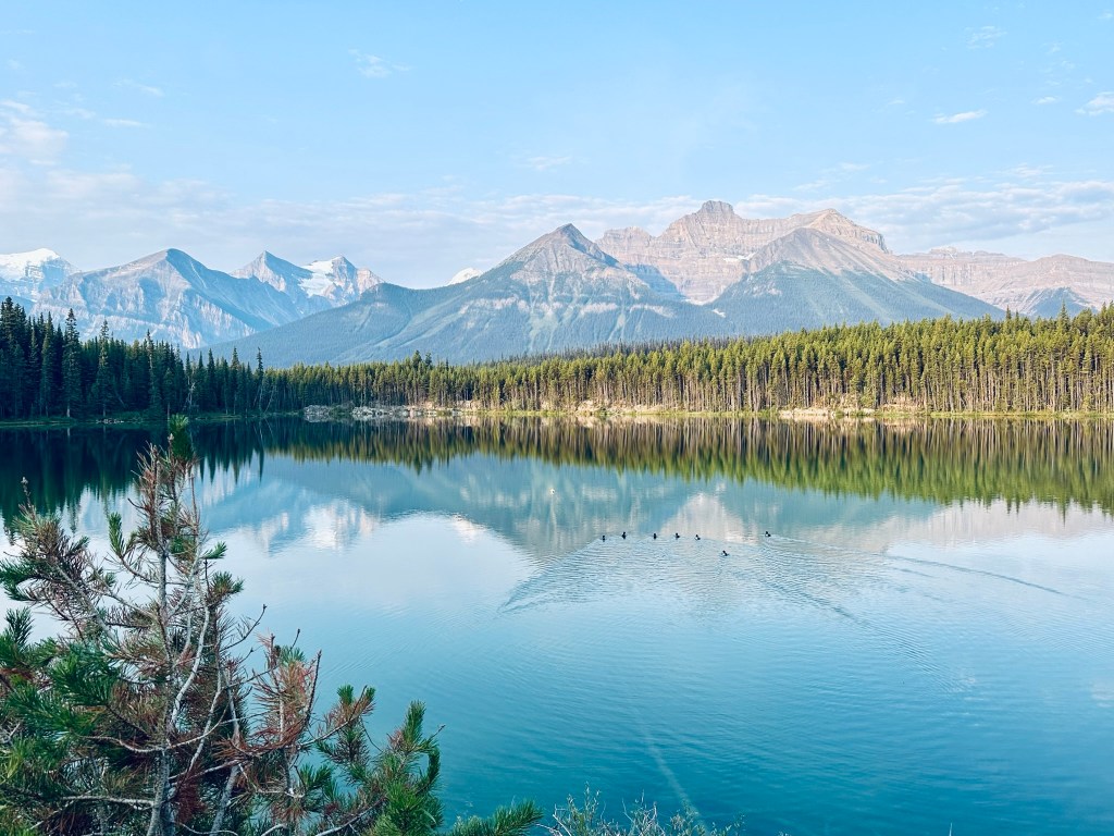
Features: Small lake, short 1-mile loop trail around the lake. Known as a photographer’s favorite for its reflection of the peaks, including Mount Temple.
Parking: Parking lot on the west side.
Herbert Lake is an easy stop on the Icefields Parkway. The photos I took here are some of my favorite pictures from the trip.
Hector Lake
Location : 23km from Lake Louise/211km from Jasper
Features: Largest lake in Banff National Park, partially obstructed viewing area off the west side.
Activities: Hike to the lake (2.8 miles, 390 ft elevation gain).
We did not stop here.
Crowfoot Glacier Viewpoint and Bow Lake Viewpoint
Location: 32 Km from Lake Louise/ 194 Km from Jasper
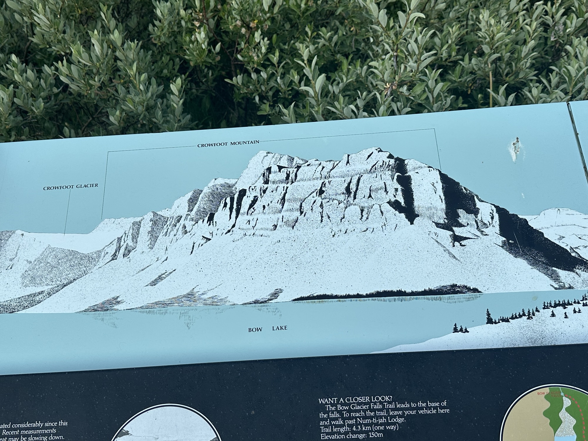
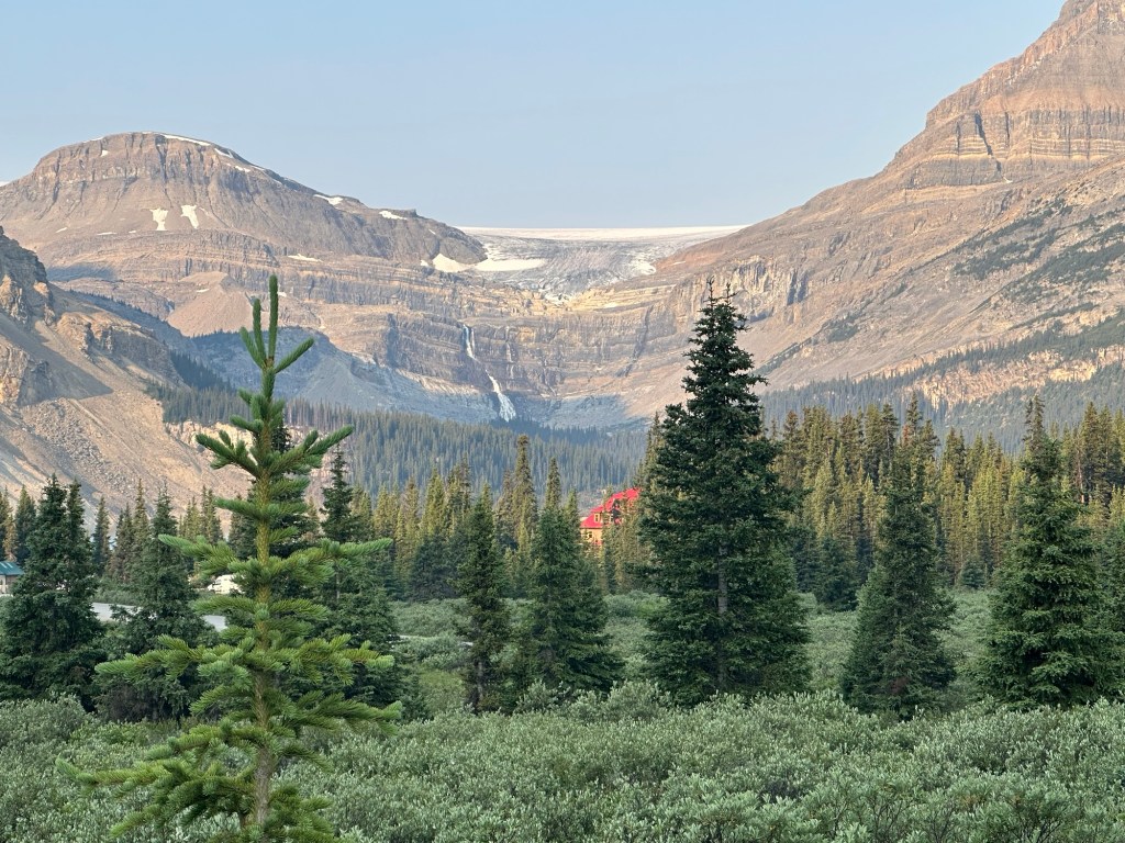
Features: Viewpoint to see the Crowfoot Glacier, Bow Lake, and surrounding mountains. It offers a scenic vista of the glacier, which is named for its three “toes” that once resembled a crow’s foot. The viewpoint is a roadside pull-off, making it easily accessible for visitors driving along the Icefields Parkway. Its a beautiful viewpoint that doesn’t require much hiking and worth the stop.
Bow Lake
Location: 37km from Lake Louise/194km from Jasper
Features: Offers views of the Wapta Icefield, Bow Glacier, and Crowfoot Glacier. Road on the west side leads to Num Ti Jah Lodge (small snacks available).
Activities: Hike to Bow Falls (5.5 miles out and back, 925 ft elevation gain), moderate hike with stairs (poles recommended). You can enjoy activities like canoeing and stand-up paddleboarding on the lake.
We stopped at the viewpoint to take in the towering mountains and the beautiful lake. There is an information panel in the parking lot that shows various views you can see from the spot.
Peyto Lake and Bow Summit
Location: 45km from Lake Louise/188km from Jasper
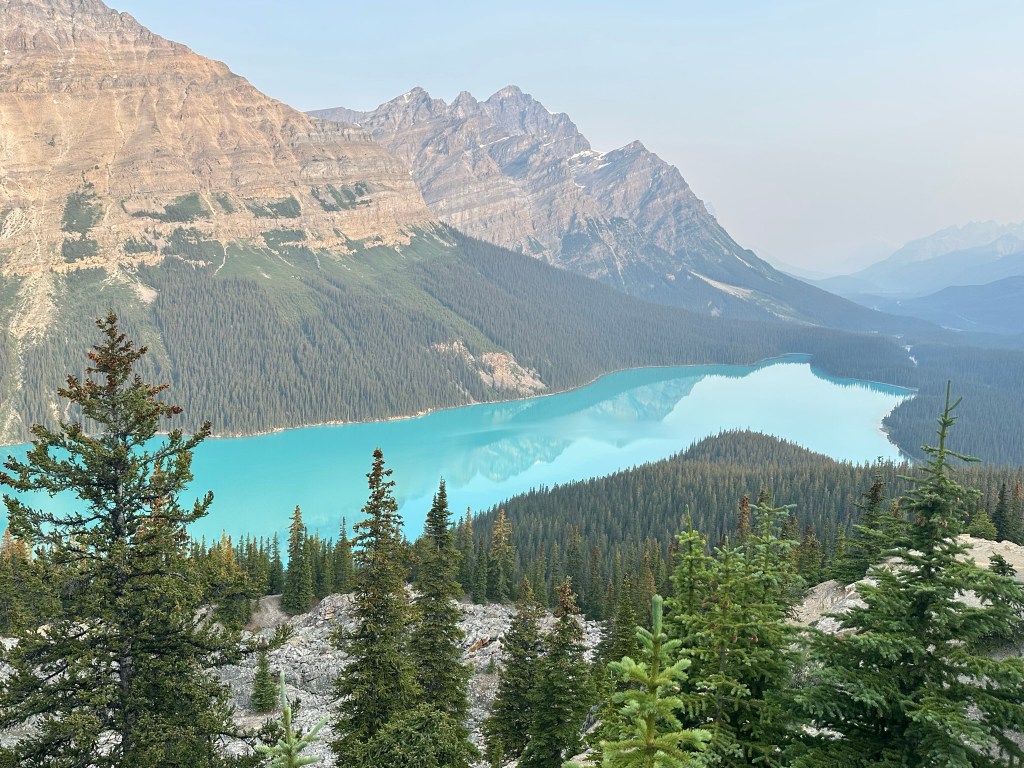
Features: Highest elevation point, beautiful lake (especially on a sunny day), known for its unique turquoise color. Expect a busy area.
Activities: 2km walk from the parking lot to the viewpoint platform, then trails to the upper ridge
This is one of the best viewpoints on the IceFields parkway and we stopped here on our way out around 7.30AM and again on the way back in the afternoon. The parking lot can get busy, but we didn’t have any issues getting parking early in the morning or late in the afternoon. There is a main trail that leads to the popular viewpoint. There is supposed to be another trail that leads to a closer view, but we couldn’t find it.
Waterfowl Lakes and Chephren Lake
Location: 60km from Lake Louise/174km from Jasper
Features: Less crowded lakes compared to other Banff lakes, providing a more serene and tranquil experience for visitors. A viewpoint is available past the FCFS campground, offering stunning panoramic views that are perfect for photography and relaxation.
Activities: Chephren Lake Hike- 5 miles round trip, 833 ft elevation gain (mostly at the beginning).
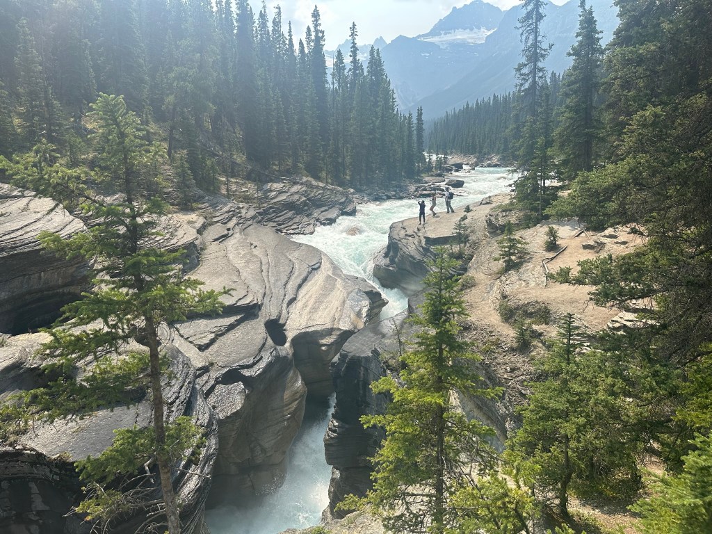
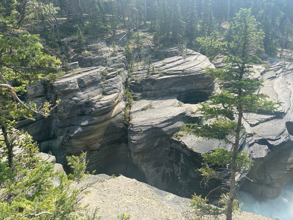
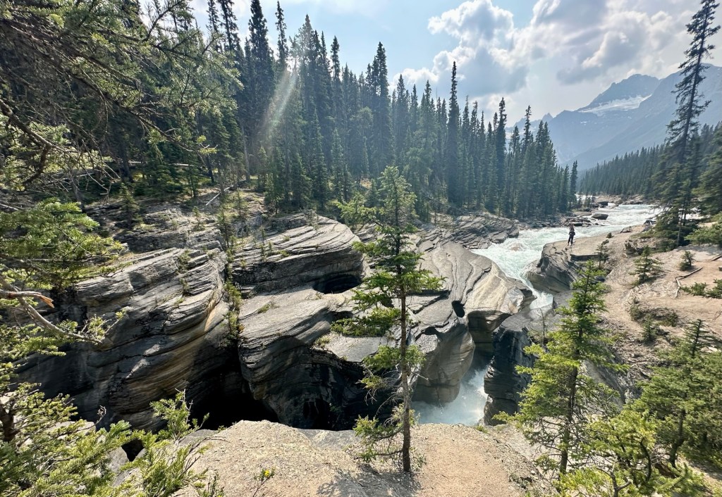
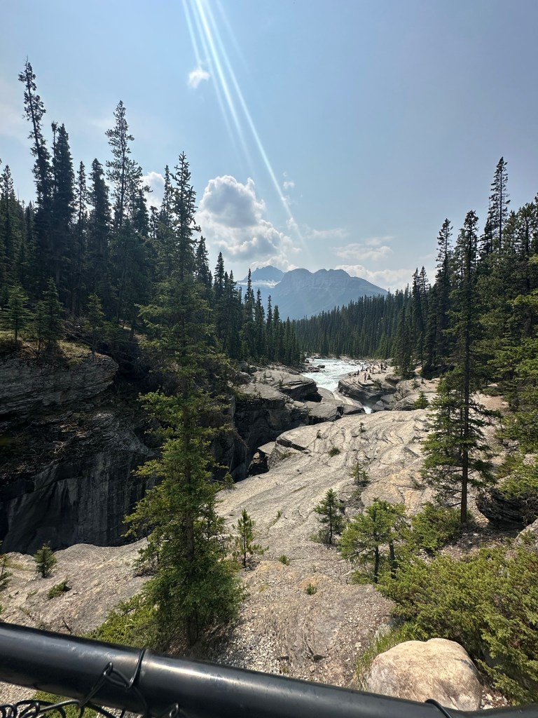
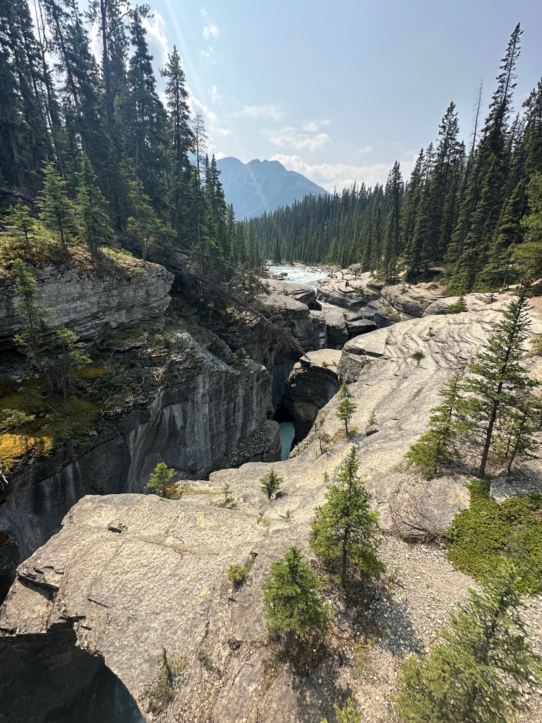
Mistaya Canyon
Location : 75km from Lake Louise/158km from Jasper
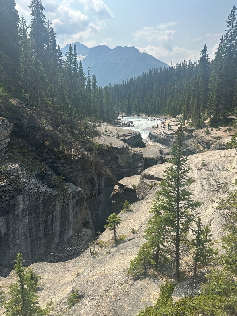
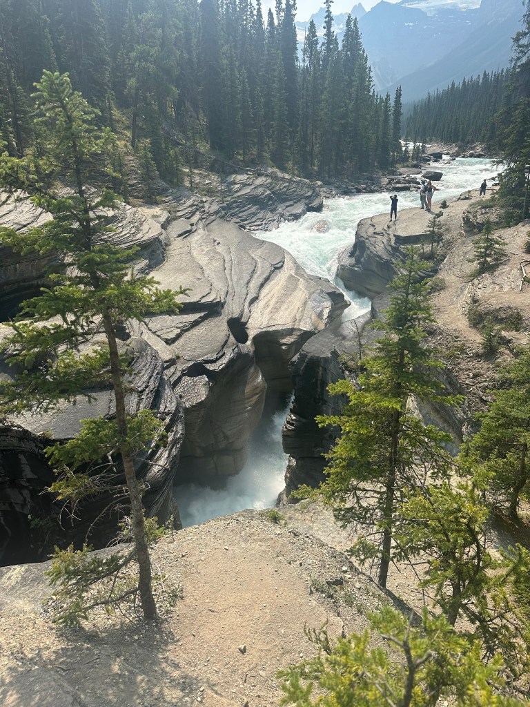
Features: Popular spot, reachable by a short trail with a scenic observation bridge. Visitors often notice the river’s erosion. This natural phenomenon led to the remarkable formation of the canyon.
Activities: Mistaya Canyon Waterfall hike (0.7 miles, 193 ft elevation out and back).
Parking: A pull-out area is available on the west side, but parking is limited
We stopped here on the way back from the Athabasca Glacier walk.
Saskatchewan River Crossing
Location: 80km from Lake Louise/153km from Jasper
Features: Only stop on the Icefields Parkway if you need gas or food. We stopped and got coffee. The store has lots of postcards and T-shirts.
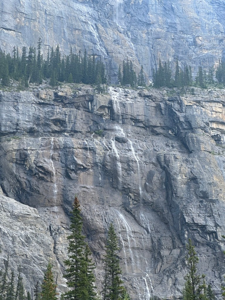
Weeping Wall
Location: 109km from Lake Louise/125km from Jasper)
Features: Unique location where water comes through the mountains. Reviews mention it looking like “tears” falling down the hill. Best seen during the spring melt. It wasn’t awe-inspiring when we saw it in July
Parking: Parking on the west side. The view is off to the right. You can see it without leaving your car.
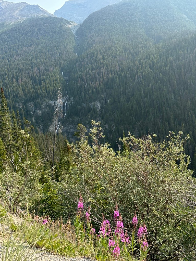
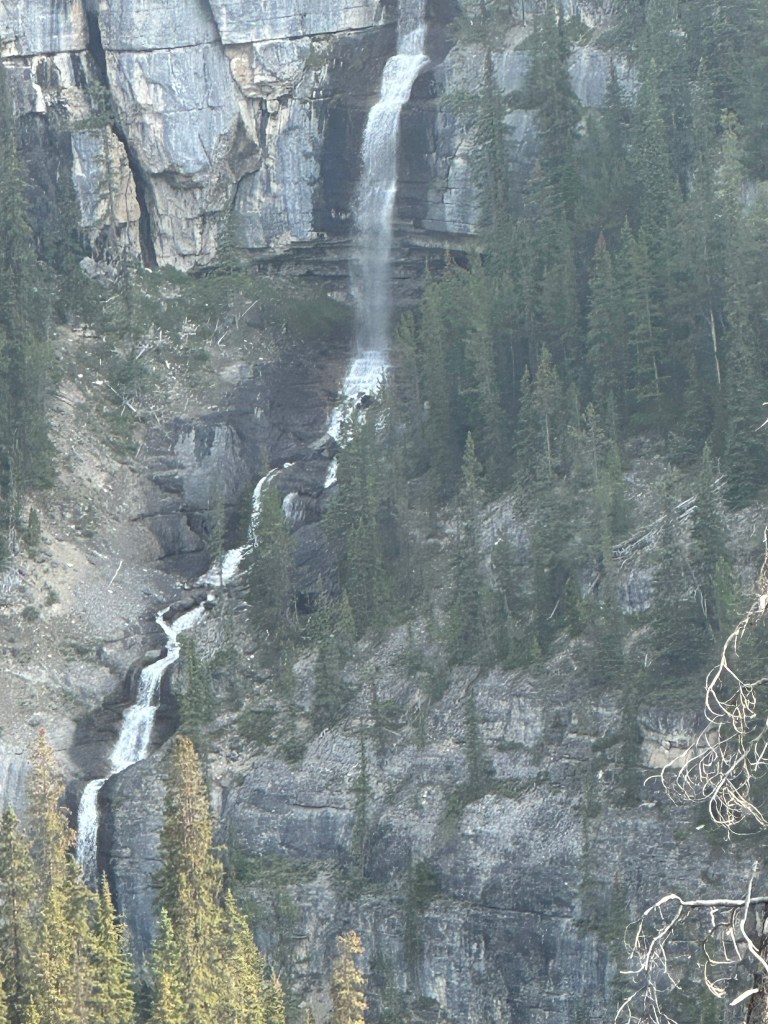
Icefields Parkway Viewpoint, Bridal Veil Falls, Panther Falls
Location: 116km from Lake Louise/118km from Jasper
Features: Two pull-outs on the east side after the Big Bend. The first provides a view looking back at the Parkway and Bridal Veil Falls.
Activities: Panther Falls Trail-0.8 miles out and back, 232 ft elevation gain. Reviews suggest turning around at Panther Falls (a 0.6-mile round-trip hike) as the view of Bridal Veil Falls is the same from the pull-out.
We couldn’t find the entrance to Panther Creek Trail and didn’t go on the trail
Parker Ridge
Location: 121km from Lake Louise/112 km from Jasper
Features: Highly recommended hike along the Parkway. The trail is 2.7 km (one-way) with 305 m of elevation gain.
Parking: Parking lot on the west/south side for the trailhead.
We didn’t go on this trial as we had 10.30 slot for the Columbia Icefields visit, but this is on my bucket list to visit next time we are in Banff
Columbia Ice Field tour, and the toe of the Athabasca Glacier
Location: 130km from Lake Louise/103km from Jasper
The toe of Athabasca Glacier hike:
Right after the information center, turn left on Snocoach Rd, then right onto Glacier Road
Toe of the Glacier Trail: 0.9 miles, 200 ft.
Columbia Icefields tour:
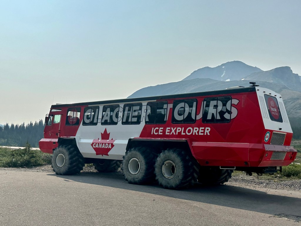
A Columbia Icefield tour includes an Ice Explorer ride on the Athabasca Glacier and a visit to the Columbia Icefield Skywalk, providing unique views of the glacier. Tours start from the Columbia Icefield Discovery Center.
Key features of the tour:
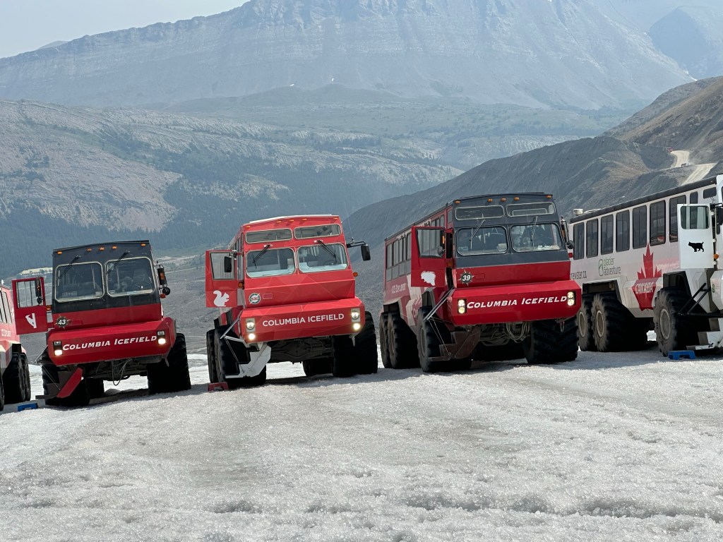
Ice Explorer Ride: You’ll travel on a specially designed, all-terrain vehicle. This vehicle takes you onto the Athabasca Glacier. The glacier is one of the six principal “toes” of the Columbia Icefields.
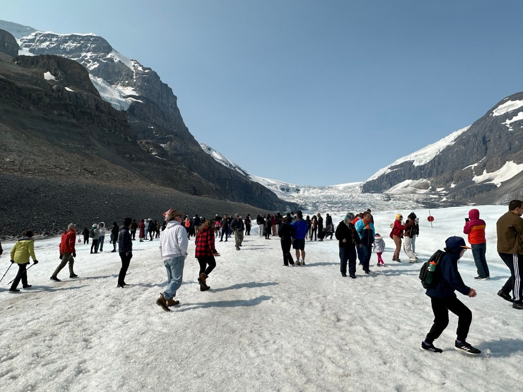
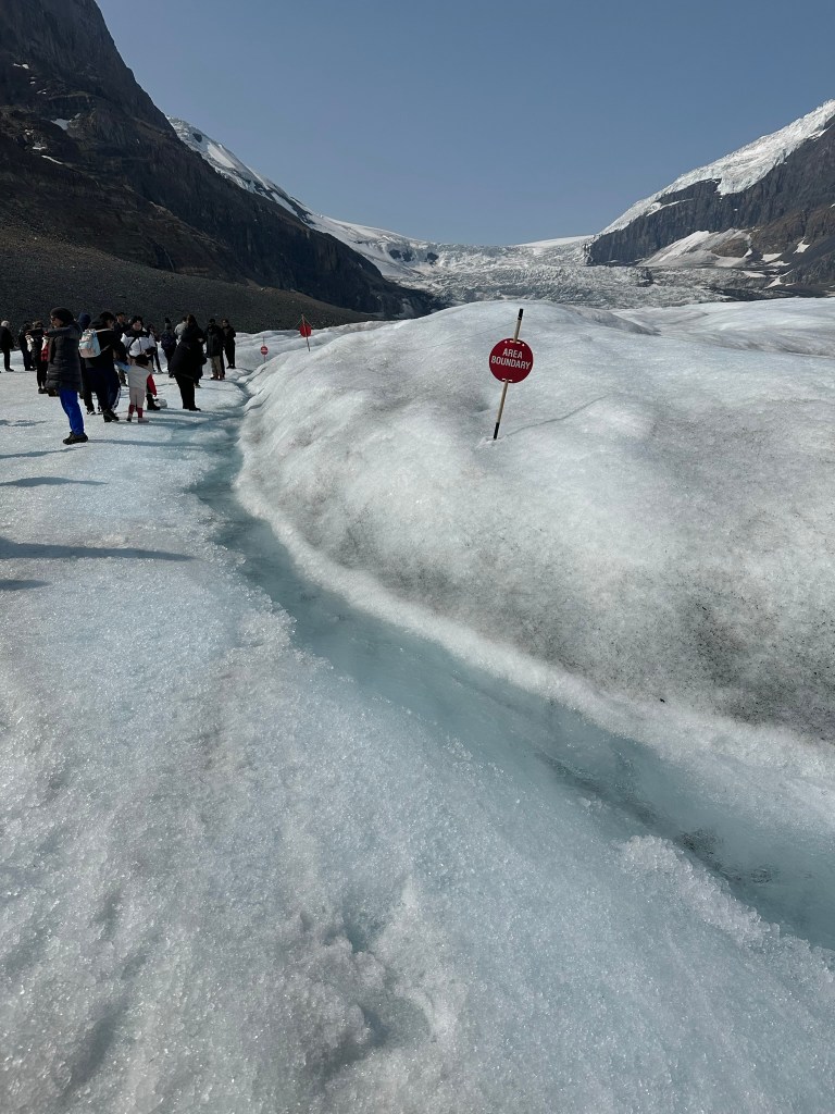
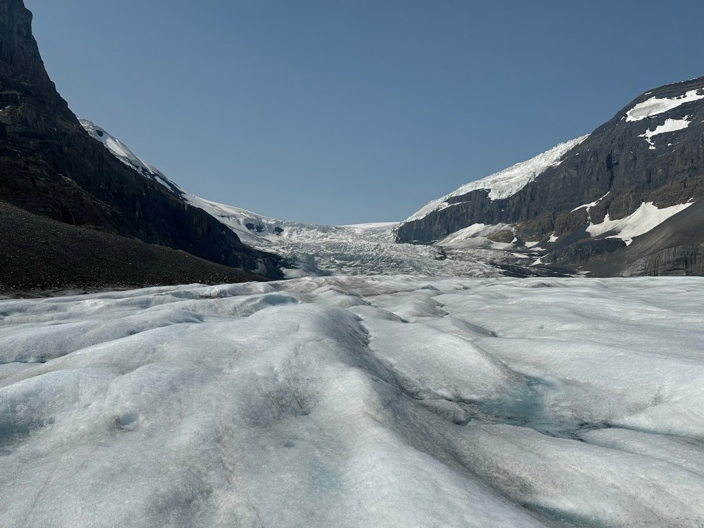
Glacier Walk:You’ll have the opportunity to disembark and walk on the glacier. You can feel the ancient ice. You might even fill your water bottle with meltwater.
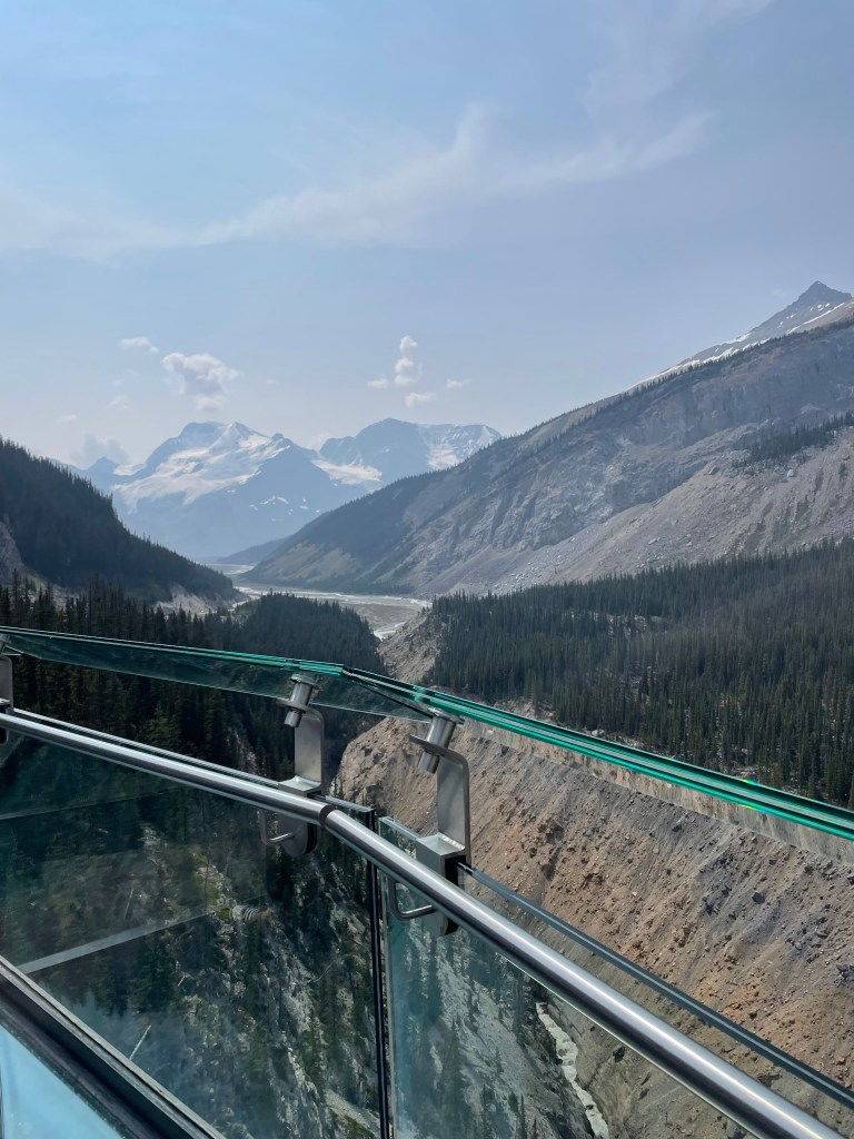
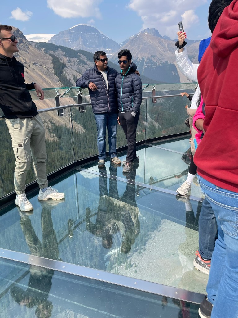
Columbia Icefield Skywalk:This glass-floored walkway offers stunning views of the Sunwapta Valley. It gives breathtaking views of the surrounding glaciers. The structure is suspended 918 feet above the valley floor.
Informative Commentary:Guides offer insights into the geology, history, and environmental changes of the Columbia Icefields.
Warm clothing and waterproof shoes are recommended due to potentially cold and windy conditions on the glacier.
Consider booking in advance, especially during peak season. You can buy tickets here.
We didn’t like the skywalk as much and felt like it was a waste of time. If we do this again, we would choose the toe of the glacier as our destination. Alternatively, we might consider a guided ice walk, such as this one.
We had lunch at the restaurant in the Columbia Icefield’s visitor center and drove back to Lake Louise village.
There are additional stops along the Icefields Parkway from the Columbia Visitor Center. These stops are worth visiting on the way to Jasper if you decide to continue. We hope to return and stop at the remaining stops along the way to Jasper.
Tangle Creek Falls
Location: 135km from Lake Louise/96km from Jasper
Features: Multi-tiered waterfall right beside the highway, beautiful and easily accessible.
Parking: Parking on the west side.
Stutfield Glacier Viewpoint
Location: 139km from Lake Louise/95km from Jasper
Features: Offers views of mountains and glaciers.
Parking: Parking loop off the west side.
Beauty Creek to Stanley Falls
Location : 145km from Lake Louise/89km from Jasper
Features: Unofficial Parks Canada trail, 2.4 miles (out and back). The hike features a narrow canyon with eight waterfalls.
Trail Details: Starts flat, then climbs a short, steep hill. The trail follows Beauty Creek and passes multiple waterfalls before reaching Stanley Falls.
Finding the Trailhead: Unmarked pull-out on the east side of the road (sign in the lot). It’s about 0.5km south of the Beauty Creek Hostel.
Sunwapta Falls
Location 179km from Lake Louise/56km from Jasper
Features: Very popular stop. Picturesque waterfalls originate from the Athabasca Glacier. The upper falls are easily accessible near the parking lot.
Activities: Hike to the upper and lower falls (2 miles, 469 ft elevation gain). The trail to the lower falls involves a downhill slope and some roots.
Access: Turn at the Sunwapta Falls Lodge (road off the west side) to reach the parking lot.
Goats & Glacier Lookout/Viewpoint
Location : 194km from Lake Louise/38km from Jasper
Features: Quick and rewarding stop with stunning views of hanging glaciers, rugged peaks, and the Athabasca River.
You might spot mountain goats here.
Activities: Short walking loop (0.2 miles, no elevation) off the west side.
Athabasca Falls
Location :202km from Lake Louise/32.5km from Jasper
Features: A popular stop on the way to Jasper; a powerful waterfall with a large volume of water.
Activities: Short, paved walk with stunning views (0.6 miles, 82 ft elevation gain). Trails and viewpoints offer you the opportunity to view the falls from various angles. You can also descend to the river. Consider exploring the trail network, which includes a bridge, a pothole, and ends at the river.
Access: Turn onto Highway 93A off the west side; the parking lot will be on your left.
Horseshoe Lake
Location : 205km from Lake Louise/28km from Jasper
Features: Small lake off the east side, known for cliff jumping. The lake is right beside the highway, with ledges overlooking the water.
Parking: Small parking area.
Note: It can get busy, and parking can be challenging.
Valley of the Five Lakes
Location: 223km from Lake Louise/10.5km from Jasper
Features: This popular hike features five clear lakes with unique shades of blue and green. The trail is wide and relatively easy, with some elevation changes.
Activities: 4.5 km loop trail. The trail passes through a forest, crosses a boardwalk, and follows a ridge with views of the lakes. Viewing benches and Parks Canada Red Chairs are along the trail.
Access: Located just under 9 km south of Jasper along the Icefields Parkway.
Final thoughts
The Icefields Parkway is considered one of the most beautiful drives in the world, and definitely lives up to the hype. We started around 6.30 AM from Lake Louise Inn and had the highway pretty much to ourselves for the first couple of hours. We also saw a few bears and other animals along the way. If you have, this is worthwhile to add to your itinerary, and try to drive as far as possible and stop along the way. For our itinerary, we were back in Lake Louise by 3 PM, making it a great day trip.
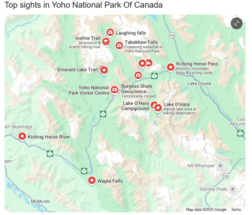
The word “Yoho” originates from a Cree word meaning “awe,” which perfectly describes this beautiful park. In my opinion, Yoho is better than Banff and less crowded. Spanning 1,313 square kilometers (507 sq mi), exploring Yoho is a worthwhile adventure filled with stunning landscapes and diverse ecosystems. It’s considered one of the most beautiful places in British Columbia, a hidden gem for nature lovers. Yoho National Park features towering peaks, pristine lakes, and rich wildlife in the majestic Canadian Rockies. Just over the Alberta/BC border in southeastern British Columbia, it offers a quieter alternative to the crowded Banff National Park. Many visitors only stop briefly at Emerald Lake, but it is definitely worth exploring a few other interesting sites within the park and spending at least a day.
Quick Summary:
What we did: We visited as a day trip from Lake Louise village. We spent the day canoeing on Emerald Lake, and Kicking horse river. We also hiked to Takakkaw Falls and Natural Bridge.
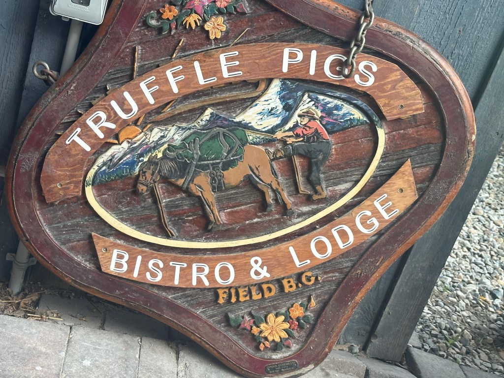
Where we ate: Truffle Pig restaurant in the Field, BC
Where we stayed: Lake Louise Inn, Lake Louise village
It’s located in eastern British Columbia on the western slopes of the Canadian Rockies. It shares borders with Banff National Park to the east. Kootenay National Park is to the south. If you are in Banff, this is a great park to add to your itinerary and spend at least a day in the park to see the highlights.
Top things to do in Yoho National park
Appreciate the engineering marvel of the Spiral Tunnels
One of the most impressive things we saw on our way to Emerald Lake was the Spiral tunnels. We were lucky enough to catch a train passing through the spiral tunnel, and it is awe-inspiring. The Spiral Tunnels are an incredible engineering feat designed to safely navigate the steep terrain of Kicking Horse Pass. Built in 1909, these tunnels were modeled after a Swiss railway system. This design choice aimed to reduce the dangerous grade of the original track. The tunnels allow trains to loop inside Mount Ogden and Cathedral Mountain, effectively spiraling over themselves to gain elevation gradually. You will be able to see Trains forming figure 8 as they pass through these tunnels.
There are two viewpoints where you can watch trains pass through the tunnels. You can also learn more about the Spiral Tunnels and the Kicking Horse Pass National Historic Site of Canada. On average, 25 to 30 trains pass through the Spiral Tunnels daily, though not regularly.
From the viewpoint 7.4 km east of Field on the Trans-Canada Highway, you can see the Lower Spiral Tunnel in Mt. Ogden (This is the viewpoint where we saw the train pass through the spiral tunnels).
The Upper Spiral Tunnel in Cathedral Mountain can be seen from the pull-off 2.3 km up the Yoho Valley Road
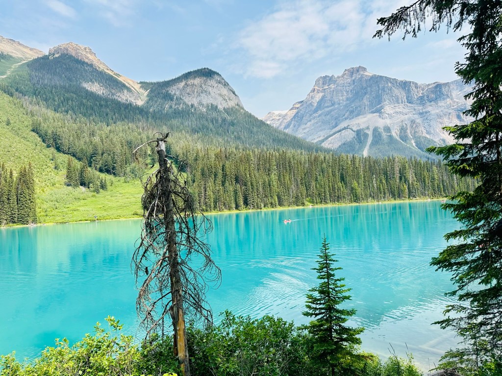
Admire the beauty of Emerald Lake
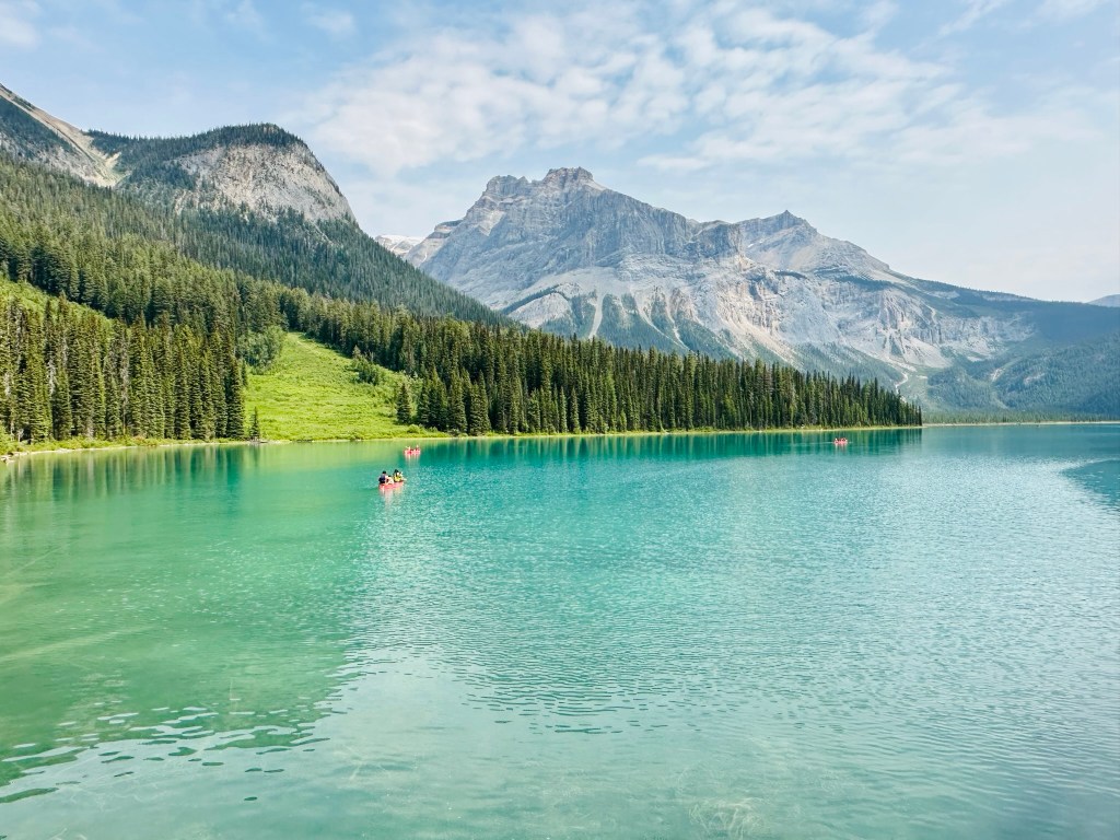
The main attraction at Yoho National Park is the beautiful Emerald Lake. It gets its name from its deep green waters. These waters are fed by glacial streams from the mountains. This stunning lake is not only great to look at but also offers many outdoor activities year-round. These features make it a perfect spot for adventure seekers and nature lovers. It provides excellent opportunities for photography and leisurely nature walks amidst gorgeous scenery. The clear waters attract paddle enthusiasts who can explore by canoe or kayak, taking in the serene surroundings. Well-marked trails around the lake allow hikers to experience the beautiful landscape. Visitors can observe native wildlife, including deer, beavers, and a variety of birds. Every visit becomes a memorable experience.
Canoeing at Emerald Lake
Compared to the more popular Lake Louise and Moraine, canoeing at Lake Emerald is cheaper and less crowded. During the summer months, the canoe rentals are on a first-come, first-served basis. You can’t reserve ahead of time. They run from 10:00 AM to 4:45 PM every day. The canoe rentals are offered by The Boathouse Trading Co., and you can find more information on their website. Each canoe can fit 2 adults and 2 small children, each weighing less than 60 lbs/27 kg. Alternatively, 3 adults can fit in a canoe.
Hike around Emerald Lake
The Emerald Lake Loop is a moderate 5.2 km hike that takes hikers around the stunning Emerald Lake. The trail offers incredible views of the lake and surrounding mountains. This hike is suitable for all levels of hikers and is an excellent choice for families with children.
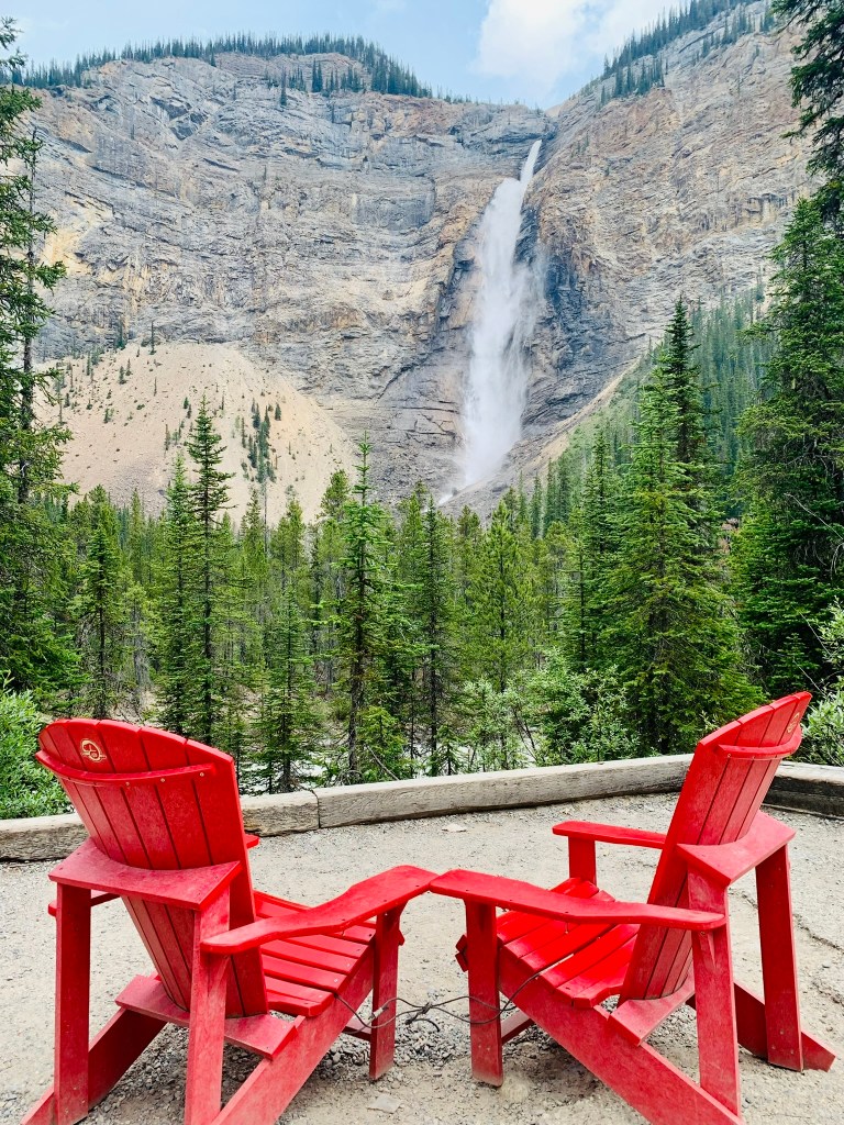
Takakkaw Falls– Second highest waterfall in Canada
The Takakkaw Falls hike is a leisurely 1.2 km walk that leads hikers to the base of the stunning Takakkaw Falls. This waterfall is one of the highest in Canada. The hike offers incredible views of the falls and provides a stunning backdrop of the surrounding mountain scenery.
The name Takakkaw, derived from the Cree word for “magnificent,” couldn’t be more fitting. Plunging a staggering 373 meters (1,224 feet), it’s the second-highest waterfall in Canada (the highest being Niagara falls) .
The falls are fed by the Daly Glacier, which means they’re especially powerful in late spring and early summer when the snowmelt is at its peak.
Where is Takakkaw falls:
You can reach Takakkaw Falls by driving from Banff or Lake Louise on the Trans-Canada Highway into Yoho National Park. Turn right onto Yoho Valley Road and drive for 15 km. After entering the park, it takes about 30-40 minutes of careful driving to reach the parking lot. Be cautious of tight hairpin turns and places where only one car can pass, as trailers or motorhomes cannot navigate these turns. There is ample parking available, but it can get busy in the summer, so we recommend arriving early to secure a spot.
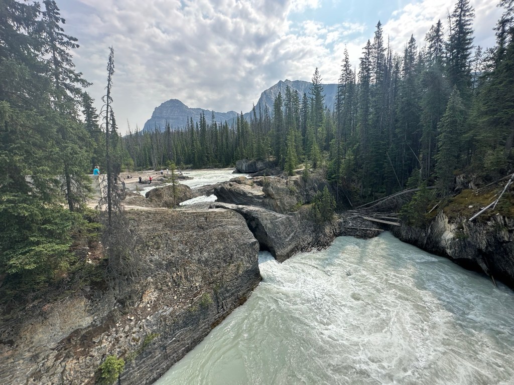
Natural Bridge –Mind the gap
A unique natural formation where the Kicking Horse River has carved through a layer of rock, forming a natural bridge.
The Natural Bridge is a stunning natural rock formation in Yoho National Park, carved by the powerful Kicking Horse River over thousands of years. This impressive landmark showcases the beauty of nature’s artistry, as the river’s erosive action has painstakingly worn away at the limestone, creating a magnificent natural arch. It is easily accessible, with viewing platforms equipped with informative interpretive displays detailing the fascinating process of its formation. It is located on Emerald Lake Road, just 3 km (1.9 miles) from the charming town of Field, making it an ideal stop for those traveling in the area. Additionally, it is a mere 10 km (about 10 minutes by car) from the picturesque Emerald Lake, allowing visitors to easily incorporate visits to both stunning locations in their itinerary.
Wapta Falls – yet another waterfall
A powerful waterfall is located on the Kicking Horse River. Visitors can hike to a viewing platform to take in the impressive sight. We skipped this but if you have time, this falls is definitely worth visiting.
The Wapta Falls hike is a relatively easy 4.8 km (~3 mile) trail that leads hikers to the impressive Wapta Falls. The trail takes hikers through beautiful forested areas and offers incredible views of the falls. This hike is suitable for all levels of hikers and is a great choice for families with children. It will take about 2 hours to finish the hike
***To find the Wapta Falls trailhead on Google Maps, search for “Wapta Falls Main Trail” or “Wapta Falls Trail Head Pk.” Searching “Wapta Falls” will take you to the campground across the Kicking Horse River. This location doesn’t give access to the falls’ base.
Meeting of the Waters
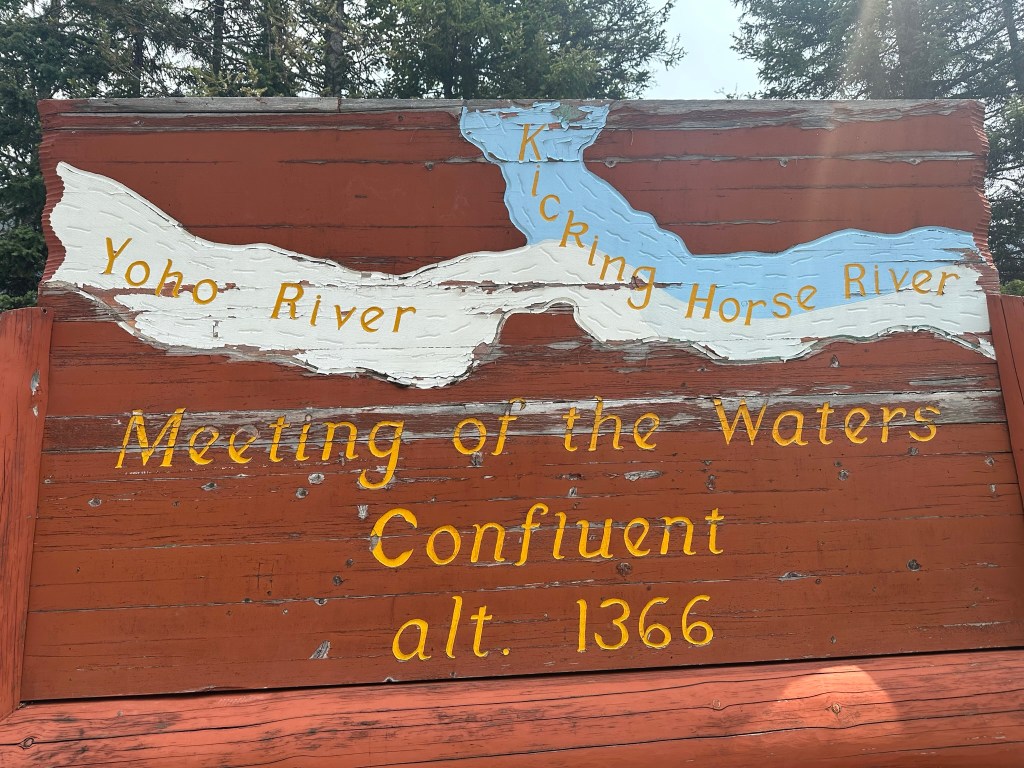
On the way to Takawakka falls, there is a stop where the Kicking Horse and Yoho rivers meet. It’s a great place to explore with the kids. The Yoho River flows from the north and meets the Kicking Horse River, which is a designated Canadian Heritage River. This confluence is a popular spot for visitors. They can view the powerful water flow and the unique glacial green color of the Yoho River. This color is caused by rock flour from melting glaciers. This was one of my favorite spots in Yoho National Park. I highly recommend stopping here on the way to Takawakka falls.
Lake O’Hara
Lake O’Hara is another notable feature of Yoho National Park. It is famous for its clear waters. The stunning mountain scenery attracts nature lovers and photographers alike. European explorers discovered it in the late 1800s. In the early 1900s, a small hotel was built nearby for visitors seeking a peaceful retreat in stunning landscapes. The area has stayed a hidden gem, protected by rules to keep its beauty for future generations.
Visiitng lake O’Hara take little bit of planning. Access is limited to preserve its fragile ecosystem. You can visit by scoring a coveted spot on the Parks Canada shuttle. Alternatively, hike the 11 km access road. You can also stay overnight at the Lake O’Hara Lodge or Elizabeth Parker Hut.
Access to Lake Ohara is managed through a Parks Canada shuttle bus system, and reservations are required.
Here’s how it works:
Day-use shuttle reservations are allocated via a random draw.
The application window for the 2025 season was March 3 to March 24.
If you missed the draw, you can still check for unclaimed spots. These spots are released to the public about 20 days after the lottery closes.
Shuttle Details:
Operates June 20 to October 5, 2025.
Departs from the Lake O’Hara parking lot (12 km west of Lake Louise or 13 km east of Field, B.C.).
Inbound buses: 8:30 a.m. and 10:30 a.m.
Outbound options: 2:30, 4:30, and 6:30 p.m.
How to Reserve:
Visit the Parks Canada Reservation Service to apply or check for availability.
You can also call 1-877-RESERVE (1-877-737-3783).
If you’re staying at Lake O’Hara Lodge, your accommodation includes a shuttle seat. A separate reservation is not needed. The same applies if you are staying at the Elizabeth Parker Hut.
Stop and enjoy the town of Field and eat lunch at Truffle Pig restaurant
After canoeing at Emerald Lake, we decided to stop in Field, a charming hamlet nestled in the heart of Yoho National Park. It was conveniently on our way to the Takakkaw Falls. As we strolled through the quaint streets, we enjoyed the picturesque surroundings before settling down for lunch at the Truffle Pig restaurant around 11:30 AM. Fortunately, it was just before the lunch rush started, allowing us to experience the serene atmosphere. The food and drinks were truly exceptional, featuring a variety of local ingredients. This restaurant truly stands up to its reputation as a must-visit place for both tourists and locals alike.
FInal thoughts
Yoho National Park is definitely worth visiting if you are in the Banff area. It offers a stunning array of natural beauty and outdoor activities. We enjoyed spending the day at Yoho, where the fresh mountain air and picturesque landscapes created an unforgettable experience. Compared to the well-known Lake Louise and Moraine Lake, Emerald Lake is less crowded. If you go in the morning, you can truly appreciate its serene surroundings. I would definitely like to return and explore Lake O’Hara, especially during larch season.
After roaming around the old Quebec city, my friend and I took a break on a bench in front of Château Frontenac. A sculpture that stood in the middle drew my attention. I had been in Qubec city for a couple of days. I spent a lot of time taking photos of the Château Frontenac and Place d’Armes public park. In the middle of the park is a Gothic fountain on which stands the Faith Monument (monument de la Foi) and this statue is next to the Faith Monument. Somehow, I had missed the statue until that moment. I decided to take a photo and try to find more information. I couldn’t find much in my quick Google search. But something about the sculpture seemed familiar, and I had a nagging feeling that I had seen it somewhere before.
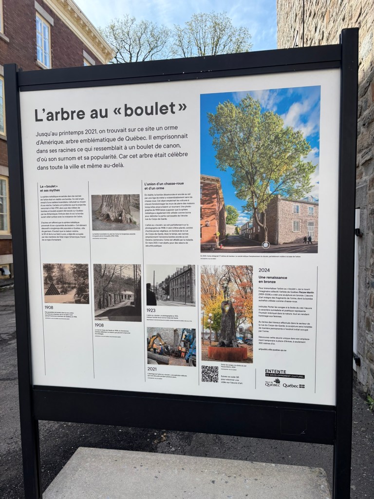
After coming home, I was downloading the photos. I saw a picture of a sign. I had taken it in front of one of the old houses on rue St-Louis that morning. This was before I saw the sculpture. The sign had the photo of the sculpture. Since everything was in French, I didn’t understand what it was until I used Google Translate.
Story of Ball and the Chain Tree
Just beyond the grandeur of Château Frontenac, where cobblestones echo with centuries of footsteps, a tree once stood. It held a secret in its heart. Locals called it the Cannonball Tree—L’Arbre au Boulet. It was an American elm that had cradled a rusting iron sphere for over a century. Legend has it that the cannonball was a relic from the 1759 Battle of the Plains of Abraham. Truth or not, the story stuck, and so did the awe.
Time, as it always does, wore the tree down. Disease crept in. The roots weakened. And in 2021, the city bid farewell. But not with silence—with reverence.
The cannonball was carefully removed by the Canadian Armed Forces, and the tree’s trunk was preserved. Today, in front of Château Frontenac, a sculpture stands—crafted from the very wood that once held history in its bark. It’s not polished to perfection. The grain is rough, the form organic. It doesn’t try to erase the past—it honors it.
This is wabi-sabi in its purest form: the beauty of what remains after loss. A tree that once bore the weight of war now offers a place for reflection. Tourists pause, not just for photos, but for silence. For story. For the reminder that even in decay, there is dignity.
Québec City didn’t just lose a tree. It gained a monument to impermanence.
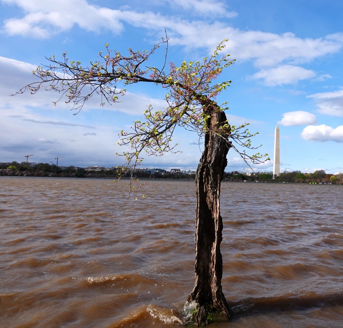
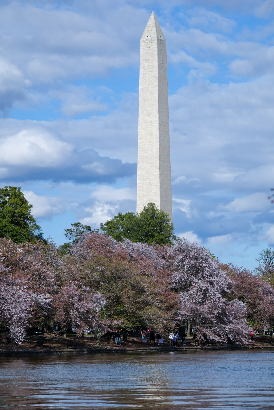
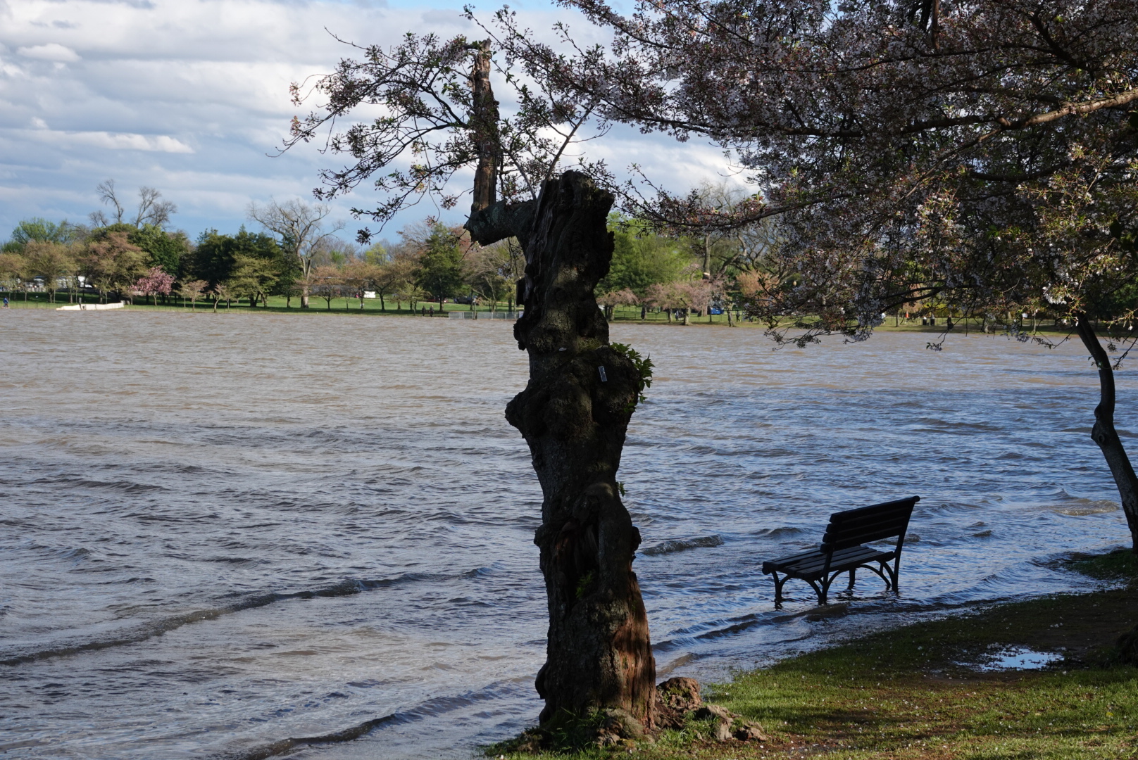
In the heart of Washington, D.C., nestled along the Tidal Basin, stood a tree that looked more like a memory than a monument. Stumpy, as he came to be known, was a Yoshino cherry tree—gnarled, hollowed, and barely clinging to life.
Stumpy was one of thousands of Cherry trees gifted by Japan in 1912, a symbol of friendship. But over time, rising tides and sinking land turned the basin into a twice-daily flood zone. Stumpy, rooted too close to the seawall, endured years of waterlogging, sun-scalding, and fungal decay. By the time he captured the public’s imagination, he had only a few flowering branches left. His trunk was more air than wood. But oh, how he bloomed. During the pandemic, a photo of Stumpy appeared on Reddit. It had a caption comparing his condition to a love life gone awry. Something about that image—a tree so clearly broken, yet defiantly blossoming—resonated. People began to visit. They left flowers, poems, even bottles of whiskey. Stumpy became a folk hero, a symbol of resilience, and a quiet reminder that beauty doesn’t need perfection
In May 2024, Stumpy was removed to make way for seawall repairs. But his story didn’t end there—it evolved. Since 2024, Stumpy has been honored as the mascot of the Credit Union Cherry Blossom Ten Mile Run. I got to see Stumpy before he was removed and managed to snap a few photos of him in 2024 April before running the Cherry Blossom race. I also received a medal with Stumpy on it after finishing the race. Even though Stumpy is gone, his legacy lives on through his clones and his role as the official mascot.
Wabi-Sabi teaches us to embrace the imperfect, the transient, the quietly profound. Stumpy was all of that—and more. He didn’t stand tall or symmetrical. He stood anyway. And now, even in his absence, he leads the race.
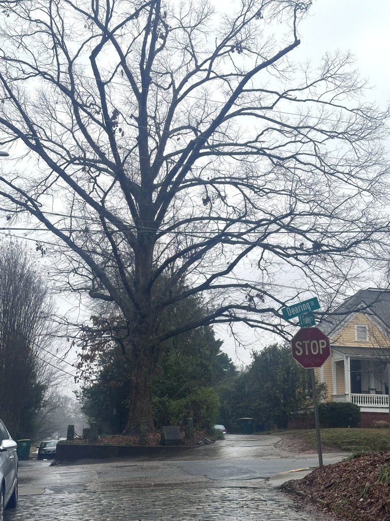
On a rainy afternoon in February 2024, while clicking around the map of Athens, Georgia—home of the University of Georgia—I stumbled upon a peculiar pin: “The Tree That Owns Itself.” In a world full of GPS dots that lead to museums or taco joints, this was something else: a legend, maybe even a love letter to impermanence. I decided to go and check it out.
The story, as it goes, began in the 1800s when Colonel William H. Jackson reportedly deeded the tree its own autonomy, along with the eight feet of ground surrounding it. There’s no surviving legal document. Just a legend, first published in 1890, and a collective decision by the people of Athens to believe in the beauty of that story. That choice—to nurture folklore rather than pick it apart—already spoke to the heart of Wabi-Sabi: the art of finding depth in the unfinished, the transient, and the perfectly imperfect.
The original tree eventually fell during a storm in 1942. But from its acorns, a new sapling was planted in its place. Today, it stands quietly at the corner of Dearing and Finley Streets, surrounded by a granite and chain enclosure, lovingly cared for by the community.
When I visited, the air was misty and soft, like the story itself. There was no grand spectacle—just a tree, an ordinary tree with a story. I stood there longer than expected. Maybe it was the quiet. Maybe it was the reminder that something doesn’t have to be flawless to be cherished.
Travel isn’t always about big monuments or bucket lists. Sometimes, it’s about allowing yourself to be moved by something small, strange, and sublime. That’s Wabi-Sabi: the cracked edges, the rain-soaked sidewalk, the way people choose to hold on to stories that have no legal weight but carry immense emotional heft.
So if you ever find yourself in Athens, don’t just go see the tree. Feel the tree. Linger. Let yourself believe in something quietly wonderful.
Planning to see oilbirds in Trinidad? Here’s my first-person guide to the Dunston Cave colony at Asa Wright Nature Center, why you need a multi-day stay, and what to expect. I’ve seen a lot of birds on my travels, but none quite like the oilbird. Weird, loud, nocturnal, and fruit-eating, it is the kind of…
August 7–17, 2026 There’s something fitting about starting a trip to Iceland with a long flight over open water — by the time we touched down from Atlanta on August 7th, the endless grey of the North Atlantic had already primed us for ten days of dramatic coastline, black sand, and glacier-fed fjords. Reykjavik, On…
Reykjavik surprised me. I’d come to Iceland chasing waterfalls and glaciers, but the capital turned out to be its own kind of photographic playground — a city of candy-colored rooftops, one unmistakable spire, and a concert hall that behaves less like a building and more like a living kaleidoscope. If you only have a day…
If the South Coast had shown us Iceland’s wild, watery side, the Golden Circle promised something different — a day of geology, history, and a few delightful surprises tucked between the big-name stops. We set off from Reykjavik ready to see Iceland’s three most famous attractions: Þingvellir National Park, the Geysir Hot Springs, and Gullfoss…
Our second day in Iceland began with an early start from Reykjavik, and honestly, I couldn’t wait. We’d heard so much about the South Coast — that mesmerizing stretch where rugged coastlines meet towering glaciers, thundering waterfalls, and black sand beaches — and I was ready to see it all for myself. Looking back, this…
Of all the excursions on this trip, Vigur Island might be the one I keep thinking back to. It’s a small stop — a tiny island in the middle of Ísafjarðardjúp fjord — but it packs in wildlife, history, and one genuinely remarkable owner into just a few hours. Getting There We were picked up…
If you’re traveling in Chile, be sure to explore the breathtaking Atacama Desert! You’ll be amazed by the incredible diversity of landscapes, from sparkling lakes and expansive salt flats to stunning canyons, bubbling geysers, graceful flamingos, and adorable alpacas. With so many captivating places to discover, every moment will be an exciting adventure! We explored this amazing place by using San Pedro Atacama as our base, a charming adobe town with dirt roads and a stunning landscape.
Quick Summary:
What we did: Spent 2 days in San Pedro Atacamam and did self-guided tours( Ideal would be 3-4 days to cover everything)
Where we stayed :Hotel Kimal Domingo Atienza 452, San Pedro de Atacama, Antofagasta,
Where we ate: Many restaurants close to the hotel on the main street
Things I wish I had known before traveling to San Pedro Atacama
This unique region, known for its stunning landscapes and rich cultural heritage, offers visitors a wide range of activities, including hiking, stargazing, and exploring ancient petroglyphs. However, the various attractions in the Atacama Desert are spread out and managed by either local tribes or the Chilean government. Some attractions allow cash payments at the entrance, while others require online reservations, which can be confusing for first-time visitors. We found it difficult to navigate all the various requirements and get the best out of our visit to Atacama; therefore, taking a guided tour can provide valuable insights and help maximize your experience is advised. Knowledgeable guides can share fascinating stories about the local flora, fauna, and historical significance of the area, making your visit truly unforgettable. Check out denomades.com for customized tours tailored to your length of stay, ensuring that you can fully immerse yourself in the beauty and wonders of Atacama.
Tickets to various attractions and where to buy them
The full moon affects the tours. No tours are offered in and around the full moon
Rainbow valley
$5000
Check with a tour operator. Not much info available
None
Check with a tour operator. Not much info avialable
Petroglyphs of Yerbas Buenas
$5,000
$5,000
Cash at the entrance
None
Check with a tour operator. Not much info available
How to get to San Pedro Atacama
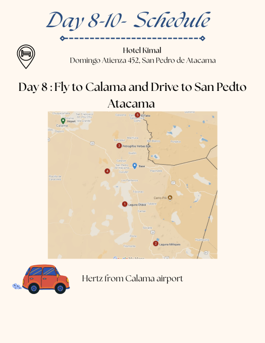
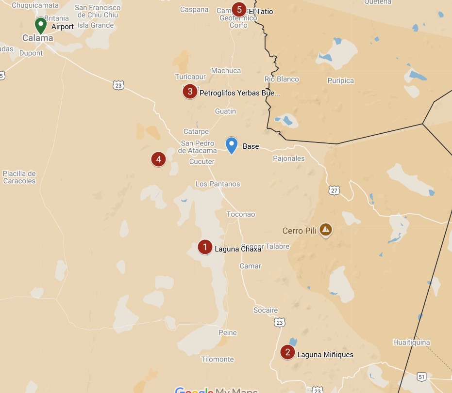
The most common way to get to San Pedro de Atacama is from Santiago to the city of Calama, and then head towards San Pedro. El Loa (CJC airport), located in Calama, about 100 kilometers northwest. It receives regular flights from Santiago and some services from other cities in Chile.
How long does the drive from Calama to San Pedro de Atacama take? The driving distance between Calama and San Pedro de Atacama is 100.5 km via Route 23. It takes about 60-90 minutes to drive this distance.
For more information on how to reach San Pedro Atacama and bus options, check this webpage.
Things to do in San Pedro Atacama
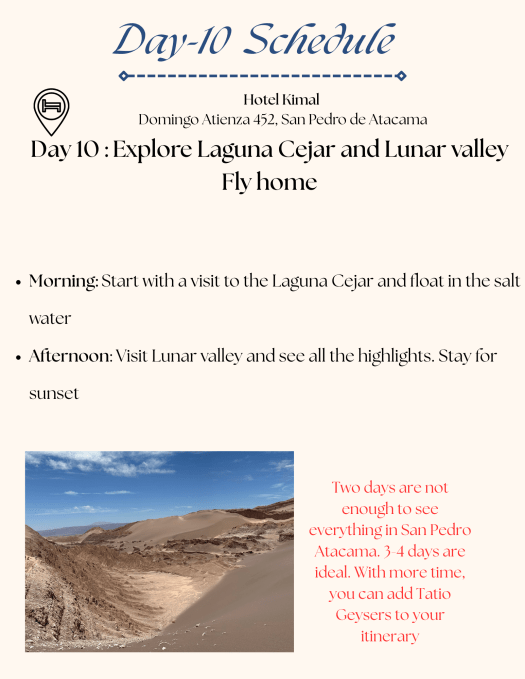
Experience the unique landscape of Valle de la Luna (Moon valley)
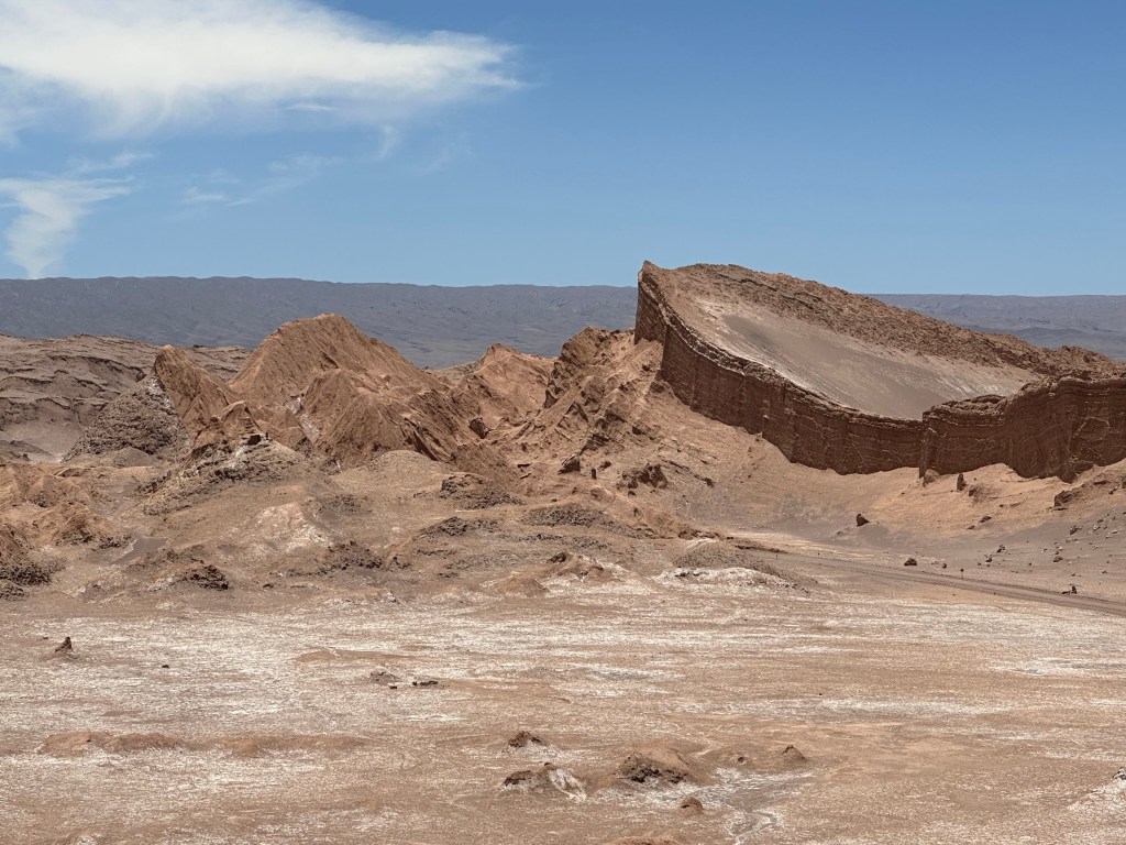
Valle de la Luna
The Valle de la Luna is named after its lunar-like landforms eroded by eons of flood and wind, creating a breathtaking landscape that captivates all who visit. This natural wonder is located approximately 15km west of San Pedro de Atacama, nestled at the northern end of the Cordillera de la Sal. It is a stunning mountain range noted for its unique geological formations. The valley is not only a feast for the eyes but also forms part of the Reserva Nacional Los Flamencos, a protected area that is home to a diverse array of flora and fauna. Visitors to Valle de la Luna can marvel at the dramatic contrasts of colors and textures, especially during sunset when the landscape transforms into a surreal palette of oranges and purples, offering a truly unforgettable experience.
You can pre-book your tickets hereor take an organized tour from one of the tour operators in San Pedro Atacama. Sunset is the time when most like to see Moon Valley and hence the busiest. Take lots of water, a hat, and sunscreen while visiting Moon Valley, as it is very dry and hot.
Float on Water in Cejar and Piedra Lagoons
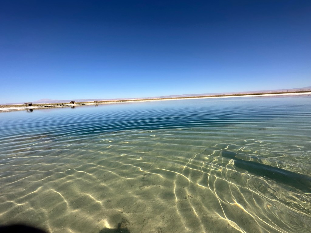
Located 18 km east of San Pedro de Atacama, these lagoons are authentic hidden gems in the heart of the vast and breathtaking desert. With saline content similar to that of the Dead Sea, visitors can swim or float effortlessly in the warm, inviting waters. The facility is very well maintained, featuring clean showers and restrooms. This is one of our favorite places we visited in the Atacama Desert, a perfect retreat to experience the natural beauty and tranquility of the region.
Renowned for their striking beauty and unique ecosystem, both lagoons are under the careful management of the Atacameña Indigenous Community of Solor, who have inhabited this area for generations. Visitors can immerse themselves in the stunning landscapes and diverse wildlife that thrive in this arid environment. However, there are specific times when the lagoons are open to the public or tour operators, ensuring that the natural habitat is preserved and respected. For those eager to explore this enchanting destination, check here for the timing and tickets, and prepare for an unforgettable experience in one of nature’s truly remarkable settings.
Stargaze in one of the most beautiful night skies
San Pedro de Atacama is a great place for stargazing! The Atacama Desert has some of the clearest skies due to its high altitude, low humidity, and little light pollution. You can join tours that provide telescopes to see stars, planets, and galaxies. Some tours also include astrophotography and talks about space. The area has top observatories like Paranal and La Silla, which help with global astronomy projects. Unfortunately, we couldn’t take any tours because we visited during the full moon, which isn’t good for stargazing, and no tours were available. Check here for available tours.
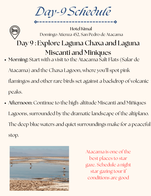
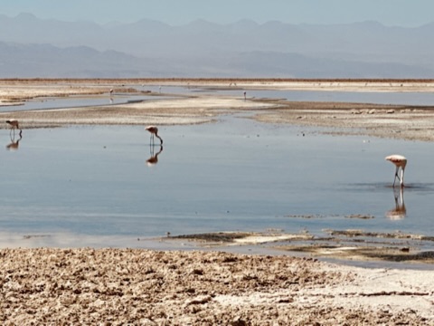
Go bird watching at Los Flamencos National Reserve-Laguna Chaxa
The Chaxa Lagoon is located at a central point of the Atacama Desert, an expansive and strikingly beautiful region known for its arid landscapes and unique ecosystems. It is situated just 7 km away from the charming village of Toconao and a little less than 50 km from San Pedro de Atacama, making it an accessible destination for both tourists and locals alike. This captivating area belongs to the Protection System of wild areas of CONAF. It is a vital part of the Flamingos National Reserve, which aims to safeguard the rich biodiversity found in the region. The lagoon attracts a variety of avian species, but it is probably one of the best places in Chile to see flamingos in their natural habitat. Visitors will find a couple of well-marked trails that meander through the reserve, allowing them to walk and observe the flamingos closely while enjoying the serene beauty of the landscape. Most people suggest going at sunrise to witness the stunning spectacle of the birds as they take flight under the rising sun, but it’s important to note that the park is not open until 8 AM, so plan accordingly.
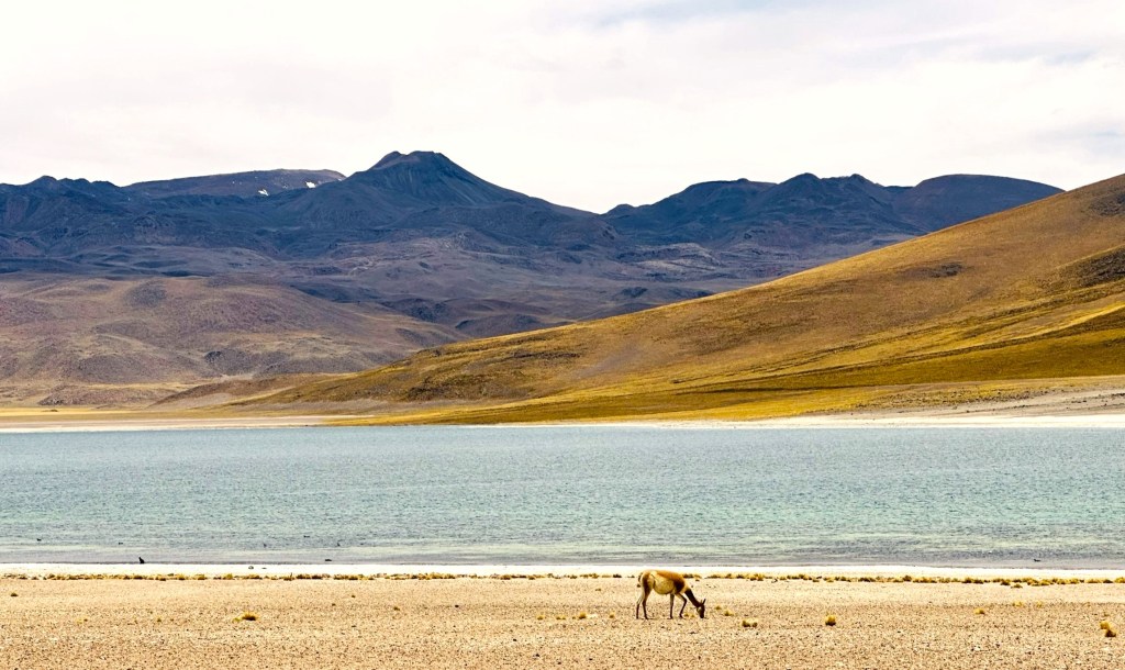
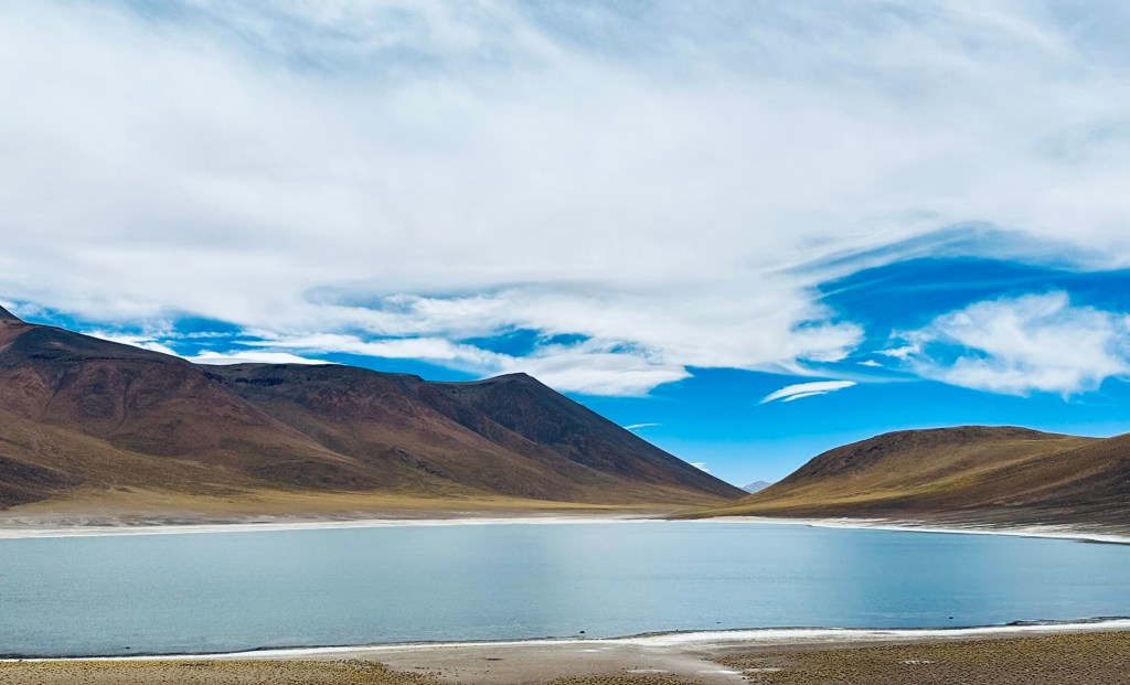
Viist Altiplanic lagoons- Miscanti and Miñique
Located east-southeast of the Salar de Atacama, the Miscanti and Miñiques lakes lie at the base of the Cerro Miscanti volcano. These lakes are part of the Los Flamencos National Reserve and are rich in wildlife and geological features. Situated 90 kilometers from San Pedro and over 4,000 meters above sea level, they draw water from the ground, attracting various animals, including many flamingoes, which contrast beautifully with the snowy mountains reflected in the water. These two blue lakes, surrounded by the driest desert on earth, are 10 meters deep and remain untouched in a stunning natural setting.
Visit the highest geysers of the world– Tatio Geysers
The Geysers of San Pedro de Atacama, located in the Andes mountains at 4,200 meters and 89 kilometers from San Pedro, offer stunning views and impressive steam columns rising up to 8 meters, particularly around sunrise. Visitors are advised to wear warm clothing and bring swimwear, as thermal pools are available nearby. The best viewing time is between 6:00 and 7:00 AM, with steam temperatures reaching 85°C. The area features a variety of wildlife and plants, making it a remarkable attraction in the Atacama Desert.
We skipped the Tatio geysers because no one wanted to wake up at 4 AM to see them, and the kids said they had already seen Old Faithful in Yellowstone and geysers in Iceland. The best way to see the geysers would be to take a tour; that way, you can leave the early morning driving to locals. Entrance to El Tatio Geysers costs CLP$ 15,000 per person and is paid in cash at the entrance.
Final Thoughts
All in all, Atacama is a great place to visit, offering breathtaking landscapes and unique natural wonders. However, be prepared to drive 1-2 hours to explore the various attractions scattered throughout the region, as they are often quite remote. It’s important to plan your itinerary carefully, as some sites may require more time than others to fully appreciate their beauty. With very limited information available on various attractions, opting for a guided tour might be a better way to ensure you make the most of your visit and get maximum bang for your buck. A knowledgeable guide can provide insights into the area’s rich history and geology, making for a more enriching experience. Plus, they can help navigate the sometimes challenging terrain, allowing you to focus on enjoying the stunning scenery.
What we did : Spent 3 days driving around Torre Del Paine doing short hikes, and stopping at various viewpoints
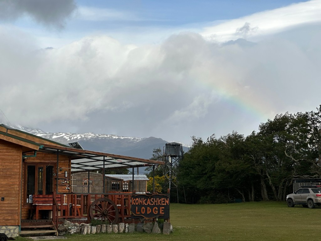
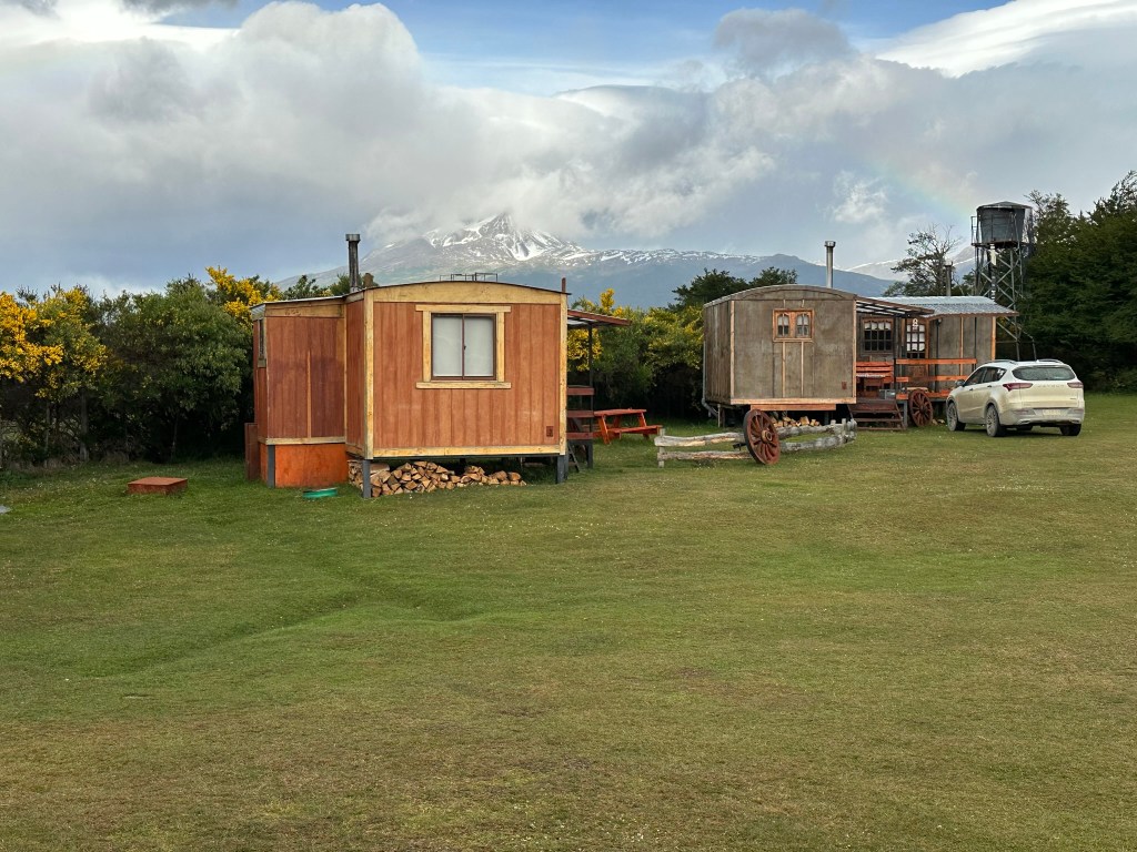
Where we stayed : Just outside the park in cabins called Konkashaken Lodge.
Where we ate: There are not many restaurants in the remote area of the park. We cooked our food in the cabin for breakfast and dinner. We had purchased bread, peanut butter, wine, pasta, pasta sauce, and snacks from a supermarket in Puerta Natales before making our way to Torre del Paine. We ate lunch at Lake Pehoe restaurant one day and at the REFUGIO TORRE CENTRAL on day 2.
What to take: Even though we were in Torre Del Paine in December, which is summer in the Southern Hemisphere, we needed our Winter jackets, gloves, hats, layers, etc. Pack for all weather conditions the weather changes quickly
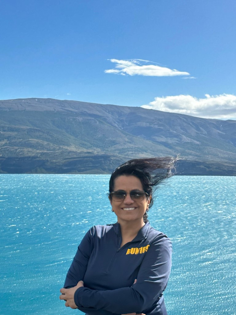
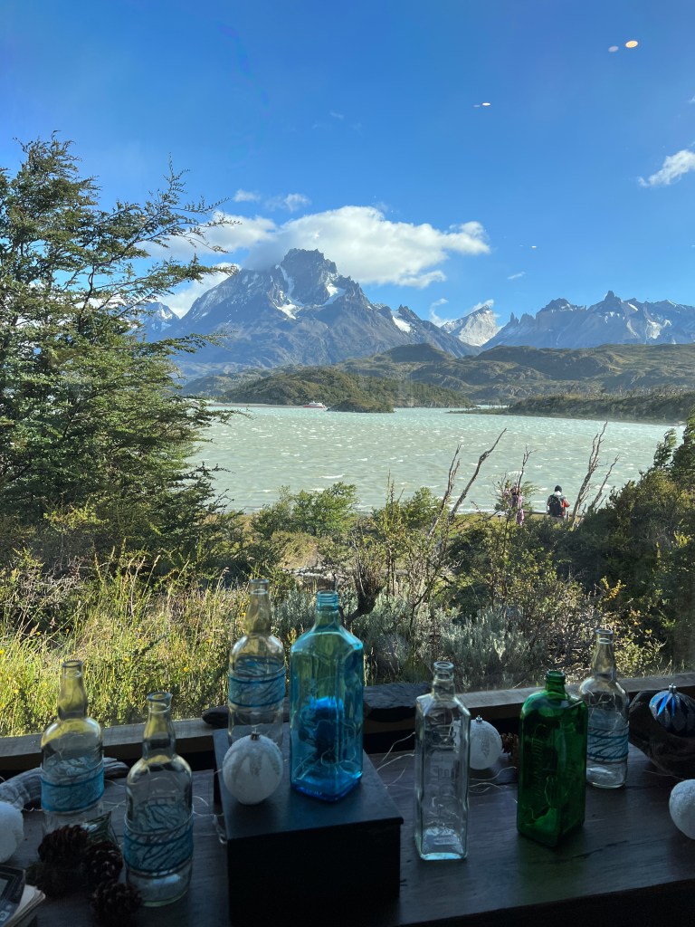
Special Notes : Torre del Paine is truly remote and lacks many facilities. We rented a car from Puerto Natales and bought groceries and supplies before heading out to the park. There are no gas stations in the park, and we purchased enough gas to make it back to Puerto Natales from our hotel owner. Other thing that really surprised us is the wind and no matter what you have heard about Torre Del Paine, we were not prepared for the hurricane force winds. Bellow picture was taken last day, and I call it ” Torre Del Paine Hair, Don’t care”
Patagonia and Torre Del Paine
Welcome to one of the most beautiful places on Earth. Patagonia is a large region shared by Argentina and Chile in the south. Though it crosses two countries, it feels like its own unique place. You can spend a few days visiting Torres del Paine National Park as part of a longer journey through South America. Or, you could explore Patagonia for two weeks, taking in the highlights of both the Chilean and Argentinian parts. If you want to see quieter, less-known areas like Aysén, you could spend weeks traveling in Patagonia.
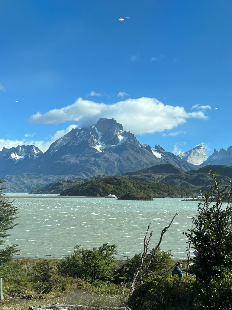
Torres del Paine National Park, the jewel of Chilean Patagonia, features stunning landscapes with sharp peaks, bright blue lakes, glaciers, and lots of wildlife, all set against wide-open grasslands. Although it can get busy, I believe Torres del Paine is the top attraction in Patagonia. It showcases the area’s wild beauty with its rolling, windy grasslands mixed with mountains, lakes, and glaciers.
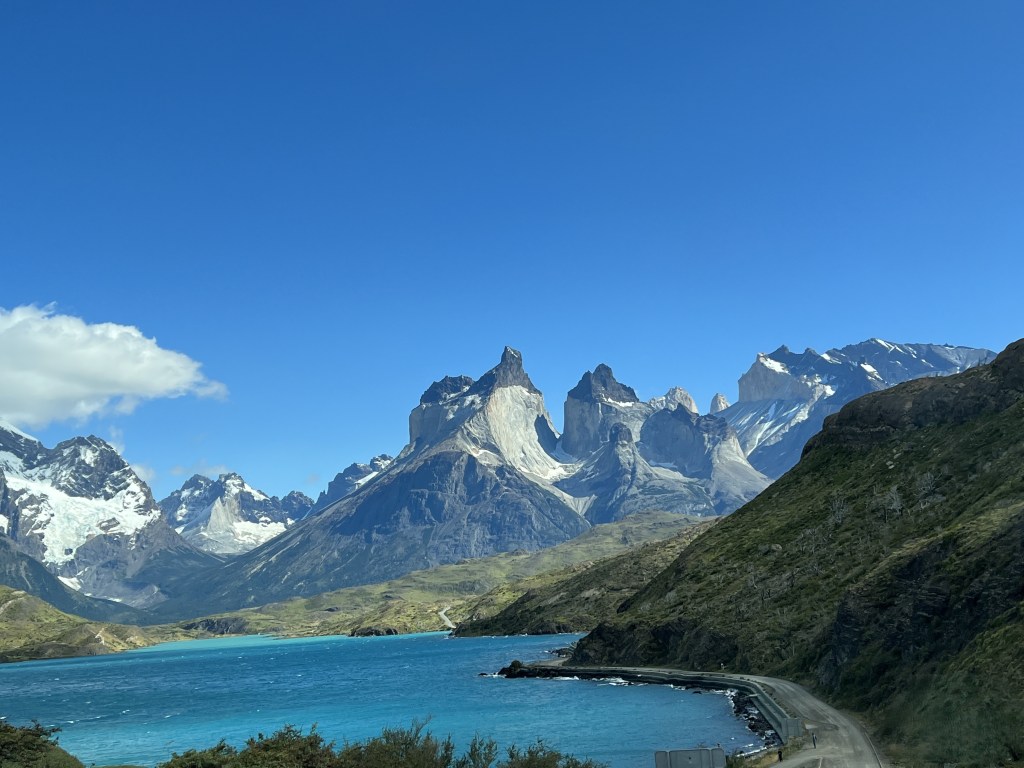
The three tall granite towers, known as the torres of the Paine Massif, are the park’s main highlight. You can see them from almost anywhere in the park. They are surrounded by the twisted black formations of the cuernos (horns) and the rugged summit of Paine Grande Mountain.
If you don’t see the Torres right away because of fog or rain, don’t worry. Patagonia can have four seasons in one day. The best time to visit is summer (December-February), the windiest period. Though the wind can make taking pictures or hiking difficult, bad weather usually passes quickly. The Torres is impressive any time of year. In winter (June-August), they look magically covered in snow. At other times, they stand tall as dark gray rock pillars.
Most people visit Torre Del Paine for its amazing hiking trials. We visited Torres del Paine National Park during Christmas of 2022 for 3 days. You can still enjoy this national park’s amazing views even if you’re not a hiker. We rented a car and drove around the park, which allowed us to explore at our own pace. We stayed just outside the park and visited various viewpoints on day one and day two, and we were planning to take a Gray Glacier boat trip on day three.
Even though we are not serious hikers, we enjoyed walking on flat paths with stunning views and minimal effort. Each lookout gave us a new perspective of the beautiful park, from mountains to clear lakes, making our trip worthwhile. I recommend against visiting for just one day, as the weather in Torre Del Paine is unpredictable. When we visited, the first two days were cloudy and rainy, but we still saw amazing scenery. Heavy winds started on the afternoon of day two, keeping us inside our cabins. On day three, we woke up to sunshine and clear skies, but the wind continued, preventing us from going on the Gray Glacier boat trip. We chose to revisit some viewpoints since the wind had cleared the skies, and day three ended up being the sunniest day of our visit.
How to reach Torre Del Paine
Torres del Paine National Park has two main airports: Puerto Natales (PNT) and Punta Arenas (PUQ). There are no direct international flights, so travelers must connect through Santiago. Both airports are about 3½ hours from Santiago by air, with LATAM operating the flights. Most travelers prefer Punta Arenas for its more frequent flights, as Puerto Natales has usually only one flight a day during high season, which leads to higher prices. From Punta Arenas, it takes about three hours by bus to reach Puerto Natales, followed by more travel time to the national park.
Travel from the Airport to the Park:
From Punta Arenas, you can take a bus or drive to Puerto Natales (about 3 hours), and then continue to the park (another 2 hours).
From Puerto Natales, buses and private transfers are available to the park entrance.
Inside the Park: Once at the park, you can explore by bus, rental car, or even boat. The park has multiple entry points, so plan your route based on your itinerary.
We flew to Port Natales and rented a car to drive to Torre del Paine. More detailed information can be found here .
Where to stay at Torre Del Paine
There are several budget-friendly options in and around the park, but it’s best to book months in advance due to limited availability. For accommodation details, check here. When we looked 8-10 months ahead, we struggled to find affordable options, but we eventually found a great place just outside the park at Konkashken Lodge. This lodge is unique and is located by the Serrano River. This is very simple accommodation with no restaurant on site and we cooked most of our meals in the room that had an attached kitchen.
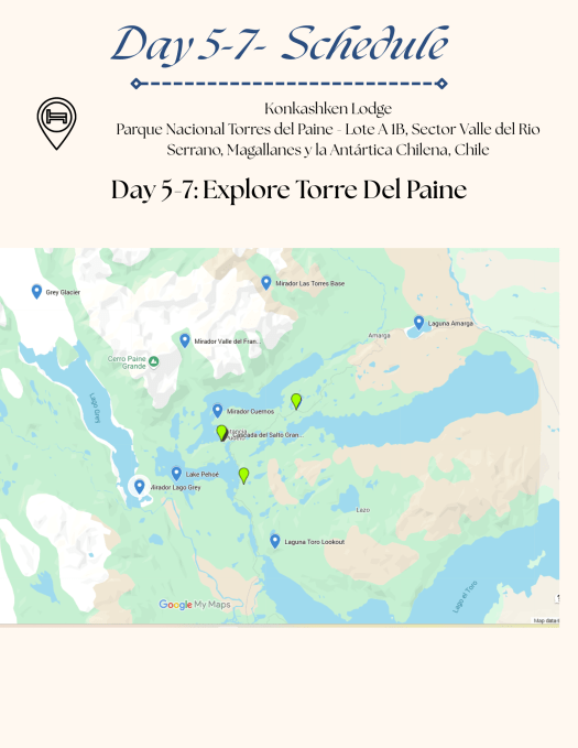
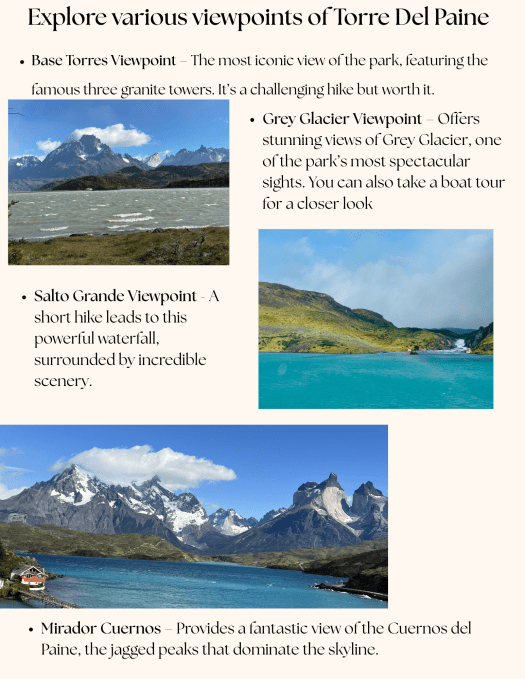
Since we weren’t planning long hikes, we used the 3 days in Torre Del Paine by driving around the park and stopping at various Miradors or viewpoints. Following are some of our favorite viewpoints that require zero or minimal hiking to enjoy.
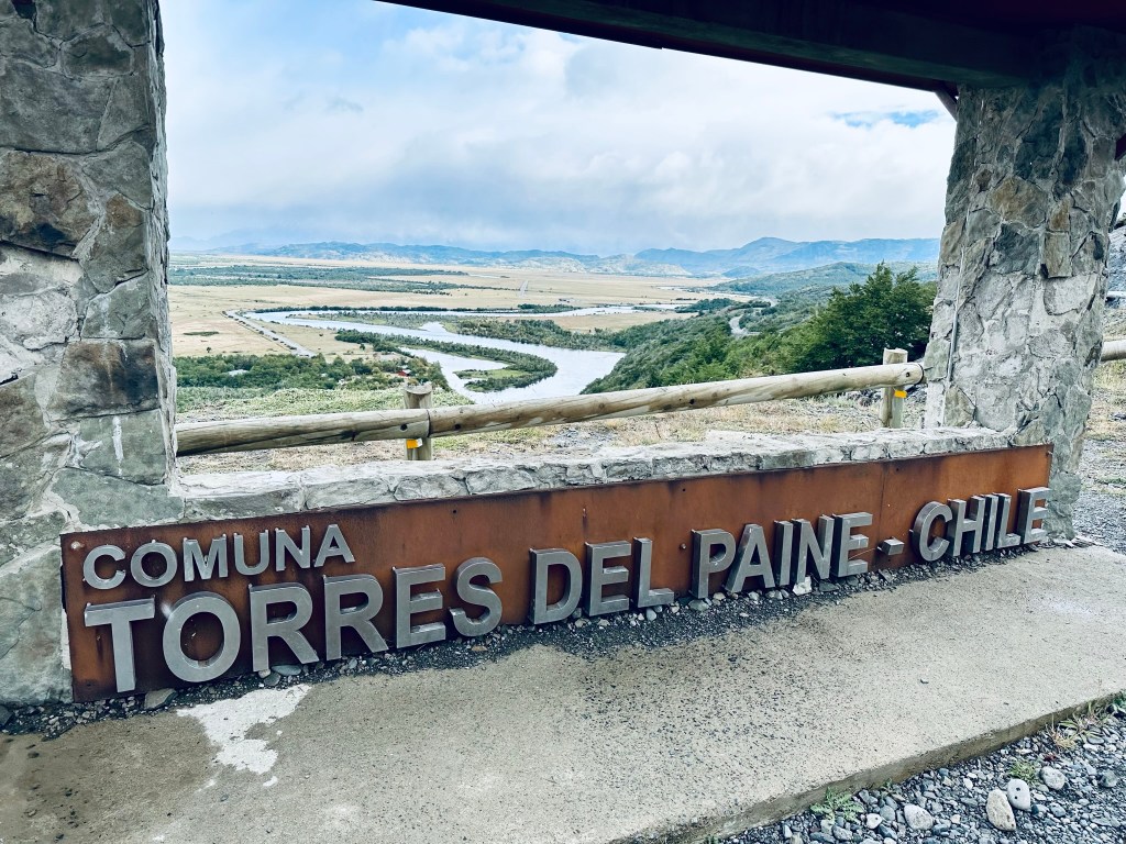
Rio Serrano and Torre Del National Park sign viewpoint
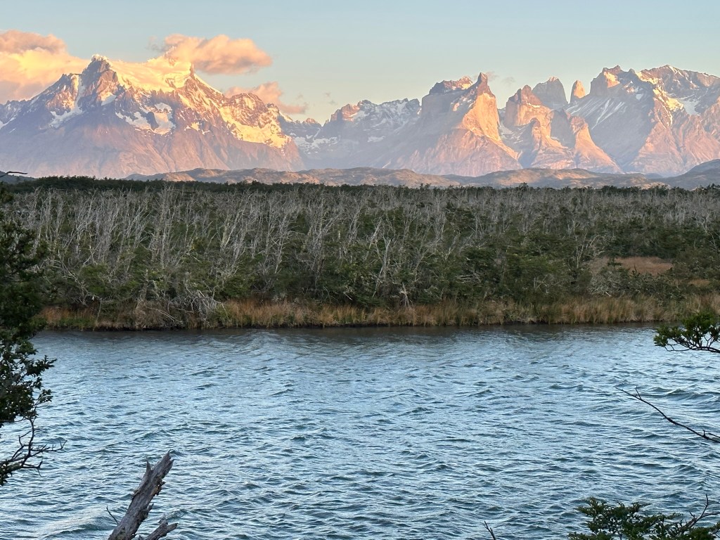
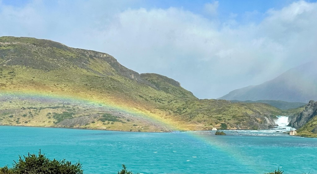
Our first view of the amazing park was on our way to the Konkashken lodge. We stopped on route 292 to enjoy the stunning view of Rio Serrano and the village below. The river curved through the landscape, and we spotted the first of many rainbows we would see over the next three days. This is a great spot for sunrise photos, too.
Views from Konkashaken lodge and Rio Serrano
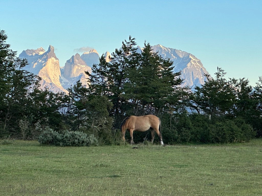
Wild horse at Konkashken LodgeRio Serrano and snowy mountains of Torres del Paine from Konkashken LodgeHuge dog at the lodge
The Konkeshken lodge is by the Rio Serrano and surrounded by horse farms, where locals often go horseback riding or hunting with their dogs. On day 3, we had a sunny morning, and I walked to the river to enjoy the stunning view of the snowy Torre del Paine mountains and horses grazing nearby. The lodge owner has large dogs, and on that day, I saw the biggest dog I’ve ever encountered, which I initially thought was a wolf. It turned out to be the owner’s dog’s sibling just visiting from the neighboring farm.
Lago Pehoe view from Hosteria Pehoe
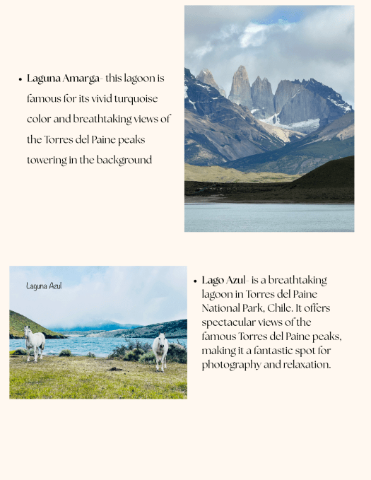
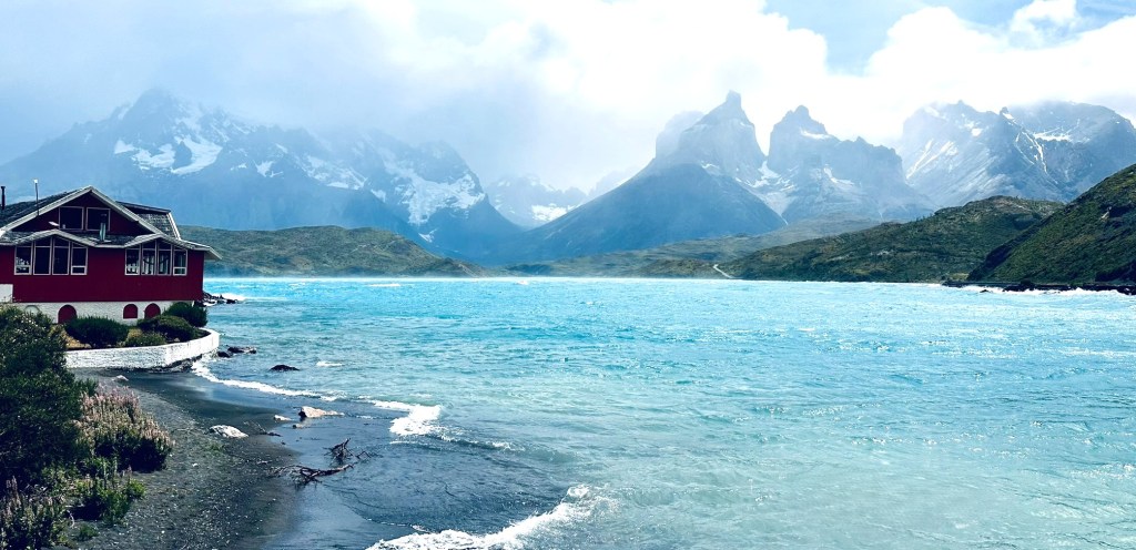
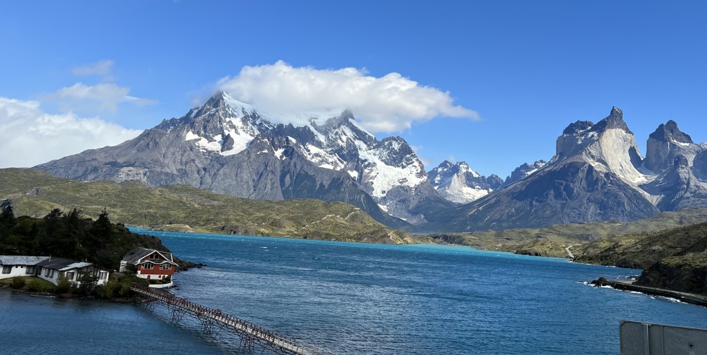
Lago Pehoe sits at the center of Torres del Paine National Park and is considered to be one of the 10 most beautiful lakes in the world. You have wonderful views of the Paine Grande Mountain and the Cuernos (horns) del Paine from the lake. Pehoe is a Tehuelche word meaning ‘hidden’ and is pronounced “pay-oh-way.” We stopped at the parking lot for Hosteria Pehoe, which is located on an island and can be accessed by a bridge. The parking lot is right off ruta Y-150 and near Mirador Cóndor. We had an amazing lunch at the restaurant in Hosteria Pehoe with views of Lake Pehoe and Los Cuernos. We stopped here multiple times during our 3-day visit for the beautiful views and food. You can hike part or all of the Mirador condor trail, which is a 2.4-km round-trip route and offers the most magnificent views of Lake Pehoé, the Southern Patagonian Ice Field and the Sierra Baguales.
Hosteria Pehoe, Lago Pehoe and Cuernos del PaineLago Pehoe and Cuernos del Paine
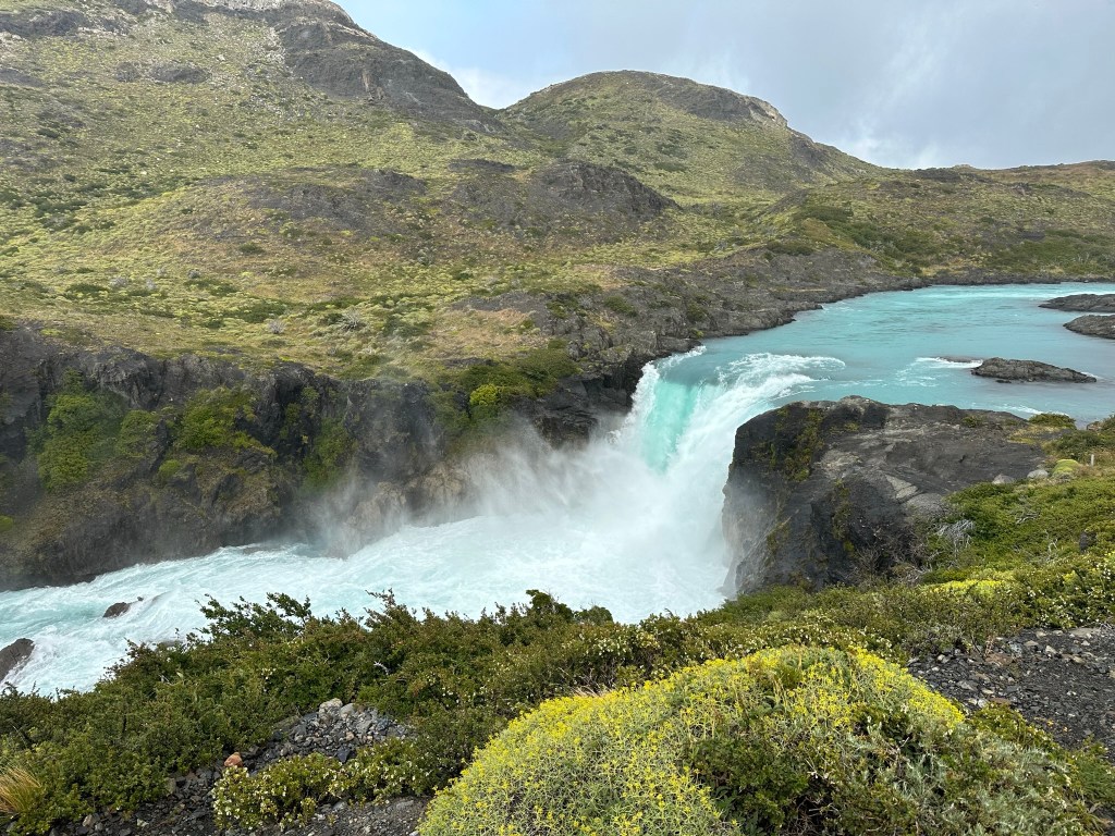
Salto Grande view point
As you drive along Ruta Y-150 toward Lake Nordenskjöld, you can see Salto Grande waterfall. There’s a place to stop and admire Lago Pehoe with Salto Grande behind it. We paused to take a quick photo of a lovely rainbow that appeared with Salto Grande in the background, but it vanished within minutes.
Lago Pehoe, Salto Grande
The lookout for Salto Grande waterfall is along Ruta Y-150, with a marked parking lot nearby. Just two kilometers from the main road, it offers a view of the impressive water flow from Lake Nordenskjöld. The area shows signs of the 2011 fire, with burned trees and eroded soil, but the view is still beautiful.
Salto Grande from view point
Mirador Nordenskjold
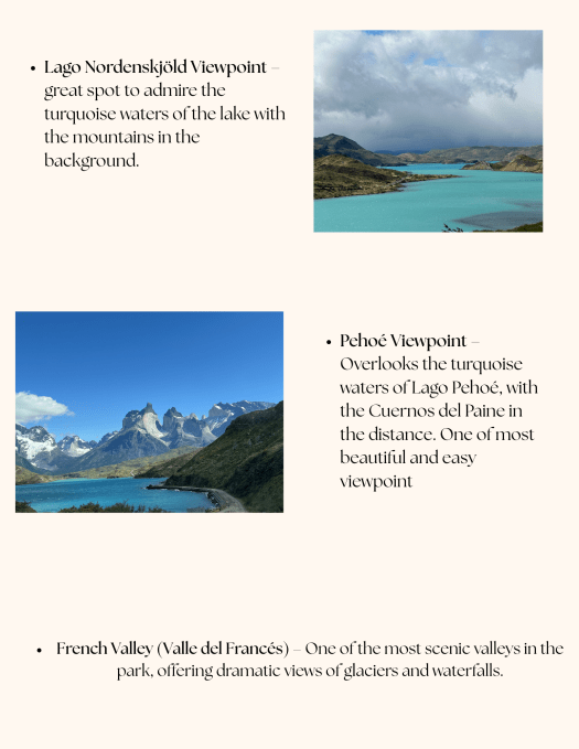
Continuing down Ruta 150, next stop was mirador Nordenskjold. There is marked parking lot and couple of minutes of walk leads to spectular view of Lake Nordenskjold
Cascade Del Paine
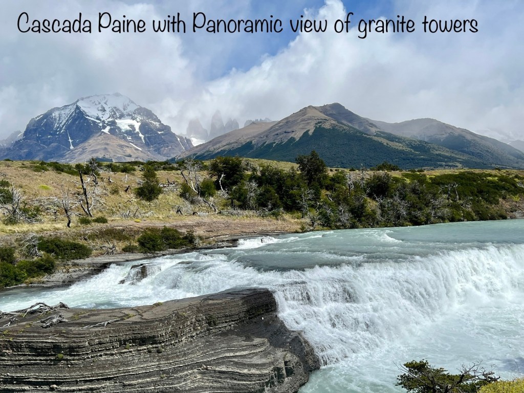
As we proceeded down Ruta 150, we reached a fork that divides the road into Ruta 150 and Ruta 156. We took Ruta 156 to Lago Azul, and our first stop was Cascade Del Paine. This is my absolutely favorite spot in the entire national park. The Cascada del Río Paine is a stunning waterfall in Torres del Paine National Park, Chile. It offers breathtaking views of the Paine River and the iconic Torres del Paine peaks in the background. This natural wonder is a popular spot for photography and a must-visit for nature enthusiasts exploring Patagon
Laguna Azul
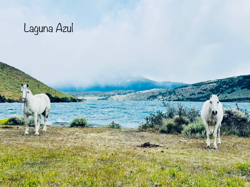
Laguna Azul, or “Blue Lagoon,” is a beautiful lake in Torres del Paine National Park, Chile. It is known for its bright blue waters that mirror the surrounding scenery, including the famous Torres del Paine peaks. This area is great for wildlife lovers, as you can spot guanacos, birds, and other local animals in the wild.
Laguna Amarga
Laguna Amarga, located in Torres del Paine National Park, Chile, is a fascinating lagoon known for its high salt content, which gives its waters a bitter taste—hence the name “Amarga,” meaning “bitter” in Spanish. The lagoon’s evaporation process leaves a soft white layer of salt on its shores, strikingly contrasting with the vibrant blue waters. This lagoon is also a prime spot for observing flamingos during summer, adding to its charm. Its strategic viewpoint offers breathtaking views of the iconic Torres del Paine peaks, making it a favorite among photographers
Lago Grey and Grey Glacier
Lago Grey is a magnificent lake fed by ancient glaciers, where the imposing Grey Glacier flows in, creating a breathtaking scene filled with icebergs and striking blue ice. This area is renowned for its enchanting and colossal icebergs that calve dramatically from the base of the Grey Glacier, crafting a visually stunning landscape. The vibrant hues of blue and white against the rocky terrain provide a striking contrast, making it a photographer’s paradise. There are various exhilarating ways to explore this pristine lake and the majestic glacier surrounding it, and we eagerly chose to embark on an adventure by boat. However, to our dismay, the winds were brutally strong that day, leading to the unfortunate cancellation of our highly anticipated boat trip, and we just had to see the glacier and lake from the Hotel Grey.
Various ways to explore Grey glacier
Boat Trips: Boat tours navigate the lake, allowing visitors to get close to the glacier and icebergs. For timing and tickets, check here. The boat trips start from Hotel Lago grey .
Hiking: The W Trek and Full Circuit hikes offer awe-inspiring views of the lake and glacier.
Kayaking: Paddle amongst the lake’s sculpted icebergs.
Ice Hiking: Don crampons and ice axes to explore the glacier.
Mirador Lago Del Torro
The Toro Lake is the biggest lake in the region and most of it is located outside the borders of Torres del Paine national park. We stopped here just off the Ruta Y-290 on our way to Puerta Natales, after our cancelled Grey glacier boat trip. The vibrant blue waters of Toro Lake contrasted beautifully with the rugged mountains in the background, creating a breathtaking view that felt almost surreal.
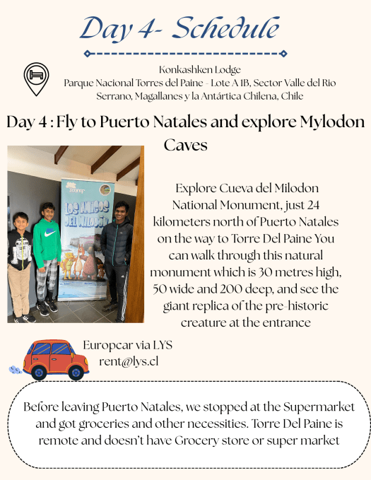
Milodon Caves
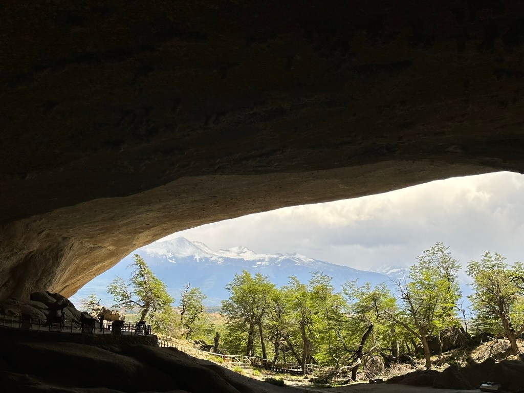
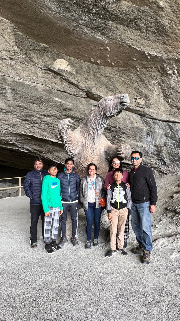
Usually when you depart from Puerto Natales, on the way to Torres del Paine National Park, you begin your adventure by visiting the Milodon Cave Natural Monument, which is located 26 km from Puerto Natales. This remarkable site is comprised of three distinct caverns nestled within a stunning landscape, featuring a fascinating rocky conglomerate known as “Silla del Diablo.” As you explore the cave, you can marvel at its impressive features and learn about the prehistoric creatures that once roamed the area, including the legendary Milodon, an enormous herbivorous mammal. After delving into the rich history and natural beauty of this unique monument, you can then continue your journey to the majestic Torres del Paine National Park, where breathtaking scenery and diverse wildlife await your discovery.
Final thoughts
Torre Del Paine is an incredible place to visit, and nothing truly prepares you for the breathtaking beauty of this stunning location. It is one of the most unique places I have ever explored, offering a diverse landscape that ranges from soaring peaks to shimmering lakes, making it a paradise for nature lovers. Patagonia’s weather is notoriously unpredictable, with the potential for all four seasons in a single day, which adds an element of excitement and challenge to your visit. While two days are sufficient if you are not hiking and just looking to take in the sights, extending your stay to three days provides you with the best chance to fully embrace the magnificence of this region. This extra time can be invaluable, especially in case of unforeseen circumstances, such as the windstorm we experienced during our trip, which temporarily altered our plans but also gave us a deeper appreciation for the raw power of nature that this area represents.
We spent a day in Santiago, Chile as part of our 10-day Chilean Itinerary. We did this trip on Christmas eve and started the day with Plaza de Armas and ended the day with having dinner at a Peruvian place not far from Cerro Santa Lucía. Since it was Christmas eve, restaurants and cafes were closing by 3.30-4 but we still were able to do lots of things in 1 day to get a feel for the city.
Quick Summary
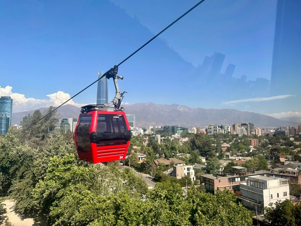
What we did: Started the day at Plaza de Armas by visiting the Metropolitan Cathedral and the surrounding area. Took a hop-on hop-off bus to get the lay of the city that included tickets Cable car ride to Cerro San Cristobal (booked through turistik ). Ended the day at Cerro Santa Lucia and had dinner at Barrio Lastarria neighborhood
Dinnner- Barrio Lastarria neighborhood cafes. This area was walking distance from the hotel and has tons of restaurants and cafes
Morning
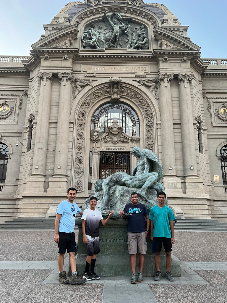
Plaza de Armas: Visit the historic center of Santiago. The Plaza de Armas is the main square, surrounded by important buildings like the Metropolitan Cathedral and the Central Post Office, and the National Museum of Fine Arts It’s a great place to soak in the city’s history and culture.
National Museum of Fine Arts – This museum is free to enter, but we chose not to explore it. However, check out sculpture called Icaro y Dédalo located outside of the building. The inscription “United in Glory and Death” refers to the myth of Daedalus, who made wings to escape imprisonment. Icarus flew too high and too close to sun, causing his wings to melt, and he fell into the sea. The statue of the mourning father is a copy; the original by Rebeca Matte, Chile’s first female sculptor, is in Rio de Janeiro, Brazil.
Metropolitan Cathedral – Located in the northwest corner of Plaza de Armas, Santiago’s Metropolitan Cathedral is free to enter. Built in neoclassical style between 1748 and 1800, it features baroque elements like gilded columns and beautiful frescoes. Italian architect Joaquín Toesca designed the building. The stunning interior includes statues, an ornate altar with marble and lapis lazuli, and intricate stained glass. The ceiling was painted by Ignazio Cremonesi in 1906.
La Chascona: After visiting the plaza, if you have time, visit one of poet Pablo Neruda’s unique homes, known for its eclectic architecture and stunning views of the surrounding landscape. La Chascona offers a fascinating insight into the life and mind of one of Chile’s most beloved literary figures, showcasing his extensive art collection and personal artifacts that reflect his poetry and passion for life.
Afternoon
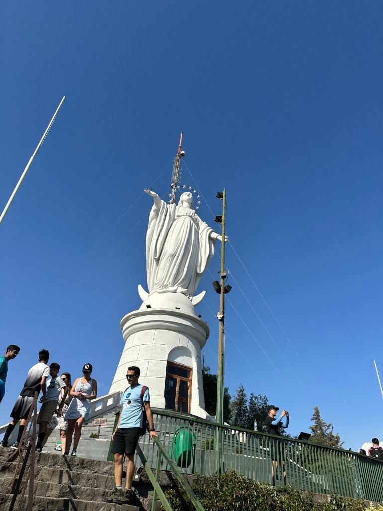
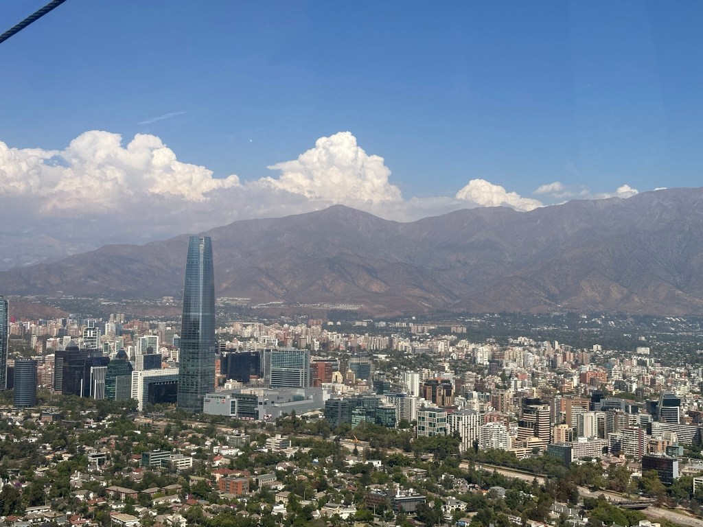
Cerro San Cristóbal: visit this iconic hill that rises majestically above the city. You can hike along the various trails, bike through scenic paths, or take the funicular to the top for stunning panoramic views of Santiago and the Andes. The fresh air and beautiful surroundings make it a perfect spot for outdoor enthusiasts. Don’t miss the statue of the Virgin Mary at the summit, which offers a perfect photo opportunity, and consider exploring the surrounding park for a complete experience.
Lunch at Mercado Central: This bustling market is famous for its seafood. Enjoy a delicious lunch of fresh fish or seafood stew at one of the many eateries inside.
Evening
Cerro Santa Lucía: For a beautiful sunset, visit this small hill in the city center. The top offers stunning views of the skyline and the Andes Mountains. As you climb, enjoy the charming paths, gardens, and fountains that provide a peaceful stroll. Cerro Santa Lucía has a rich history as a former military post turned public park, attracting both locals and tourists. Don’t forget your camera to capture the sunset and the diverse plants and animals in this urban oasis.
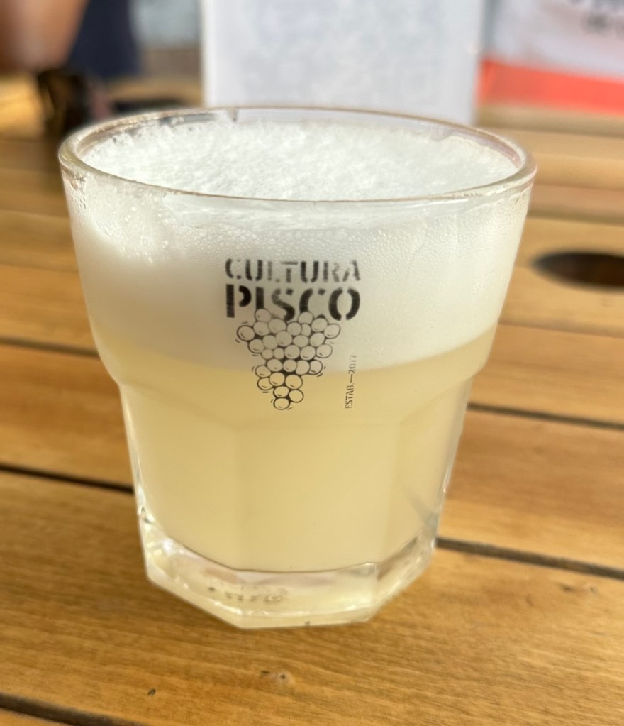
Barrio Lastarria – Is a vibrant neighborhood within walking distance from Cerro Santa Lucia and the perfect way to end the day by having dinner and drinks at one of the many cafes, and restaurants. We had one of the best pisco sours in a small cafe on the villavicencio street
One of the best Pisco Sours I had at the restaurant in Lastarria
Final thoughts
There are many things to do in Santiago, and you can spend a few days exploring the city and its vibrant culture. You can visit historical landmarks like the Plaza de Armas, immerse yourself in the local cuisine at bustling markets, and enjoy the stunning views from San Cristóbal Hill. Additionally, you can explore various museums, attend lively cultural festivals, and experience the warmth and friendliness of the local people, making your stay truly memorable.
Our final day on the cruise brought us to Ísafjörður — another gorgeous day of weather and, once again, a town that felt like the quintessential slice of Iceland. Right near the harbor, a flower-and-branch arch spelling out “ISAFJÖRÐUR” frames the view straight down the fjord toward the mountains — a popular photo stop for…
If you’ve ever wanted to walk through what looks like the ruins of a giant’s fortress, Dimmuborgir will feel like it was built for exactly that daydream. This otherworldly field of jagged black lava towers near Lake Mývatn is one of the strangest, most photogenic landscapes in Iceland—and it comes with a story as dramatic…
There’s a stretch of Iceland’s Ring Road where the vegetation simply stops. One minute you’re driving past green wetlands and grazing sheep, the next you’re pulling into a barren, steaming, sulfur-stained moonscape where the ground hisses and bubbles like it’s alive. Locals call it “Hell’s Kitchen.” The rest of us call it Hverir — and…